The best MTB trails around North Laurel
4.7
(25)
232
riders
6
rides
Mountain biking around North Laurel offers a network of wooded trails and riverside paths. The region is characterized by peaceful natural landscapes where Maryland's coastal plain meets the Piedmont eco-regions, providing varied plant life and extensive forested areas. While not offering rugged mountainous terrain, the area is suitable for various outdoor activities, including biking along the Little Patuxent River and through local parks.
Best mountain bike trails around North Laurel
- The most popular mountain bike trail is Crowsfoot and Viper…
Last updated: October 2, 2026
4.3
(9)
80
riders
11.4km
00:56
100m
100m
Get ready to mountain bike the Crowsfoot and Viper Loop Trail, a moderate route spanning 7.1 miles (11.4 km) with an elevation gain of 313 feet (95 metres). You can…
5.0
(1)
27
riders
Hard mountain bike ride. Good fitness required. Advanced riding skills necessary. Some portions of the route may require you to push your bike.

12
riders
Moderate mountain bike ride. Good fitness required. Advanced riding skills necessary.
5.0
(3)
8
riders
22.8km
01:32
140m
140m
Easy mountain bike ride. Great for any fitness level. Suitable for all skill levels.
4.3
(9)
63
riders
Hard mountain bike ride. Great for any fitness level. Advanced riding skills necessary. Some portions of the route may require you to push your bike.
Our route recommendations are based on thousands of hikes, rides, and runs completed by other people on komoot.
Start today with a free account
Your next adventure awaits.
Tips from the Community

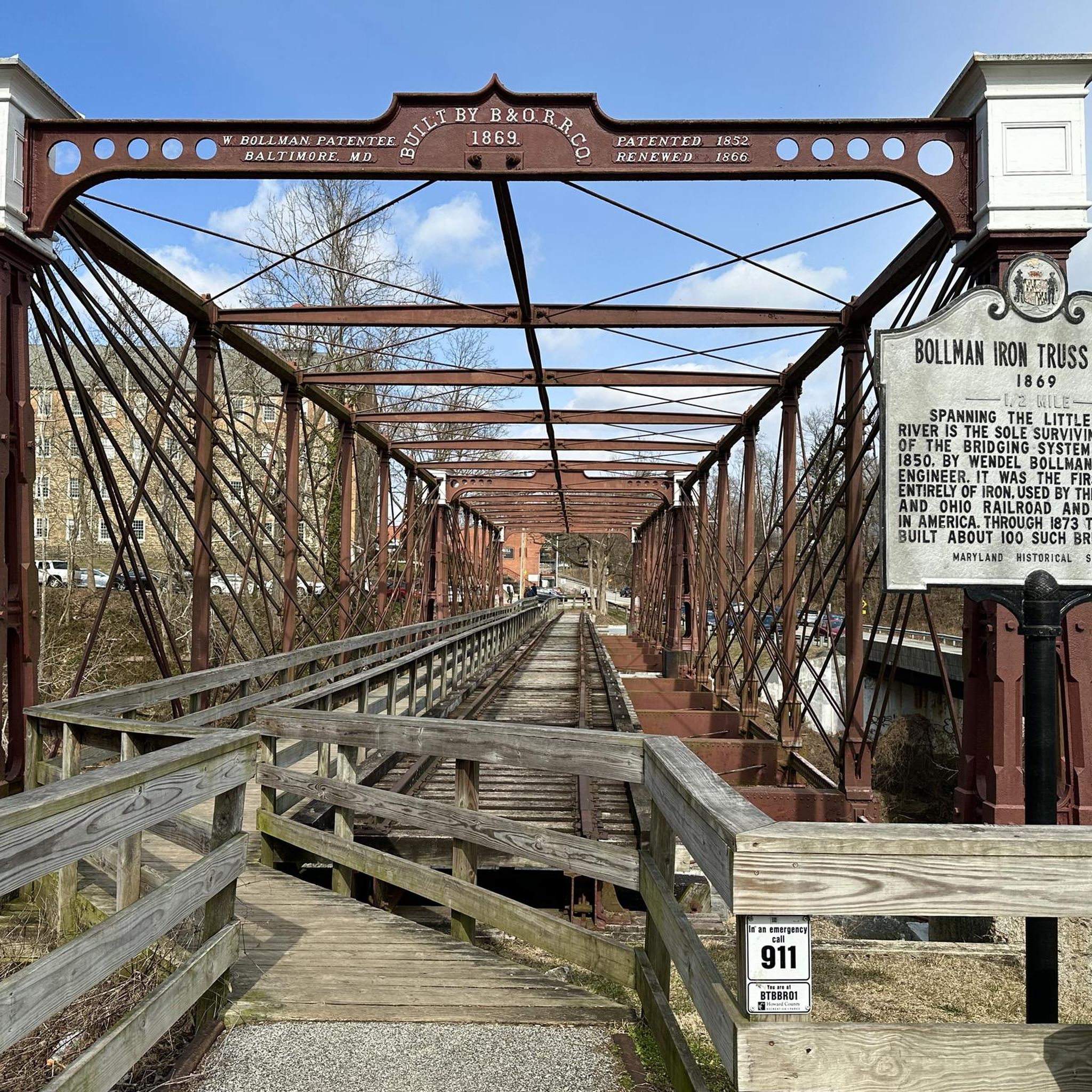
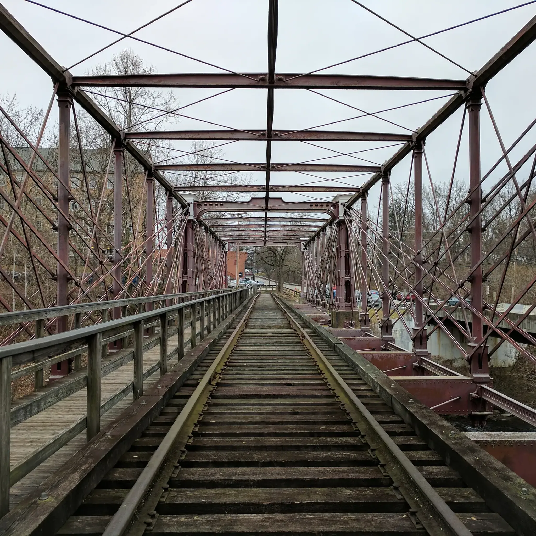
It gets very cold as you get close to Patapsco River near the bridge. The bridge does move a little but very secure as you cross it. Be mindful if you’re wearing a skirt (Ms Monroe)
0
0

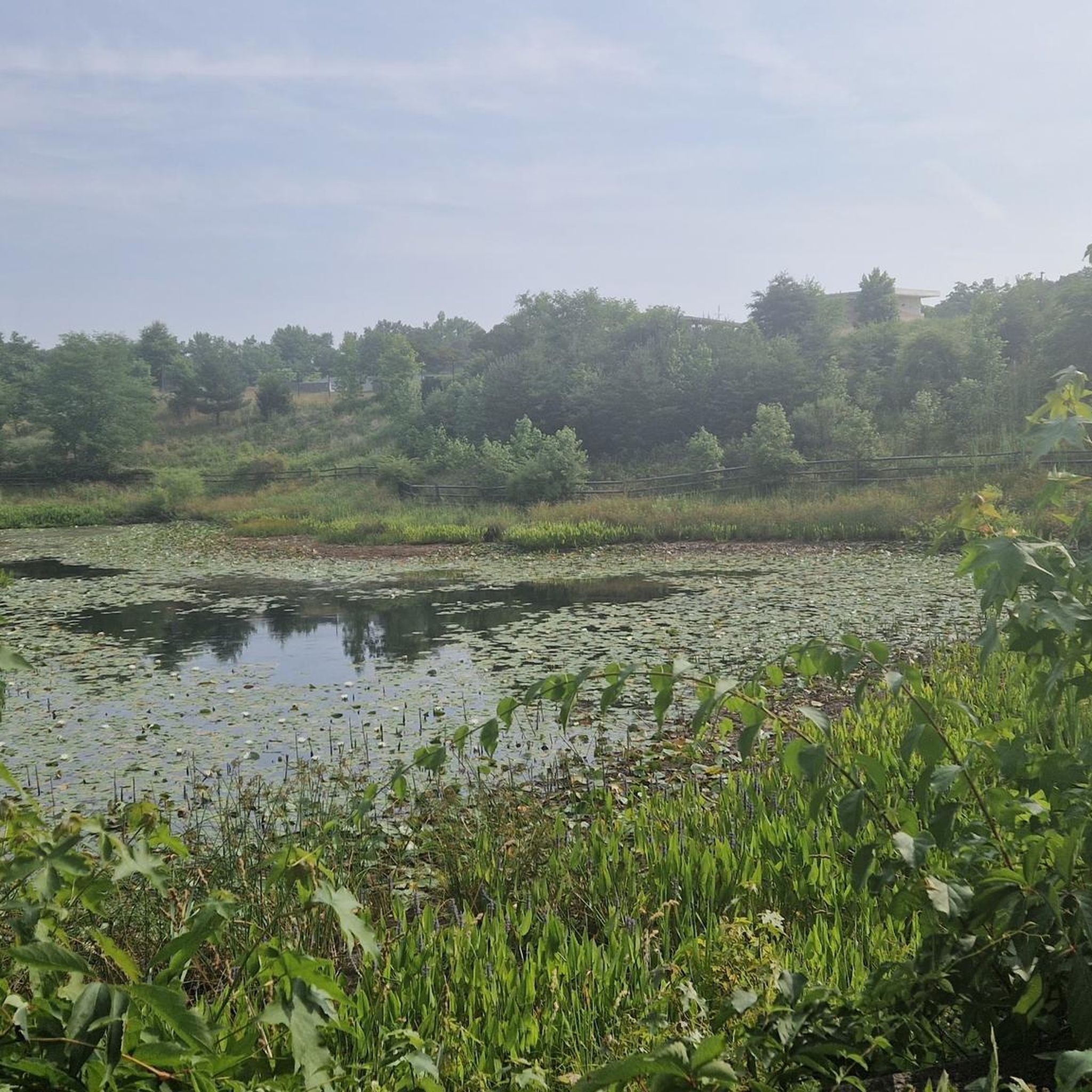
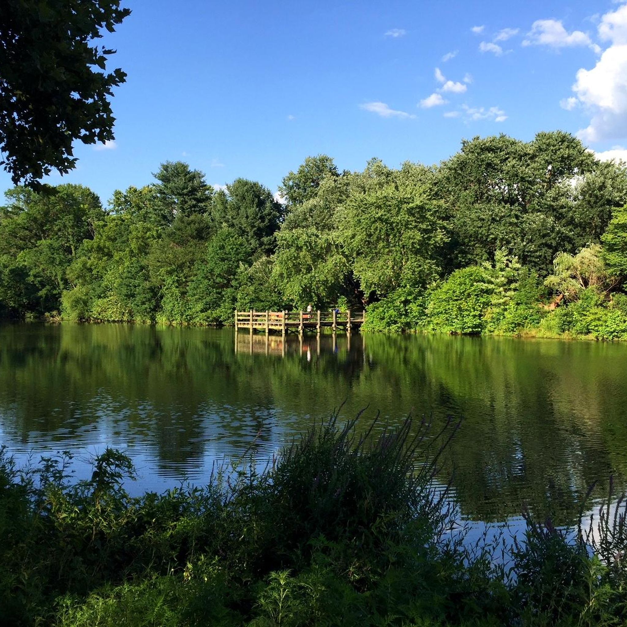
Lake Elkhorn is the third-largest lake in the county. It is surrounded by woodland and has several paved trails that run along the perimeter of the water.
0
0
The Lake Elkhorn loop trail is a paved trail that circles the lake with the same name. It is an easy trail and traffic free, so it is a great place for a recovery ride.
0
0

Check out this old, rusty car while biking on the Crow's Foot Trail. This trail has no major ascents or descents and brings riders from the Greencastle parking lot and Crow's Foot Loop Trail to the Viper Trail.
0
0

The Crowfoot trail winds its way through the park and connects to just about every trail in Fairland at some point. It's a mix use trail and you pass right by "The Pit" MTB area, so expect to encounter mountain bikers on your walk.
0
0

The Patapsco Valley was Maryland's first and remains its largest state park. The 14,000 acres (5,700 ha) are made up of forests, winding rivers and cascading waterfalls. It's a great place for hiking, camping, canoeing, horseback riding and mountain biking. Or simply just bring a picnic and relax by the river. Some historical sites are also worth visiting in the park such as the Thomas Viaduct and Orange Grove Flour Mill.
0
0

This popular swinging bridge crosses the Patapsco River. It is a wooden suspension bridge with metal cables. On the bridge you'll have great views of the river and surrounding woodland. It isn't too high up, so even if you're afraid of heights it's still worth passing over the bridge. Be courteous of other pedestrians as the bridge is fairly narrow!
1
0
The Grist Mist Trail passes through the Patapsco Valley State Park, alongside the Patapsco River. For a large part of the trail it also passes alongside the railroad. The surface is mostly paved and quite flat so well suited to families and kids. There are various historic sites of interest alongside the trail, including the famous swinging bridge which was originally used by mill workers to cross the river.
1
0
Frequently Asked Questions
How many mountain bike trails are available in North Laurel?
There are 6 mountain bike trails around North Laurel listed in this guide. The majority are easy routes (5 trails), with one moderate option available for those seeking a bit more challenge.
What kind of terrain can I expect on mountain bike trails in North Laurel?
Mountain biking in North Laurel primarily features wooded trails and riverside paths. The region is where Maryland's coastal plain meets the Piedmont eco-regions, offering varied plant life and extensive forested areas. You'll find peaceful natural landscapes, suitable for various outdoor activities, rather than rugged, mountainous terrain.
Are there any easy or beginner-friendly mountain bike trails in North Laurel?
Yes, North Laurel offers several easy mountain bike trails perfect for beginners or those looking for a relaxed ride. For example, the Lake Elkhorn – Little Patuxent River loop from Lake Elkhorn is an easy 22.5 km (14.0 miles) path offering scenic views. Another easy option is the Little Patuxent River – Lake Elkhorn loop from Savage, which is a longer 27.4 km (17.0 miles) route.
What are some scenic mountain bike trails or landmarks to see in North Laurel?
Many trails offer scenic views, especially those along the Little Patuxent River. The Lake Elkhorn – Little Patuxent River loop from Lake Elkhorn provides picturesque views of both the river and Lake Elkhorn. Additionally, the area features historic sites like those found along the Savage Mill Trail, which passes by the historic Bollman Truss Bridge. You can also explore nearby attractions such as Lake Elkhorn or the Patuxent Research Refuge.
Are there any family-friendly mountain bike trails in North Laurel?
Yes, the easy and moderate trails in North Laurel are generally suitable for families. Routes like the Lake Elkhorn – Little Patuxent River loop from Lake Elkhorn are great for a family outing, offering relatively flat terrain and scenic views. For a shorter option, consider the Fairland Skills Park – Abandoned car ruins loop from Paint Branch High School, which is 7.0 km (4.4 miles) long.
What do other mountain bikers enjoy most about mountain biking in North Laurel?
The mountain bike trails around North Laurel are highly rated by the komoot community, with an average score of 4.8 stars from over 10 reviews. Riders often praise the peaceful natural landscapes, the network of wooded trails, and the scenic riverside paths along the Little Patuxent River.
Can I bring my dog on the mountain bike trails in North Laurel?
Many trails in the North Laurel area, particularly those in local parks and along river paths, are generally dog-friendly. However, it's always best to check specific park regulations or trail signage for any restrictions, and ensure your dog is on a leash and you clean up after them.
What is the best time of year to go mountain biking in North Laurel?
The best time to go mountain biking in North Laurel is typically during spring and fall. These seasons offer pleasant temperatures and beautiful scenery, with spring bringing lush greenery and fall showcasing vibrant foliage. Summer can be enjoyable, but be prepared for warmer temperatures and potential humidity. Winter riding is possible, but trails may be muddy or icy depending on conditions.
Are there any loop mountain bike trails in North Laurel?
Yes, several trails in North Laurel are designed as loops. The Crowsfoot and Viper Loop Trail is a popular 11.4 km (7.1 miles) moderate loop. Another great option is the Lake Elkhorn – Little Patuxent River loop from Lake Elkhorn, an easy 22.5 km (14.0 miles) route.
Are there any mountain bike shops or cafes near the trails in North Laurel?
North Laurel and its surrounding areas offer various amenities. While specific bike shops directly adjacent to every trailhead might vary, you can find bike shops, cafes, and restaurants within a short drive in North Laurel and nearby towns. It's advisable to check local listings for current operating hours and locations.
What are the elevation gains like on North Laurel mountain bike trails?
The mountain bike trails in North Laurel are generally characterized by relatively gentle elevation changes, reflecting the region's landscape where the coastal plain meets the Piedmont. For instance, the Crowsfoot and Viper Loop Trail has an elevation gain of about 95 meters (312 feet), and the Patuxent Branch Trail – Little Patuxent River loop from Savage has an even gentler gain of around 61 meters (200 feet). These routes are more about scenic rides than challenging climbs.
Is public transport available to access mountain biking areas in North Laurel?
While North Laurel has some public transport options, direct access to specific trailheads via public transport can be limited. Many riders find it more convenient to drive to trailheads, especially for carrying bikes. For areas like Patapsco Valley State Park, which is nearby and offers more challenging trails, public transport might require transfers or a final leg by taxi/rideshare. Checking local transit authority websites for specific routes and schedules is recommended.
Most popular attractions around North Laurel

Get inspired with the komoot mobile app


Explore more
Browse the best MTB trails in other regions.
