The best road cycling routes around Dargan
30
riders
11
rides
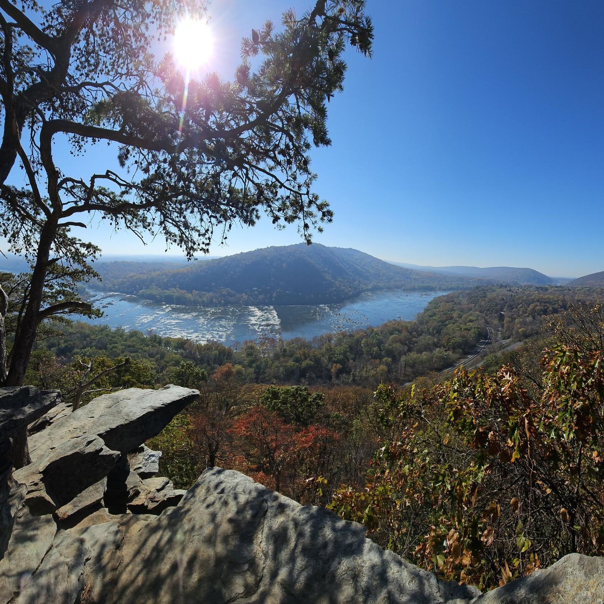
Road cycling routes around Dargan, Maryland, are characterized by their proximity to the Potomac River and historical features. The area offers varied terrain, including mostly paved surfaces suitable for road bikes, with some routes incorporating unpaved sections. Cyclists can find paths ranging from easy, with minimal elevation gain, to more challenging routes with significant climbs. The landscape includes riverine environments and historical landmarks, providing diverse backdrops for rides.
Best road cycling routes around Dargan
- The most popular road cycling route…
Last updated: May 17, 2026
5
riders
46.8km
02:37
570m
570m
Moderate road ride. Good fitness required. Some segments of this route may be unpaved and difficult to ride.
3
riders
26.5km
01:22
230m
230m
Easy road ride. Great for any fitness level. Mostly well-paved surfaces and easy to ride.

Sign up for free
3
riders
21.1km
01:12
190m
190m
Easy road ride. Great for any fitness level. Mostly well-paved surfaces and easy to ride.
3
riders
48.0km
02:18
430m
430m
Moderate road ride. Good fitness required. Some segments of this route may be unpaved and difficult to ride.
5
riders
15.4km
00:50
80m
80m
Moderate road ride. Great for any fitness level. Some segments of this route may be unpaved and difficult to ride.
Get access to more routes and recommendations from other explorers.
Sign up for free
Already have an account?
Our route recommendations are based on thousands of hikes, rides, and runs completed by other people on komoot.
Start today with a free account
Your next adventure awaits.
Login or Signup



Tips from the Community

The Antietam Aqueduct was built in 1834 to carry canal boats over Antietam Creek. It is over 140 feet long and is one of many such aqueducts along the C&O Canal.
0
0

The Antietam Aqueduct, located at mile 69.4 of the C&O Canal Towpath, is a three-arch stone aqueduct that once carried the canal over Antietam Creek. Built in 1834, it is constructed from limestone quarried nearby and remains one of the best-preserved aqueducts along the canal. During the Civil War, it was near the site of Confederate troop movements before and after the Battle of Antietam in 1862. Though it suffered some damage over the years, it has been fully restored and now serves as a scenic and historic stop along the towpath, offering great river views and picnic spots.
0
0
Shepherdstown, West Virginia, is the oldest town in the state (founded in 1762) and has a fun, vibrant college-town atmosphere. Located along the Potomac River at mile 72 of the C&O Canal Towpath, it is home to Shepherd University, giving it a lively college-town vibe with great cafés, restaurants, and shops. Rich in Civil War history, it played a role in the aftermath of the Battle of Antietam, as wounded soldiers were treated here. With its historic district, riverside views, and plenty of accommodations, Shepherdstown is a perfect overnight stop for cyclists C&O Canal Towpath or to just visit when exploring the area.
0
0

The Weverton-Roxbury Rail Trail is a picturesque segment of the South Mountain Recreation Area. The reserve features an unspoiled trail that offers a glimpse of the remnants of historic bridges, such as the Baltimore & Ohio Railroad Bridge that crosses over Antietam Creek. It is an idyllic setting for a scenic ride in this storied region.
0
0

From here, you can look up at the West Portal of the Harpers Ferry Tunnel. The tunnel is part of the B & O Railroad Potomac River Crossing, which is on the National Register of Historic Places for its significance in commerce, engineering, industry, invention, and transportation.
1
0

This railroad bridge that spans over the Potomac River in Harpers Ferry is quite the spectacle. A walk across the bridge grants you quick access between the C&O Canal Trail and Harpers Ferry town.
1
0

Location of notable Civil War battle at Shepherdstown. There are markers and tablets along River Road to commemorate the battle.
1
0

Aspects of an historic pulp mill, instrumental in the manufacture of paper, are still visible here. The mill was water-powered, and evidence of these channels remains.
0
0
Frequently Asked Questions
How many road cycling routes are available in Dargan?
Dargan offers a selection of 11 road cycling routes, catering to various skill levels. These routes provide diverse experiences, from easy rides to more challenging excursions.
What kind of terrain and difficulty levels can I expect on Dargan's road cycling routes?
You'll find a mix of terrain, predominantly paved surfaces suitable for road bikes, though some routes might include short unpaved sections. Difficulty ranges from easy, with minimal elevation gain, to moderate and challenging routes featuring significant climbs. For example, the Sharpsburg – Antietam National Battlefield loop from Sharpsburg is an easy, relatively flat ride, while the Shenandoah Pulp Factory Ruins – Shepherdstown loop from Harpers Ferry is a moderate route with varied terrain and over 500 meters of elevation gain.
Are there any family-friendly road cycling routes in the Dargan area?
Yes, Dargan offers several easier routes suitable for families or those preferring a more relaxed pace. For instance, the Sharpsburg – Antietam National Battlefield loop from Sharpsburg is an easy 16.4-mile path through historical landscapes, ideal for a family outing. Many routes near the C&O Canal Trail also provide flat, scenic riding opportunities.
What historical landmarks or points of interest can I see along the road cycling routes?
The Dargan area is rich in history. Cyclists can encounter sites like the Maryland Heights Stone Fort, a Civil War-era fortification, and the Harpers Ferry Tunnel and Railroad Bridges, part of the historic B&O Railroad Potomac River Crossing. The Goodloe E. Byron Memorial Pedestrian Walkway, a railroad bridge, also offers a unique cycling connection between the C&O Canal Trail and Harpers Ferry.
Are there circular road cycling routes available around Dargan?
Yes, many of the routes in the Dargan area are designed as loops, allowing you to start and end at the same point. Examples include the Shepherdstown – Shepherdstown Battlefield loop from Shepherdstown and the Antietam Aqueduct – Antietam Aqueduct loop from Shepherdstown, providing convenient round trips.
Where can I find parking for road cycling routes in Dargan?
While specific parking areas for each route are not detailed here, Dargan's proximity to Harpers Ferry and other popular cycling areas suggests that parking is generally available near trailheads or in nearby towns. It's advisable to check local municipal parking options or designated visitor parking in areas like Harpers Ferry or Shepherdstown before your ride.
Is Dargan accessible by public transport for cyclists?
Public transport options directly to Dargan for cyclists might be limited. However, its location near Harpers Ferry, a more established tourist destination, may offer better public transport connections. Cyclists often use the Goodloe E. Byron Memorial Pedestrian Walkway to connect between the C&O Canal Trail and Harpers Ferry, which could be a hub for regional transport.
What is the best time of year for road cycling in Dargan?
The region generally offers good cycling conditions during spring, summer, and fall. Spring and fall provide milder temperatures and beautiful scenery, while summer can be warm but enjoyable, especially along the river. Winter cycling might be possible but could involve colder temperatures and potential for icy conditions on some routes.
Are there cafes or amenities available along the road cycling routes?
While Dargan itself is a smaller community, its proximity to towns like Harpers Ferry and Shepherdstown means that cafes, pubs, and other amenities are accessible within a short cycling distance. Many routes are designed to pass through or near these towns, offering opportunities for refreshments and breaks.
What do other road cyclists enjoy most about cycling in Dargan?
Cyclists frequently praise the region's blend of scenic beauty and historical significance. The routes along the Potomac River, the views of the C&O Canal, and the opportunity to explore Civil War-era landmarks like the Antietam National Battlefield are often highlighted as key attractions. The varied terrain also appeals to a wide range of cyclists.
How long do road cycling routes in Dargan typically take to complete?
Route durations vary significantly based on distance and difficulty. Easy routes, like the Sharpsburg – Antietam National Battlefield loop (16.4 miles), can take around 1 hour 20 minutes. Longer, moderate routes, such as the Antietam Aqueduct loop from Shepherdstown (29.8 miles), typically require about 2 hours 19 minutes, depending on your pace and stops.
Most popular routes around Dargan
Most popular attractions around Dargan

Get inspired with the komoot mobile app


Explore more
Browse the best Road cycling routes in other regions.
