The best running trails around Antietam
34
runners
7
runs
Jogging around Antietam National Battlefield offers a combination of historical landscapes and varied trails. The area features gently rolling terrain, open farm fields, and pastures, providing a mix of easy to moderate challenges for runners. Antietam Creek, a prominent natural feature, runs through the battlefield, with several trails following its course. Patches of oak/hickory forests and woodlots offer shaded sections for running.
Best jogging routes around Antietam
- The most popular jogging route is Appalachian Trail to White Rocks Overlook, a 7.0 miles (11.2 km) trail that takes 1 hour 28 minutes to complete, offering scenic views from the overlook.
- Another top favourite among local runners is Appalachian Trail, a moderate 7.3 miles (11.7 km) path. This route features varied terrain through natural landscapes.
- Local runners also love the Maryland Heights – Shenandoah River Bridge loop from Harpers Ferry, a 5.4 miles (8.7 km) trail leading through the historic Harpers Ferry area and across the Shenandoah River Bridge, often completed in about 1 hour 8 minutes.
- Jogging around Antietam is defined by rolling hills, historic farm fields, and sections along Antietam Creek. The network of running routes offers options for various ability levels, from gentle paths to more challenging ascents.
- The guide includes highly-rated routes that showcase the best of the region's landscape. More than 40 runners have used komoot to explore Antietam's varied terrain.
Last updated: October 1, 2026
2
runners
11.7km
01:29
220m
220m
Moderate run. Good fitness required. Mostly paved surfaces. Suitable for all skill levels.
2
runners
11.2km
01:28
240m
240m
Moderate run. Good fitness required. Mostly paved surfaces. Suitable for all skill levels.

11
runners
29.3km
03:30
110m
110m
Hard run. Very good fitness required. Mostly paved surfaces. Suitable for all skill levels.
12
runners
10.6km
01:18
70m
70m
Moderate run. Good fitness required. Mostly paved surfaces. Suitable for all skill levels.
7
runners
15.4km
01:47
60m
60m
Hard run. Very good fitness required. Mostly paved surfaces. Suitable for all skill levels.
Get access to more routes and recommendations from other explorers.
Already have an account?
Our route recommendations are based on thousands of hikes, rides, and runs completed by other people on komoot.
Start today with a free account
Your next adventure awaits.



Tips from the Community

One of my favorite rides! The trail is well maintained and smooth. So many spots to rest and take breathtaking pics
1
0

Shepherdstown, West Virginia, is the oldest town in the state (founded in 1762) and has a fun, vibrant college-town atmosphere. Located along the Potomac River at mile 72 of the C&O Canal Towpath, it is home to Shepherd University, giving it a lively college-town vibe with great cafés, restaurants, and shops. Rich in Civil War history, it played a role in the aftermath of the Battle of Antietam, as wounded soldiers were treated here. With its historic district, riverside views, and plenty of accommodations, Shepherdstown is a perfect overnight stop for cyclists C&O Canal Towpath or to just visit when exploring the area.
0
0

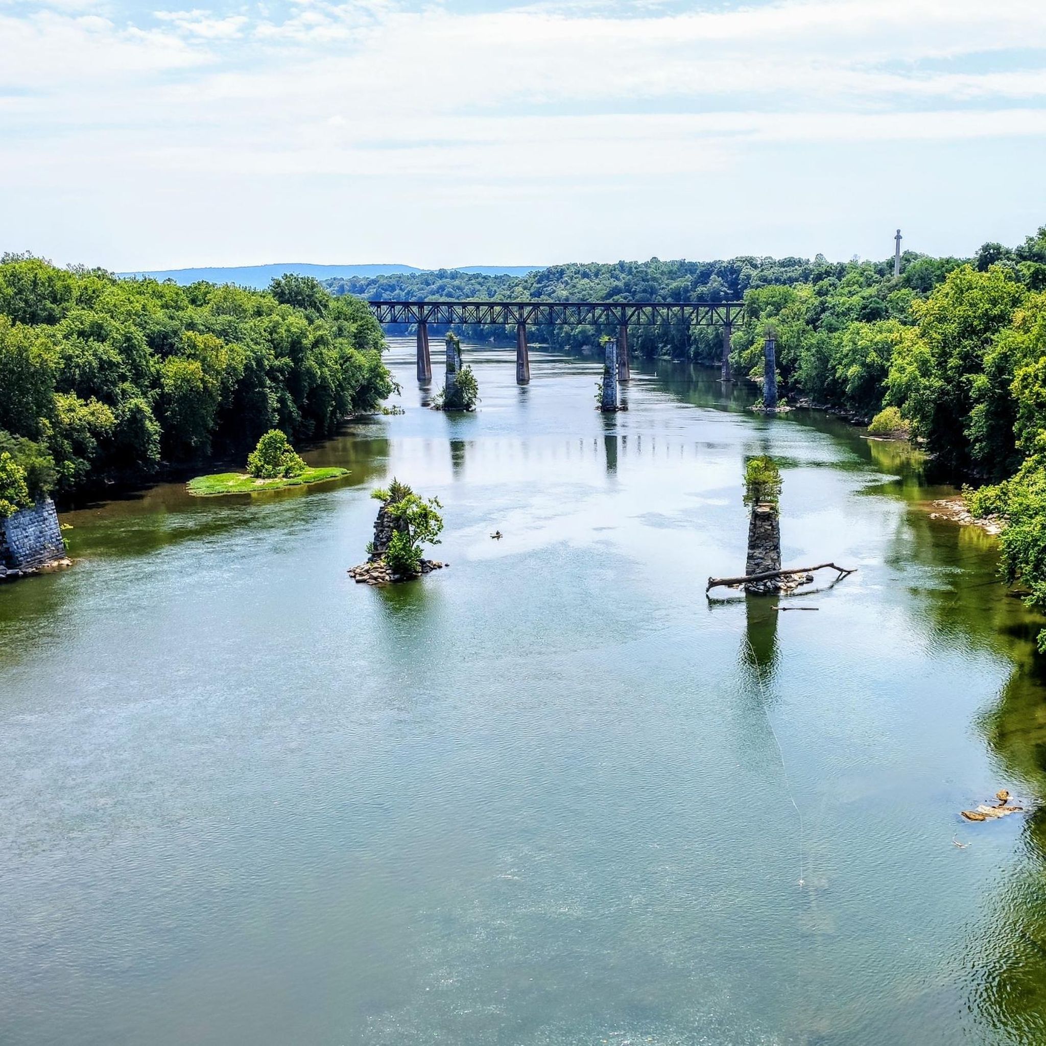
The Potomac River has a mix of flatwater and whitewater, visible as you pedal along the C&O Canal bike trail; this is a great spot to stop and watch some of those rapids.
0
0

The beginning and end section of this segment of the Appalachian Trail between Gathland Picnic Shelter and White Rocks gains a fair bit of elevation at the start and end, but the middle is fairly flat. It's a lovely, challenging run for those familiar with trail running. The ground can become rocky underfoot and tends to collect ice in the winter, so best completed in the warmer months.
0
0
Take a turn here and travel 50m or so along a rocky footpath to enjoy tremendous views across the South Mountain State Park. The trail to White Rocks is a little overgrown and rocky, but well-marked and easy to see. It's a lovely place to catch your breath whilst admiring the phenomenal views.
0
0
This is a nice, not too challenging, section of the Appalachian Trail to run. There are some inclines and declines, but not as much as many other sections of the trail. The ground can get rocky underfoot and tends to hold ice in the winter, so best completed in the warmer months.
1
0

This is one of the fancier and more contemporary Appalachian Trail shelters, making it a popular layover for hikers/trail runners. The enclosed loft offers above-average protection from the elements, and a privy is also available at the site. There's a reliable spring approximately half a mile downhill from the shelter, but an intermittent seep may be found much closer to the shelter, depending on the season.
0
0

From here, you can look up at the West Portal of the Harpers Ferry Tunnel. The tunnel is part of the B & O Railroad Potomac River Crossing, which is on the National Register of Historic Places for its significance in commerce, engineering, industry, invention, and transportation.
1
0
Frequently Asked Questions
How many running routes are available around Antietam?
Komoot features over 5 jogging routes in the Antietam area, offering a variety of experiences from moderate to difficult. These routes allow you to explore the historic battlefield and its surrounding natural beauty.
What kind of terrain can I expect when running in Antietam National Battlefield?
The terrain at Antietam National Battlefield is characterized by gently rolling hills, open farm fields, and pastures, providing a mix of easy to moderate challenges. You'll also find sections along the tranquil Antietam Creek and through wooded areas, offering varied surfaces and shade. Some trails, like the Cornfield Trail, can have uneven surfaces.
Are there routes suitable for beginners or those looking for an easier run?
While komoot lists several moderate routes, the Antietam National Battlefield itself offers trails with generally gentle slopes. For example, the Snavely Ford Trail near Burnside Bridge is mostly flat and shady, ideal for an easier run. The Antietam Remembered Trail is a shorter, paved loop near the visitor center, perfect for a very gentle jog.
Are there more challenging running trails in the Antietam area?
Yes, for those seeking a more challenging run, the area offers routes with significant elevation changes. Consider the Maryland Heights – Shenandoah River Bridge loop from Harpers Ferry, which is rated as difficult and includes substantial ascents. Another challenging option is the Running loop from Dargan.
What are the best times of year to go running at Antietam?
Spring and fall are generally the most pleasant seasons for running at Antietam, with mild temperatures and beautiful scenery. Spring brings blooming wildflowers, while fall offers vibrant foliage. Summer can be hot and humid, so early mornings or late evenings are recommended. Winter running is possible, but check for ice or snow conditions, especially on uneven trails.
Can I find routes with scenic views or natural features?
Absolutely! Many routes offer scenic views and highlight natural features. The Appalachian Trail to White Rocks Overlook provides stunning vistas. You can also enjoy the tranquil Antietam Creek along trails like the Snavely Ford Trail, or run through picturesque farm fields and wooded areas that characterize the battlefield. The View of the Potomac River from the Shepherdstown Bridge is another notable scenic spot.
Are there any circular running routes in the Antietam area?
Yes, several routes in the Antietam area are designed as loops. For instance, the Maryland Heights – Shenandoah River Bridge loop from Harpers Ferry and the Killiansburg Cave loop from Shepherdstown are popular circular options. Within the battlefield, trails like the Cornfield Trail and Bloody Lane Trail also offer loop configurations.
Are the running trails around Antietam suitable for families or running with kids?
Many trails at Antietam National Battlefield are suitable for families, especially those with gentler slopes and shorter distances. The Antietam Remembered Trail is a short, paved loop that's very accessible. The Snavely Ford Trail along Antietam Creek is also a good option due to its mostly flat and shady nature. These trails offer an opportunity to combine exercise with historical education.
Can I bring my dog on the running trails at Antietam?
Yes, leashed dogs are generally permitted on the trails at Antietam National Battlefield. It's always a good idea to check the National Park Service website for the most current regulations regarding pets to ensure a pleasant experience for everyone. You can find more information on the NPS Antietam hiking page.
Where can I park when visiting the Antietam running trails?
Antietam National Battlefield offers various parking areas throughout the park, often near trailheads and significant historical sites. The Visitor Center has ample parking, and there are smaller lots accessible from the battlefield's auto tour route. Specific parking availability can vary by trail, so it's advisable to consult a park map or the NPS website for detailed information.
What interesting landmarks or historical sites can I see along the running routes?
Antietam National Battlefield is rich with history. As you run, you can encounter numerous landmarks such as the historic Mumma and Roulette Farms along the Bloody Lane Trail, the iconic Burnside Bridge, and Miller's Cornfield. Other notable sites nearby include the National War Correspondents Memorial Arch and the Maryland Heights Stone Fort. The trails are often lined with interpretive signs, offering an educational experience.
What do other runners enjoy the most about jogging in Antietam?
Runners often praise the unique combination of historical immersion and natural beauty found at Antietam. The ability to jog through significant Civil War sites while enjoying the peaceful, rolling landscape, farm fields, and sections along Antietam Creek is a major draw. The varied terrain and well-maintained trails also contribute to a highly rated experience.
Most popular routes around Antietam
Most popular attractions around Antietam

Get inspired with the komoot mobile app


Explore more
Browse the best Running Trails & Routes in other regions.
