The best road cycling routes around Frederick
4.4
(9)
755
riders
83
rides
Road cycling routes around Frederick offer a varied landscape, from the rolling hills of the Monocacy Valley to the more challenging inclines of the Catoctin Mountains. The region features scenic routes through historic countryside, alongside rivers like the Potomac, and along the C&O Canal Towpath. This diverse topography provides options for different fitness levels, including routes with significant elevation gain and flatter, paved paths.
Best road cycling routes around Frederick
- The most popular road cycling route is Gambrill State Park loop, a 28.9 miles (46.5 km) trail that takes 2 hours 25 minutes to complete. This moderate route features significant climbs through forested terrain.
- Another top favourite among local road cyclists is North County Bridge Sampler, a moderate 37.5 miles (60.3 km) path. This route traverses rolling terrain and passes by historic covered bridges.
- Local road cyclists also love the Campaign Ride, a 19.0 miles (30.6 km) trail leading through historic Civil War sites, often completed in about 1 hour 15 minutes.
- Road cycling around Frederick is defined by rolling hills, the Catoctin Mountains, and the C&O Canal. The network offers options for different ability levels, from easy, flat rides to difficult routes with substantial elevation gain.
- The routes in Frederick are highly rated by the komoot community with an average score of 4.4 stars from 10 reviews. More than 800 road cyclists have used komoot to explore Frederick's varied terrain.
Last updated: July 7, 2026
38
riders
46.5km
02:25
660m
660m
Prepare for a demanding road cycling experience on the Gambrill State Park loop, a moderate route covering 28.9 miles (46.5 km) with a significant 2150 feet (655 metres) of elevation gain. This ride, estimated to take 2 hours and 25 minutes, challenges you with steep gradients as you ascend Catoctin Mountain. The road winds through shaded wooded areas, offering a pleasant environment even during rigorous sections. You will be rewarded with panoramic vistas from the park's three stone overlooks at High Knob, including the Frederick Overlook.
This route is considered challenging due to its steep climbs and descents, so ensure you have good fitness before you start. The park provides an excellent starting point for exploring the extensive network of scenic road routes throughout Frederick County. After your ride, you can easily access local amenities such as breweries or dining options in nearby Frederick City.
The Gambrill State Park loop takes you up Catoctin Mountain, offering a unique perspective of the region's landscape. The park's well-known stone overlooks are a highlight, providing expansive views that make the effort worthwhile. This area is a hub for road cyclists, connecting you to many other routes if you wish to extend your adventure beyond this loop.
5.0
(2)
24
riders
60.3km
02:34
370m
370m
Embark on the North County Bridge Sampler, a moderate road cycling route that guides you through the scenic Maryland countryside. This 37.5 miles (60.3 km) journey features a total elevation gain of 1223 feet (373 metres), offering a good workout that you can complete in about 2 hours and 34 minutes. As you pedal, you will encounter charming historic covered bridges, such as the Roddy Road Covered Bridge, which serve as picturesque landmarks along the way.
When planning your ride, you can typically find parking and access points near the start of the route in the Thurmont area. The trail is mostly on well-paved surfaces, making for a smooth road cycling experience. However, be aware that some segments might be unpaved, which could add a bit of challenge to your ride.
What truly sets this route apart is its unique blend of history and outdoor activity, highlighted by the mid-19th century covered bridges. These structures are not just crossings; they are historical anchors that give the ride a distinct character. The North County Bridge Sampler offers a chance to connect with the past while enjoying a rewarding day on your racebike.

Sign up for free
11
riders
97.6km
05:10
1,580m
1,580m
The Watershed loop offers a challenging road cycling experience through forested landscapes and past scenic overlooks, particularly beautiful during autumn. This difficult route covers 60.6 miles (97.6 km) and involves a significant elevation gain of 5182 feet (1579 metres), typically taking around 5 hours and 10 minutes to complete. You will navigate varied terrain, including sections within Catoctin Mountain Park, providing a demanding yet rewarding ride for experienced cyclists.
Before you set out, be aware that while much of the Watershed loop is paved, some segments feature unmaintained gravel roads. These unpaved sections can be rough, with persistent bumps and ruts, which might make riding on a traditional road bike difficult. For a smoother experience on these mixed-terrain parts, you might find a gravel bike more suitable. Plan your ride accordingly to ensure you have the right equipment for the conditions.
This route is notable for its journey through the Frederick Watershed, an area renowned for its natural beauty and changing foliage, especially vibrant in the fall. The diverse terrain and elevation changes make it a true test of endurance and skill, setting it apart as a premier challenging ride in the region. You will experience a blend of natural scenery and demanding climbs that define the character of this unique loop.
4.0
(1)
3
riders
30.6km
01:15
100m
100m
Easy 19.0-mile road cycling route through Monocacy National Battlefield, featuring historical sites and gentle elevation gain.
90
riders
86.9km
05:05
1,500m
1,500m
Hard road ride. Very good fitness required. Some segments of this route may be unpaved and difficult to ride.
Get access to more routes and recommendations from other explorers.
Sign up for free
Already have an account?
Our route recommendations are based on thousands of hikes, rides, and runs completed by other people on komoot.
Start today with a free account
Your next adventure awaits.
Login or Signup
Tips from the Community


Hamburg Road passes through the Frederick Municipal Forest in Frederick, Maryland. This scenic winding road is a great place to ride through the dense woods all seasons, but is especially nice in the fall when the leaves change from green to vibrant hues of yellow, orange, and red.
0
0

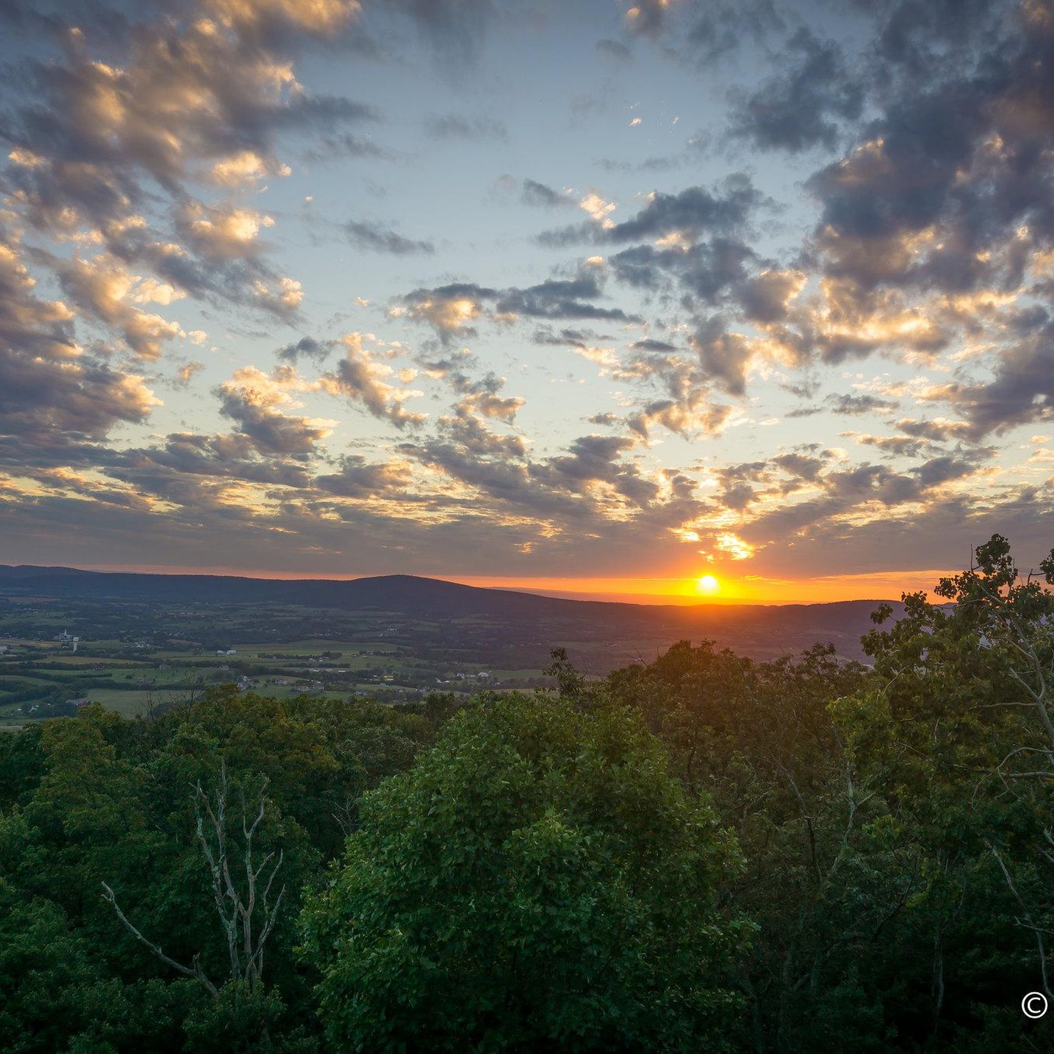
Gambrill State Park is situated on Catoctin Mountain outside Frederick. The park is renowned for its spectacular views of the surrounding area, as well as its hiking and biking trails.
0
0

High Knob is the highest point in the Gambrill State Park. It's a great place to stop and catch your breath on a run, where you can enjoy views stretching across Frederick and Middletown.
1
0
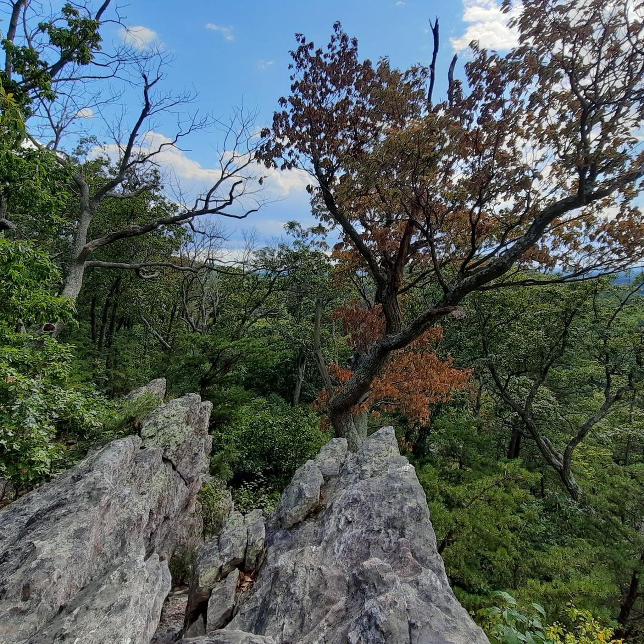
Catoctin Mountain Park is a 5,120-acre national park that is also home to the Presidential retreat, Camp David. The park, with its scenic vistas of the Blue Ridge Mountains, offers 25 miles of hiking trails, fishing streams, camping, and horseback riding.
0
0
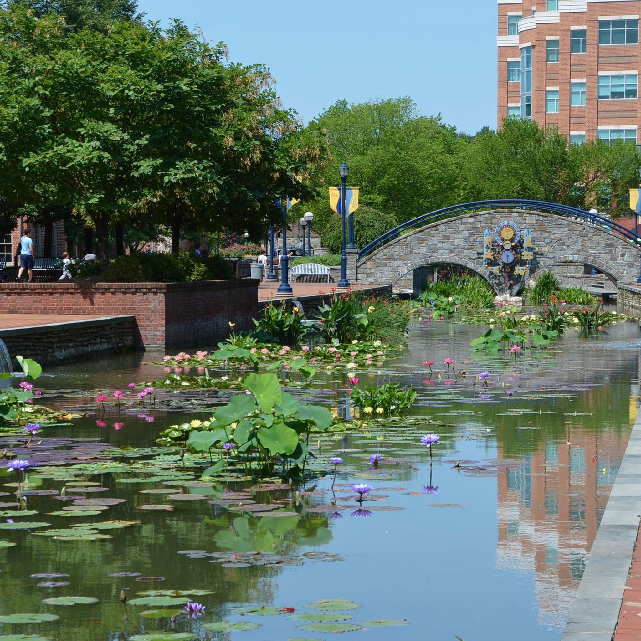
There are a number of pedestrian footbridges that reach over the Carroll Creek in Frederick, but this is a particularly pretty one. The stone bridge is covered in carvings and lovely detail. The community were part of the design of it and thousands gave their artistic suggestions.
1
0
The Utica Mills Covered Bridge was built in 1850 to span the Monocacy River. However, the bridge was washed away during a severe storm. The locals gathered the remains and reconstructed it over Fishing Creek, its correct location.
0
0
Frequently Asked Questions
What kind of terrain can I expect on road cycling routes in Frederick?
Frederick offers a diverse landscape for road cycling. You'll find everything from the rolling hills of the Monocacy Valley to the more challenging, steep inclines of the Catoctin Mountains. There are also scenic routes through historic countryside, alongside rivers like the Potomac, and along the relatively flat C&O Canal Towpath.
How many road cycling routes are available around Frederick?
There are over 80 road cycling routes available around Frederick, catering to various skill levels and preferences. This includes a mix of easy, moderate, and difficult rides.
Are there options for beginner or easy road cycling routes in Frederick?
Yes, Frederick has several easy road cycling routes. For instance, the Campaign Ride is an easy 19-mile (30.6 km) trail that leads through historic Civil War sites with minimal elevation gain. The C&O Canal Towpath also offers flat, traffic-free riding sections.
Are there challenging road cycling routes for experienced riders?
Absolutely. For experienced riders seeking a challenge, routes like the Watershed loop offer significant elevation gain, with over 1500 meters of climbing over 97.5 km. The Catoctin Mountains also provide routes with substantial climbs, such as the 'Catoctin Climbing ride' mentioned in regional research.
What scenic landmarks or natural features can I see while road cycling in Frederick?
Frederick's routes often pass by beautiful natural features and landmarks. You can cycle through scenic valleys, dense woodlands, and along rivers. Notable sights include the Utica Covered Bridge, the Carroll Creek Bridge, and the historic Monocacy Battlefield. Many routes also offer stunning viewpoints, such as High Knob in Gambrill State Park.
Can I find routes that feature Frederick's historic covered bridges?
Yes, Frederick County is known for its historic covered bridges, and several routes incorporate them. The North County Bridge Sampler is a moderate 37.5-mile (60.3 km) path that traverses rolling terrain and passes by multiple historic bridges, including covered ones.
What do other road cyclists enjoy most about road cycling in Frederick?
The area is highly rated by the komoot community, with an average score of 4.4 stars. Reviewers often praise the varied terrain, from challenging mountain climbs to scenic rides through historic countryside, and the well-maintained routes that cater to different fitness levels.
Are there any family-friendly road cycling routes in Frederick?
While many routes are suitable for various skill levels, the C&O Canal Towpath offers a relatively flat and traffic-free experience, making it a good option for families. The Frederick Historic Bicycle Loop is also a 10-mile paved route within the city, suitable for a leisurely family ride.
Is parking available near road cycling routes in Frederick?
Yes, many road cycling routes in Frederick have accessible parking. For routes along the C&O Canal Towpath, there are access points with parking in areas like Brunswick, Point of Rocks, and Lander. State parks and trailheads typically offer designated parking facilities.
What is the best time of year for road cycling in Frederick?
Spring and fall are generally considered the best times for road cycling in Frederick. The weather is mild, and the scenery is particularly vibrant, especially in the fall when the woodlands display rich colors. Summer can be enjoyable, but be prepared for warmer temperatures, while winter riding may require checking for road conditions.
Are there any road cycling routes that pass through historic towns or offer cultural experiences?
Yes, Frederick's rich history is often intertwined with its cycling routes. The Campaign Ride takes you through historic Civil War sites. The Frederick Historic Bicycle Loop allows cyclists to experience the city's history and vibrant downtown, passing by sites like the Francis Scott Key Memorial and the Barbara Fritchie House. The C&O Canal Towpath also offers a journey through historical locks and aqueducts.
Can I find road cycling routes that are loops or circular?
Many of the road cycling routes around Frederick are designed as loops, allowing you to start and end at the same point. Examples include the popular Gambrill State Park loop and the Watershed loop. The Frederick Historic Bicycle Loop is also a circular route within the city.
Most popular routes around Frederick
Most popular attractions around Frederick

Get inspired with the komoot mobile app


Explore more
Browse the best Road cycling routes in other regions.
