The best walks and hikes around Fryeburg
4.9
(13)
194
hikers
8
hikes
Hikes around Fryeburg Maine explore the foothills of the White Mountains, a region defined by rolling hills, the Saco River Valley, and forested peaks. The area's landscape offers a variety of trails, from gentle paths along riverbanks to more demanding ascents to summit viewpoints. This mix of terrain provides hiking options suitable for different fitness levels.
Best hiking trails around Fryeburg
- The most popular hiking route is View from Pleasant Mountain loop from Southwest Ridge Trail Trailhead, a 5.4…
Last updated: October 2, 2026
5.0
(1)
35
hikers
5.95km
02:04
320m
320m
Moderate hike. Good fitness required. Easily-accessible paths. Suitable for all skill levels.
4.4
(9)
100
hikers
3.64km
01:11
180m
180m
Easy hike. Great for any fitness level. Easily-accessible paths. Suitable for all skill levels.

7
hikers
6.27km
01:35
10m
10m
Easy hike. Great for any fitness level. Easily-accessible paths. Suitable for all skill levels.
5.0
(1)
8
hikers
5.90km
01:48
210m
210m
Easy hike. Great for any fitness level. Easily-accessible paths. Suitable for all skill levels.
2
hikers
15.1km
05:10
780m
780m
Hard hike. Very good fitness required. Easily-accessible paths. Suitable for all skill levels.
Get access to more routes and recommendations from other explorers.
Already have an account?
Our route recommendations are based on thousands of hikes, rides, and runs completed by other people on komoot.
Start today with a free account
Your next adventure awaits.
Popular around Fryeburg

Tips from the Community

Great winter hike. Use microspikes as there is a lot of ice
0
0

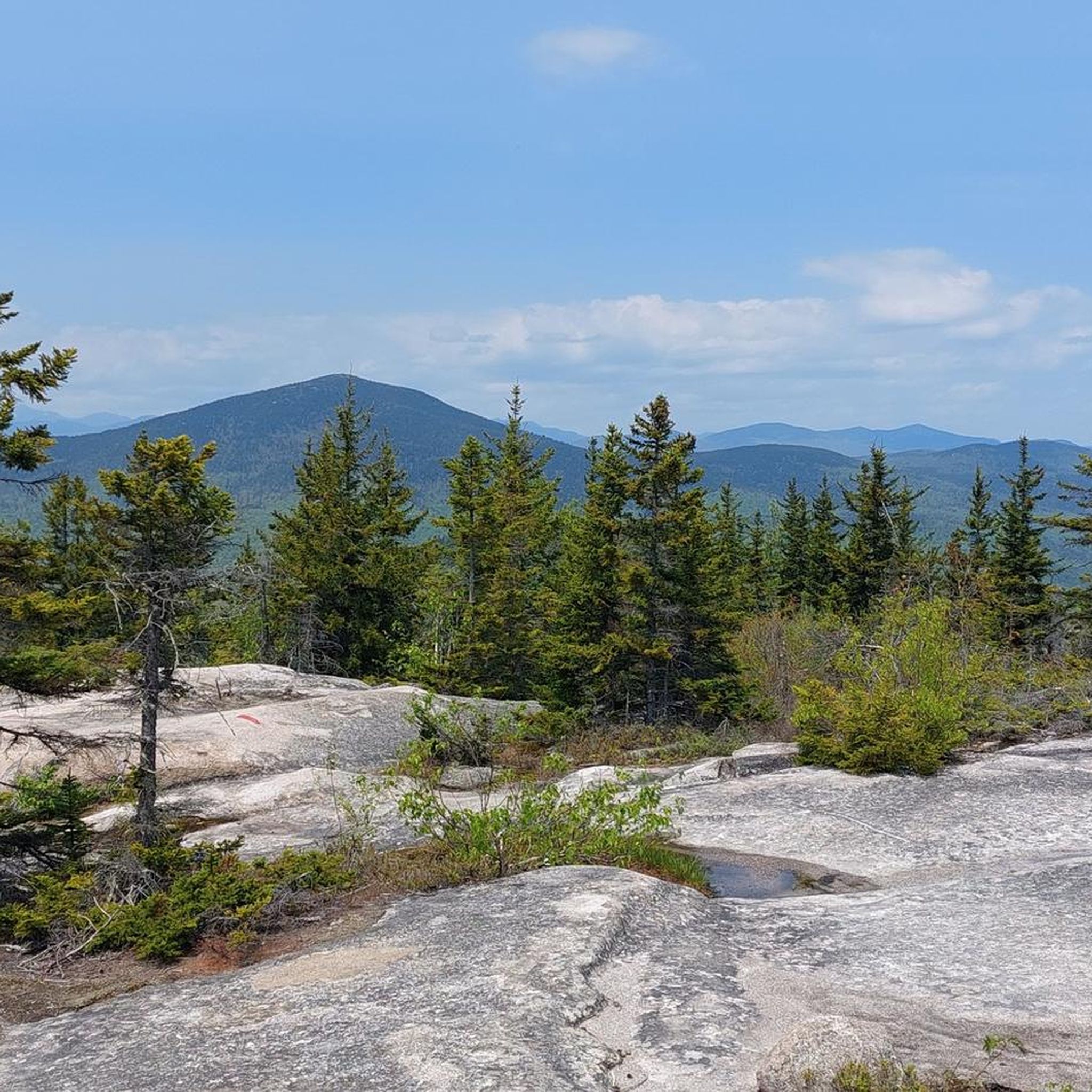
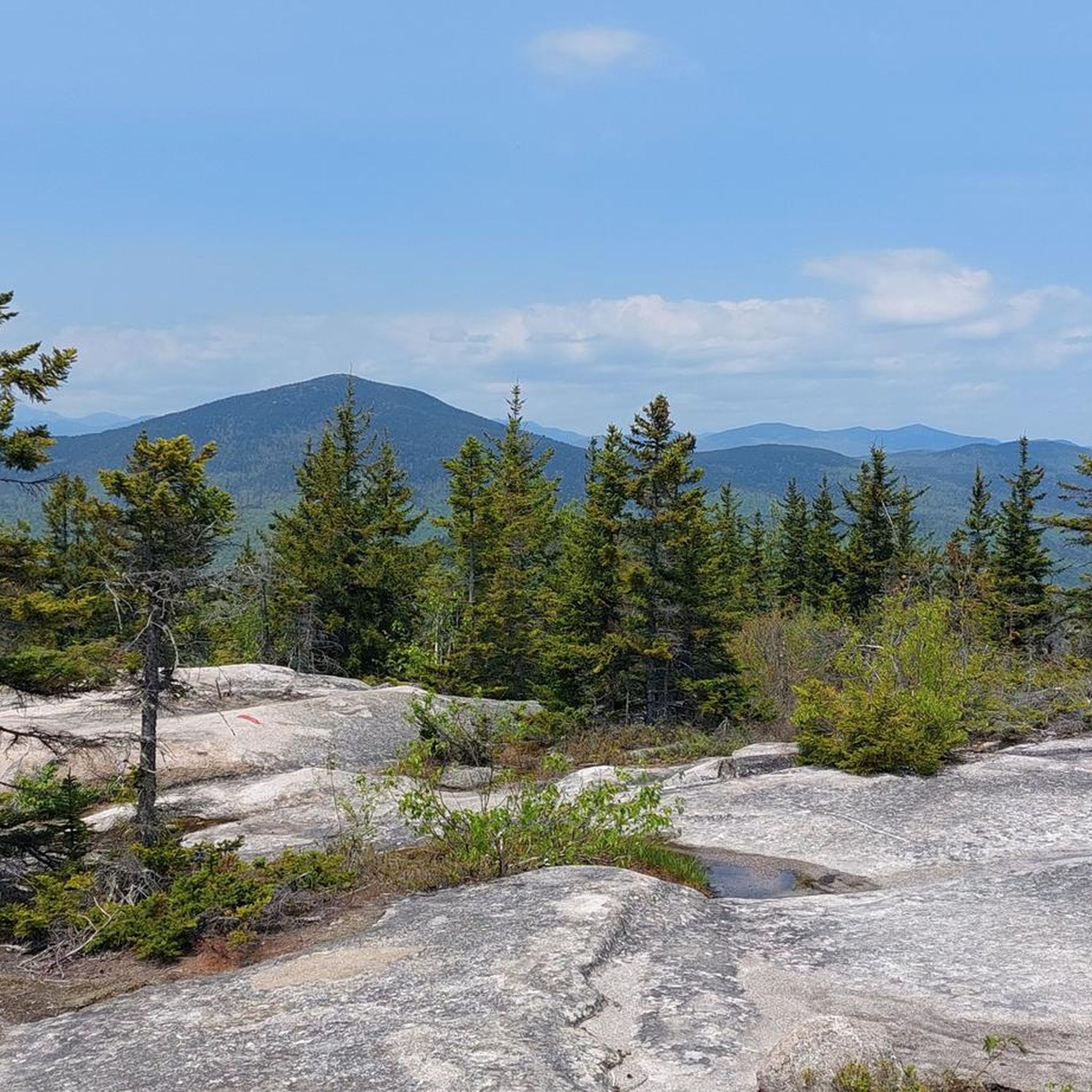
Black Cap, a 2,369-foot mountain in Conway, New Hampshire, sits between Kearsarge North Mountain and Peaked Mountain. Its rocky summit offers sweeping views of Maine and New Hampshire's White Mountains. Known as the "little mountain with big views," Black Cap is a favorite for its stunning scenery despite its modest climb to the peak.
0
0
Black Cap Trail is one of the most popular short hikes in the White Mountains. This well-maintained, red-blazed trail offers really nice views of the White Mountains and the Presidential Range. With a gradual uphill path, it's a fun, family-friendly hike. While some areas can be muddy and the trail gets busy, especially on weekends and in the fall. The hike rewards you with amazing views at the top, and parking at the trailhead is free.
0
0

The summit of (Mount) Kearsarge North stands at 3,268 feet in the Mount Washington Valley. This mountain is relatively popular in part because of its proximity to North Conway, but also because there is a 15-foot observation tower at its rocky, open summit. Whether you climb the tower or not, you get fantastic views of the Presidentials and Mount Washington, The Mount Washington Valley, and the interior of Maine to the east.
0
0

Cranmore Mountain is a very popular spot year round. In winter, it is a ski resort and the rest of the year, it is full of hikers, runners and cyclist. There are great views from the peak of the other mountains and valleys in North Conway.
1
0
The peak of Black Cap is located at a bare summit, so it gives you great views of the surrounding mountains and valleys. The trail up is moderately challenging and takes you through spruce and beech forest.
1
0

Cranmore Mountain in North Conway is a four-season recreational destination. While in the winter it is a popular skiing destination, it is a great spot for hiking from spring to autumn. At the top of the chairlift, you get a great overview over the area.
0
0
The Conway Recreational Path is a trail near the town of Conway, that leads along the Saco River. The path winds its way through picturesque landscape, is surrounded by forests, and offers glimpses at the nearby river.
0
0
Frequently Asked Questions
Are there any easy, family-friendly hikes in the Fryeburg area?
Yes, the region has several great options for families. The Black Cap Trail loop is a popular choice, offering a relatively short walk to a granite summit with wide-open views. Another excellent spot is the Fryeburg Town Forest, which features an easy 1-mile loop trail perfect for a leisurely walk with children.
Can I bring my dog on the hiking trails around Fryeburg?
Many trails in the Fryeburg area are dog-friendly, but policies can vary, especially within the White Mountain National Forest and private preserves. It's always best to check local regulations before you go. The Fryeburg Town Forest is a reliable option where dogs are allowed on leashes. For any trail, ensure your dog is under control and you pack out all waste.
What are some hikes near Fryeburg with great views?
The area is known for its rewarding viewpoints. For a challenging hike with panoramic views of the Saco River Valley and surrounding peaks, the View from Pleasant Mountain loop is an excellent choice. For a much shorter but equally impressive vista, the hike up Jockey Cap provides 360-degree views right from the edge of town.
Are there any difficult or challenging hikes available?
Yes, for those seeking a strenuous climb, the Kearsarge North Summit via Weeks Brook Trail offers a significant challenge. This 9.4-mile (15.1 km) route involves a substantial elevation gain and takes over 5 hours to complete, rewarding hikers with a historic fire tower and expansive views from the top.
Where can I find information about the trails at Mount Tom Preserve?
The Mount Tom Preserve offers a network of trails with varying difficulty, managed by The Nature Conservancy. A popular route is the West Ridge Trail, a moderate 3-mile round trip that leads to rocky ledges with beautiful views of the Saco River Valley. For more detailed information on the preserve's ecology and trail network, you can visit the official page from The Nature Conservancy.
Are there any hikes with waterfalls near Fryeburg?
While the immediate trails around Fryeburg are more focused on summit views, a short drive into Evans Notch in the White Mountain National Forest will lead you to several. Trails in this area can take you to scenic spots like Emerald Pool and Rattlesnake Pool, which feature small, beautiful cascades in a rugged forest setting.
What is the Mountain Division Trail like for walking?
The Mountain Division Trail in Fryeburg is a paved, multi-use path that is excellent for walking. It's a flat and accessible route, making it suitable for all fitness levels, strollers, and inline skating. The trail runs for about four miles, offering a pleasant and easy way to enjoy the outdoors without any climbing.
What do other hikers think of the trails around Fryeburg?
The hiking routes around Fryeburg are very highly rated by the komoot community, with an average score of 5.0 stars. Hikers often praise the variety of trails, from the accessible forested paths to the rewarding climbs up granite-topped hills with expansive views.
Are there any good options for a very short hike?
For a quick but rewarding outing, the Cranmore Mountain trail offers a relatively easy 3.7-mile (5.9 km) hike. If you're looking for something even shorter, the trail up Jockey Cap is a local favorite that can be done in well under an hour and provides fantastic views for minimal effort.
How long does it take to hike the Fryeburg Town Forest loop?
The loop trail at the Fryeburg Town Forest is approximately 1 mile long. For most people, walking this easy and relatively flat trail takes about 20 to 30 minutes, making it a perfect option for a quick nature walk.
Are most of the hiking trails free to access?
Yes, most of the popular hiking trails and trailheads near Fryeburg, such as those at the Fryeburg Town Forest and Mount Tom Preserve, are free to access. However, some areas, particularly within the White Mountain National Forest or specific lookouts like Cathedral Ledge, may require a recreation pass or have a per-person fee, so it's wise to have some cash on hand.
Is there a flat, paved path for an easy walk?
Yes, the Conway Recreational Path is an ideal choice. It's a paved, nearly flat trail that is perfect for a gentle stroll, a bike ride, or pushing a stroller. It provides a safe and scenic way to get some exercise without navigating uneven terrain.
Most popular routes around Fryeburg
Most popular attractions around Fryeburg

Get inspired with the komoot mobile app


Explore more
Browse the best Hikes in other regions.
