The best cycling routes around Forêt de Villecartier
4.3
(434)
3,199
riders
98
rides
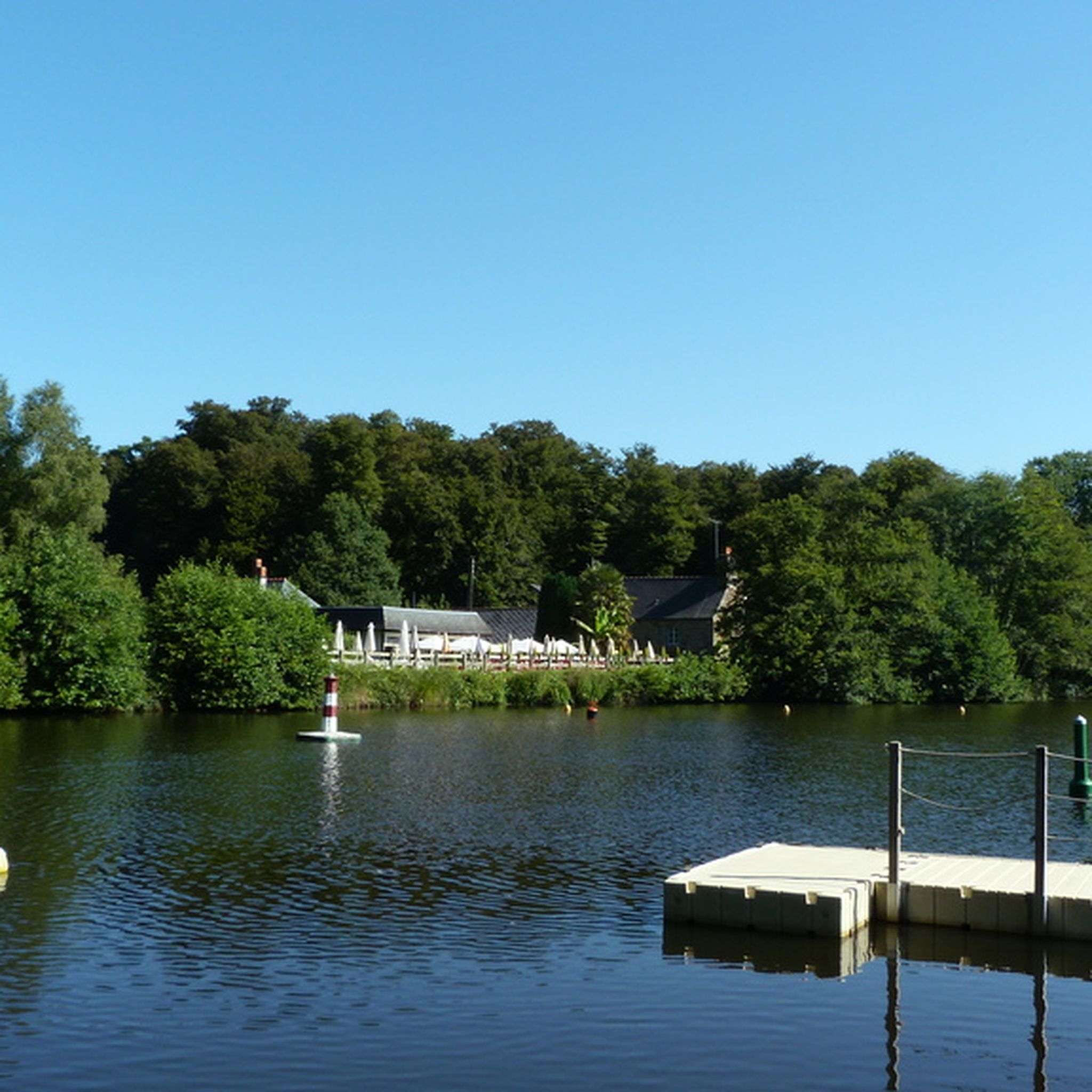
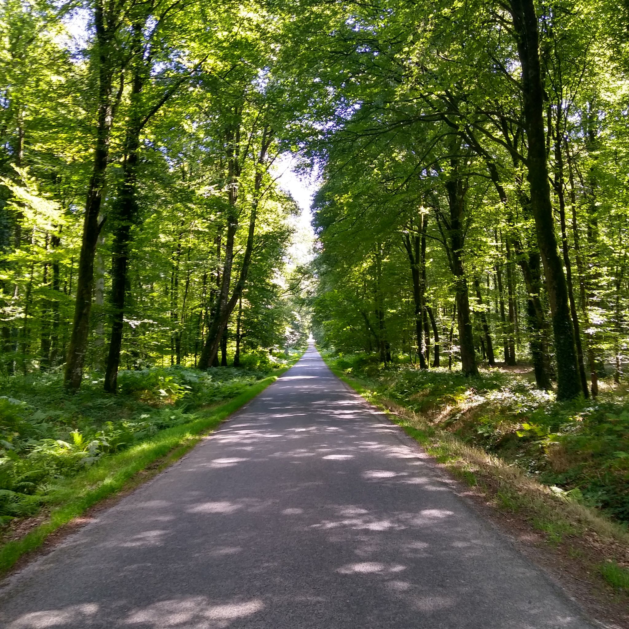
Touring cycling around Forêt de Villecartier offers a network of routes through dense woodlands and open countryside in Brittany, France. The terrain features gentle undulations with some more challenging ascents, providing varied experiences for cyclists. The forest is characterized by magnificent high forest of beeches and oaks, a serene undergrowth, a forest pond, deep valleys, and rocky outcrops. Extensive forest cover is interspersed with agricultural lands and small villages, connecting natural areas with local points of interest.
Best touring cycling…
Last updated: July 5, 2026
4.0
(3)
20
riders
60.6km
03:44
470m
470m
Hard bike ride. Very good fitness required. Mostly paved surfaces. Suitable for all skill levels.
8
riders
Hard bike ride. Good fitness required. You may need to push your bike for some segments of this route.

Sign up for free
3
riders
13.5km
01:10
90m
90m
Easy bike ride. Great for any fitness level. Mostly paved surfaces. Suitable for all skill levels.
7
riders
51.0km
03:39
440m
440m
Hard bike ride. Good fitness required. You may need to push your bike for some segments of this route.
5
riders
Moderate bike ride. Good fitness required. Mostly paved surfaces. Suitable for all skill levels.
Get access to more routes and recommendations from other explorers.
Sign up for free
Already have an account?
Our route recommendations are based on thousands of hikes, rides, and runs completed by other people on komoot.
Start today with a free account
Your next adventure awaits.
Login or Signup


Tips from the Community

At the beginning of the 16th century, Bazouges-la-Pérouse had over 5,000 inhabitants, focused on agriculture and trade. The town retains many traces of this past prosperity along its alleyways and its characterful buildings.
0
0

beautiful old town church
1
0

Considered the first modern telecommunications system, aerial telegraphy was developed by Claude Chappe in 1791. A revolutionary invention, it allowed a signal to be transmitted from Paris to Brest in twenty minutes. It is the only telegraph in Brittany whose mechanism has been completely rehabilitated, and has been open to the public since 2002.
0
0

A unique old mill on top of the highest point in the area. Nice resting place with a café too.
1
0


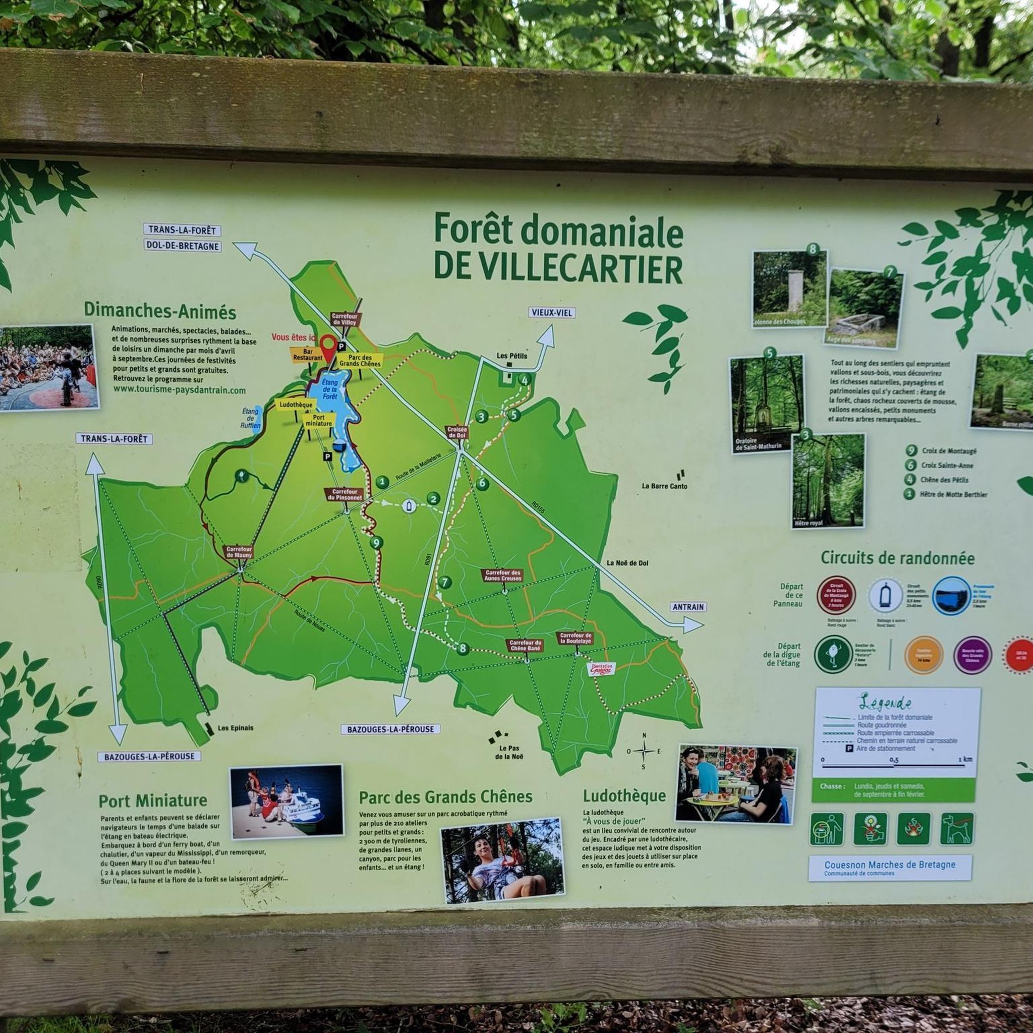
A recommended small hiking area is the Villecartier forest. The forest consists mostly of beech and oak trees, but also of larger areas where there must have been a fire not long ago. In addition to the hiking trails, this national forest is home to a recreation center that offers activities such as tree rope climbing and electric boat pond rides.
1
0

The place is easy to explore by bike
2
0

This locality experienced its golden age in the 16th century, enriched by merchant exchanges on this meeting point of commercial routes. This “Small town of character” has retained its old-world charm with its granite stone walls and half-timbered walls.
1
0
Frequently Asked Questions
What is the overall difficulty level of touring cycling routes in Forêt de Villecartier?
Forêt de Villecartier offers a diverse range of touring cycling routes. You'll find options from easy, gentle rides to more challenging trails with significant elevation changes. Out of over 100 routes, there are 23 easy routes, 50 moderate routes, and 35 difficult routes, catering to various skill levels.
Are there easy touring cycling routes suitable for beginners or families in Forêt de Villecartier?
Yes, Forêt de Villecartier has several easy touring cycling routes perfect for beginners or families. These routes typically feature gentler terrain and shorter distances. An example is the L'Auge des Sabotiers loop from Forêt de Villecartier, which is 13.5 km long and classified as easy.
Are there challenging touring cycling routes for experienced cyclists in Forêt de Villecartier?
Experienced cyclists looking for a challenge will find several difficult routes in Forêt de Villecartier. These often include longer distances, more significant ascents, and sections with varied surfaces like gravel. The Bazouges-la-Pérouse – Gravel Path loop from Vieux-Viel is a difficult 42.4 km route featuring mixed-surface cycling.
What is the typical length and duration of touring cycling routes in the area?
Route lengths and durations vary significantly. You can find shorter loops, like the Small town with character – Bazouges-la-Pérouse loop from Forêt de Villecartier at 26.2 km, which takes about 2 hours 10 minutes. Longer routes, such as the Bazouges-la-Pérouse – Étang de Boulet loop from Forêt de Villecartier, cover 60.6 km and can take nearly 4 hours to complete.
Are there circular touring cycling routes available in Forêt de Villecartier?
Yes, many touring cycling routes in Forêt de Villecartier are designed as loops, allowing you to start and end at the same point. This is convenient for exploring the forest and surrounding areas without needing to retrace your steps. Examples include the L'Auge des Sabotiers loop and the The Chappe telegraph loop from Trans-la-Forêt.
What is the best time of year to go touring cycling in Forêt de Villecartier?
The best time for touring cycling in Forêt de Villecartier is generally from spring through autumn (April to October). During these months, the weather is typically mild, and the forest is vibrant. Summer offers longer daylight hours, while spring and autumn provide beautiful foliage and cooler temperatures, ideal for longer rides.
Is touring cycling possible in Forêt de Villecartier during winter?
While touring cycling is possible in winter, conditions can be more challenging due to colder temperatures, shorter daylight hours, and potentially wet or icy paths. Some routes may be less accessible. It's advisable to check local weather conditions and trail status before heading out and to dress appropriately for cold weather.
What kind of terrain can I expect on the touring cycling routes?
The terrain around Forêt de Villecartier is characterized by extensive forest paths, interspersed with agricultural lands and small villages. You can expect a mix of surfaces, including paved roads, gravel sections, and compacted earth trails. The region features gentle undulations, with some routes including more challenging ascents.
Are there any scenic viewpoints or interesting landmarks along the routes?
Many routes offer scenic views of the dense woodlands and open countryside. The region is known for its natural beauty, and some routes connect to local points of interest. For instance, the Bazouges-la-Pérouse – Étang de Boulet loop leads to the Étang de Boulet, a notable lake in the area.
What do other touring cyclists enjoy the most about touring cycling in Forêt de Villecartier?
The area is highly rated by the komoot community, with an average score of 4.4 stars from over 500 reviews. Reviewers often praise the extensive forest paths, the variety of routes for different skill levels, and the connection to charming local villages and lakes, providing a rich and engaging cycling experience.
Where can I park my car when visiting Forêt de Villecartier for cycling?
Designated parking areas are typically available at key access points around Forêt de Villecartier, especially near popular trailheads or visitor centers. For routes starting from specific towns like Bazouges-la-Pérouse or Vieux-Viel, you can usually find public parking within the village centers.
Are there places to eat or drink along the touring cycling routes?
While the routes primarily traverse natural areas, many connect to small villages and towns like Bazouges-la-Pérouse. These villages often have local cafes, bakeries, or small restaurants where you can stop for refreshments or a meal. It's a good idea to check the route map for towns along your chosen path.
Most popular routes around Forêt de Villecartier

Get inspired with the komoot mobile app


Explore more
Browse the best Cycling routes in other regions.
