The best running trails around Plateau de Chamoise
4.4
(59)
3,135
runners
132
runs
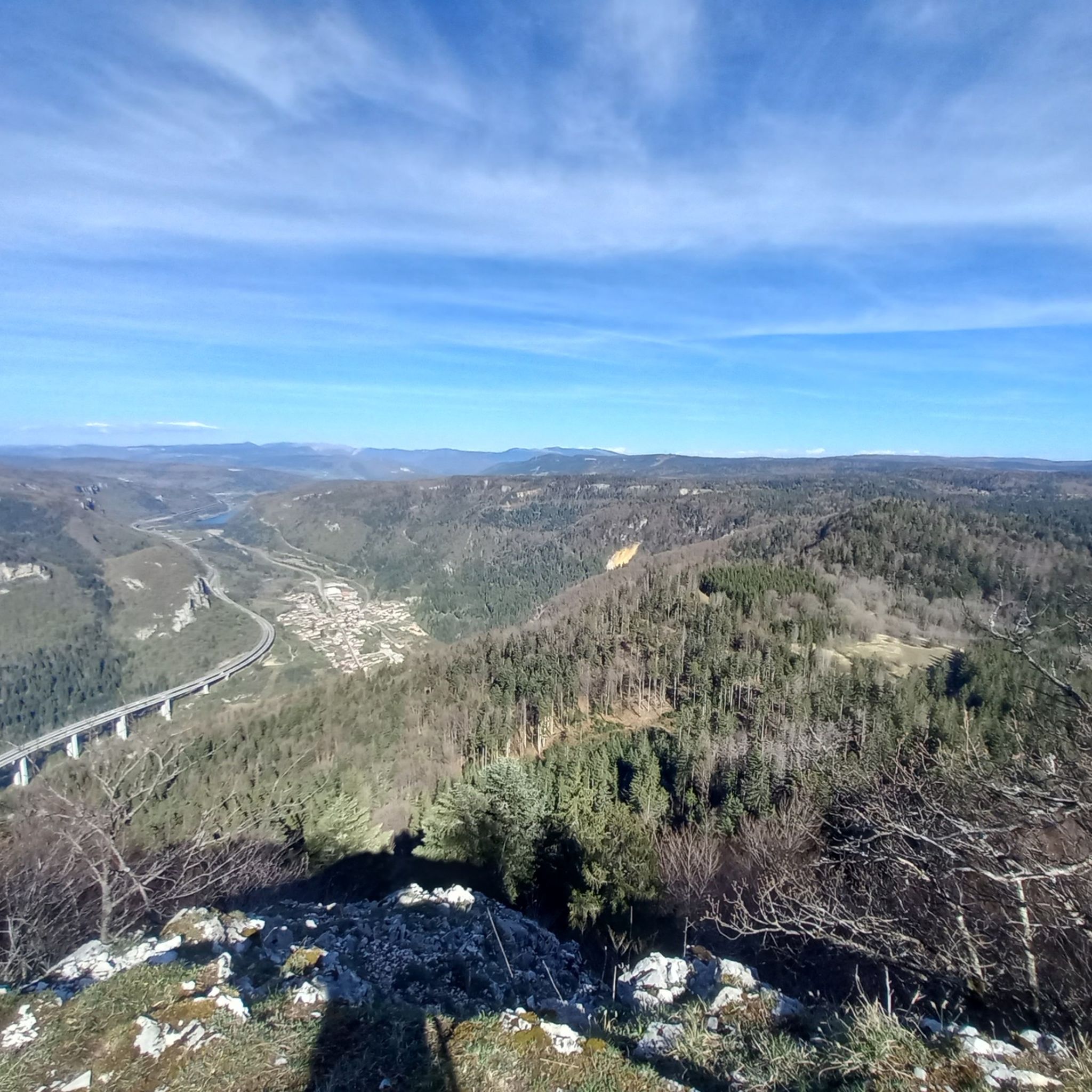
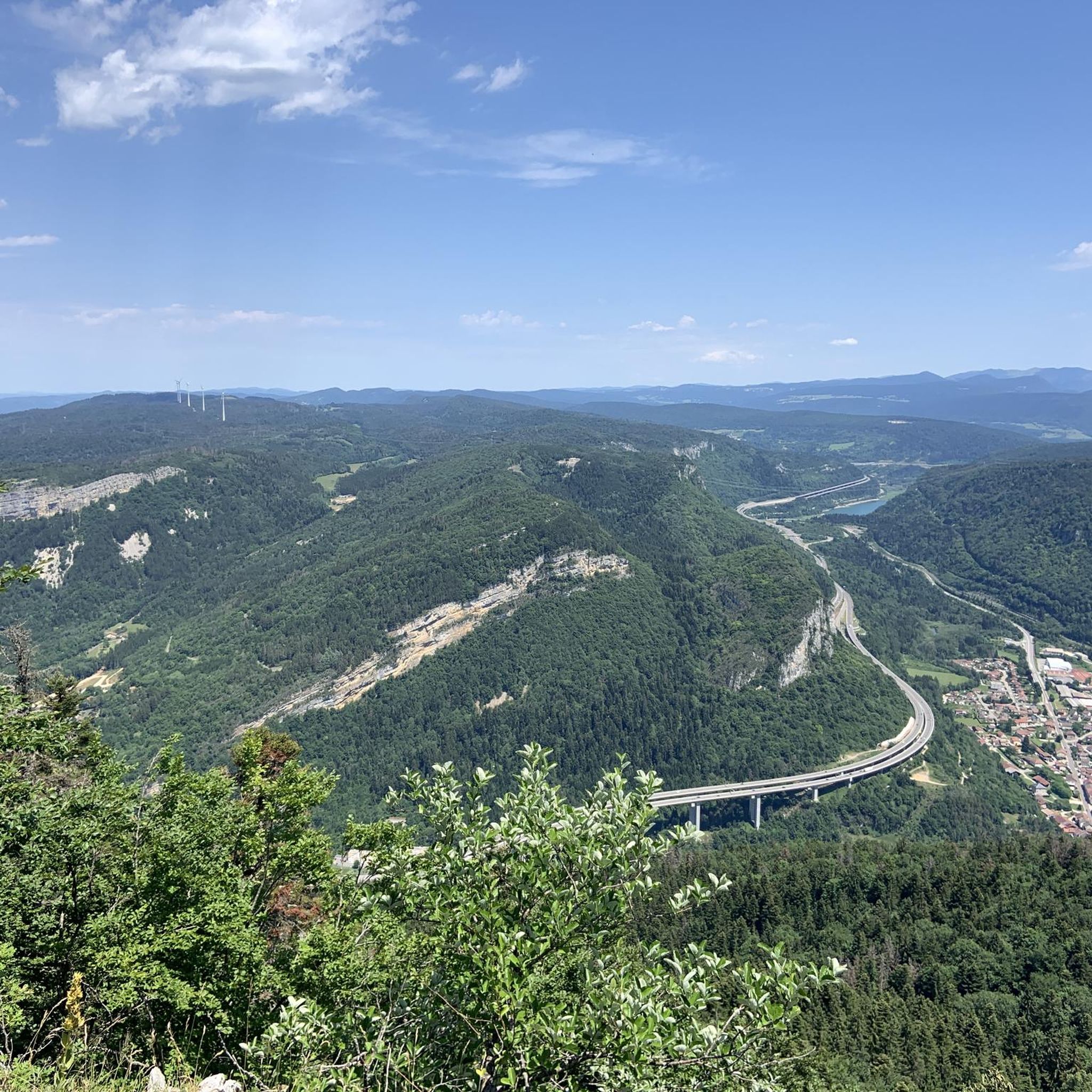
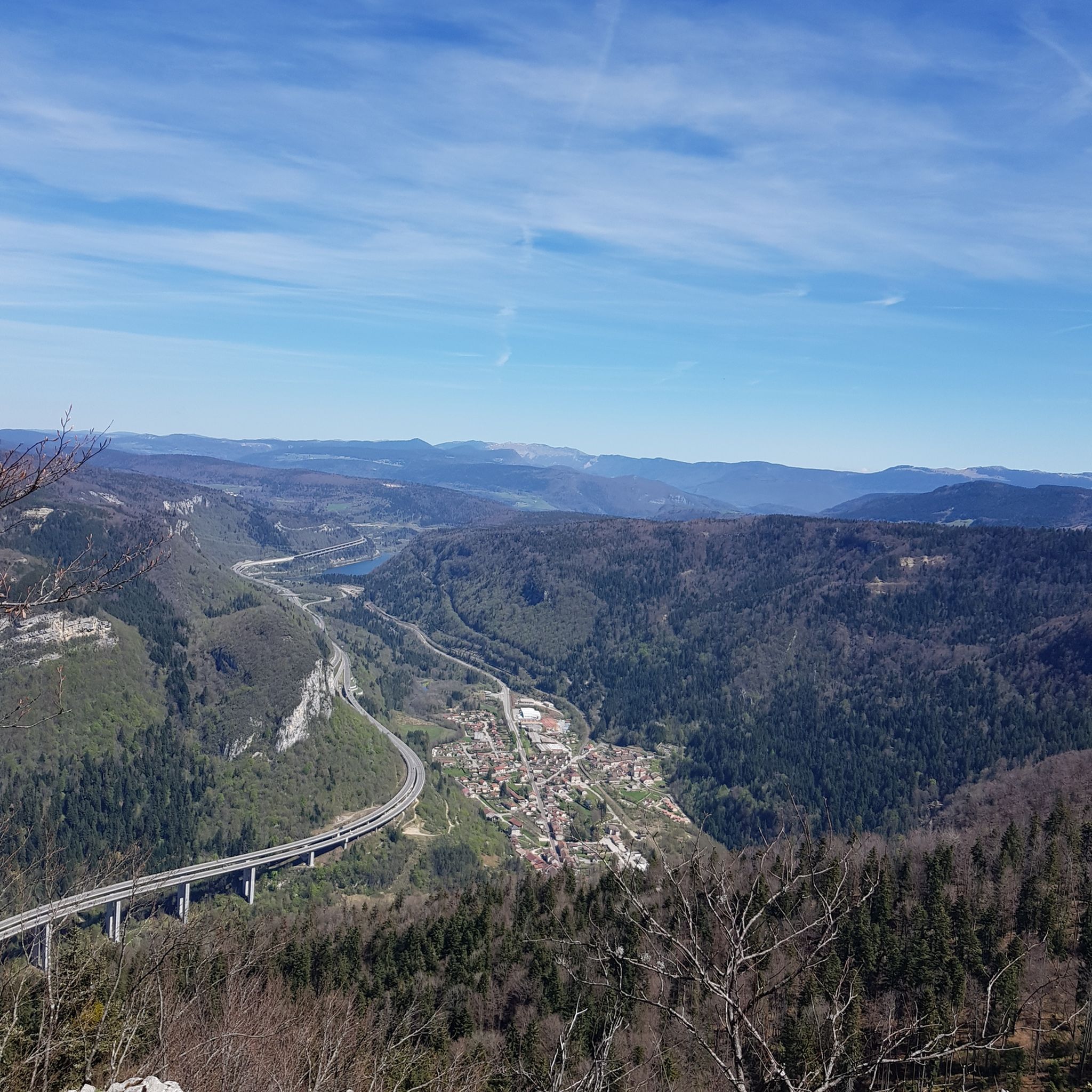
Jogging routes around Plateau de Chamoise traverse an elevated landscape in the Jura mountains, offering varied terrain suitable for running. The region features a diverse topography, including wide tracks, paths through deep woods, and routes along limestone cliffs. From its highest points, the plateau provides views over Lake Nantua and the surrounding valleys. This area is characterized by its natural features and varied elevation, making it suitable for different running experiences.
Best jogging routes around Plateau de Chamoise
- The most…
Last updated: June 27, 2026
152
runners
13.6km
01:52
620m
620m
Hard run. Very good fitness required. Sure-footedness, sturdy shoes and alpine experience required.
4.0
(2)
155
runners
8.22km
00:53
120m
120m
Moderate run. Good fitness required. Mostly paved surfaces. Suitable for all skill levels.

Sign up for free
108
runners
28.4km
04:17
1,240m
1,240m
Hard run. Very good fitness required. Sure-footedness, sturdy shoes and alpine experience required.
37
runners
22.5km
03:28
1,000m
1,000m
Hard run. Very good fitness required. Sure-footedness, sturdy shoes and alpine experience required.
13
runners
9.62km
01:25
410m
410m
Hard run. Very good fitness required. Sure-footedness, sturdy shoes and alpine experience required.
Get access to more routes and recommendations from other explorers.
Sign up for free
Already have an account?
Our route recommendations are based on thousands of hikes, rides, and runs completed by other people on komoot.
Start today with a free account
Your next adventure awaits.
Login or Signup

Tips from the Community

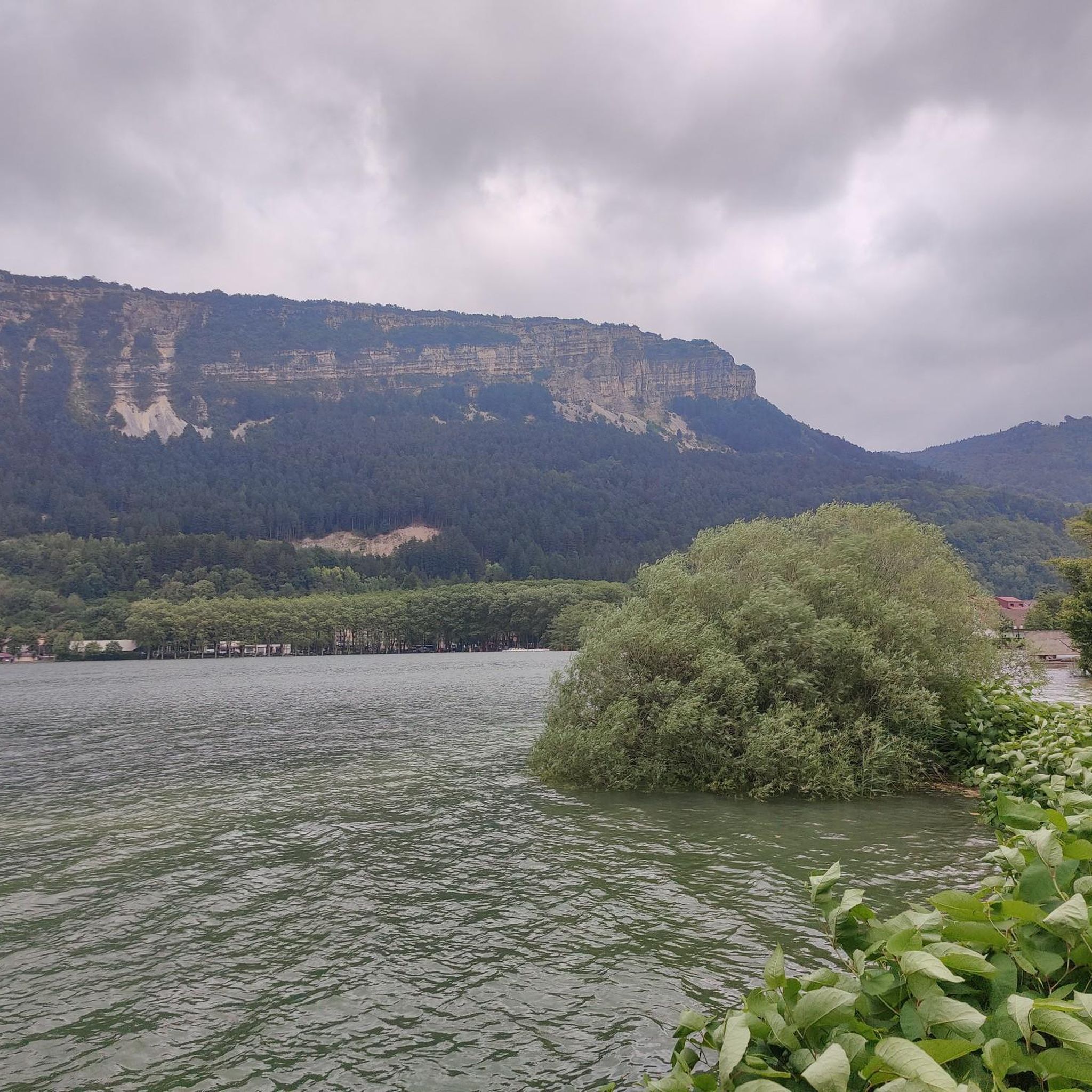
The Lac de Nantua is a superb body of water of 141 hectares. In the heart of the Jura, it offers an ideal setting for practicing a multitude of sports. It is even possible to swim in its waters.
1
0

Beautiful, simple, easy walk; lots of traffic noise on the "road" section, a bit of a shame, but the color of the water is magical
1
0

Unfortunately I was unlucky with the weather, but even as I drove past the place looked very nice, lots of grass and a place to swim.
0
0
Still tracks but very nice route with a nice climb
1
0

The Chemin des Fècles offers a superb route. As you follow this path which passes from deep woods to steep cliffs, be extremely careful not to go too far to the edge of the void. Above all, respect the safety instructions.
1
0


Natural jewel, sapphire blue or emerald green waters, nautical activities.
1
0

Great view of the Lac from Belvedere.
2
0
Frequently Asked Questions
How many running routes are available in Plateau de Chamoise?
There are over 120 running routes around Plateau de Chamoise, offering a wide range of options for different fitness levels. These include 8 easy routes, 69 moderate routes, and 51 difficult routes, ensuring there's a trail for every runner.
Are there any easy jogging routes suitable for beginners or families in Plateau de Chamoise?
Yes, Plateau de Chamoise offers 8 easy running routes that are great for beginners or families looking for a less strenuous experience. While specific family-friendly routes aren't detailed, the easier paths generally provide a gentler introduction to the area's beautiful landscapes.
What kind of views can I expect while running in Plateau de Chamoise?
Jogging routes in Plateau de Chamoise offer breathtaking panoramic views. From elevated points like "le Signal" (1,125 meters), you can enjoy a 180-degree panorama that, on clear days, includes the majestic Alps and even Mont Blanc. Many trails also provide stunning vistas of Lake Nantua, often described as a "natural jewel" with its sapphire or emerald-colored waters, and the Oignin valley.
Are there any circular running routes in Plateau de Chamoise?
Yes, many of the running routes in Plateau de Chamoise are circular, allowing you to start and finish at the same point. For example, the popular Lake Nantua loop from Nantua is a 9.5-mile (15.3 km) circular trail offering diverse terrain and lake views.
What is the best time of year to go running in Plateau de Chamoise?
The Plateau de Chamoise is suitable for running through much of the year. Spring and autumn offer pleasant temperatures and vibrant scenery, with wildflowers like wild orchids and martagon lilies in bloom during spring. Summer is also popular, though some routes might be more exposed. Winter conditions can vary, with snow possible at higher elevations, which might require appropriate gear or alternative routes.
Are dogs allowed on the running trails in Plateau de Chamoise?
While specific regulations for dogs on every trail are not provided, generally, dogs are welcome on many outdoor trails in France, especially if kept on a leash. It's always advisable to check local signage at trailheads for any specific restrictions or protected areas where dogs might not be permitted.
Where can I park when visiting Plateau de Chamoise for a run?
Parking is generally available in and around the town of Nantua, which serves as a common starting point for many routes on the Plateau de Chamoise. Specific parking areas for trailheads are usually indicated locally, making it convenient to access the running paths.
What do other runners say about the trails in Plateau de Chamoise?
The running routes in Plateau de Chamoise are highly rated by the komoot community, with an average score of 4.3 stars from over 50 reviews. Runners often praise the varied terrain, from wide tracks to paths through deep woods, and the rewarding panoramic views, especially over Lake Nantua and towards the Alps.
Are there any challenging running routes for experienced runners?
Absolutely. Plateau de Chamoise features 51 difficult running routes, including challenging ascents and longer distances. For instance, the View over Lake Nantua – Lake Nantua loop from Nantua is a difficult 17.6-mile (28.4 km) path with significant elevation gain, offering extensive views and a demanding workout.
Can I access the running trails in Plateau de Chamoise using public transport?
The town of Nantua, located at the base of Plateau de Chamoise, is generally accessible by public transport, such as regional buses. From Nantua, many trailheads are within walking distance or a short local connection. It's recommended to check local transport schedules for the most up-to-date information on reaching specific starting points.
Are there any routes around 10 km (6 miles) in length?
Yes, there are several routes around that distance. For example, the Le Fulet – Plage Albert Griot loop from Nantua is a 6.4-mile (10.3 km) trail that takes about 1 hour 44 minutes to complete, offering varied landscapes suitable for a good run.
What kind of terrain will I encounter on the running routes?
The terrain in Plateau de Chamoise is quite diverse. You'll find wide tracks, paths winding through deep woods, and routes along steep limestone cliffs. The area's elevated nature means you can expect varied topography, from gentler slopes to more challenging ascents, providing a dynamic running experience.
Most popular routes around Plateau de Chamoise

Get inspired with the komoot mobile app


Explore more
Browse the best Running Trails & Routes in other regions.
