The best road cycling routes around Council Bluffs
4.3
(46)
630
riders
43
rides
Road cycling around Council Bluffs features an extensive network of paved trails, offering diverse experiences for cyclists. The region is characterized by its position along the Missouri River, providing scenic riverfront routes, and the unique Loess Hills to the east. Cyclists can explore a continuous trail system that connects urban areas with natural landscapes like Lake Manawa State Park. This varied terrain includes relatively flat riverfront paths and routes that traverse the edges of the Loess Hills.
Best road cycling…
Last updated: May 16, 2026
17
riders
42.9km
02:20
80m
80m
Moderate road ride. Good fitness required. Some segments of this route may be unpaved and difficult to ride.
46
riders
Moderate road ride. Good fitness required. Mostly well-paved surfaces and easy to ride.

Sign up for free
14
riders
Easy road ride. Great for any fitness level. Mostly well-paved surfaces and easy to ride.
5.0
(2)
17
riders
Moderate road ride. Great for any fitness level. Some segments of this route may be unpaved and difficult to ride.
4
riders
50.2km
04:17
310m
310m
Moderate road ride. Good fitness required. Mostly well-paved surfaces and easy to ride.
Get access to more routes and recommendations from other explorers.
Sign up for free
Already have an account?
Our route recommendations are based on thousands of hikes, rides, and runs completed by other people on komoot.
Start today with a free account
Your next adventure awaits.
Login or Signup

Other adventures around Council Bluffs

Tips from the Community

This large park has sports fields, trails, picnic areas, and a golf course. There's parking and access to trails that traverse the city so it's a good place to start and end a ride.
0
0
The multi-use Keystone Trail is an important part of Omaha's urban to rural trail system. Linking many of the areas business districts, parks, and Universities to the surrounding rural areas. Much of the trail follows along Little Papillion Creek, with multiple bridges over the water.
0
0
This 20-mile trail runs along the river and through downtown Omaha and multiple parks. It's a great way to get out and explore the city.
0
0

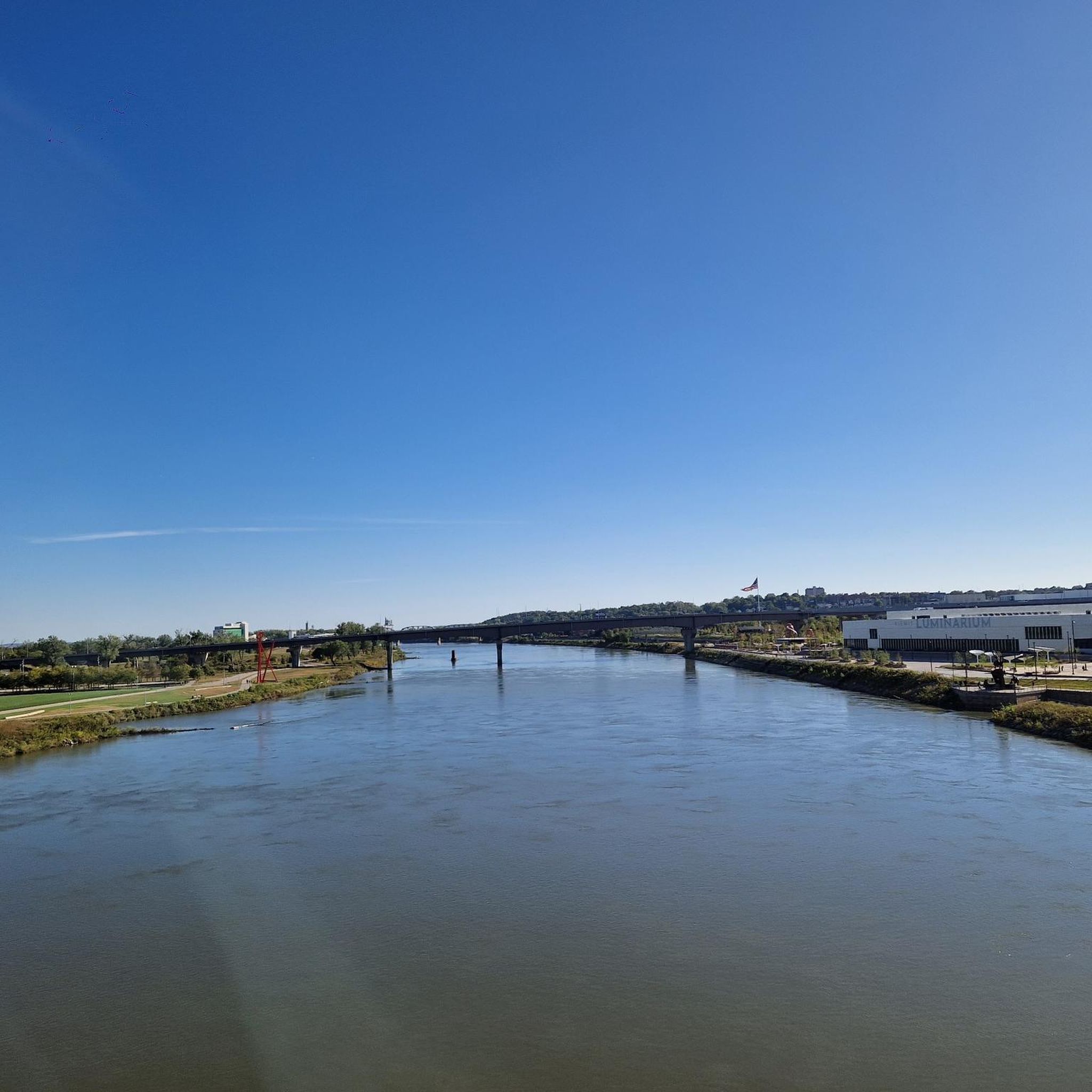
You get a nice view of the river here, and could even park your bike and hop on a river cruise if you like. But the best thing about River Road (just south of you) is that it connects cycle-friendly paths on the north and south sides of I-80.
0
0
This old railroad bridge reveals the origins of this stretch of trail: It was once part of the country's first transcontinental railroad.
0
0

At this spot you cross a nice bridge over West Papio Creek. The water is lined with rushes and tall grasses, which makes the water sometimes a little hard to see from the side, but makes it a popular spot with birds and other wildlife. This is a nice place to slow down and keep an eye out for them!
0
0

Nice Trail with some cool art here and there and insight on the former use of the trail
0
0

Frequently Asked Questions
How extensive is the road cycling trail system in Council Bluffs?
Council Bluffs boasts a remarkable 41-mile continuous paved trail system, often featuring 10-foot-wide concrete and asphalt trails with dedicated bike lanes. This network connects various neighborhoods, attractions, and even extends across the Missouri River into Omaha via the iconic Bob Kerrey Pedestrian Bridge. Overall, komoot lists over 50 road cycling routes in the area.
What kind of terrain and difficulty can I expect on Council Bluffs' road cycling routes?
The road cycling routes in Council Bluffs offer a diverse range of terrain. You'll find relatively flat riverfront paths along the Missouri River, as well as routes that traverse the edges of the unique Loess Hills, which can introduce some varied elevation. The komoot community rates 15 routes as easy, 42 as moderate, and 2 as difficult, ensuring options for all skill levels.
Are there family-friendly road cycling routes in Council Bluffs?
Yes, many of Council Bluffs' paved trails are suitable for families. The extensive, well-maintained trail system, including routes like the Keystone Trail – Harrison Heights Park loop, offers safe and enjoyable rides away from vehicular traffic. The relatively flat sections of trails like the Iowa Riverfront Trail are particularly good for younger riders.
What scenic views or attractions can I discover along the road cycling routes?
You can enjoy diverse scenery, from the unique Loess Hills to the Missouri Riverfront. Routes often pass by attractions like the Bob Kerrey Pedestrian Bridge, offering panoramic river views. You might also encounter natural features like Childs Hollow or Carter Lake Boardwalk. The Bob Kerrey Pedestrian Bridge loop from College View Elementary School is a great option for scenic views.
Are there good loop road cycling routes available?
Yes, Council Bluffs offers several excellent loop routes. For example, the Keystone Trail – Big Papio Trail loop from Omaha is a popular 27.3-mile option. Another favorite is the Bob Kerrey Pedestrian Bridge – Bob Kerrey Pedestrian Bridge loop from Omaha, which covers 16.1 miles through the riverfront area.
Where can I find parking or access points for road cycling trails?
Council Bluffs' extensive trail system has numerous access points and parking options throughout the city and at various parks. Major trailheads are often located near parks like Tom Hanafan River's Edge Park, Lake Manawa State Park, and along the Wabash Trace Nature Trail. For specific parking information, it's advisable to check local city resources or trail maps.
What is the best time of year for road cycling in Council Bluffs?
The spring and fall months generally offer the most pleasant conditions for road cycling in Council Bluffs, with milder temperatures and beautiful foliage. Summer can be warm, but early mornings or evenings are often comfortable. Winter cycling is possible, but conditions can vary with snow and ice, so checking local weather forecasts is essential.
Are there places to eat or drink along the road cycling routes?
Yes, several trails offer convenient access to dining options. The Wabash Trace Nature Trail is famous for its "Thursday Taco Ride," which draws cyclists to Tobey Jack's Mineola Steakhouse. Trails connecting to downtown Council Bluffs or Omaha also provide access to various cafes, restaurants, and pubs. Lake Manawa State Park, for instance, is near several establishments.
Can you tell me more about the Wabash Trace Nature Trail?
The Wabash Trace Nature Trail is one of southwest Iowa's most iconic routes, a 63-mile converted railroad corridor stretching from Council Bluffs to Blanchard. It offers a mix of small-town charm, rolling countryside, and scenic views, featuring over 70 bridges. It's relatively flat and much of it is shaded by a tree canopy, making it suitable for all skill levels. While not exclusively a road cycling route, its paved sections are popular.
What is the Iowa Riverfront Trail like for road cycling?
The Iowa Riverfront Trail is a scenic 7.8-mile paved trail running along the Missouri River. It provides beautiful river views and offers easy connections to attractions like Tom Hanafan River's Edge Park and the Bob Kerrey Pedestrian Bridge. It's a relatively flat and accessible route, ideal for a relaxed ride with picturesque surroundings.
How do other road cyclists rate the routes in Council Bluffs?
The road cycling routes in Council Bluffs are highly rated by the komoot community, with an average score of 4.1 stars from over 100 reviews. Reviewers often praise the extensive paved trail system, the scenic riverfront views, and the variety of routes available for different skill levels.
Are there any resources for trail information or maps for Council Bluffs?
Yes, for detailed information on the local trail system, including maps and updates, you can visit the official Council Bluffs city website. They often provide comprehensive resources for outdoor enthusiasts. You can find more information at councilbluffs-ia.gov/Trails.
Most popular attractions around Council Bluffs

Get inspired with the komoot mobile app


Explore more
Browse the best Road cycling routes in other regions.
