The best running trails around Clyne Valley Woods
5.0
(1)
499
runners
18
runs
Jogging around Clyne Valley Woods offers access to over 700 acres of varied natural landscapes, including extensive woodlands, streamlets, gorges, and hills. The region is characterized by a network of footpaths, bridleways, and dirt trails, providing diverse terrain for runners. The Clyne River flows through the park, complemented by lakes, wetlands, and semi-natural grasslands. This area provides a mix of paths suitable for different fitness levels, from gentle runs to more challenging routes.
Best jogging routes around Clyne Valley Woods
- The most popular jogging route is Three Cliffs loop from Black Pill via Mumbles, a 17.9 miles (28.9 km) trail that takes 3 hours 7 minutes to complete. This difficult route offers coastal views and passes through the Mumbles area.
- Another top favourite among local runners is Clyne Valley Country Park loop — Gower, a moderate 3.5 miles (5.6 km) path. This route explores the varied woodlands and river systems within the park.
- Local runners also love the Clyne Valley Cycle Path – The Railway Inn loop from Dunvant, a 4.7 miles (7.6 km) trail leading through the park's wooded areas and along its cycle path, often completed in about 48 minutes.
- Jogging around Clyne Valley Woods is defined by extensive woodlands, river systems, and varied terrain, including footpaths and bridleways. The network offers options for different ability levels, from moderate loops to more difficult long-distance runs.
- The routes in Clyne Valley Woods are highly rated by the komoot community with an average score of 5.0 stars from over 1 review. More than 480 runners have used komoot to explore Clyne Valley Woods's varied terrain.
Last updated: June 30, 2026
3
runners
28.9km
03:07
390m
390m
Embark on a challenging jogging adventure with the Three Cliffs loop from Black Pill via Mumbles. This difficult 17.9-mile (28.9 km) route, typically completed in 3 hours and 7 minutes, offers a diverse experience. You will start on mostly paved surfaces along the Mumbles seafront, enjoying relatively flat sections. As you head towards Three Cliffs Bay, the terrain shifts to rugged coastal paths, sandy tracks, and wooded areas, with some uneven and potentially muddy sections. The trail provides breathtaking views of the dramatic limestone peaks of Three Cliffs Bay, golden sands, and the historic ruins of Pennard Castle perched above the valley.
This loop is best suited for joggers with good to very good fitness due to its undulating terrain and steeper inclines, especially on the coastal paths leading to Three Cliffs. While the Mumbles sections are flatter, be prepared for rougher paths and potential sand dunes further along the route. You might even need to navigate stepping stones to cross a stream near Three Cliffs Bay. Always check local conditions, especially after rain, as some parts can become muddy. This route is part of the larger Wales Coast Path, so signage should be clear.
The Three Cliffs loop is a quintessential Gower experience, showcasing the region's natural beauty and historical significance. Three Cliffs Bay itself is one of the most photographed locations on the Gower Peninsula, famous for its distinctive three limestone peaks and an archway leading to Pobbles Beach. The route also offers panoramic views across Swansea Bay, Mumbles Head, and the iconic Mumbles Lighthouse. You will be jogging through an Area of Outstanding Natural Beauty, providing a stunning backdrop of diverse landscapes including beaches, cliffs, and farmland.
5.0
(1)
4
runners
5.58km
00:37
90m
90m
Embark on a moderate jogging loop through Clyne Valley Country Park, a 3.5-mile (5.6 km) route that takes approximately 36 minutes to complete. You will gain about 302 feet (92 metres) in elevation as you explore 700 acres of varied natural terrain. The trail winds through dense woodlands of oak, birch, and beech trees, following the meandering Clyne River, and passing by lakes and wetlands. Keep an eye out for diverse birdlife like wagtails and woodpeckers, and notice the interesting fungi along the way.
The park offers a network of footpaths, bridleways, and dirt trails, with this specific loop featuring mostly accessible and paved paths. While generally easy to navigate, some sections may require sure-footedness. A central cycle track also runs through the park, providing another option for your run. Good fitness is recommended for this moderate route, ensuring you can comfortably enjoy the mix of surfaces.
Clyne Valley Country Park is a significant green space within Swansea, acting as an important ecological corridor. Beyond its natural beauty, the valley holds a rich industrial past, with remnants of coal mining, mineral workings, and railways dotted throughout. This historical context adds a unique dimension to your jogging experience, blending nature with the echoes of the past. The park's extensive path network makes it a versatile destination for various outdoor activities.

Sign up for free
106
runners
12.7km
01:19
100m
100m
Moderate run. Good fitness required. Mostly paved surfaces. Suitable for all skill levels.
92
runners
Moderate run. Good fitness required. Mostly paved surfaces. Suitable for all skill levels.
78
runners
19.7km
02:03
130m
130m
Hard run. Very good fitness required. Mostly paved surfaces. Suitable for all skill levels.
Get access to more routes and recommendations from other explorers.
Sign up for free
Already have an account?
Our route recommendations are based on thousands of hikes, rides, and runs completed by other people on komoot.
Start today with a free account
Your next adventure awaits.
Login or Signup

Tips from the Community

This is a great trail to run along. It is nice and flat and leads down to the beach. It is really peaceful and there is a pub along the way as well
1
0
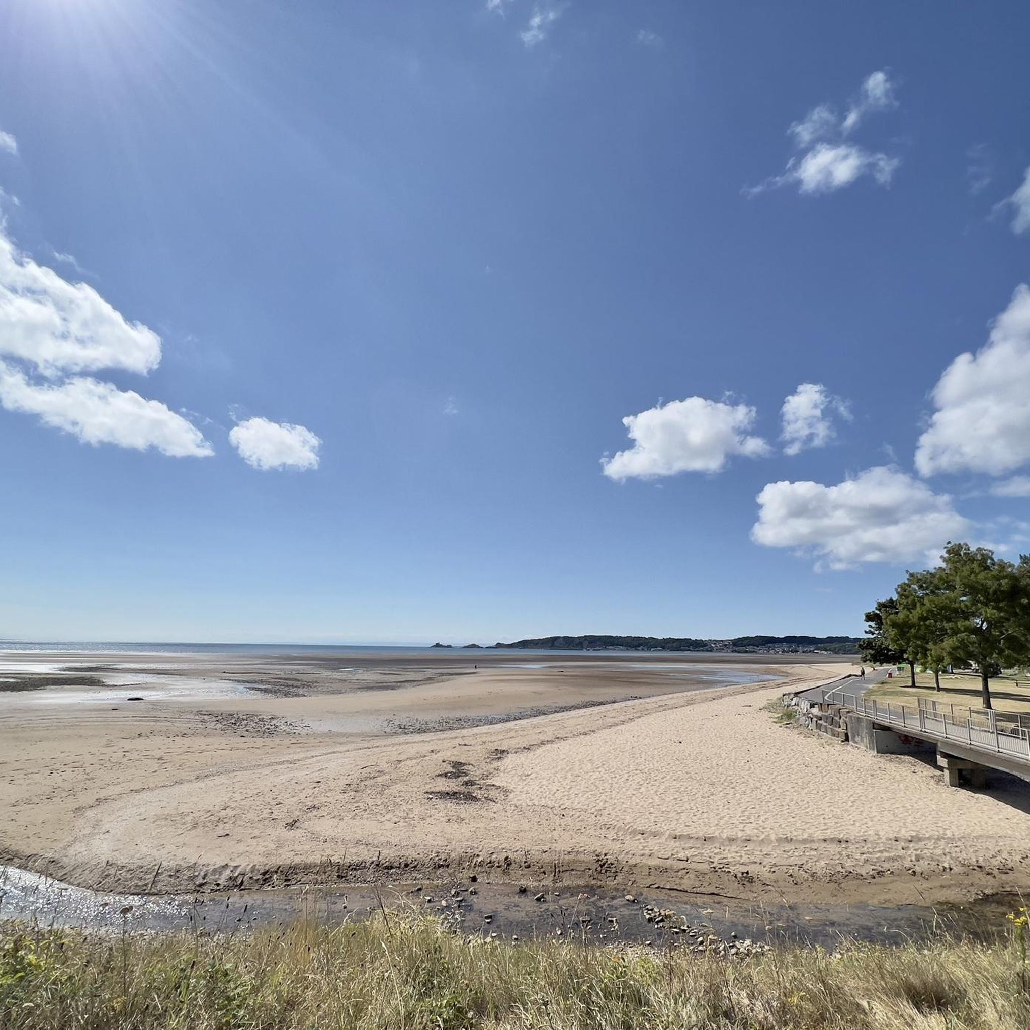
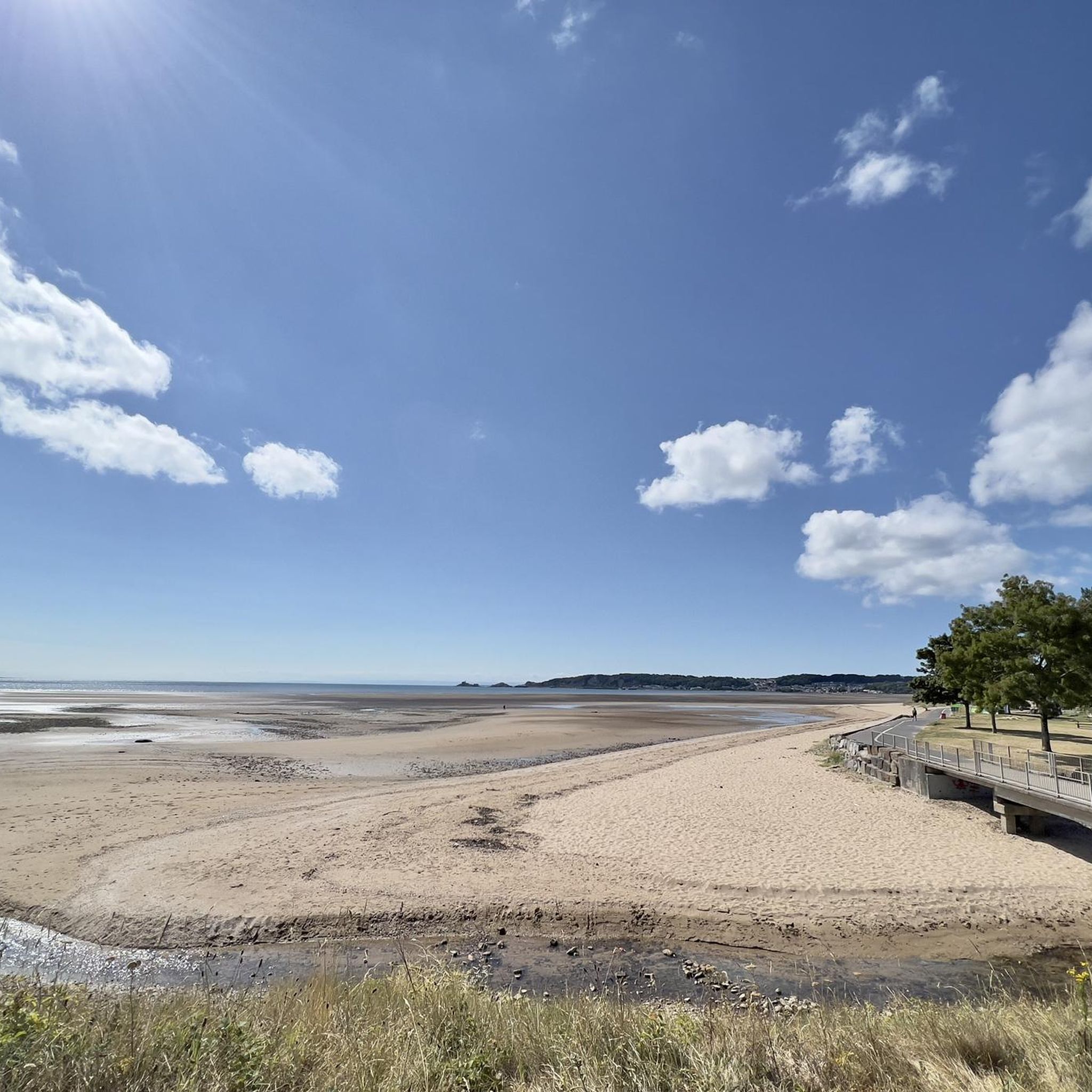
A lovely long stretch of beach across from the Clyne cycle path. You can run all the way along the promenade down to Swansea city or along to Mumbles. There are is a cafe further along and public toilets.
1
0
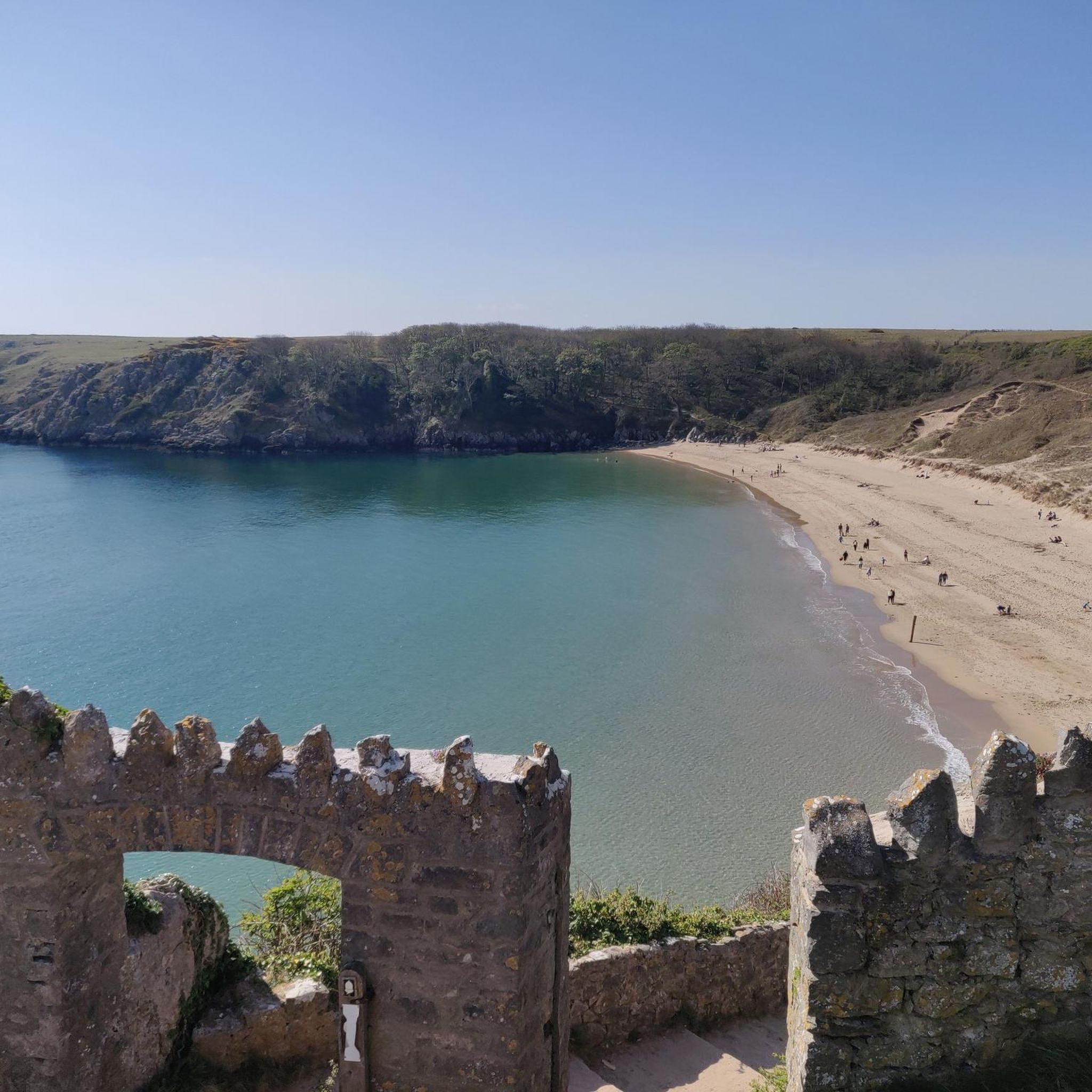
Lovely bay great place to swim. There is a car park and toilets and a nice cafe and restaurant as well
1
0

A pair of walking shoes would be good on this route some sections in Feb were still muddy. However generally sand a grass under foot The pub in the photo is a great place to stop while waiting for bus to arrive.
0
0

Clyne Valley Country Park is a 691-acre (280-hectare) area set around the Clyne River that runs into the sea at the Mumbles seafront between Lower Sketty and Blackpill. It is a marvellous green area that covers both sides of the valley in thick woodlands of oak, birch, and beech trees. There are signs of its intensive industrial history dotted within the park, but mainly it is now noted for its extensive network of walking, running, and cycling trails.
1
0


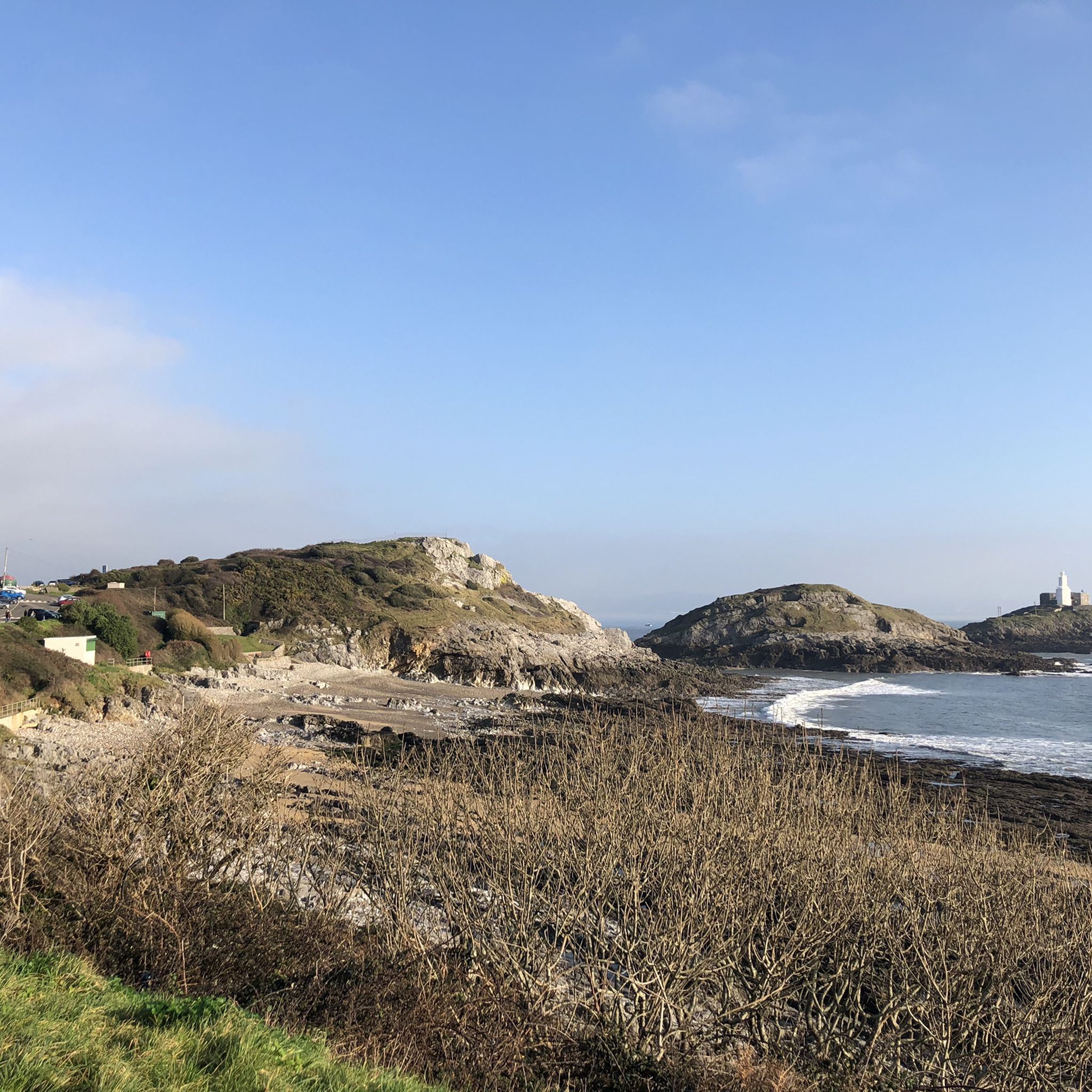
Bracelet Bay is a small bay on the south of the Gower Peninsula. It is the first bay one comes to after leaving Swansea Bay and rounding Mumbles Head. Surrounded by limestone cliffs, the bay is pebbly, with some sand. To the west, the bay is separated from Limeslade Bay by Tutt Hill, the location of a coastguard look-out station. A notable feature of the bay is the "Big Apple" kiosk, a concrete structure that was erected by the roadside during the 1930s as an advertising feature and has been a sales outlet ever since. Several similar kiosks were erected along the South Wales coast, but the one in Bracelet Bay is the only example surviving. In 2010 it was largely rebuilt after being damaged by a vehicle the previous year, and in 2019 it was designated a Grade II listed building. The name 'Bracelet' is thought to be a corruption of 'Broad Slade'.
1
0
Frequently Asked Questions
How many running routes are available in Clyne Valley Woods?
Komoot offers nearly 20 diverse running routes around Clyne Valley Woods, catering to various preferences and fitness levels. These include moderate loops through the park's woodlands and more challenging long-distance runs.
What kind of terrain can I expect when jogging in Clyne Valley Woods?
Clyne Valley Woods offers a varied terrain for runners, including a network of footpaths, bridleways, and dirt trails. You'll encounter extensive woodlands, streamlets, gorges, and hills, with a central cycle track also serving as a pathway. This mix allows for both gentle runs and more challenging routes.
Are there running routes suitable for beginners or those looking for an easier run?
Yes, while there are no routes specifically graded as 'easy' in the komoot guide, many of the 16 moderate routes are suitable for those looking for a less strenuous run. For example, the Clyne Valley Country Park loop — Gower is a moderate 5.6 km path that explores the varied woodlands and river systems within the park.
Are there any circular running routes in Clyne Valley Woods?
Yes, many of the routes in Clyne Valley Woods are circular, allowing you to start and finish at the same point. A popular option is the Clyne Valley Cycle Path – The Railway Inn loop from Dunvant, a 7.6 km trail through wooded areas.
Can I bring my dog on the running trails in Clyne Valley Woods?
Clyne Valley Woods is generally dog-friendly, with many footpaths and bridleways suitable for running with your canine companion. As a Site of Interest for Nature Conservation, it's important to keep dogs under control, especially around wildlife and other park users. Always check local signage for specific restrictions.
Are the running trails in Clyne Valley Woods suitable for families?
Yes, the varied network of paths in Clyne Valley Woods includes options suitable for families. The central cycle track and some of the wider footpaths offer smoother surfaces for a family run or walk. The diverse natural features and historical elements can also make for an engaging outing for all ages.
What kind of natural features or landmarks can I see while jogging?
While jogging in Clyne Valley Woods, you'll experience extensive woodlands with magnificent beech, ash, and oak trees, the graceful Clyne River, lakes, wetlands, and semi-natural grasslands. You might also spot wildlife like otters and various bat species. For specific points of interest, consider exploring the Clyne Valley Trail.
Are there any historical sites along the running paths in Clyne Valley Woods?
Clyne Valley Woods has a rich industrial history, and evidence of its past as a coal mining and industrial hub is still present. You can find remnants of mineral workings, railways, and canals. A notable historical landmark is the WWII Pillbox at Clyne Valley Cycle Path, offering a glimpse into the area's past.
Where can I park when visiting Clyne Valley Woods for a run?
Clyne Valley Woods has multiple entry points, and parking is available at various locations around the park. Specific parking details can often be found on local council websites or by checking the starting points of individual routes on komoot.
Is Clyne Valley Woods accessible by public transport?
Yes, Clyne Valley Woods is readily accessible to the population of Swansea and has multiple entry points, some of which are reachable by public transport. Bus routes often serve areas adjacent to the park, allowing for convenient access to the running trails.
What do other runners enjoy most about jogging in Clyne Valley Woods?
The running routes in Clyne Valley Woods are highly rated by the komoot community, with an average score of 5.0 stars. Runners often praise the extensive woodlands, the varied terrain that offers both gentle and challenging options, and the peaceful natural environment that makes for an engaging outdoor experience.
Are there options for longer, more challenging runs in the area?
Absolutely. For those seeking a more demanding run, there are difficult routes available. The Three Cliffs loop from Black Pill via Mumbles is a challenging 28.9 km trail offering coastal views, while the West Cross Beach – Swansea Bay Beach loop from Dunvant covers 19.6 km.
Are there any cafes or pubs near the running trails?
Yes, after a run, you can find options for refreshments. The The Railway Inn is a pub located near one of the popular routes, offering a convenient stop. Additionally, the proximity to Swansea and Mumbles means there are various cafes and pubs within a short distance of the park's entry points.
Most popular routes around Clyne Valley Woods
Most popular attractions around Clyne Valley Woods

Get inspired with the komoot mobile app


Explore more
Browse the best Running Trails & Routes in other regions.
