The best road cycling routes around Campbell'S Island
4.5
(2)
175
riders
26
rides
Road cycling routes around Campbell'S Island primarily follow the flat terrain along the Mississippi River and Duck Creek. The region features established multi-use paths and road networks, offering accessible cycling experiences. Elevations are generally low, with routes typically staying below 200 meters of ascent. This landscape provides opportunities for both shorter, easy rides and longer distance road cycling routes.
Best road cycling routes around Campbell'S Island
- The most popular road cycling route is Mississippi River Trail and Le Claire Loop…
Last updated: October 5, 2026
2
riders
34.6km
01:30
170m
170m
Easy road ride. Great for any fitness level. Mostly well-paved surfaces and easy to ride.
1
riders
59.1km
02:43
200m
200m
Moderate road ride. Good fitness required. Mostly well-paved surfaces and easy to ride.

25
riders
40.2km
02:14
140m
140m
Moderate road ride. Good fitness required. Mostly well-paved surfaces and easy to ride.
5.0
(1)
18
riders
36.4km
02:10
100m
100m
Moderate road ride. Good fitness required. Mostly well-paved surfaces and easy to ride.
4.0
(1)
21
riders
39.9km
02:28
50m
50m
Moderate road ride. Good fitness required. Mostly well-paved surfaces and easy to ride.
Get access to more routes and recommendations from other explorers.
Already have an account?
Our route recommendations are based on thousands of hikes, rides, and runs completed by other people on komoot.
Start today with a free account
Your next adventure awaits.
Popular around Campbell'S Island


Tips from the Community

Schwiebert Riverfront Park offers a variety of features, including art sculptures, a digital playground, a fountain, a great lawn, an observation shelter, a parking lot, a promenade, restrooms, a stage, a triangle lawn, an urban concrete beach, and a walk/jog path/trail. The park was named after former Mayor Mark Schwiebert, who lived from 1989 to 2009, for his dedication to enhancing public access to the riverfront. The park hosts live music events and is a picturesque setting for leisure and for recreation.
0
0

This 50-acre lake is part of wooded Sunset Park, right on the edge of the Mississippi River. The park also offers restrooms, picnic and playground equipment, and a ball diamond.
0
0

Sylvan Slough is a river in Illinois that passes Rock Island. If you follow the river further east, you'll get wonderful views to Rock Island Arsenal and Sylvan Island.
1
0

From this spot along the Great River Trail you get great views of Sylvan Island. You can cross a bridge to the island, but there are really only hiking and single track mountain bike trails that are unsuitable for road cycling.
2
0

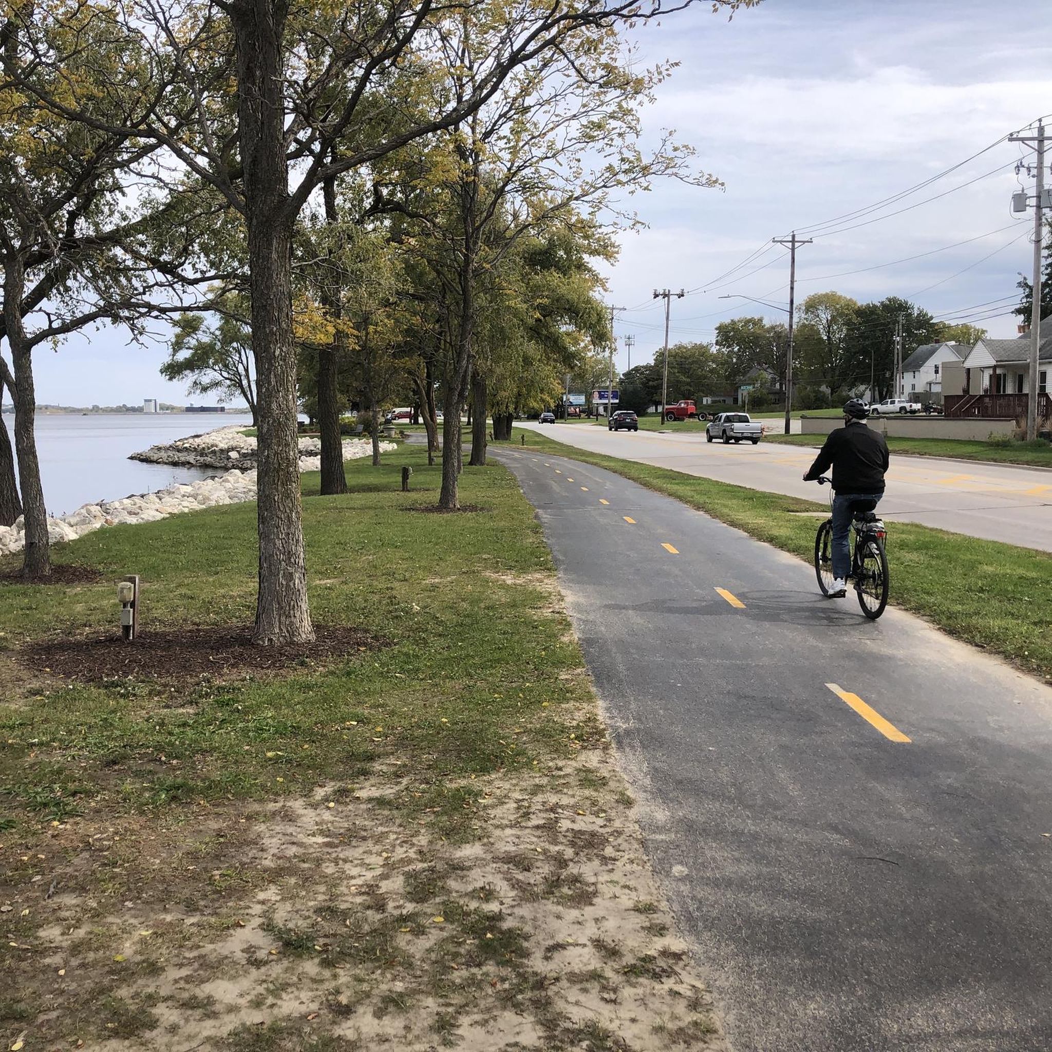
The Duck Creek Trail is a paved multiuse path that runs through Davenport. It connects urban areas with parks and residential areas on mostly off-road trails.
0
0

This is a great little bridge heading from East Moline out to delightful Campbell Island. You have great views out over the river, and on the island, you can do a nice short, two-mile loop and visit Campbell's Island State Historic Site if you have time on your hands. It is worth crossing the bridge and doing the loop just to get the river views.
1
0
This harbor sits sandwiched between the Great River Trail and the great river itself, the Mississippi — all of which offer stupendous scenery as you cycle by.
0
0
The Mississippi River Trail (MRT) is a long distance bike trail that traverses 10 states. It travels for over 2,000 continuous miles on each side of the river, between the headwaters at Lake Itasca, Minnesota and the Gulf of Mexico. It is still work in progress but when complete the route will consist of trails and bike-friendly roads, with “MRT” signs identifying the way. In Illinois, the MRT route goes through some of the state’s most diverse landscapes and provides miles of great cycling. It hugs historic canals, crosses unglaciated hills, parallels the Rock and Fox Rivers, and includes one of America’s first rail-trails.
0
0
Frequently Asked Questions
How many road cycling routes are available around Campbell's Island?
There are over 30 road cycling routes documented on komoot for the Campbell's Island area, offering a variety of distances and difficulty levels.
Are there easy road cycling routes suitable for beginners or families?
Yes, the region offers 14 easy road cycling routes. Many follow the flat terrain along the Mississippi River and Duck Creek, making them ideal for a relaxed ride. An example is the Mississippi River Trail and Le Claire Loop, which is 21.5 miles long and offers scenic river views.
What kind of terrain can I expect on road cycling routes around Campbell's Island?
Road cycling routes around Campbell's Island primarily feature flat terrain, following the Mississippi River and Duck Creek. You'll find established multi-use paths and road networks with generally low elevations, typically staying below 200 meters of ascent. This makes the area suitable for consistent, enjoyable rides.
Are there options for longer distance road cycling tours?
Absolutely. For those seeking longer rides, routes like the Mississippi River and Duck Creek Trail Loop cover 36.7 miles (59.1 km), combining riverfront sections with dedicated creek trails for an extended experience.
What are the typical lengths of road cycling routes in this area?
Routes vary in length, from shorter, easy rides around 20-25 miles to longer tours exceeding 35 miles. For instance, the Duck Creek Trail – Duck Creek Trail loop from Panorama Park is 24.9 miles (40.2 km) long.
Are there challenging road cycling routes around Campbell's Island?
While the region is generally flat, there are 16 moderate routes that offer longer distances and can provide a good workout. The challenge typically comes from the length of the ride rather than significant elevation gains, as routes usually stay below 200 meters of ascent.
What scenic views or attractions can I expect along the road cycling routes?
Many routes offer picturesque views along the Mississippi River and through local communities. You can also encounter various points of interest such as the I-74 Pedestrian and Bicycle Bridge, the Hampton Village Hall and Soldiers Memorial, and the Sylvan Island Ruins. The Mississippi River Trail (MRT) – Illinois itself is a major scenic feature.
Are there circular road cycling routes available?
Yes, many of the routes are designed as loops, allowing you to start and end at the same point. Examples include the Mississippi River and Duck Creek Trail Loop and the Safe Harbor – Campbell Island Bridge loop from Hampton.
When is the best time of year for road biking in Campbell's Island?
The spring, summer, and fall months generally offer the most pleasant conditions for road cycling in Campbell's Island. The flat terrain makes it enjoyable across these seasons, with autumn providing particularly scenic views as foliage changes along the river.
What do other road cyclists enjoy most about road cycling in Campbell's Island?
Road cyclists frequently praise the well-maintained multi-use paths and the scenic riverfront sections. The accessibility of the routes and the relatively flat profile are often highlighted as key advantages, making it a popular destination for both casual and more experienced riders.
Are there routes that pass through or near towns with amenities like cafes?
Many routes, especially those following the Mississippi River and Duck Creek, pass through or near local communities. This provides opportunities for stops at cafes, restaurants, or shops, particularly in towns like Le Claire or East Moline, which are often part of the route network, such as the Duck Creek Trail – Duck Creek Trail loop from East Moline.
Most popular routes around Campbell'S Island
Most popular attractions around Campbell'S Island

Get inspired with the komoot mobile app


Explore more
Browse the best Road cycling routes in other regions.
