The best running trails around Milan
5.0
(2)
206
runners
23
runs
Jogging around Milan offers diverse landscapes, from historic city parks to extensive canal paths and artificial hills. The city's green spaces and waterways provide varied terrain suitable for different running preferences. Runners can explore flat, scenic routes along the Navigli canals, tackle the gentle inclines of Monte Stella, or enjoy the landscaped paths within urban parks like Parco Sempione.
Best jogging routes around Milan
- The most popular jogging route is Parco Sempione Loop, a 2.2 miles (3.5 km) trail that takes about 25 minutes to complete. This route offers views of landmarks like Sforza Castle and Arco della Pace.
- Another top favourite among local runners is Naviglio Grande Canal Path, a difficult 31.1 miles (50 km) path. This route provides a flat, traffic-free experience along the historic canal, suitable for long-distance training.
- Local runners also love the Idroscalo Lake Circuit, a 4.0 miles (6.5 km) trail leading around the man-made lake, often completed in about 45 minutes.
- Jogging around Milan is defined by historic parks, extensive canal paths, and artificial hills. The network offers options for different ability levels, from easy urban loops to longer, more challenging routes.
- The routes in Milan are highly rated by the komoot community with an average score of 4.0 stars from over 3 reviews. More than 200 runners have used komoot to explore Milan's varied terrain.
Last updated: June 28, 2026
6
runners
15.7km
01:38
30m
30m
The Mississippi River Trail: Credit Island Loop offers a unique jogging experience, blending pleasant green surroundings with expansive views of the Mississippi River. As you navigate the 9.7-mile (15.7 km) route, you'll encounter a mix of paved and crushed rock surfaces, winding through woodlands and past a tranquil lagoon that serves as a resting spot for migratory birds. Despite its modest 92 feet (28 metres) of elevation gain, the trail is rated difficult due to potential challenges from inconsistent maintenance and flood zone conditions, which can lead to overgrown or uneven paths.
Planning your visit requires a bit of foresight; the island is occasionally closed for large events, so it's wise to check its status beforehand. While the estimated duration for this jogging loop is around 1 hour and 38 minutes, be prepared for potential delays if you encounter poorly maintained sections. For the best wildlife viewing, especially for bald eagles and migratory waterfowl, consider visiting in the fall, winter, or spring.
Credit Island holds significant historical importance as the site of the Battle of Credit Island during the War of 1812, adding a layer of historical intrigue to your run. Beyond its natural beauty and historical context, the park provides excellent access to the water's edge for close-up river views. You can also connect to the 11-mile Riverfront Trail for an extended workout, making this a versatile option for joggers in the Davenport area.
6
runners
5.84km
00:36
10m
10m
If you're looking for a pleasant, accessible jog with consistent river views, the Mississippi River Trail delivers a moderate 3.6-mile (5.8 km) experience with only 49 feet (15 metres) of elevation gain, typically taking around 36 minutes. The route follows paved multi-use paths, offering a smooth surface for runners and showcasing the iconic Mississippi River, particularly with sweeping riverfront vistas in the Iowa Quad Cities section. You'll likely spot river activity, native trees, and perhaps even some wildlife like herons or egrets along the way.
Planning your run on the Mississippi River Trail is straightforward, as it's generally considered very safe and accessible, especially during daylight hours. While no specific permits are needed, be mindful that some sections of the larger trail system can be exposed, so check the weather for wind and sun exposure, especially during warmer months. This well-trafficked path is suitable for all skill levels, making it a great option for a casual outing.
The Mississippi River Trail is part of an incredibly extensive system, spanning thousands of miles along the river's course, and is designated as US Bicycle Route 45. This particular segment offers a taste of the trail's diverse character, blending natural river scenery with urban accessibility. Its flat terrain and paved surface make it a popular Mississippi River Trail jogging route for those seeking an easy-to-navigate, scenic run.

Sign up for free
5.0
(1)
25
runners
19.0km
01:57
30m
30m
Hard run. Very good fitness required. Mostly paved surfaces. Suitable for all skill levels.
5.0
(1)
17
runners
16.0km
01:39
20m
30m
This 10.0-mile (16.0 km) jogging loop from Davenport offers a unique blend of urban riverfront and natural backwater scenery, making it a truly diverse run. You'll start with sweeping views of the Mississippi River and the Davenport skyline from Schwiebert Riverfront Park, then transition to the tranquil Sylvan Slough with its lily pads and waterfowl, before exploring the mixed terrain of Sylvan Island. With 82 feet (25 metres) of elevation gain and an estimated duration of 1 hour and 38 minutes, this route is classified as difficult, perfect for runners seeking a substantial workout with changing landscapes.
To tackle this route, plan your start from Schwiebert Riverfront Park in Davenport, which provides excellent access to the paved riverfront paths. The trail incorporates various surfaces, including crushed limestone and dirt sections on Sylvan Island, so be prepared for varied footing. The quick-drying soil on Sylvan Island is a plus, meaning you can often enjoy the trails even after recent rainfall.
This loop is a fantastic example of urban renewal, transforming former industrial sites into vibrant public spaces that reconnect you with the Mississippi River. You'll pass by historic Sylvan Island and Arsenal Island, offering glimpses into the area's past while enjoying diverse wildlife viewing opportunities, especially bald eagles in winter around Sylvan Slough. It's a great way to experience the natural and historical richness of the Quad Cities.
15
runners
35.0km
03:37
90m
90m
Hard run. Very good fitness required. Mostly paved surfaces. Suitable for all skill levels.
Get access to more routes and recommendations from other explorers.
Sign up for free
Already have an account?
Our route recommendations are based on thousands of hikes, rides, and runs completed by other people on komoot.
Start today with a free account
Your next adventure awaits.
Login or Signup
Popular around Milan

Tips from the Community

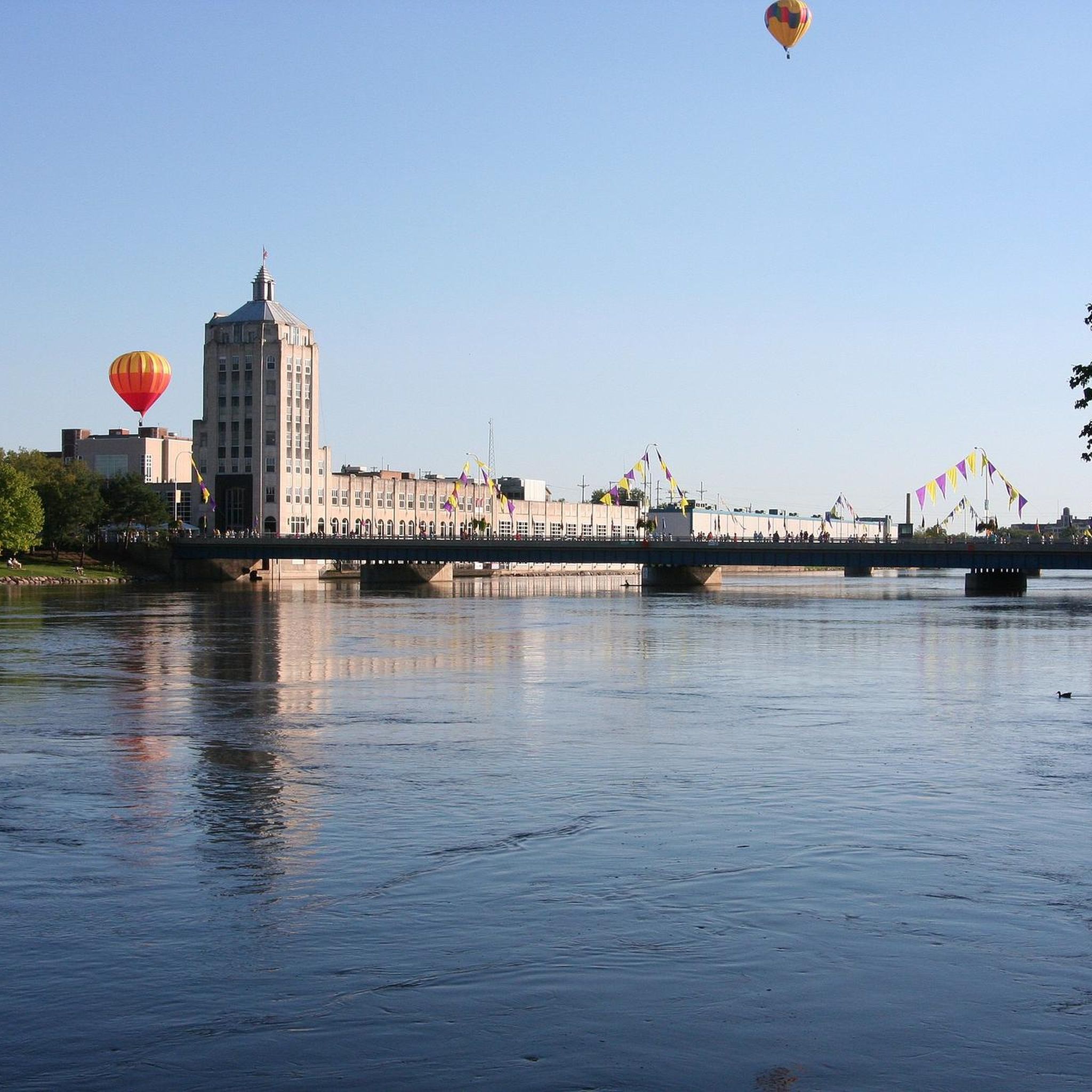
This bridge parallels the course of I-74 across the Mississippi River, keeping cyclists and other pedestrians safely away from the fast-moving vehicles. The bridge connects to cycleways on either side of the river, and also has a viewing area with an oculus.
1
0

Schwiebert Riverfront Park offers a variety of features, including art sculptures, a digital playground, a fountain, a great lawn, an observation shelter, a parking lot, a promenade, restrooms, a stage, a triangle lawn, an urban concrete beach, and a walk/jog path/trail. The park was named after former Mayor Mark Schwiebert, who lived from 1989 to 2009, for his dedication to enhancing public access to the riverfront. The park hosts live music events and is a picturesque setting for leisure and for recreation.
0
0

Sylvan Slough is a river in Illinois that passes Rock Island. If you follow the river further east, you'll get wonderful views to Rock Island Arsenal and Sylvan Island.
1
0

From this spot along the Great River Trail you get great views of Sylvan Island. You can cross a bridge to the island, but there are really only hiking and single track mountain bike trails that are unsuitable for road cycling.
1
0

The Mississippi River Trail (MRT) is a long distance bike trail that traverses 10 states. It travels for over 2,000 continuous miles on each side of the river, between the headwaters at Lake Itasca, Minnesota and the Gulf of Mexico. It is still work in progress but when complete the route will consist of trails and bike-friendly roads, with “MRT” signs identifying the way. In Illinois, the MRT route goes through some of the state’s most diverse landscapes and provides miles of great cycling. It hugs historic canals, crosses unglaciated hills, parallels the Rock and Fox Rivers, and includes one of America’s first rail-trails.
0
0

Fort Armstrong, established in 1816, served as a vital military installation on Rock Island Arsenal, Illinois. Initially constructed to maintain peace among Native American tribes and European settlers, it later played a significant role in safeguarding American interests during the War of 1812. Throughout its history, Fort Armstrong served as a key strategic outpost, witnessing various conflicts and transformations until its eventual decommissioning in 1836.
0
0
The Mississippi River Trail (MRT) is a long distance bike trail that traverses 10 states. It travels for over 2,000 continuous miles on each side of the river, between the headwaters at Lake Itasca, Minnesota and the Gulf of Mexico. It is still work in progress but when complete the route will consist of trails and bike-friendly roads, with “MRT” signs identifying the way. In Illinois, the MRT route goes through some of the state’s most diverse landscapes and provides miles of great cycling. It hugs historic canals, crosses unglaciated hills, parallels the Rock and Fox Rivers, and includes one of America’s first rail-trails.
0
0

These bridges are often referred to as "The Twin Bridges" and carry traffic across the Mississippi River on I-74. The original bridge opened to traffic in 1935, and the new bridge was completed in 2020.
0
0
Frequently Asked Questions
How many running routes are available in Milan on komoot?
Komoot features over 20 jogging routes around Milan, catering to various preferences and fitness levels. These include easy urban loops, moderate park trails, and more challenging long-distance paths.
What kind of terrain can I expect on Milan's jogging trails?
Milan offers a diverse range of jogging terrain. You'll find flat, paved paths along the historic Navigli canals, landscaped dirt and gravel paths in parks like Parco Sempione, and even varied inclines on artificial hills such as Monte Stella for a more challenging workout.
Are there any family-friendly jogging paths in Milan?
Yes, several parks in Milan are excellent for family jogging. Giardini Indro Montanelli offers a pleasant 2 km path, perfect for shorter runs. Parco Sempione also provides wide, accessible paths suitable for families, with plenty of space to enjoy the surroundings.
Which jogging routes in Milan are dog-friendly?
Many of Milan's green spaces welcome dogs, provided they are kept on a leash. Parco Sempione and Giardini Indro Montanelli are popular choices. For a more expansive natural setting, Boscoincittà offers extensive trails through woodlands and glades where you and your dog can enjoy a longer run.
Are there jogging routes in Milan accessible by public transport?
Absolutely. Many of Milan's most popular jogging spots are well-connected by public transport. Parco Sempione and Giardini Indro Montanelli are centrally located and easily reachable by metro or tram. The Naviglio Grande Canal Path is also accessible from various points within the city via public transport.
Where can I find parking for jogging routes in Milan?
For routes slightly outside the immediate city center, such as the Idroscalo Lake Circuit, dedicated parking facilities are available. For urban parks like Parco Sempione, public parking garages are usually found nearby, though they may require a short walk to the park entrance.
What are some scenic jogging spots near Milan?
Beyond the city center, the Idroscalo Lake Circuit offers beautiful lake views and a refreshing atmosphere. The Naviglio Martesana canal path provides a naturalistic setting with views of ancient villas and changing scenery, extending about 38 km from the city.
Are there any circular jogging routes in Milan?
Yes, many of Milan's jogging routes are designed as loops. The Parco Sempione Loop is a popular 3.5 km circular route. The Idroscalo Lake Circuit is another excellent circular option, covering about 6.5 km around the lake.
What landmarks can I see while running in Milan?
Jogging in Milan offers a unique blend of nature and history. On the Parco Sempione Loop, you'll pass iconic sights like the Sforza Castle, the Arena Civica, and the Arco della Pace. Along the Navigli canals, you can admire historic architecture and the unique canal system.
What do other runners enjoy most about jogging in Milan?
The jogging routes in Milan are highly rated by the komoot community, with an average score of 4.0 stars. Runners often praise the variety of landscapes, from the peaceful canal paths to the vibrant city parks, and the accessibility of these green spaces within an urban environment.
Are there any jogging routes in Milan with varied elevation for a more challenging run?
For runners seeking more challenging terrain, Monte Stella (also known as San Siro little mountain) is an excellent choice. This artificial hill provides differences in height, offering a good workout with varied elevation changes. Parco Lambro also features nearly 4 km of paths with climbs and descents.
Which jogging routes are best for long-distance training in Milan?
For long-distance training, the Naviglio Grande Canal Path is ideal, stretching almost 50 km from the Darsena. The Naviglio Martesana also offers a lengthy, nearly flat route of about 38 km, connecting the city with the Adda river, perfect for extended runs.
Most popular routes around Milan
Most popular attractions around Milan

Get inspired with the komoot mobile app


Explore more
Browse the best Running Trails & Routes in other regions.
