The best road cycling routes around East Moline
4.5
(2)
282
riders
44
rides
Road cycling routes around East Moline are primarily characterized by the flat terrain along the Mississippi River. The region features extensive trail networks, including the Great River Trail, which offers continuous river views. These routes often connect to various parks and natural areas, providing a mix of scenic riverfront paths and dedicated multi-use trails. The landscape is generally low-lying, making it suitable for accessible road cycling.
Best road cycling routes around East Moline
- The most popular road cycling route is…
Last updated: July 2, 2026
3
riders
34.6km
01:30
170m
170m
Easy road ride. Great for any fitness level. Mostly well-paved surfaces and easy to ride.
1
riders
59.1km
02:43
200m
200m
Moderate road ride. Good fitness required. Mostly well-paved surfaces and easy to ride.

Sign up for free
24
riders
40.2km
02:14
140m
140m
Moderate road ride. Good fitness required. Mostly well-paved surfaces and easy to ride.
30
riders
Easy road ride. Great for any fitness level. Mostly well-paved surfaces and easy to ride.
17
riders
36.4km
02:10
100m
100m
Moderate road ride. Good fitness required. Mostly well-paved surfaces and easy to ride.
Get access to more routes and recommendations from other explorers.
Sign up for free
Already have an account?
Our route recommendations are based on thousands of hikes, rides, and runs completed by other people on komoot.
Start today with a free account
Your next adventure awaits.
Login or Signup
Popular around East Moline


Tips from the Community

The Government Bridge, also known as the Arsenal Bridge, spans the Mississippi River between Rock Island, Illinois, and Davenport, Iowa. Built in 1896, the bridge has two levels: the upper deck serves the Iowa Interstate Railroad, while the lower deck carries vehicle traffic and has lanes on each side for pedestrians and cyclists. It features a swing section to allow river navigation. The current bridge is the fourth at this location; the first, built in 1856, was the first railroad bridge across the Mississippi. Subsequent bridges were built after damage from collisions, ice storms, and tornadoes.
1
0

Sylvan Slough is a river in Illinois that passes Rock Island. If you follow the river further east, you'll get wonderful views to Rock Island Arsenal and Sylvan Island.
1
0
From this spot along the Great River Trail you get great views of Sylvan Island. You can cross a bridge to the island, but there are really only hiking and single track mountain bike trails that are unsuitable for road cycling.
1
0

The Duck Creek Trail is a paved multiuse path that runs through Davenport. It connects urban areas with parks and residential areas on mostly off-road trails.
0
0

Fort Armstrong, established in 1816, served as a vital military installation on Rock Island Arsenal, Illinois. Initially constructed to maintain peace among Native American tribes and European settlers, it later played a significant role in safeguarding American interests during the War of 1812. Throughout its history, Fort Armstrong served as a key strategic outpost, witnessing various conflicts and transformations until its eventual decommissioning in 1836.
0
0
The Rock Island Centennial Bridge, spanning the Mississippi River, was constructed to commemorate the centennial anniversary of the city of Rock Island, Illinois, in 1940. Its elegant design and strategic location have made it an iconic landmark, facilitating transportation and fostering connections between Rock Island and Davenport, Iowa, for over eight decades.
1
0

This is a great little bridge heading from East Moline out to delightful Campbell Island. You have great views out over the river, and on the island, you can do a nice short, two-mile loop and visit Campbell's Island State Historic Site if you have time on your hands. It is worth crossing the bridge and doing the loop just to get the river views.
1
0

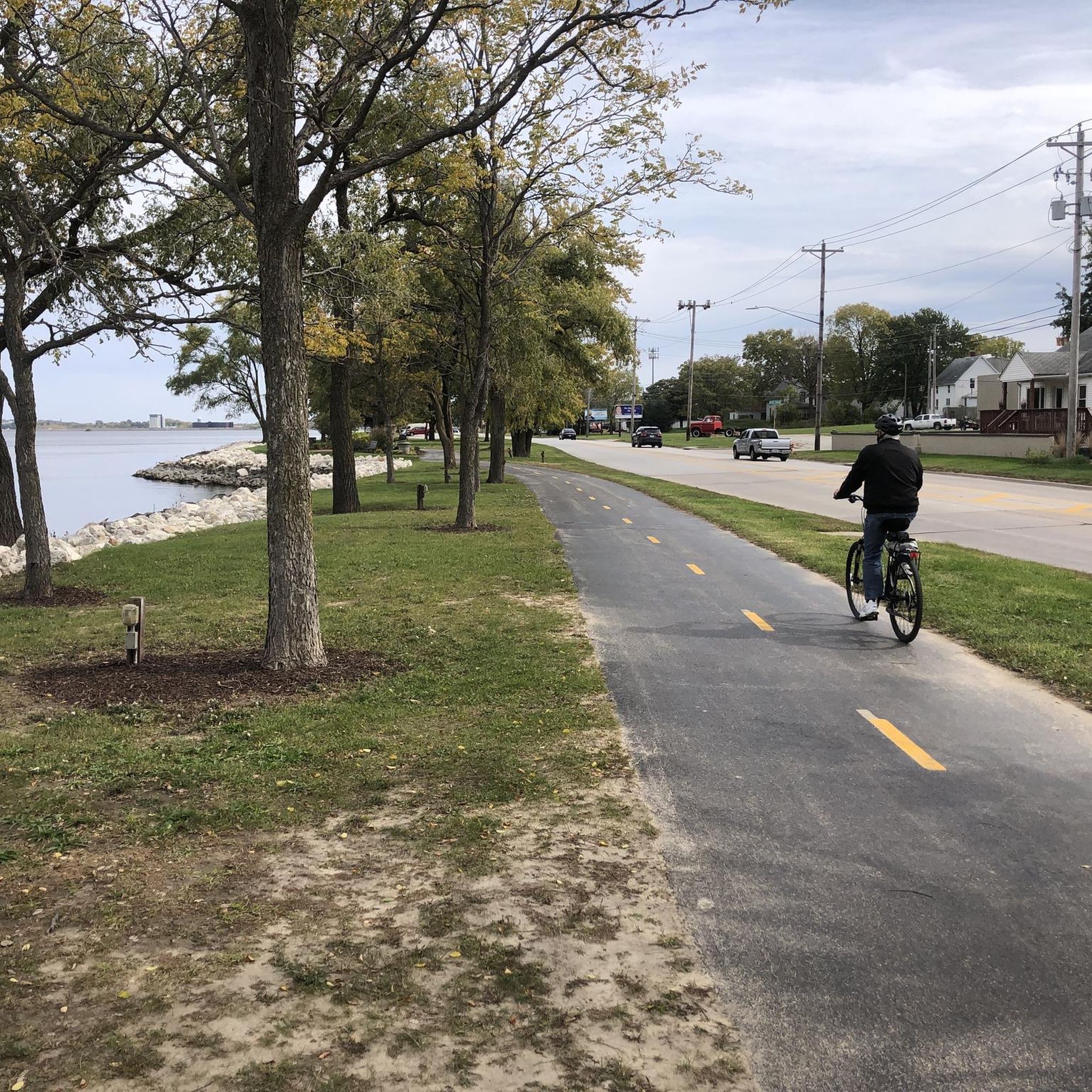
This harbor sits sandwiched between the Great River Trail and the great river itself, the Mississippi — all of which offer stupendous scenery as you cycle by.
0
0
Frequently Asked Questions
How many road cycling routes are available in East Moline?
East Moline offers a diverse selection of road cycling routes, with over 40 options available on komoot. These routes cater to various skill levels, including 19 easy and 25 moderate trails, ensuring there's something for every cyclist.
What makes road cycling in East Moline unique?
Road cycling in East Moline is defined by its scenic riverfront and extensive trail networks, primarily along the Mississippi River. The region's flat terrain, especially on the Great River Trail, provides continuous river views and accessible cycling experiences. You'll find routes that connect various parks and natural areas, offering a blend of natural beauty and well-maintained paths.
Are there easy road cycling routes suitable for beginners or families in East Moline?
Yes, East Moline has several easy road cycling routes perfect for beginners and families. Many of these routes utilize the flat, paved sections of the Great River Trail. An excellent option is the Mississippi River Trail and Le Claire Loop, an easy 21.5-mile (34.6 km) trail that offers beautiful views of the Mississippi River.
Are there longer distance road cycling routes for experienced cyclists in East Moline?
For experienced cyclists looking for longer distances, East Moline offers several moderate routes that combine riverfront scenery with established trail networks. The Mississippi River and Duck Creek Trail Loop is a popular moderate 36.7-mile (59.1 km) path. Another option is the Duck Creek Trail – Duck Creek Trail loop from East Moline, which spans 52.3 miles (84.2 km).
What scenic views can I expect on road cycling routes in East Moline?
Road cycling routes in East Moline offer picturesque views primarily along the Mississippi River. You can expect sweeping vistas of the river and the Iowa shoreline, especially on sections of the Great River Trail. Many routes also pass through local parks like Empire Park and Butterworth Park, featuring ancient oaks, flowers, and lagoons, adding diverse natural beauty to your ride.
Are there any interesting landmarks or attractions along the road cycling routes?
Yes, several interesting landmarks and attractions can be found along or near East Moline's road cycling routes. You might encounter impressive structures like the Government Bridge or the modern I-74 Pedestrian and Bicycle Bridge. Natural features like Sylvan Slough also provide scenic points of interest.
Are there road bike trails with parking available in East Moline?
Yes, several road bike trails in East Moline offer convenient parking. Empire Park, located on the East Moline/Hampton border, provides direct access to the East Moline and Hampton bike path and includes restrooms and picnic pavilions, making it an ideal starting point with parking facilities.
Are there loop road bike trails in East Moline?
Yes, East Moline features several excellent loop road bike trails. A popular choice is the Duck Creek Trail – Duck Creek Trail loop from Panorama Park, a 24.9-mile (40.2 km) route that takes you through parklands. Another option is the Safe Harbor – Campbell Island Bridge loop from Hampton, a moderate 36.4-mile (58.6 km) loop.
Can I connect to larger trail networks from East Moline?
Absolutely. East Moline is strategically located along the Great River Trail (GRT), which is part of larger regional and national trail systems. The GRT connects to the Mississippi River Trail (MRT), a 3,000-mile system, and the American Discovery Trail (ADT). You can also connect to the Ralph B. Birks Recreational Trail/Ben Butterworth Parkway in Moline, expanding your cycling options significantly.
What is the best time of year for road cycling in East Moline?
The best time for road cycling in East Moline is typically during spring, summer, and fall. These seasons offer pleasant temperatures and vibrant natural scenery, making for enjoyable rides along the riverfront and through parks. While winter cycling is possible, conditions can be challenging due to cold weather and potential snow or ice.
What do other road cyclists enjoy the most about road cycling in East Moline?
Road cyclists frequently praise the flat, well-maintained trails and the continuous scenic views of the Mississippi River. The accessibility of the Great River Trail and its connections to various parks are often highlighted as key attractions, providing a relaxing yet engaging cycling experience for all skill levels.
Most popular routes around East Moline
Most popular attractions around East Moline

Get inspired with the komoot mobile app


Explore more
Browse the best Road cycling routes in other regions.
