The best mountain hikes around Frostastaðavatn
5.0
(6)
75
hikers
6
hikes
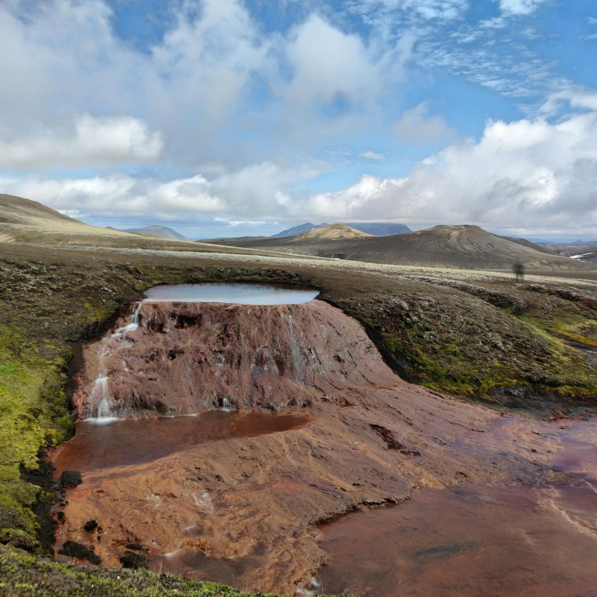
Mountaineering routes around Frostastaðavatn traverse a unique volcanic landscape in Iceland's Landmannalaugar region. The area is characterized by colorful rhyolite mountains, extensive lava fields such as Dómdalshraun and Frostastaðahraun, and ancient volcanic flows. Notable features include explosion craters like Ljótipollur and the small volcanic cone of Stútur, offering varied terrain for challenging mountain ascents. This remote highland environment provides demanding trails for experienced mountaineers.
Best mountaineering routes around Frostastaðavatn
- The most popular mountaineering route is Reykjadalur Hot Springs loop from…
Last updated: June 29, 2026
14
hikers
6.76km
02:24
190m
190m
Hard mountaineering route. Good fitness required. Sure-footedness, sturdy shoes and alpine experience required.
5.0
(1)
21
hikers
9.82km
04:19
460m
470m
Hard mountaineering route. Good fitness required. Sure-footedness, sturdy shoes and alpine experience required.

Sign up for free
5.0
(3)
17
hikers
7.90km
03:10
280m
280m
Hard mountaineering route. Good fitness required. Sure-footedness, sturdy shoes and alpine experience required.
5.0
(1)
14
hikers
6.24km
02:46
280m
280m
Hard mountaineering route. Good fitness required. Sure-footedness, sturdy shoes and alpine experience required.
4
hikers
9.50km
03:40
330m
330m
Hard mountaineering route. Good fitness required. Sure-footedness, sturdy shoes and alpine experience required.
Our route recommendations are based on thousands of hikes, rides, and runs completed by other people on komoot.
Start today with a free account
Your next adventure awaits.
Login or Signup
Popular around Frostastaðavatn
Tips from the Community

This spring, the area was flooded extensively. It's passable by bike—it was too deep for an e-bike. It wasn't even a straight path through a stream. Still, a fascinating area. The walk was truly strenuous. Some DB railway tracks are easier to navigate.
0
0

Amazing hot springs, especially after a cold and rainy day. They ask you to pay a facility fee to use them (if you're not camping there anyways). The closer you are to the stream, the hotter the water is.
0
0

The name "Landmannalaugar" means "the countrymen's pools" because of the natural hot springs that have been used by visitors for centuries. These pools are an ideal place to relax. It is one of the most impressive and popular areas in Iceland, known for its unique and colorful landscape. It is located in the interior of Iceland, within the Fjallabak nature reserve, on the edge of the Laugahraun lava field, which was created by an eruption in the 15th century. This place is famous for its rhyolite mountains, lava fields, natural hot springs.
0
0
There is a campsite run by the Icelandic Tourist Association (Ferðafélag Íslands), which provides basic facilities for visitors. There is also a mountain hut where beds can be rented. Landmannalaugar is in the highlands of Iceland, and access is limited to the summer months (June to September) due to extreme weather conditions.
0
0

great view
0
0

Both tributaries are very hot, but the water cools down considerably after a few meters. Very crowded! No changing rooms: you have to make do with the towel you brought with you.
0
0
In a large tent you can warm yourself up a bit and enjoy the snacks you brought with you.
1
2

Great glacier foothills and a great place to relax for a while (as long as the weather plays along).
0
0
Frequently Asked Questions
How many mountaineering routes are available around Frostastaðavatn?
There are 6 challenging mountaineering routes detailed in this guide for the Frostastaðavatn area. These routes are specifically curated for experienced adventurers seeking demanding trails in Iceland's unique volcanic landscape.
What is the typical difficulty level of mountaineering routes around Frostastaðavatn?
All the mountaineering routes listed in this guide for the Frostastaðavatn area are classified as difficult. They traverse rugged volcanic terrain, often involving significant elevation gain and requiring good fitness, sure-footedness, and sturdy footwear. Some routes may even benefit from alpine experience.
Are there circular mountaineering routes around Frostastaðavatn?
Yes, many of the routes around Frostastaðavatn are circular, allowing you to experience diverse landscapes without retracing your steps. For example, the Reykjadalur Hot Springs loop from Landmannalaugar and the View of Landmannalaugar – Reykjadalur Hot Springs loop from Landmannalaugar are excellent circular options that showcase the region's geothermal features and expansive views.
What notable natural features or landmarks can I expect to see along these routes?
The Frostastaðavatn region is rich in dramatic volcanic scenery. You can expect to encounter colorful rhyolite mountains, extensive lava fields like Dómdalshraun and Frostastaðahraun, and ancient volcanic flows. Notable landmarks include explosion craters such as Ljótipollur with its impressive colors, and the small volcanic cone of Stútur, which offers superb views. Many routes also provide panoramic vistas of the Landmannalaugar area and its unique geological formations.
What are the typical durations for mountaineering routes in this area?
The durations for mountaineering routes around Frostastaðavatn vary depending on the specific trail and your pace. For instance, the Reykjadalur Hot Springs loop from Landmannalaugar typically takes around 2 hours 7 minutes, while the longer Bláhnúkur Summit – Landmannalaugar Hiking Area loop from Landmannalaugar can take approximately 2 hours 46 minutes. Some of the more extensive routes can take up to 4 hours 17 minutes or more.
When is the best time of year to go mountaineering in the Frostastaðavatn region?
The remote highland location of Frostastaðavatn means it is primarily accessible during the summer months. This is generally the best time for mountaineering, as conditions are more favorable, and the highland routes (like F208 and F225) are open, allowing access by 4x4 vehicles. Outside of summer, conditions can be extremely challenging due to snow, ice, and unpredictable weather.
How do I access the mountaineering routes around Frostastaðavatn, and is parking available?
The Frostastaðavatn area is located along well-known highland routes, Fjallabaksleið nyrðri (F208) and Landmannaleið (F225). Access typically requires a 4x4 vehicle, especially during the summer season when these roads are open. Parking is generally available at key trailheads, such as near Landmannalaugar, which serves as a common starting point for many routes in the broader region.
Is public transport available to reach the Frostastaðavatn area?
While direct public transport to Frostastaðavatn itself might be limited, there are bus services that operate to Landmannalaugar during the summer months. From Landmannalaugar, you can access many of the trails in the wider region, including those that lead towards Frostastaðavatn. It is advisable to check current bus schedules and routes for the Landmannalaugar area before planning your trip.
What do other mountaineers enjoy most about mountaineering in Frostastaðavatn?
The mountaineering routes around Frostastaðavatn are highly rated by the komoot community, with an average score of 5.0 stars. Reviewers often praise the region's unparalleled volcanic landscapes, the vibrant colors of the rhyolite mountains, and the challenging yet rewarding nature of the trails. The sense of remoteness and the dramatic views are frequently highlighted as key attractions.
Are there any family-friendly mountaineering options around Frostastaðavatn?
The mountaineering routes specifically highlighted in this guide are all classified as difficult, requiring a good level of fitness and experience, making them less suitable for young children or those seeking very easy walks. However, the broader Landmannalaugar area, which is nearby, does offer a range of hikes from easy to moderate, including lake loop trails and shorter walks that might be more appropriate for families, though these may not be strictly 'mountaineering' in nature.
Can I bring my dog on these trails?
Regulations regarding dogs on hiking trails in Iceland's protected highland areas, such as the Fjallabak Nature Reserve where Frostastaðavatn is located, can be strict. It is generally recommended to check the specific rules for the Landmannalaugar area and the nature reserve before bringing a dog, as restrictions may apply to protect the fragile ecosystem and wildlife. Always keep dogs on a leash where permitted.
What kind of gear and clothing should I bring for mountaineering in Frostastaðavatn?
Given the challenging nature of the routes and the unpredictable highland weather, it's crucial to be well-prepared. You should bring sturdy, waterproof hiking boots with good ankle support, layered clothing (including waterproof and windproof outer layers), a hat, gloves, and plenty of water and snacks. A map, compass or GPS device, and a first-aid kit are also essential. Trekking poles can be very helpful on steep and uneven terrain.
Are there any amenities like cafes or shops near the trails?
The Frostastaðavatn area is very remote. While there are no permanent cafes or shops directly at Frostastaðavatn, the nearby Landmannalaugar area, a significant hub in the highlands, typically has basic facilities during the summer season. These might include a small shop for essentials and a mountain hut that sometimes offers simple refreshments. It is always best to carry all necessary supplies with you.
Most popular routes around Frostastaðavatn

Get inspired with the komoot mobile app


Explore more
Browse the best Mountain Hikes & Routes in other regions.
