The best walks and hikes around Volcano
4.8
(678)
7,255
hikers
60
hikes
Hiking around Volcano features a unique landscape shaped by active volcanic processes, including craters and solidified lava flows. The area is characterized by diverse geological formations and varying elevations. Trails often traverse volcanic rock, offering distinct views of the caldera and surrounding natural features. This region provides a range of hiking experiences within a dynamic environment.
Best hiking trails around Volcano
- The most popular hiking route is Kīlauea Iki Crater Loop — Hawai‘i Volcanoes National Park, a 3.6 miles (5.8 km) trail that takes 1 hour 42 minutes to complete. This easy loop offers views into the Kīlauea Iki Crater.
- Another top favourite among local hikers is Kīlauea Iki Crater via Crater Rim Trail Loop — Hawai‘i Volcanoes National Park, a moderate 7.2 miles (11.5 km) path. This route combines crater views with sections along the Crater Rim Trail.
- Local hikers also love the Crater Rim Trail — Hawai‘i Volcanoes National Park, a 5.2 miles (8.4 km) trail leading through volcanic terrain, often completed in about 2 hours 26 minutes.
- Hiking around Volcano is defined by volcanic craters, solidified lava flows, and unique geological features, with options ranging from easy day hikes to more challenging routes. The network offers options for different ability levels.
- The routes in Volcano are highly rated by the komoot community with an average score of 4.8 stars from over 600 reviews. More than 6000 hikers have used komoot to explore Volcano's varied terrain.
Last updated: July 9, 2026
4.9
(136)
1,567
hikers
5.77km
01:42
170m
170m
The Kīlauea Iki Trail is an extraordinary hiking experience that transports you from a vibrant rainforest into the heart of a volcanic crater. This 3.6-mile (5.8 km) loop takes you across a solidified lava lake, a surreal landscape dotted with cracks and steaming vents, before ascending back through lush vegetation. You'll encounter native Hawaiian plants like ʻŌhiʻa and Hāpuʻu as you descend into the crater, then navigate the barren, otherworldly floor, guided by rock cairns.
Planning your visit to this easy trail, which typically takes about 1 hour and 42 minutes to complete, is straightforward. The trailhead is at the Kīlauea Iki Overlook within Hawaiʻi Volcanoes National Park, but parking can be limited, so arriving early is a good idea. With 545 feet (166 metres) of elevation gain, the trail has some steep sections; hiking clockwise is recommended for a more gradual ascent out of the crater. Always wear sturdy hiking shoes to protect against the sharp lava rock.
This trail is a geological marvel, offering a tangible connection to the powerful 1959 eruption where lava fountains soared incredibly high. Walking across the crater floor, you're directly on the remnants of that event, observing unique features like solidified lava and steaming ground. The dramatic contrast between the dense, humid rainforest and the dry, volcanic crater floor makes this one of the most captivating and educational hikes in the park.
4.9
(70)
486
hikers
Moderate hike. Good fitness required. Easily-accessible paths. Suitable for all skill levels.

Sign up for free
4.9
(70)
492
hikers
11.5km
03:22
300m
300m
The Kīlauea Iki and Crater Rim Trail offers an incredible journey from a vibrant rainforest into the heart of a solidified lava lake. You'll trek through dense ʻōhiʻa forests before descending into the vast, otherworldly Kīlauea Iki Crater, where steam still rises from cracks and cairns guide you across the uneven, rocky surface. The dramatic contrast between lush greenery and barren volcanic landscape, with the Puʻu Puaʻi cinder cone as a focal point, makes this a truly memorable experience.
This moderate 7.2-mile (11.5 km) hike involves 989 feet (301 metres) of elevation gain and typically takes around 3 hours and 21 minutes. The trailhead is easily accessible near the Nāhuku (Thurston Lava Tube), but parking can fill up quickly, so plan to arrive early. Sturdy hiking shoes are a must for the rocky crater floor, and carrying ample water is always recommended, regardless of the weather.
What makes this route truly special is the chance to walk directly across the floor of a lava lake formed during the powerful 1959 eruption of Kīlauea Iki. You'll see geological features like fissures and steam vents, and the
4.8
(19)
291
hikers
8.42km
02:26
210m
210m
The Crater Rim Trail offers a captivating journey around the summit caldera of Kīlauea, one of the world's most active volcanoes, making it one of the most popular routes in Hawaiʻi Volcanoes National Park. As you hike, you'll experience a remarkable diversity of ecosystems, from dense rainforests with 'Ōhi'a trees to the stark, arid beauty of the Kaʻū Desert, all while walking over ancient lava flows. Keep an eye out for steam vents and the dramatic Halemaʻumaʻu Crater, which provide constant reminders of the dynamic geological forces at play.
This moderate 5.2-mile (8.4 km) hike, with 688 feet (210 metres) of elevation gain, typically takes about 2 hours and 26 minutes to complete. While some sections are paved, you should be prepared for uneven gravel paths and occasional steep inclines or stairs. You can access various parts of the trail from multiple trailheads, such as Uēkahuna, allowing you to choose a shorter out-and-back section if you prefer. Always stay on marked trails due to unstable ground and be ready for rapid weather changes.
What truly sets this trail apart is its unique position on the edge of an active volcano, offering an unparalleled opportunity to witness ongoing geological processes. It's a fantastic way to explore the park's diverse landscapes, from lush greenery to volcanic desolation, all within a single route. The Crater Rim Trail provides a profound sense of connection to the Earth's raw power and is a must-do for anyone visiting Hawaiʻi Volcanoes National Park.
4.8
(10)
73
hikers
6.43km
01:50
150m
150m
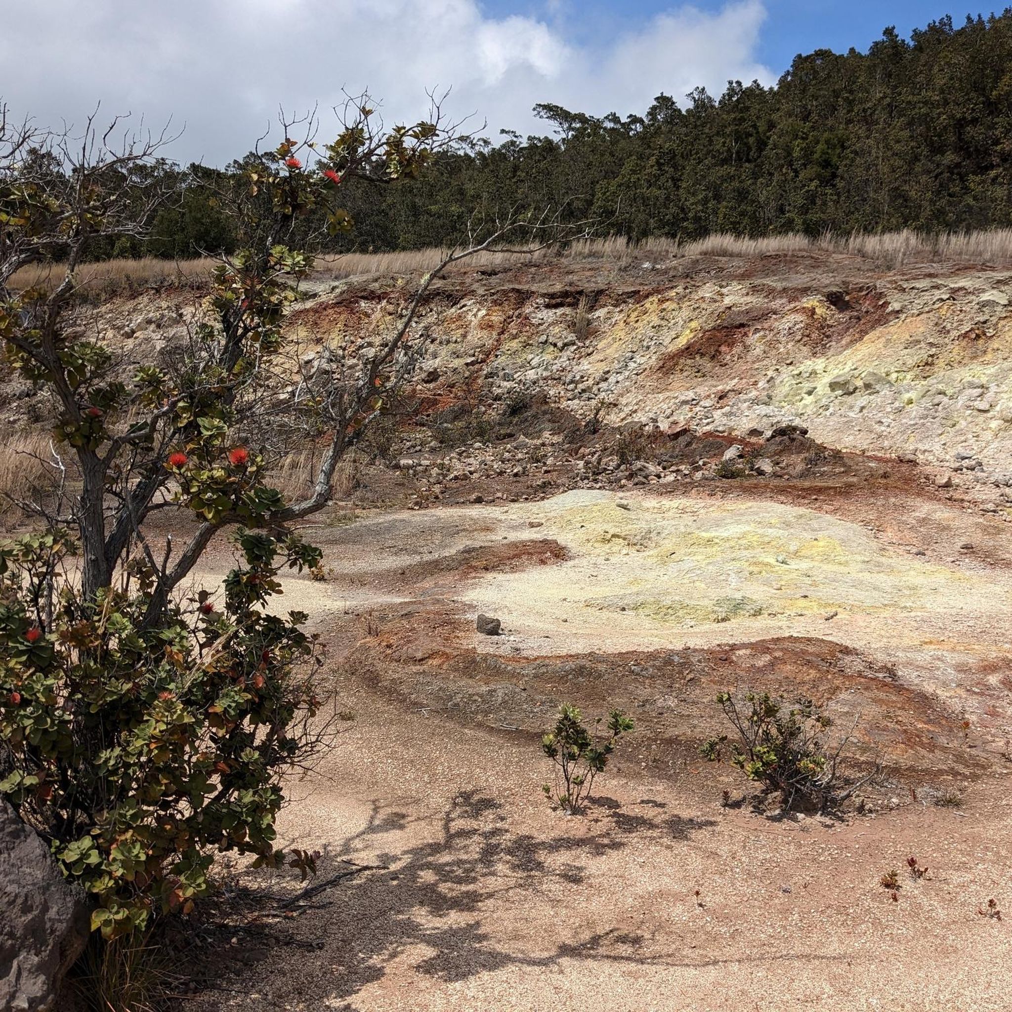
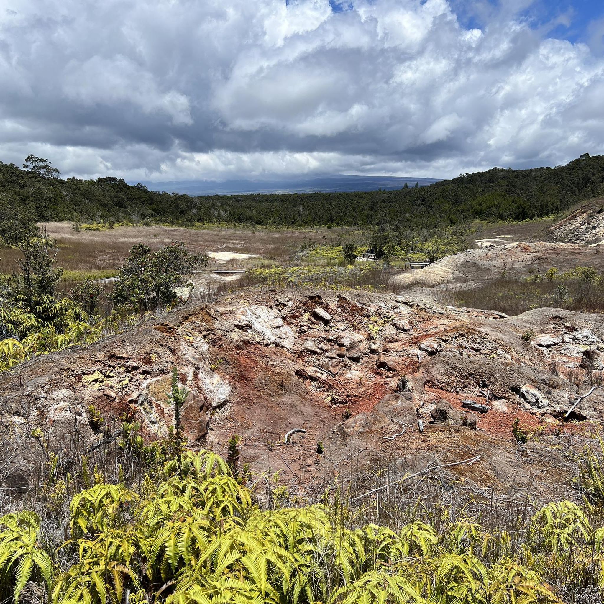
The Sulphur Banks and Crater Rim Trail Loop offers a truly unique journey through Hawaiʻi Volcanoes National Park, transitioning from a steaming, mineral-rich volcanic landscape to a lush rainforest. You'll walk on paved paths and boardwalks through the Haʻakulamanu (Sulphur Banks) area, where vibrant yellow sulfur crystals and steaming cracks create an otherworldly scene, complete with the pungent smell of volcanic gases. Further along the Crater Rim Trail, you'll find yourself amidst dense ferns and trees, with incredible views across the vast Kīlauea Caldera and the transformed Halemaʻumaʻu Crater.
This easy 4.0-mile (6.4 km) hiking loop, with 482 feet (147 metres) of elevation gain, takes about 1 hour and 49 minutes, making it accessible for most visitors. The Sulphur Banks section is even wheelchair accessible from the Steam Vents parking area. Always check air quality at the Kīlauea Visitor Center before you go, especially if you have respiratory sensitivities, and be sure to stay on marked paths due to unstable ground.
What makes this route stand out is its direct connection to active geology, providing a close-up view of the island's ongoing volcanic processes. The rapid shift from barren, steaming ground to a verdant rainforest highlights the incredible diversity within the park. It's a sensory experience unlike any other, offering a memorable glimpse into the powerful forces shaping Hawaiʻi.
Get access to more routes and recommendations from other explorers.
Sign up for free
Already have an account?
Our route recommendations are based on thousands of hikes, rides, and runs completed by other people on komoot.
Start today with a free account
Your next adventure awaits.
Login or Signup
Popular around Volcano
Tips from the Community

impressive 500-meter-long tunnel in the lava flow
2
0

great view from the crater rim
0
0
Closed and inaccessible since 2018!
2
0
easily accessible viewpoint with good views of the volcano
1
0
The center is closed for renovations until August 2026
2
0

Not quite as great as Iceland, but worth seeing
0
0
Ferns in oversize - super impressive
0
0
Never seen anything like this before
0
1
Frequently Asked Questions
How many hiking trails are there in Volcano?
There are over 60 hiking trails available around Volcano, offering a variety of experiences for different skill levels.
Are there easy hiking options suitable for beginners or families?
Yes, Volcano offers over 40 easy hiking routes. A great option is the Kīlauea Iki Crater Loop — Hawai‘i Volcanoes National Park, which is 3.6 miles long and provides views into the crater.
What kind of landscapes can I expect to see while hiking in Volcano?
The landscape around Volcano is uniquely shaped by active volcanic processes. You'll encounter diverse geological formations, including volcanic craters, solidified lava flows, and varying elevations. Trails often traverse volcanic rock, offering distinct views of the caldera and surrounding natural features.
Are there any circular hiking routes in the Volcano area?
Yes, many trails in Volcano are circular. For example, the Kīlauea Iki Crater via Crater Rim Trail Loop — Hawai‘i Volcanoes National Park is a moderate 7.2-mile loop that combines crater views with sections along the Crater Rim Trail.
What are some unique geological features I can explore on the trails?
The region is rich in unique geological features. You can explore solidified lava flows and volcanic craters. Consider visiting Nāhuku (Thurston Lava Tube), a fascinating cave, or the Devastation Trail which showcases the aftermath of volcanic activity.
What do other hikers enjoy most about hiking in Volcano?
The area is highly rated by the komoot community, with an average score of 4.8 stars from over 600 reviews. Hikers often praise the unique volcanic terrain, the diverse geological formations, and the range of options from easy walks to more challenging routes.
Are there any challenging hikes for experienced hikers?
Yes, there are 5 difficult routes for experienced hikers. These trails offer more strenuous climbs and longer distances, providing a greater challenge within the volcanic landscape.
What are some interesting landmarks or points of interest near the hiking trails?
Beyond the trails themselves, you can visit several interesting points. The Kīlauea Iki Crater Trail offers direct views into the crater, and the Kīlauea Caldera North Overlook provides panoramic vistas. You can also explore the Fern Rainforest for a change of scenery.
Is there a visitor center or facilities available in the Volcano area?
Yes, the Kīlauea Visitor Center is available in the area, providing information and facilities for visitors exploring Hawai‘i Volcanoes National Park.
Can I find moderate difficulty trails in Volcano?
Certainly. There are 18 moderate trails available. The Crater Rim Trail — Hawai‘i Volcanoes National Park is a good example, covering 5.2 miles through volcanic terrain.
Are there any trails that feature both crater views and other unique elements?
Yes, the Crater Rim to Sulphur Banks Loop — Hawai‘i Volcanoes National Park is an easy 4-mile route that offers crater views alongside the distinctive Sulphur Banks.
Most popular attractions around Volcano

Get inspired with the komoot mobile app


Explore more
Browse the best Hikes in other regions.
