The best running trails around Balderhead Reservoir
3.9
(9)
129
runners
19
runs
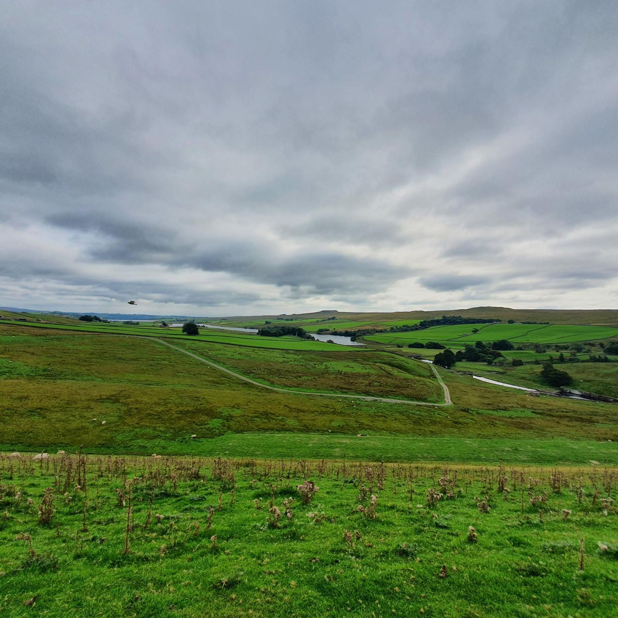
Jogging routes around Balderhead Reservoir traverse open moorland and offer views across the reservoir and surrounding hills like Shacklesborough. The area is part of a designated National Landscape within the North Pennines, featuring diverse terrain including reservoir paths, stone tracks, and grassy sections. Balderhead is one of three interconnected reservoirs, providing options for extended running routes that link all three.
Best jogging routes around Balderhead Reservoir
- The most popular jogging route is Blackton & Balderhead reservoirs loop, a 5.8…
Last updated: July 1, 2026
4
runners
11.8km
01:18
180m
180m
Moderate run. Good fitness required. Mostly paved surfaces. Suitable for all skill levels.
2
runners
9.38km
01:04
130m
130m
Moderate run. Good fitness required. Mostly paved surfaces. Suitable for all skill levels.

Sign up for free
3
runners
22.5km
02:43
380m
380m
Hard run. Very good fitness required. Mostly paved surfaces. Suitable for all skill levels.
5
runners
10.4km
01:10
160m
170m
Moderate run. Good fitness required. Mostly paved surfaces. Suitable for all skill levels.
2
runners
19.7km
02:10
210m
220m
Hard run. Very good fitness required. Mostly paved surfaces. Suitable for all skill levels.
Get access to more routes and recommendations from other explorers.
Sign up for free
Already have an account?
Our route recommendations are based on thousands of hikes, rides, and runs completed by other people on komoot.
Start today with a free account
Your next adventure awaits.
Login or Signup
Tips from the Community

Best views from the north side of the river i.e. before crossing Wynch bridge
0
0

This is among the more interesting of the bridges that cross the river Tees. This suspension footbridge owes its existence to the Holwick lead miners who used it to get to the lead mine at Little Eggleshope in the fells to the north.
0
0
Low Force is a beautiful spot. With a series of low cascades, it is not as dramatic as nearby High Force, but it is an area still worth visiting. You can park nearby at Bowlees Visitor Centre, which has a decent car park with a donations payment box.
0
0

Summerhill Force is a picturesque waterfall in Upper Teesdale, County Durham, famous for the recessed area behind its single-drop cascade known as Gibson's Cave.
0
0


Blackton Reservoir is a beautiful stretch of water that is home to a great deal of wildlife. The area around the western end of the reservoir is protected as a nature reserve. Nearby, Hannah's Meadows has been designated as a site of special scientific interest due to them having many species of grass and herbs which are threatened elsewhere.
0
0

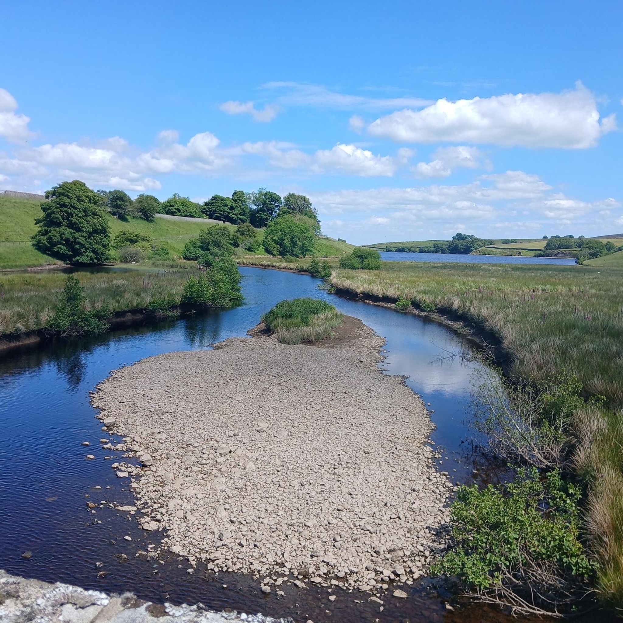
Among the three reservoirs, Balderhead is the one located furthest to the west. It takes its waters from the River Balder, a tributary of the River Tees, and was built in 1961.
1
0

What3Words Location = ///beam.hindered.glorious
0
0
Frequently Asked Questions
How many running routes are available around Balderhead Reservoir?
There are over 15 running routes around Balderhead Reservoir, offering a variety of options for different fitness levels. The komoot community has explored more than 130 of these trails.
Are there any easy or beginner-friendly running trails in the Balderhead Reservoir area?
While many routes around Balderhead Reservoir feature varied and sometimes challenging terrain, there are options suitable for beginners. The area offers a mix of reservoir paths, stone tracks, and grassy sections. For a moderate introduction, consider the Blackton & Balderhead reservoirs loop, which is 5.8 miles (9.4 km) long.
Are there circular running routes around Balderhead Reservoir?
Yes, many of the running routes around Balderhead Reservoir are circular, allowing you to start and finish at the same point. A popular option is the Blackton & Balderhead reservoirs loop, offering scenic views of both reservoirs.
Can I bring my dog on the running trails at Balderhead Reservoir?
Yes, the open moorland and reservoir paths around Balderhead Reservoir are generally dog-friendly. However, as the area is characterized by open ground with grazing Swaledale sheep, it's important to keep dogs under close control, especially during lambing season, and to clean up after them.
What kind of terrain can I expect on the running routes around Balderhead Reservoir?
The terrain around Balderhead Reservoir is diverse, featuring reservoir paths, stone tracks, and open grassy sections. Some parts can be stony, while others are springy with moss-covered plastic or standard grass. It's advisable to wear road-to-trail or hybrid running shoes to handle the varied surfaces.
Are there any family-friendly running routes near Balderhead Reservoir?
While the terrain can be challenging in places, families looking for a run can find suitable sections. The dam wall itself offers a relatively flat and accessible length. For a slightly longer, moderate option, the Blackton Reservoir – Barn Honesty Snack Stop loop from Hury is a 6.4-mile (10.4 km) trail that connects through the interconnected reservoir landscape.
What are the best viewpoints or scenic spots for runners around Balderhead Reservoir?
Runners can enjoy spectacular views across the unpaved banks and open moorland. Routes often provide fantastic vistas of Shacklesborough Hill with its distinctive plateau silhouette, and the flat-topped Goldsborough in the distance. The wild, bleak northern hills offer a sense of rugged beauty and solitude.
Is there parking available for runners at Balderhead Reservoir?
Yes, car parks are conveniently available on either side of the dam wall at Balderhead Reservoir, providing easy access to the running trails.
Are there any facilities or cafes near the running routes at Balderhead Reservoir?
It's worth noting that there are no facilities for snacking directly at Balderhead Reservoir, and shelter can be limited. It's recommended to bring your own refreshments and be prepared for varying weather conditions.
What do other runners enjoy most about jogging in Balderhead Reservoir?
The running routes in Balderhead Reservoir are highly rated by the komoot community, with an average score of 3.9 stars. Runners often praise the area for its open moorland, stunning reservoir views, and the sense of solitude and tranquility it offers, allowing for a peaceful escape into nature.
Can I connect to other reservoirs or long-distance paths from Balderhead Reservoir?
Yes, Balderhead is one of three interconnected reservoirs, along with Hury and Blackton, in Upper Baldersdale. This connectivity allows for more extended and challenging runs, with routes connecting all three, such as the Blackton Reservoir – Hury Reservoir Dam loop from Hannah's Meadows SSSI. The reservoir also provides access to the Pennine Way, offering opportunities to link into this long-distance footpath.
Are there opportunities to see wildlife while running around Balderhead Reservoir?
Absolutely! Joggers may encounter various wildlife, including Swaledale sheep and spring lambs. The reservoir is also home to numerous birds such as curlews, lapwings, oystercatchers, and kites, making it a fantastic spot for birdwatching while you run.
Most popular routes around Balderhead Reservoir

Get inspired with the komoot mobile app


Explore more
Browse the best Running Trails & Routes in other regions.
