The best walks and hikes around Abberton Resevoir
4.7
(410)
3,053
hikers
306
hikes
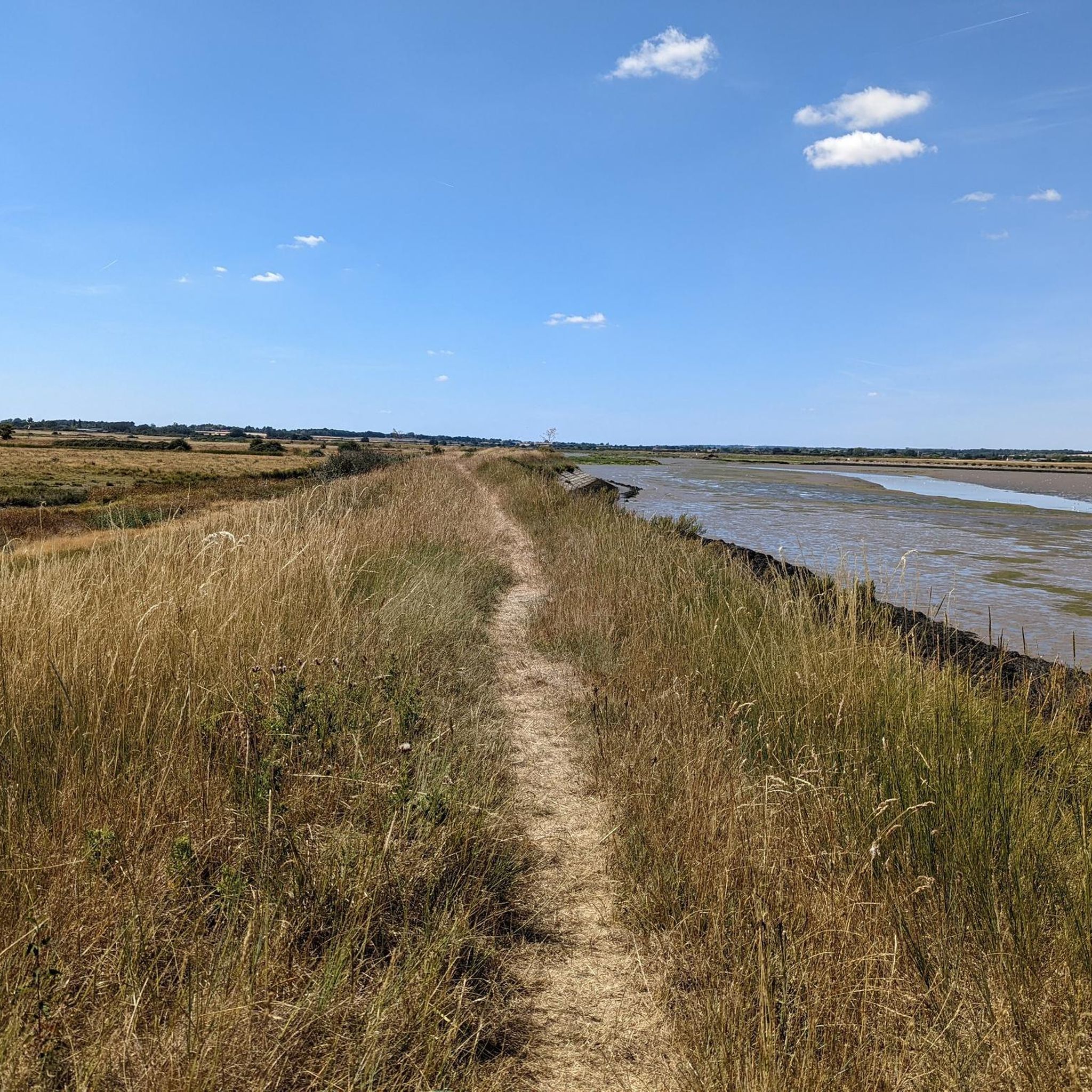
Hiking around Abberton Reservoir offers routes characterized by expansive water views and surrounding natural landscapes. The area is defined by the large freshwater reservoir, which is a significant nature reserve, providing open paths and opportunities for wildlife observation. The terrain is generally flat, making it accessible for various fitness levels, with trails often following the reservoir's perimeter or extending into nearby fields and villages.
Best hiking trails around Abberton Resevoir
- The most popular hiking route is Abberton Church – Layer Church loop from Layer Breton, a 12.5 miles (20.1 km) trail that takes 5 hours 13 minutes to complete. This difficult route explores the wider area around the reservoir, connecting local churches.
- Another top favourite among local hikers is Wild Birds on the Reservoir loop from Layer Breton, an easy 3.1 miles (5.0 km) path. This trail offers close-up views of the reservoir and its birdlife.
- Local hikers also love the Wild Birds on the Reservoir loop from Layer-de-la-Haye, a 4.9 miles (7.9 km) trail leading through the reservoir's natural surroundings, often completed in about 2 hours 2 minutes.
- Hiking around Abberton Reservoir is defined by open reservoir paths, nature reserve landscapes, and surrounding agricultural fields. The network offers options for different ability levels, from easy strolls to longer, more challenging routes.
- The routes in Abberton Reservoir are highly rated by the komoot community with an average score of 4.6 stars from over 300 reviews. More than 3000 hikers have used komoot to explore Abberton Reservoir's varied terrain.
Last updated: July 9, 2026
5.0
(3)
18
hikers
19.8km
05:10
130m
130m
Hard hike. Very good fitness required. Easily-accessible paths. Suitable for all skill levels.
4.3
(3)
31
hikers
7.82km
02:01
30m
40m
Moderate hike. Good fitness required. Easily-accessible paths. Suitable for all skill levels.

Sign up for free
4.5
(2)
27
hikers
5.00km
01:17
20m
20m
Easy hike. Great for any fitness level. Easily-accessible paths. Suitable for all skill levels.
4.0
(3)
5
hikers
Easy hike. Great for any fitness level. Easily-accessible paths. Suitable for all skill levels.
5.0
(1)
2
hikers
8.35km
02:12
70m
70m
Moderate hike. Good fitness required. Easily-accessible paths. Suitable for all skill levels.
Get access to more routes and recommendations from other explorers.
Sign up for free
Already have an account?
Our route recommendations are based on thousands of hikes, rides, and runs completed by other people on komoot.
Start today with a free account
Your next adventure awaits.
Login or Signup
Tips from the Community

The concrete road surface is pretty rough but best to try and carry your speed if you can for the rises at either end.
0
0
Not much to be seen from the road but continue just south of the church and there are good views across Abberton Reservoir.
0
0

Info taken from https://www.merseamuseum.org.uk/mmresdetails.php?pid=GWG_CHC&rhit=5&ba=mmwig.php Beautifully situated on the top of a hill at the highest point of the parish, the tower of the church is a landmark for many miles around. The large manor (Abbots (Abbess) Hall belonged to the important nunnery of Barking from at Least the Norman Conquest (1066) until the dissolution of the monasteries in 1539, and with that went the patronage of the parish church, so we can assume that there was a church here from at least early Norman times. There are records of clergy here back to the 13th century. There was also from early times a chapel at Salcot-Wigborough (now Salcott Parish Church) for the convenience of that hamlet at a distance from the main parish and across the creek, but annexed to the parish church of Great Wigborough. Virley was a separate parish with its own church. The present church of St Stephen, of septaria and rubble with tilled roofs, owing to rebuilding and restoration has no features earlier than the 14th century. The nave and chancel were built late in the 14th century, but the chancel has been completely rebuilt. Late in the 15th Century a west tower was added, also a south porch, but both have been rebuilt following the extensive damage done by the N.E. Essex Earthquake in 1884. The nave thus remains the only part of the original building, but the windows are mostly modern work. The now blocked north doorway is of late 14th century date; the south doorway is of mid 15th century date. In the northeast corner behind the pulpit is the late 14th century staircase which led to the rood-loft above the chancel screen in pre-Reformation days. The is some reused 15th century material in both tower and porch. The severe local earthquake in 1884 which did much damage in the area between Colchester and Mersea Island, badly shook the church, dislodging pinnacles from the tower, causing serious cracks, and making the whole building unsafe. The tower had to be rebuilt, the money raised by public subscription and help from the Mansion House Fund; the foundation stone was laid by Mrs Watson on Sept 4th 1885. In 1890 the chancel was entirely rebuilt and the nave restored at a cost of £3,000 by the generosity of the rector - the Revd. Frederick Theobald. In 1895 a new vestry was built on the south side, and in 1903 the south porch restored.
1
0
Info taken from http://www.layerchurches.org.uk/churches.htm The first record of the church's existence is found in a charter of 1128, although the oldest parts of the present walls were built some time before. At this time the church belonged to the Abbey of St John in Colchester, but within sixty years it had passed to the Priors of St Botolph. It was from these two great religious houses that the priests who ministered to the needs of the parish were drawn for over four hundred years. The written records of the church are few. We know that after the Black Death the monks of St Botolph set to work to rebuild the nave and tower, both of which date from about 1350. A hundred years later they raised the chancel arch and gave the church its oldest bell (1459). Layer de la Haye interiorDuring the 17th and 18th centuries the church suffered from neglect while it was held in plurality with Berechurch and other places. It was not until the middle of the 19th century that steps were taken to repair the fabric of the church and make it fully fit for worship. This was during the incumbency of the first resident vicar. The church was also enlarged by the building of the south aisle because the population had more than doubled since the turn of the century. The registers of the church date only from 1752, fire having destroyed the earlier ones which probably dated from the sixteenth century. The bells are of particular interest and below is a link to a page giving fuller details. Early in 2001 we completed a major restoration project involving the installation of a new bell frame and ringing chamber in the tower, a new bell, and refurbishment of the other bells, the oldest of which dates back to circa 1459.
1
0

Another way to cross Abberton Reservoir with water views on both sides. As the title suggests, a great spot for some mid-ride bird spotting.
0
0

Nice off road route for those who don't want to mix with fast motor vehicles. Tho the path needs maintenance as suffering subsidence.
0
0

New cyclepath which is part of a larger network of new permissive footpaths and bridleways around Abberton reservoir. A bit bumpy in places, but takes you off the 60mph Wigborough Road, and some lovely views (especially if you stop along the way and walk up a few steps).
0
0
£5 per jar from the porch of a cottage, honesty box system. Since finding this I've been back several times to buy it - the honey is good.
0
0
Frequently Asked Questions
What is the general terrain like for hiking around Abberton Reservoir?
The terrain around Abberton Reservoir is generally flat, making it accessible for various fitness levels. Trails often follow the reservoir's perimeter or extend into nearby fields and villages, offering open paths and natural landscapes.
Are there many hiking trails available at Abberton Reservoir?
Yes, there are over 300 hiking routes around Abberton Reservoir. These include a wide range of options, from easy strolls to more challenging routes, catering to different abilities.
Are there easy hiking options for beginners or families with children?
Absolutely. Abberton Reservoir offers many easy routes suitable for beginners and families. For example, the Wild Birds on the Reservoir loop from Layer Breton is an easy 3.1-mile path that provides close-up views of the reservoir and its birdlife.
Can I bring my dog on the hiking trails around Abberton Reservoir?
Abberton Reservoir is a nature reserve, so while dogs are generally welcome, it's important to keep them on a lead to protect the abundant wildlife, especially ground-nesting birds. Always check specific trail signage for any restrictions.
Are there circular hiking routes available?
Yes, many of the routes around Abberton Reservoir are circular, allowing you to start and end at the same point. An example is the Wild Birds on the Reservoir loop from Layer-de-la-Haye, a 4.9-mile trail that takes you through the reservoir's natural surroundings.
What kind of wildlife can I expect to see while hiking?
Abberton Reservoir is a significant nature reserve, particularly renowned for its birdlife. Hikers can often spot various wild birds, especially waterfowl, along the reservoir's edges. The surrounding natural landscapes also support other local wildlife.
What is the best time of year to hike around Abberton Reservoir?
Abberton Reservoir offers pleasant hiking opportunities year-round. Spring and autumn are ideal for birdwatching, while summer provides longer daylight hours. Winter walks can be crisp and offer unique views, but be prepared for potentially muddy conditions.
Are there any viewpoints or scenic spots along the trails?
The reservoir itself provides expansive water views throughout many of the trails. The open nature of the paths often allows for panoramic vistas across the water and surrounding countryside, perfect for enjoying the natural scenery.
Where can I find parking for the hiking trails?
There are several car parks located around Abberton Reservoir, often associated with visitor centers or specific trailheads. It's advisable to check the starting point of your chosen route for the most convenient parking options.
Is Abberton Reservoir accessible by public transport?
Public transport options to Abberton Reservoir are limited but available. Local bus services connect nearby villages like Layer Breton and Layer-de-la-Haye to larger towns such as Colchester, from which you can then access the reservoir area. Planning your journey in advance is recommended.
Are there places to eat or drink near the hiking trails?
While the immediate reservoir area is primarily a nature reserve, you can find cafes and pubs in the nearby villages such as Layer-de-la-Haye and Layer Breton, which are often starting points or pass-through locations for many of the hiking routes.
What do other hikers enjoy most about hiking in Abberton Reservoir?
The area is highly rated by the komoot community, with an average score of 4.6 stars from over 370 reviews. Reviewers often praise the peaceful atmosphere, the abundant wildlife, and the accessible, well-maintained paths offering beautiful reservoir views.
What should I wear for hiking around Abberton Reservoir?
Given the generally flat and open terrain, comfortable walking shoes are usually sufficient. In wetter conditions, waterproof footwear is advisable. Layers are recommended for varying weather, and a waterproof jacket is always a good idea, especially as the open reservoir can be exposed to wind.
Most popular routes around Abberton Resevoir

Get inspired with the komoot mobile app


Explore more
Browse the best Hikes in other regions.
