The best MTB trails around Belvide Reservoir
5.0
(12)
38
riders
3
rides
Mountain biking around Belvide Reservoir features routes that traverse the surrounding Staffordshire countryside, characterized by a mix of country lanes, canal paths, and sections through woodlands. While the immediate reservoir area is primarily a nature reserve, the broader region offers varied cycling terrain. The routes often follow historical canal networks and former railway lines, providing mostly gentle gradients suitable for mountain biking.
Best mountain bike trails around Belvide Reservoir
- The most popular mountain bike trail is Summerfield Canal Path –…
Last updated: June 26, 2026
5.0
(3)
10
riders
61.0km
03:22
210m
210m
Moderate mountain bike ride. Good fitness required. Suitable for all skill levels.
5.0
(4)
4
riders
25.8km
01:58
160m
160m
Easy mountain bike ride. Great for any fitness level. Suitable for all skill levels.

Sign up for free
3
riders
25.9km
01:26
120m
120m
Easy mountain bike ride. Great for any fitness level. Suitable for all skill levels.
5.0
(5)
20
riders
Easy mountain bike ride. Great for any fitness level. Suitable for all skill levels.
1
riders
Moderate mountain bike ride. Good fitness required. Suitable for all skill levels.
Our route recommendations are based on thousands of hikes, rides, and runs completed by other people on komoot.
Start today with a free account
Your next adventure awaits.
Login or Signup
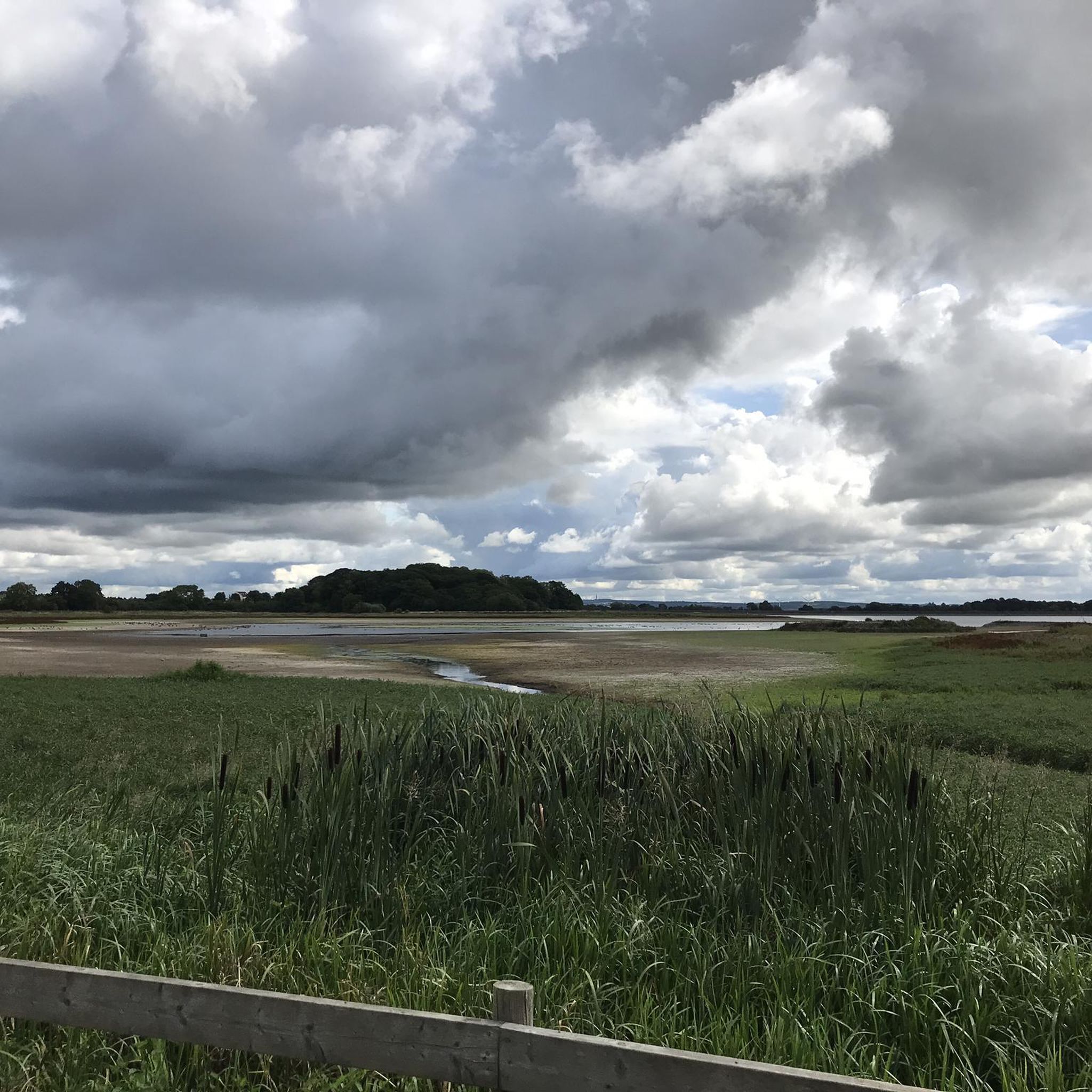


Tips from the Community


Cafe with lots of outside seating and bike space. A good menu of food and drinks as well. Worth a stop.
0
0

Have a look at this vid of the Wolverhampton canals and out to Wombourne. https://youtu.be/0_tq81TZtR0
0
0

Excellent views up and down. Plenty of wildlife if your quiet.
0
0
Beware fishing rods and dogs in the height of summer. Slow down and soak it all in
0
0
Take a picture to reference later. Worth popping back and exploring more
0
0
Frequently Asked Questions
What kind of terrain can I expect on mountain bike trails around Belvide Reservoir?
Mountain biking around Belvide Reservoir primarily features routes that traverse the surrounding Staffordshire countryside. You can expect a mix of country lanes, canal paths, and sections through woodlands. Many routes follow historical canal networks and former railway lines, providing mostly gentle gradients. While the immediate reservoir area is a nature reserve, the broader region offers varied cycling terrain suitable for mountain biking.
How many mountain bike trails are available in the Belvide Reservoir area?
There are 5 mountain bike trails detailed in this guide for the Belvide Reservoir area. These routes offer a range of distances and experiences, from easy loops to more moderate journeys through the local landscape.
Are there any easy mountain bike trails suitable for beginners or a relaxed ride?
Yes, there are easy mountain bike trails available. For instance, the Cupcake Lane Station – Gravel Path loop from Wolverhampton Racecourse is an easy 16.0 miles (25.8 km) path offering a mix of gravel paths and quiet roads. Another easy option is the Railway Viaduct – Aldersley Junction loop from Bilbrook, which is 16.1 miles (25.9 km) and leads through former railway lines and canal-side scenery.
What do other mountain bikers say about the trails around Belvide Reservoir?
The routes in the Belvide Reservoir area are highly rated by the komoot community, with an average score of 5.0 stars from more than 10 reviews. Mountain bikers often praise the varied terrain, which includes canal paths, country lanes, and woodlands, offering enjoyable rides for different ability levels.
Are there any circular mountain bike routes in the area?
Yes, all the mountain bike routes featured in this guide are circular. For example, you can explore the Summerfield Canal Path – Engine Arm Aqueduct loop from Bilbrook, which is a 38.2 miles (61.5 km) trail following canal towpaths and rural lanes, or the shorter Cupcake Lane Station – Railway Walk loop from Wolverhampton Lock, covering 21.6 miles (21.6 km).
Is Belvide Reservoir suitable for family-friendly mountain biking?
While the immediate Belvide Reservoir nature reserve has restricted access, the surrounding area offers routes with gentle gradients and varied terrain that can be suitable for families. Trails that follow canal paths and former railway lines, like the easy routes mentioned, are generally less technical and more accessible for a family outing.
Can I bring my dog on the mountain bike trails around Belvide Reservoir?
The trails around Belvide Reservoir often utilize public footpaths and country lanes. While dogs are generally permitted on public rights of way, it's important to keep them under control, especially near livestock or in areas with abundant wildlife, such as the nature reserve itself. Always check local signage for specific restrictions.
Are there any specific permits required for mountain biking around Belvide Reservoir?
Direct public access to the bird hides and certain paths within the immediate nature reserve area of Belvide Reservoir is restricted and often requires a permit from the West Midland Bird Club. However, the mountain bike routes in this guide typically use public rights of way, country lanes, and canal towpaths, which generally do not require special permits for cycling. Always respect private land and nature reserve boundaries.
Where can I find parking for mountain biking near Belvide Reservoir?
While specific dedicated mountain bike parking isn't highlighted for Belvide Reservoir itself, routes often start from towns or villages like Bilbrook or Wolverhampton Racecourse, where public parking facilities may be available. It's advisable to check parking options in the starting locations of specific routes before your ride.
What is the best time of year to go mountain biking around Belvide Reservoir?
The trails around Belvide Reservoir, consisting of country lanes, canal paths, and woodlands, are generally accessible throughout the year. However, for the most pleasant experience, spring and autumn offer milder temperatures and beautiful scenery. During wetter months, some unpaved sections might become muddy, so appropriate tires and gear are recommended.
Are there any cafes or pubs near the mountain bike trails for a break?
The routes around Belvide Reservoir pass through or near several villages and towns in Staffordshire. While specific establishments aren't listed for each trail, you can typically find cafes and pubs in nearby communities like Brewood, Bilbrook, or Wolverhampton, which are often starting points or pass-through locations for these routes. For example, the Newport to Stafford Greenway – Red Lion Farm Shop & Café loop from Great Chatwell specifically mentions a farm shop and café along its route.
What kind of elevation gain can I expect on these trails?
The mountain bike trails around Belvide Reservoir are characterized by mostly gentle gradients, often following canal networks and former railway lines. For example, the Summerfield Canal Path – Engine Arm Aqueduct loop from Bilbrook, a longer route, has an elevation gain of approximately 218 meters. Shorter, easier routes like the Cupcake Lane Station – Railway Walk loop from Wolverhampton Lock have around 105 meters of elevation gain, making them suitable for various fitness levels.
Most popular routes around Belvide Reservoir

Get inspired with the komoot mobile app


Explore more
Browse the best MTB trails in other regions.
