The best walks and hikes around Piethorne Reservoir
4.6
(2116)
16,102
hikers
427
hikes
Hiking around Piethorne Reservoir offers routes through a landscape of open moorland and interconnected waterways in the Piethorne Valley. The area is characterized by its network of Victorian-era reservoirs, including Piethorne, Ogden, and Kitcliffe, which are linked by stone-step cascades. Trails navigate a mix of reservoir paths, woodlands, and the surrounding hills, providing varied terrain for walkers. The region features expansive open moorland, tranquil waterside paths, and undulating rolling hills.
Best hiking trails around Piethorne Reservoir
- The most popular hiking route is Rochdale Way and Piethorne Reservoirs Loop, a 5.0 miles (8.1 km) trail that takes 2 hours 15 minutes to complete. This moderate hike follows a section of the Rochdale Way and circles the reservoirs.
- Another top favourite among local hikers is Norman Hill Spillway – Stone Hut with Fireplace loop from Newhey, a moderate 5.1 miles (8.2 km) path. This route features views across the valley and passes notable reservoir spillways.
- Local hikers also love the Overflow at Ogden Reservoir – Piethorne Reservoir loop from Newhey, a 3.7 miles (5.9 km) trail leading through the heart of the reservoir system, often completed in about 1 hour 40 minutes.
- Hiking around Piethorne Reservoir is defined by wide-open moorland, waterside paths, and rolling hills. The network of trails provides options for different ability levels, from easy reservoir circuits to more moderate moorland hikes.
- The routes in Piethorne Reservoir are highly rated by the komoot community with an average score of 4.6 stars from over 2,000 reviews. More than 16,000 hikers have used komoot to explore Piethorne Reservoir's varied terrain.
Last updated: July 9, 2026
4.6
(26)
94
hikers
8.05km
02:14
150m
140m
Moderate hike. Good fitness required. Easily-accessible paths. Suitable for all skill levels.
4.6
(19)
77
hikers
5.81km
01:39
130m
130m
Easy hike. Great for any fitness level. Easily-accessible paths. Suitable for all skill levels.

Sign up for free
4.9
(8)
29
hikers
6.01km
01:42
130m
130m
Easy hike. Great for any fitness level. Easily-accessible paths. Suitable for all skill levels.
4.2
(6)
22
hikers
15.4km
04:26
380m
380m
Moderate hike. Good fitness required. Easily-accessible paths. Suitable for all skill levels.
4.5
(4)
15
hikers
4.50km
01:18
120m
120m
Easy hike. Great for any fitness level. Easily-accessible paths. Suitable for all skill levels.
Get access to more routes and recommendations from other explorers.
Sign up for free
Already have an account?
Our route recommendations are based on thousands of hikes, rides, and runs completed by other people on komoot.
Start today with a free account
Your next adventure awaits.
Login or Signup

Tips from the Community


Broadhead Noddle 376.5m P11.1 (1235ft) (Hill ID: 511693) [JNSA s6457] County of Yorkshire Definitive List summit. South Pennines Park Definitive List summit. Kent List.
0
0

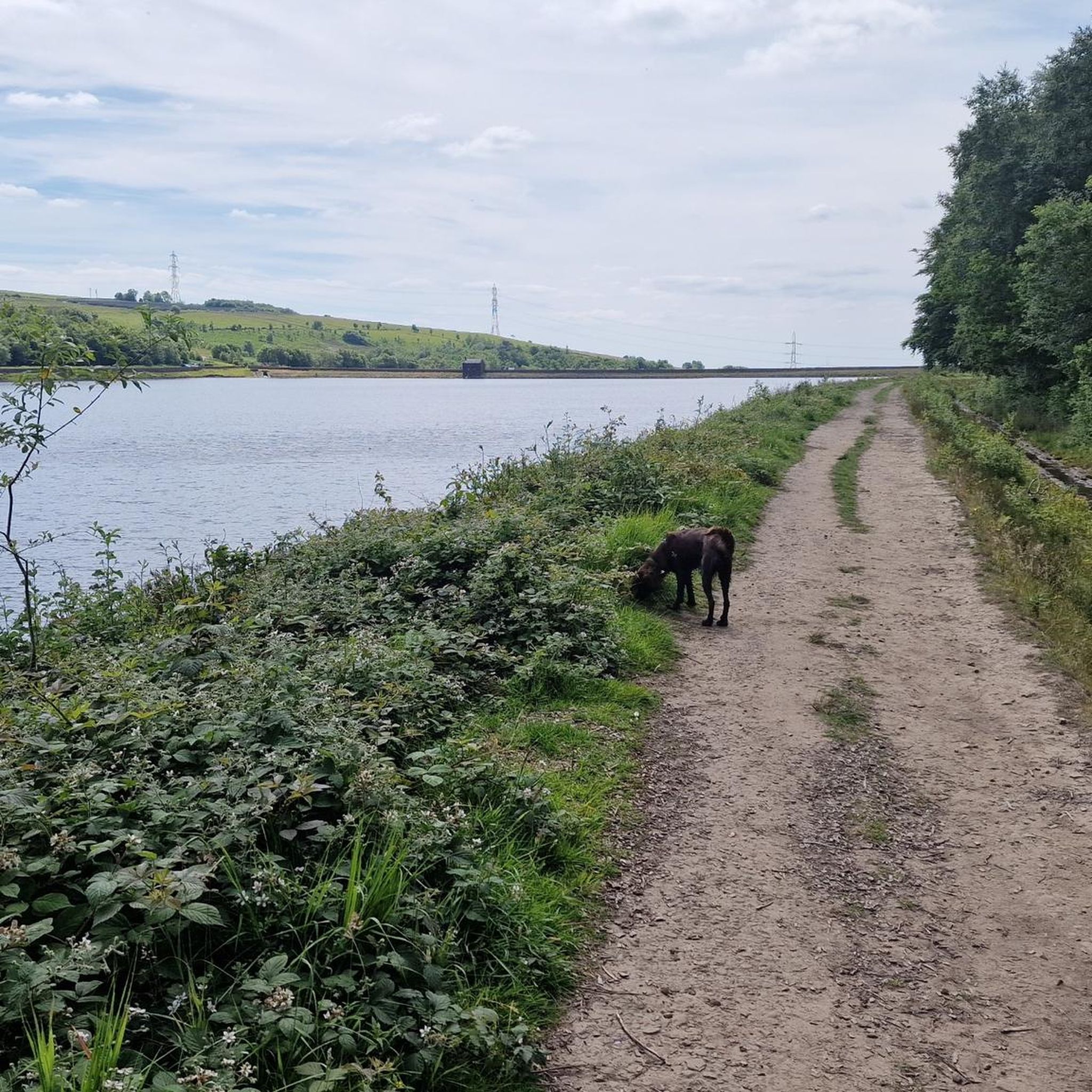
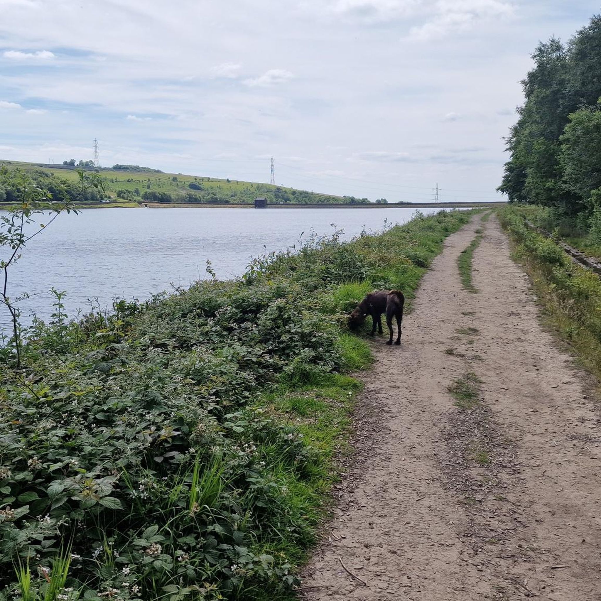
Lovely walk through the Piethorne Valley, taking in the six reservoirs.
0
0

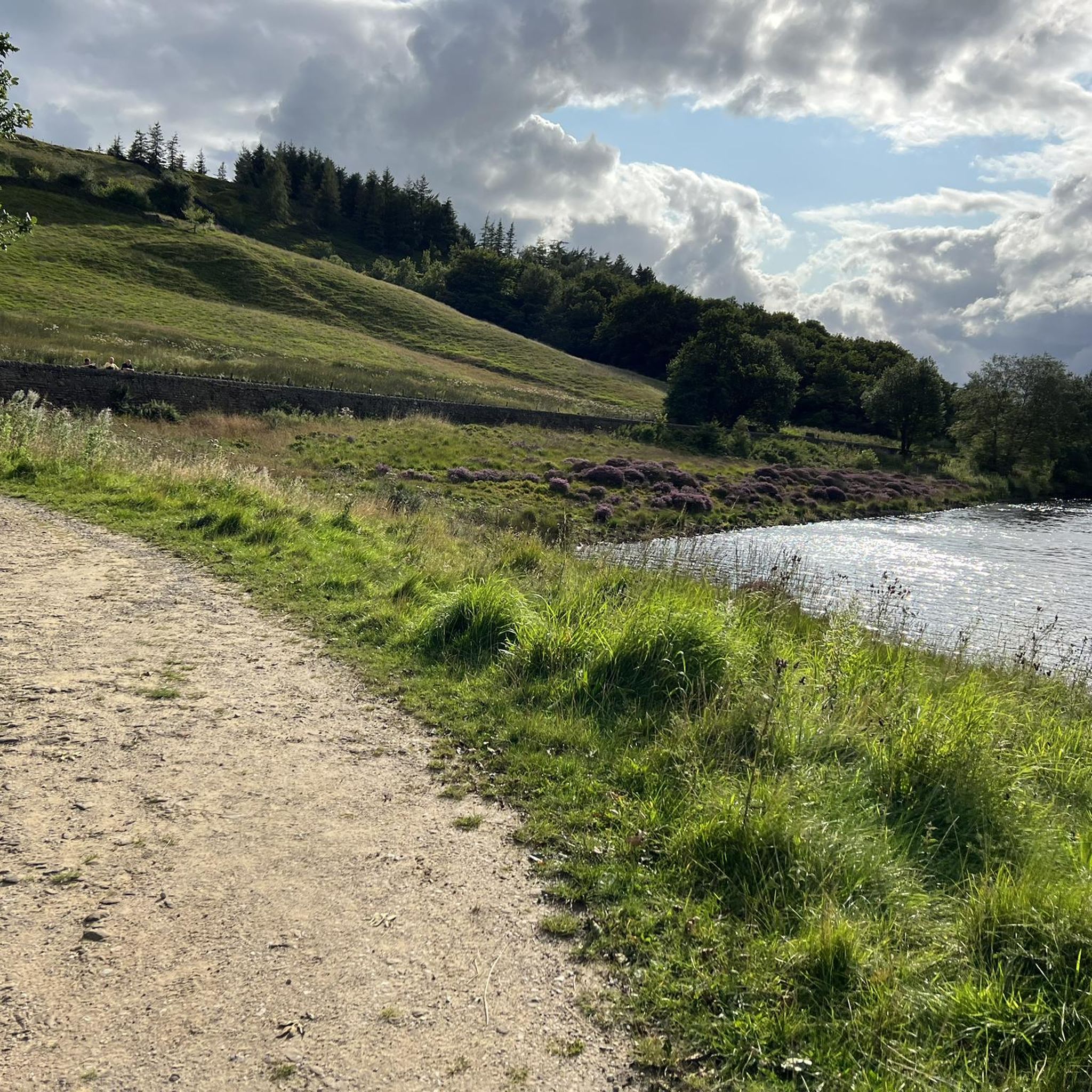
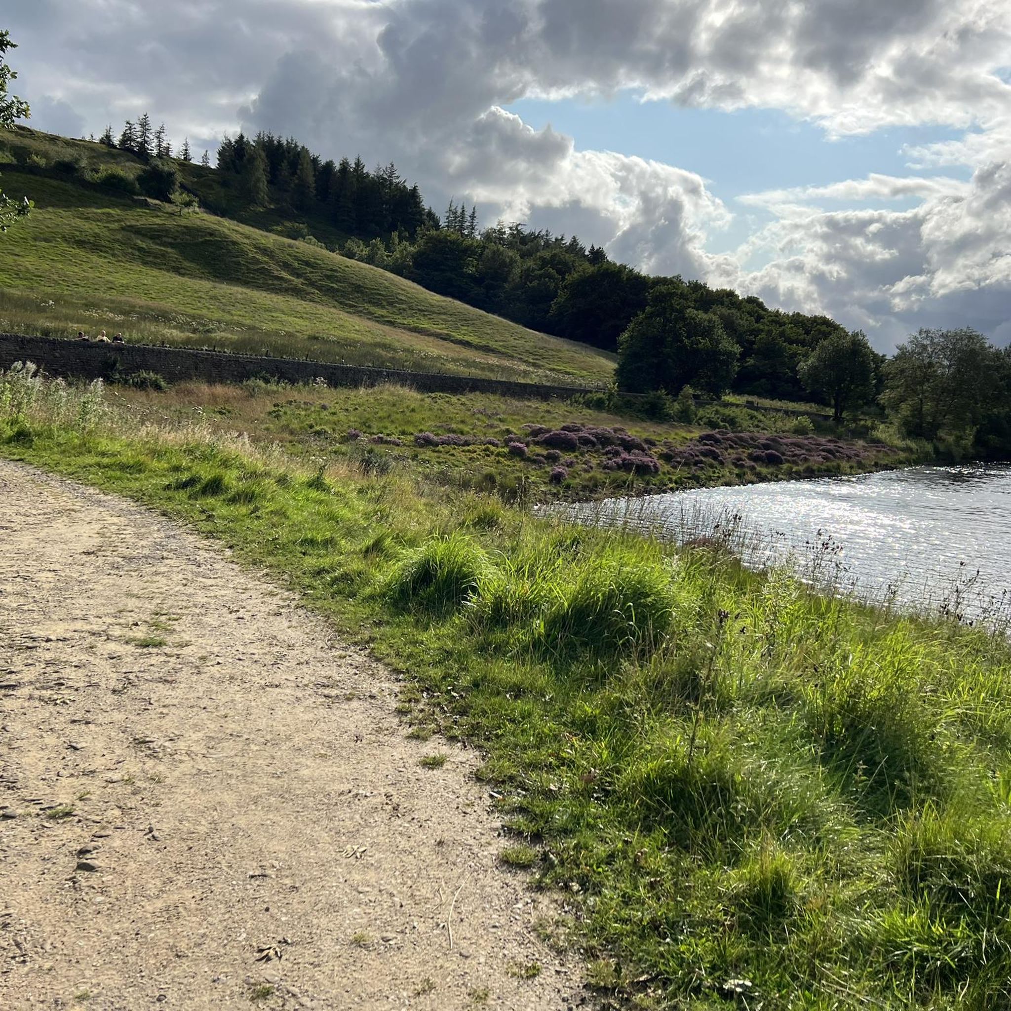
Perched in an elevated position just north of the renowned Peak District National Park, the breathtaking views from this vantage point unveil a rugged moorland landscape. Here, amidst the undulating hills, lies the mesmerising Castleshaw Reservoir, a tranquil oasis that adds a touch of serenity to the dramatic surroundings.
1
0

Frequently Asked Questions
Where can I park for a walk at Piethorne Reservoir?
There is a free car park located at Ogden Reservoir, which serves as a popular starting point for many trails in the Piethorne Valley. On-street parking is also available nearby, but it can get busy, especially on weekends. It's advisable to arrive early to secure a spot.
Are the hiking trails around Piethorne Reservoir suitable for dogs?
Yes, the Piethorne Valley is a great place to walk with dogs. The open spaces and reservoir paths offer plenty of room for them to explore. However, you will be walking through open moorland which may have grazing livestock, so it's essential to keep your dog under control and on a lead where required.
Are there any easy, family-friendly walks in the area?
Definitely. The area offers several gentle routes perfect for a family outing. For a straightforward and scenic walk, consider the Piethorne Reservoir – Stone Hut with Fireplace loop from Haugh. It's a relatively flat and short trail that still provides lovely views of the water and surrounding landscape.
Can I get to Piethorne Reservoir using public transport?
Yes, you can reach the area via public transport. The nearest Metrolink tram stop is in Newhey, which is a walkable distance from the start of many trails. Several bus routes also service the areas around Newhey and Littleborough, providing access to the valley.
What kind of scenery and features can I expect to see on a walk?
Walks in the Piethorne Valley are known for their varied scenery. You'll experience sweeping open moorland, paths alongside the six Victorian reservoirs, and pockets of woodland. A key feature is the impressive stone-step cascades that carry water between the reservoirs, creating picturesque man-made waterfalls, especially after rainfall.
Are there any circular walks available?
Yes, most of the popular trails in the area are circular. A great option that takes in multiple reservoirs is the Overflow at Ogden Reservoir loop from Newhey. This route provides a comprehensive tour of the valley's waterway network without you having to retrace your steps.
What do other hikers enjoy most about the Piethorne Reservoir area?
The area is highly regarded by the komoot community, with an average rating of 4.6 stars. Hikers frequently praise the stunning and varied scenery, from the wild open moorlands to the tranquil reservoir paths. The well-maintained tracks combined with the sense of local history are also commonly highlighted as major attractions.
How many hiking trails are there around Piethorne Reservoir?
There is a wide variety of routes to choose from. You can find over 400 trails in the area on komoot, ranging from easy, family-friendly reservoir loops to more challenging hikes up into the surrounding moorland hills.
What is the terrain like on the trails?
The terrain is quite mixed. You'll find well-maintained, relatively flat paths directly around the reservoirs, which are suitable for most walkers. As you venture into the surrounding hills and moors, the paths can become more rugged, uneven, and include some steep slopes that offer rewarding views.
Are there any pubs or cafes near the walking routes for refreshments afterwards?
While there are no pubs or cafes directly on the reservoir paths, the nearby villages of Newhey, Denshaw, and Littleborough have several options. You can find a number of traditional pubs and cafes a short drive from the main car parks, perfect for a post-hike meal or drink.
What is the history of the Piethorne Valley?
The valley is rich in history. The reservoirs themselves are feats of Victorian engineering, built in the mid-19th century to supply water to Oldham. As you walk, you can spot historical features like the Lime House, used to treat the water, and the ruins of old farms that predate the reservoirs. The area's history goes back even further, with evidence of ancient packhorse routes and even Bronze Age activity.
Most popular routes around Piethorne Reservoir

Get inspired with the komoot mobile app


Explore more
Browse the best Hikes in other regions.
