The best walks and hikes around Derryclare lough
4.5
(48)
328
hikers
15
hikes
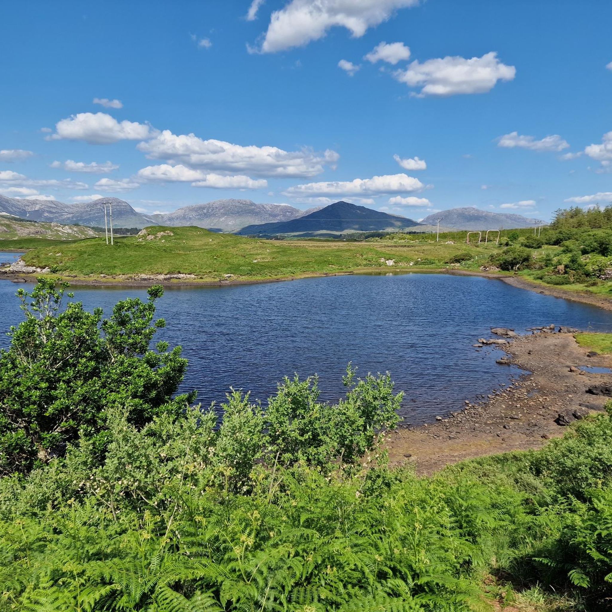
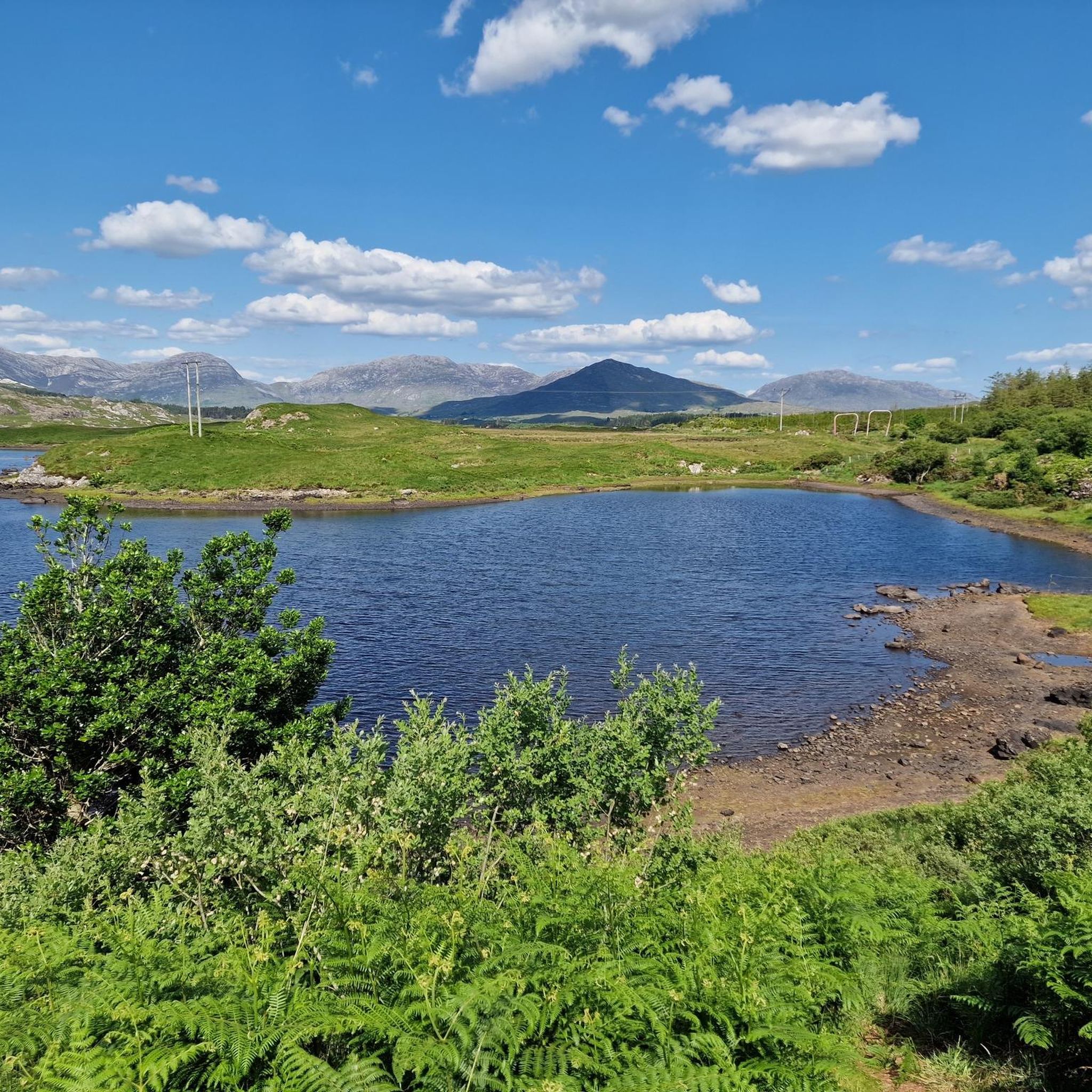
Hiking trails around Derryclare lough traverse a landscape characterized by the rugged beauty of Connemara, County Galway. The region features a mix of mountainous terrain, including peaks like Derryclare and Bencorr, alongside the tranquil waters of Derryclare Lough itself. Elevations can be significant, offering expansive views of the surrounding wilderness. The area provides a diverse environment for hikers, from lakeside paths to challenging mountain ascents.
Best hiking trails around Derryclare lough
- The most popular hiking route is Binn Doire Chláir / Derryclare from Derrynavglaun — County Galway, a 3.7 miles (6.0 km) trail that takes 3 hours 11 minutes to complete. This route involves a significant ascent to the summit of Derryclare.
- Another top favourite among local hikers is Binn Doire Chláir / Derryclare and Binn Chorr / Bencorr from Derrynavglaun, a difficult 5.4 miles (8.7 km) path. This trail combines two prominent peaks, offering challenging climbs and panoramic views of the Connemara landscape.
- Local hikers also love the Derryclare and Bencorr Loop Trail, a 7.1 miles (11.5 km) trail leading through mountainous terrain, often completed in about 3 hours 38 minutes.
- Hiking around Derryclare lough is defined by rugged mountain peaks, serene lough views, and open moorland. The network offers options for various ability levels, from easier lakeside walks to demanding mountain ascents.
- The routes in Derryclare lough are highly rated by the komoot community with an average score of 4.5 stars from over 40 reviews. Nearly 300 hikers have used komoot to explore Derryclare lough's varied terrain.
Last updated: July 7, 2026
5.0
(1)
17
hikers
6.03km
03:12
600m
600m
Hard hike. Good fitness required. Sure-footedness, sturdy shoes and alpine experience required.
5.0
(1)
9
hikers
Hike the difficult 5.4-mile Binn Doire Chláir / Derryclare and Binn Chorr / Bencorr trail for superb mountain views in Connemara National Pa

Sign up for free
2
hikers
11.5km
03:39
850m
850m
Hike the difficult 7.1-mile Binn Doire Chláir and Binn Chorr trail in Derryclare Nature Reserve for panoramic views of the Twelve Bens.
1
hikers
14.1km
04:41
860m
860m
Hike the Central Maumturks loop in County Galway, a challenging 8.8-mile route with 2806 feet of gain and stunning Connemara views.
4.5
(2)
30
hikers
Easy hike. Great for any fitness level. Easily-accessible paths. Suitable for all skill levels.
Get access to more routes and recommendations from other explorers.
Sign up for free
Already have an account?
Our route recommendations are based on thousands of hikes, rides, and runs completed by other people on komoot.
Start today with a free account
Your next adventure awaits.
Login or Signup
Popular around Derryclare lough
Tips from the Community

From the R341, you look out over the mirror-smooth water of the lake, where the wooded islets and the contours of the stately Ballynahinch Castle blend seamlessly into the majestic backdrop of the Twelve Bens. The imposing peaks of Benlettery and Bengower dominate the horizon here and are often beautifully reflected in the deep blue water.
7
0
Viewpoint at Ballynahinch Lake (Loch Bhaile na hInse). From the R341, you look out over the mirror-smooth water of the lake, where the wooded islands and the contours of the stately Ballynahinch Castle seamlessly merge into the majestic backdrop of the Twelve Bens. The imposing peaks of Benlettery and Bengower dominate the horizon here and often reflect beautifully in the deep blue water.
7
0

well maintained riverside walk with views to Ballynahinch castle
1
0

From here to the top of Derryclare and Bencorr is a strenuous mountain walk. The trail is steep and tough, with a mix of rock and bog sections. In the wet the rock can be very treacherous. Proper mountain hiking equipment, in particular footwear, is a must. In addition, make sure you have your food and fluids. There is very little by way of footpaths or waymarks, so the ability to navigate in the mountains, in particularly poor weather, is also a must. The trail gives you a rough outline and is best suited for the more experienced hikers out there with good fitness levels. Even then, the drier the day, the better experience you will have. You will be rewarded with an exceptional mountain day that has fine views of the 12 Bens from the tops and between the two summits, but you will certainly have to work for it.
0
0
Barrlugrevagh at 558 metres high makes for a small, scenic summit between Knocknahillion and Letterbreckaun. It has a decent size cairn and makes for a great vantage point to look down the ridge connectingh these two peaks.
0
0
Letterbreckaun is the second highest peak in the Maumturk Mountains here in Connemara at 667 metres high. It is the endmost northern mountain of the Central Maumturks area. It is connected to its lower sister hill of Knocknahillion by a long winding, undulating rocky ridge. From here you have great views out over Lough Inagh and towards Derryclare and Bencorr,
0
0
Cnoc na hUilleann, or Knocknahillion, which is 607 metres high, is a gem of a mountain in the central Maumturks area. It is not that high, but it is big in attitude, and if you follow the spectacular undulating ridge north, you will reach the slightly higher point of Letterbreckaun, which is 667 metres high. On the way you will be able to take in the stunning views of the 12 Bens and the beautiful Lough Inagh Valley.
0
0
Derryclare is 673 metres high and sits just south of its bigger neighbour Bencorr, and both of them form two of the ’12 Bens of Connemara’. They are connected by a rocky ridge that offers great views in all directions.
1
0
Frequently Asked Questions
What is the general difficulty level of hiking trails around Derryclare Lough?
The hiking trails around Derryclare Lough offer a range of difficulties. You'll find everything from easier lakeside paths to demanding mountain ascents. For instance, Binn Doire Chláir / Derryclare from Derrynavglaun is considered difficult due to its significant ascent, while other routes cater to moderate and easy levels.
How long do hikes around Derryclare Lough typically take?
Hike durations vary significantly depending on the route and your pace. Shorter, easier walks might take just over an hour, while more challenging mountain trails can take several hours. For example, the difficult Binn Doire Chláir / Derryclare and Binn Chorr / Bencorr from Derrynavglaun typically takes around 4 hours 30 minutes to complete.
Are there family-friendly hiking options around Derryclare Lough?
Yes, there are several easier trails suitable for families. While the region is known for its rugged mountain terrain, there are also less strenuous paths, particularly those closer to the lough or in flatter areas. These routes offer a chance to enjoy the scenery without significant elevation gain.
Can I bring my dog on hikes around Derryclare Lough?
Many trails in the Connemara region are dog-friendly, but it's always best to keep dogs on a lead, especially in areas with livestock or ground-nesting birds. Be mindful of local signage and respect wildlife. Always carry waste bags and leave no trace.
When is the best time of year to hike around Derryclare Lough?
The best time to hike is generally from late spring to early autumn (May to September) when the weather is milder and daylight hours are longer. However, Connemara weather can be unpredictable, so always be prepared for rain and wind regardless of the season. The vibrant greens of spring and the heather-covered hills of late summer are particularly beautiful.
Is hiking around Derryclare Lough possible in winter?
Winter hiking is possible but requires careful planning and appropriate gear. Days are shorter, and weather conditions can be harsh, with strong winds, rain, and potentially snow on higher ground. Visibility can also be poor. It's recommended for experienced hikers only, and checking local weather forecasts is crucial.
Are there circular hiking routes available?
Yes, there are several circular routes. For instance, the Derryclare and Bencorr Loop Trail is a challenging 7.1-mile (11.5 km) loop that takes you through mountainous terrain, offering expansive views. Another option is the moderate Letterbreckaun and Knocknahillion Loop.
What can I see along the hiking trails around Derryclare Lough?
The trails offer stunning views of the Twelve Bens mountain range, the tranquil waters of Derryclare Lough, and the surrounding Connemara landscape. You'll encounter rugged moorland, ancient woodlands, and diverse flora and fauna. Keep an eye out for local wildlife and the ever-changing light on the mountains.
Are there any easy trails suitable for beginners?
Yes, beginners can find suitable options. For a relatively easy experience, consider routes that stick to lower elevations or lakeside paths. An example of an easy route is the View of Ballynahinch Castle loop from Roundstone, which offers gentle terrain and scenic views.
What do other hikers enjoy the most about hiking in Derryclare Lough?
The area is highly rated by the komoot community, with an average score of 4.5 stars. Reviewers often praise the breathtaking panoramic views from the mountain summits, the serene beauty of the lough, and the sense of wild, untouched nature that defines the Connemara landscape.
Is there public transport access to the Derryclare Lough hiking areas?
Public transport options directly to trailheads around Derryclare Lough are limited. It's generally recommended to have your own transport to access many of the hiking starting points. Some local bus services might operate to nearby towns, but onward travel to specific trailheads would likely require a taxi or pre-arranged shuttle.
Are there opportunities for wild swimming in Derryclare Lough?
Derryclare Lough, like many of Connemara's freshwater loughs, can be appealing for wild swimming. However, always exercise caution: check water temperatures, be aware of currents, and ensure easy entry and exit points. It's best to swim with company and avoid isolated areas. The water can be very cold, even in summer.
Most popular routes around Derryclare lough

Get inspired with the komoot mobile app


Explore more
Browse the best Hikes in other regions.
