The best walks and hikes around Glenade Lough
4.3
(114)
569
hikers
5
hikes
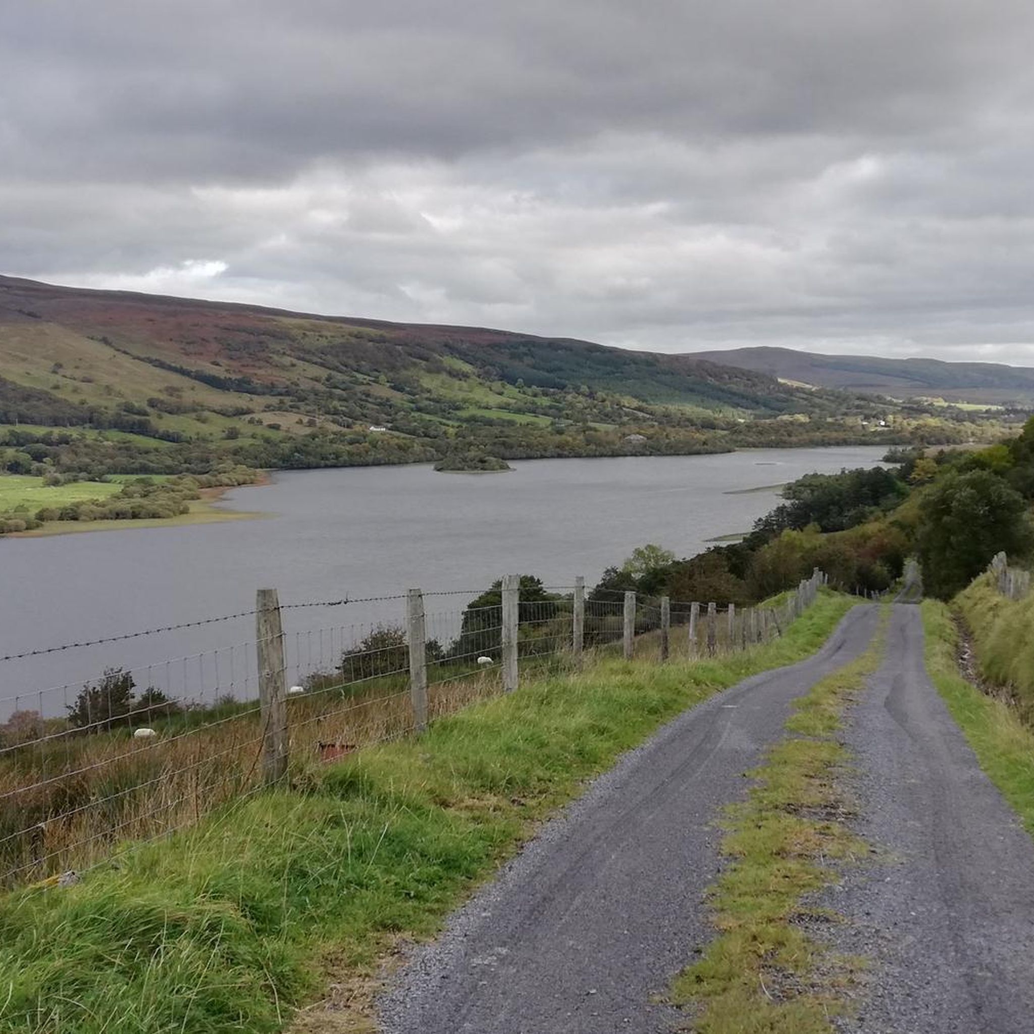
Hiking trails around Glenade Lough are set within one of Europe's most impressive glacial valleys, flanked by the Dartry Mountains and Arroo Mountain range. The landscape features diverse deciduous woodlands and offers panoramic views stretching across Donegal Bay and Mullaghmore on clear days. This Special Area of Conservation (SAC) includes the freshwater lake and surrounding hills, providing varied terrain for outdoor activities.
Best hiking trails around Glenade Lough
- The most popular hiking route is Eagle's Rock from Glenade — County…
Last updated: May 15, 2026
4.3
(3)
16
hikers
5.98km
02:07
330m
330m
Moderate hike. Good fitness required. Easily-accessible paths. Suitable for all skill levels.
4.5
(4)
7
hikers
14.8km
04:26
410m
410m
Moderate hike. Good fitness required. Easily-accessible paths. Suitable for all skill levels.

Sign up for free
4.7
(6)
51
hikers
695m
00:12
20m
20m
Easy hike. Great for any fitness level. Easily-accessible paths. Suitable for all skill levels.
4.2
(10)
63
hikers
4.88km
01:24
120m
120m
Easy hike. Great for any fitness level. Easily-accessible paths. Suitable for all skill levels.
4.8
(24)
151
hikers
Easy hike. Great for any fitness level. Easily-accessible paths. Suitable for all skill levels.
Our route recommendations are based on thousands of hikes, rides, and runs completed by other people on komoot.
Start today with a free account
Your next adventure awaits.
Login or Signup
Popular around Glenade Lough

Tips from the Community

The teaSHED is a well reviewed cafe near the base of the Glencar Waterfall Trail. It's also a perfect start point for a longer walk to visit the Glencar Lough and Devil's Chimney waterfall. The cafe is open daily, with plenty of indoor and outdoor seating, and a good range of cakes and savory snacks.
0
0

As if out of nowhere, a deep crevice opens up, containing a small lake and trees. The vegetation in this crevice also differs from the otherwise predominant heath and peat landscape.
0
0

Remnants from the last ice age
0
0

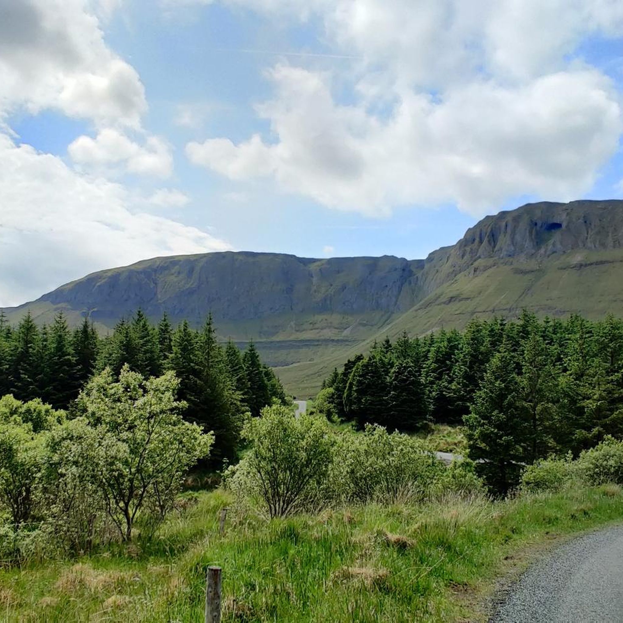
The view of Eagles Rock and the Truskmore Cliffs are stunning from this road. Should you fancy a closer look it is possible to jump off the bike and head up on foot.
1
0

This is quite a short run up to here but it is steep and it will get your heat pounding. it is all worth while however as the views are magnificent.
0
0
Just a joy to behold. A soaring cliff face that looks like a giant has cleaved a chunk of it away with an axe. A stunning sight!
0
0
Walking trail on private property from the parking.
0
0

Impressive cliffs rising up from the valley of Glenade.
0
0
Frequently Asked Questions
How many hiking trails are available around Glenade Lough?
There are several hiking trails around Glenade Lough, offering diverse experiences. These routes are set within one of Europe's most impressive glacial valleys, providing options for various skill levels.
Are there any easy hiking trails suitable for beginners or families around Glenade Lough?
Yes, there are easy hiking options. For instance, The Devil's Chimney Waterfall – Viewpoint loop from Lurganboy is an easy 3.0-mile (4.9 km) trail that takes about 1 hour 24 minutes. Another easy option is the Devil's Chimney Waterfall – The Devil's Chimney Waterfall loop from Cliffoney, which is shorter at 2.4 miles (3.9 km).
What kind of natural features and landmarks can I expect to see on the trails?
Hikers can expect panoramic views of Glenade Lough, the Glenade Valley, and distant coastlines. Notable natural features include the majestic Dartry Mountains and Arroo Mountain range. The unique rock formation known as Eagle's Rock is a prominent landmark, accessible via routes like Eagle's Rock from Glenade. The area also features diverse deciduous woodlands and the ecologically important Glenade Lough itself, a Special Area of Conservation.
Are there any circular hiking routes around Glenade Lough?
Yes, several routes offer a circular experience. The Truskmore cliffs – Eagle's Rock loop from Aghanlish Electoral Division is a moderate 9.2-mile (14.8 km) path that provides a comprehensive loop exploring the cliffs and views. Another option is The Devil's Chimney Waterfall – Viewpoint loop from Lurganboy, which is an easy circular trail.
Is Glenade Lough suitable for dog-friendly walks?
While specific dog regulations for individual trails are not detailed, many outdoor areas in Ireland welcome well-behaved dogs on leads. It's always advisable to keep dogs under control, especially in areas with livestock or wildlife, and to follow the Leave No Trace principles. Check local signage for any specific restrictions.
What is the best time of year to go hiking around Glenade Lough?
The best time to hike around Glenade Lough is generally during the spring, summer, and early autumn months (April to October) when the weather is milder and daylight hours are longer. Clear days offer the most spectacular panoramic views across Donegal Bay and Mullaghmore. Winter hiking is possible but requires appropriate gear due to potentially colder, wetter conditions and shorter daylight.
Are there any facilities like cafes or accommodation near Glenade Lough?
While Glenade Lough itself is a natural area, nearby towns such as Manorhamilton, Kinlough, and Dromahair offer various amenities including cafes, pubs, and accommodation options. It's recommended to check in these towns for services before or after your hike.
What do other hikers enjoy most about hiking in Glenade Lough?
The area is highly rated by the komoot community, with an average score of 4.2 stars from over 70 reviews. Reviewers often praise the stunning panoramic views, the dramatic glacial valley landscape, and the unique natural landmarks like Eagle's Rock. The variety of trails catering to different abilities is also frequently highlighted.
Is there parking available at the trailheads around Glenade Lough?
Yes, a car park and viewing area are available at the southern end of Glenade Lough, providing convenient access for visitors. Specific parking details for individual trailheads may vary, but general access points are usually provided.
Are there any historical or mythical points of interest in the Glenade Lough area?
Yes, Glenade Lough is rich in local lore. It's famously associated with the legend of the Dobhar-chú, a mythical otter-like creature, with a gravestone in a nearby cemetery reportedly commemorating a tragic encounter from 1722. Additionally, a cave in the valley, Pol na mBear, yielded remains of Ireland's last brown bears, which were found to be maternal ancestors of the modern polar bear, adding significant natural historical interest.
Do I need a permit to hike around Glenade Lough?
Generally, permits are not required for hiking on the established trails around Glenade Lough. However, it's always good practice to respect private land, follow Leave No Trace principles, and check for any specific local regulations or temporary access restrictions before your visit.
Can I reach Glenade Lough using public transport?
Public transport options directly to the immediate vicinity of Glenade Lough may be limited. It is advisable to check bus routes to nearby towns like Manorhamilton or Kinlough and then consider local taxi services or cycling to reach the lake and trailheads. For scenic exploration, Glenade Lake is a stop on The Manorhamilton – Glenade Valley Scenic Looped Drive.
Most popular routes around Glenade Lough

Get inspired with the komoot mobile app


Explore more
Browse the best Hikes in other regions.
