The best road cycling routes around Lough Bunny
5.0
(1)
202
riders
7
rides
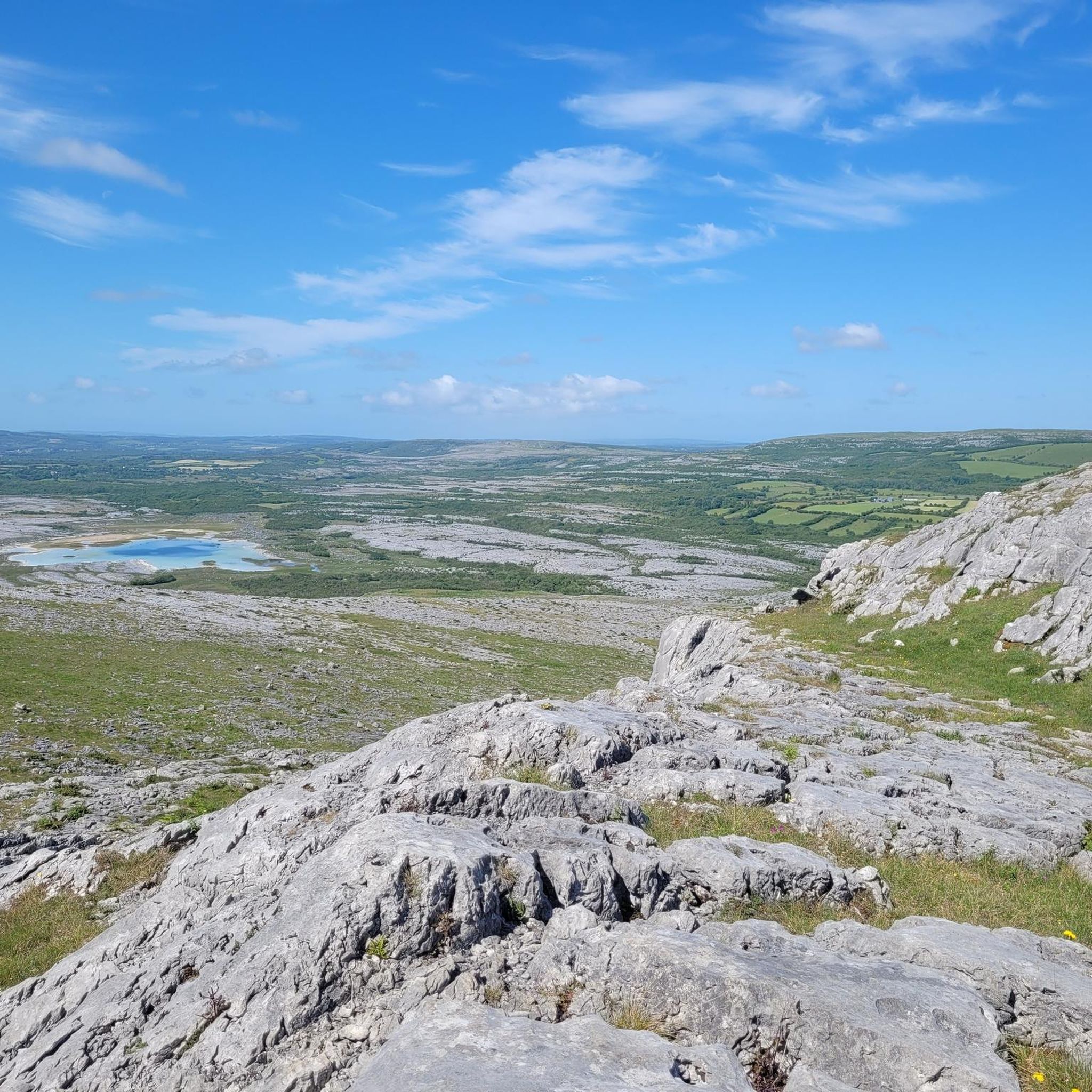
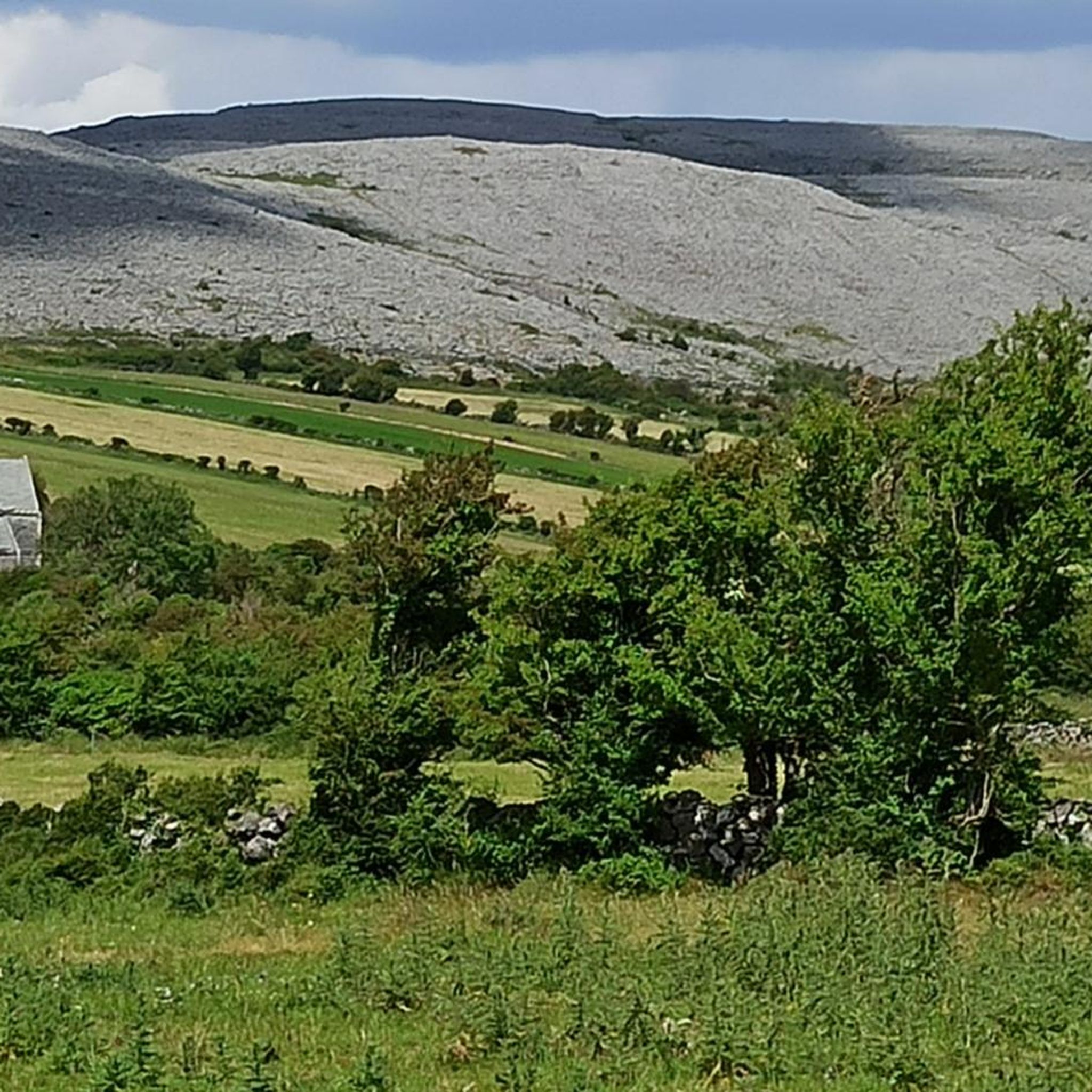
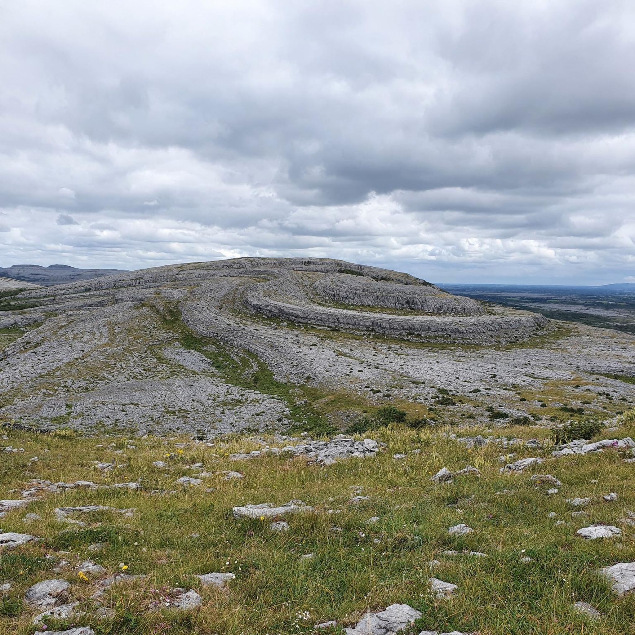
Road cycling routes around Lough Bunny traverse a distinctive karst landscape within County Clare, Ireland. This region is characterized by vast limestone pavements, rolling hills, and the tranquil freshwater of Lough Bunny itself. Cyclists encounter views of Mullaghmore Mountain and the R460 road runs alongside the lake, providing continuous scenic views. The terrain offers a mix of paved surfaces and varying elevation gains, with generally light traffic on minor country roads.
Best road cycling routes around Lough Bunny
- The most…
Last updated: June 28, 2026
12
riders
98.5km
04:24
760m
760m
Moderate road ride. Good fitness required. Some segments of this route may be unpaved and difficult to ride.
2
riders
98.0km
04:16
700m
700m
Moderate road ride. Good fitness required. Some segments of this route may be unpaved and difficult to ride.

Sign up for free
2
riders
50.3km
02:18
380m
380m
Moderate road ride. Good fitness required. Mostly well-paved surfaces and easy to ride.
4
riders
91.1km
03:58
760m
760m
Moderate road ride. Good fitness required. Mostly well-paved surfaces and easy to ride.
12
riders
91.4km
04:06
810m
810m
Moderate road ride. Good fitness required. Mostly well-paved surfaces and easy to ride.
Get access to more routes and recommendations from other explorers.
Sign up for free
Already have an account?
Our route recommendations are based on thousands of hikes, rides, and runs completed by other people on komoot.
Start today with a free account
Your next adventure awaits.
Login or Signup
Popular around Lough Bunny
Tips from the Community

This stretch of Ennis' Riverwalk provides excellent views across Post Office Field's greenery towards St Columba's Church of Ireland. This fine example of Gothic revival architecture was built between 1868 and 1871 and designed by Francis Bindon.
0
0

Located on a narrow spit of land between Ballyvaughan and the N67, the ruin forms a dramatic silhouette against the backdrop of the grey Burren hills and the changing tides of the bay.
3
0
The Soda Café is a modern and beloved stopover in Ballyvaughan, housed in a characteristic building at the foot of the Burren. This café is known for its excellent coffee, homemade soda bread, and fresh, local dishes that celebrate the flavors of County Clare.
5
0
The Tea Rooms in Ballyvaughan is an iconic stopover located in a charming, whitewashed building dating back to 1944. This atmospheric venue is known for its traditional Irish hospitality, homemade cakes, and the famous 'cheesecake' which has been a staple in the Burren for decades. With an idyllic garden overlooking Galway Bay, it offers a nostalgic resting place where time seems to stand still.
6
0
Gleninagh Castle is an impressive 16th-century L-shaped tower house that majestically overlooks Galway Bay. A former stronghold of the O'Loughlin clan, it is built from the characteristic limestone of the Burren and remains in remarkably good condition. Beside the castle ruins, you will find a small medieval church, a holy well, and a circular 'fullacht fiadh' (cooking place). The contrast between the robust structure and the bare, grey karst landscape makes this a fascinating historical anchor point along the northern coast of County Clare.
6
0
The R477 coastal road winds through the heart of the Burren and is considered one of Ireland's most spectacular driving routes. On one side, the grey limestone mountains tower up, while on the other, the Atlantic Ocean crashes directly against the rock plateaus. This road connects Fanore with Doolin and offers constant views of the Aran Islands and Galway Bay. It is the perfect route to experience the raw scale of the karst landscape, with numerous parking bays for a short walk across the iconic 'limestone pavements'.
6
0
Fanore Beach is one of the most beautiful sandy beaches along the Wild Atlantic Way, uniquely situated at the foot of the Burren's limestone hills. This award-winning Blue Flag beach is known for its vast dunes and is a favourite spot for surfers, swimmers, and walkers. As the Caher River flows into the ocean here, you can enjoy sweeping views of Galway Bay and the Aran Islands. The contrast between the golden sand and the grey moonscape of the surrounding rocks makes this an unmissable stop for any nature lover.
5
0
Near the coast of Fanore, in the shadow of Black Head, lie the overgrown stone ruins of an abandoned settlement that recalls the Great Famine (1845-1852). These simple one-room dwellings, often built from local limestone, once housed families who lived off small-scale farming and fishing until extreme poverty and hunger forced them to abandon their homes.
5
0
Frequently Asked Questions
How many road cycling routes are available around Lough Bunny?
There are 7 road cycling routes available around Lough Bunny on komoot, offering a range of experiences from moderate to more challenging rides.
What kind of terrain can I expect when road cycling around Lough Bunny?
The terrain around Lough Bunny is characterized by the unique Burren karst landscape, featuring vast limestone pavements and rolling hills. Cyclists will encounter a mix of paved surfaces with varying elevation gains, often requiring lower gears for ascents, but rewarding with exhilarating descents. The R460 road runs alongside the lake, providing continuous scenic views.
Are there any challenging road cycling routes in the Lough Bunny area?
While many routes are moderate, the hilly terrain of the Burren can present challenging ascents. For instance, routes like Inchicronan Lough – Tuamgraney loop from Muckanagh ED and The Burren Limestone Pavement – Burren Coastal Road loop from Ruan feature significant elevation gains, making them rewarding for experienced cyclists seeking a challenge.
Can I find easy or beginner-friendly road cycling routes near Lough Bunny?
Yes, there is one easy road cycling route available on komoot around Lough Bunny. The broader Burren Lowlands region also offers routes catering to all ability levels, so you can find options suitable for beginners or those preferring a less strenuous ride.
Are there circular road cycling routes around Lough Bunny?
Many of the road cycling routes around Lough Bunny are designed as loops, allowing you to start and finish at the same point. Examples include the Inchicronan Lough – Tuamgraney loop from Muckanagh ED and the View of the Burren – The Burren Perfumery loop from Muckanagh ED.
What historical landmarks or natural features can I see along the road cycling routes?
Road cycling routes around Lough Bunny offer views of Mullaghmore Mountain and its dramatic folded shape. You can also spot historical elements such as the ruins of a medieval tower house on the northeast shore of Lough Bunny and Boston Castle (Cloondooan Castle) at the northern end of the lake. The routes also showcase the unique karst features, including turloughs and sinkholes, characteristic of the Burren National Park.
Where can I park my car when cycling around Lough Bunny?
Lough Bunny is located between the towns of Corofin and Gort, which can serve as starting points for exploring the Burren National Park. These towns typically offer parking facilities. The R460 road runs alongside Lough Bunny, and minor country roads in the area generally have light traffic, which may offer roadside parking opportunities, though specific designated cycling parking areas are not detailed.
What is the best time of year to go road cycling in Lough Bunny?
The Burren region is known for its wildflowers from spring to autumn, making these seasons particularly scenic for cycling. Reviewers often praise the generally light traffic on minor country roads, which can be enjoyed throughout the warmer months. However, the unique geological features are visible year-round.
Are the road cycling routes around Lough Bunny suitable for families?
The region offers routes catering to various ability levels, including one easy route on komoot. While the Burren's hilly terrain can be challenging, families might find suitable options on less strenuous sections or in nearby areas like the Lough Avalla Farm Loop or Gort River Walk, which are also popular for cycling.
Are there places to stop for refreshments or food along the cycling routes?
Lough Bunny is situated between the towns of Corofin and Gort, which provide amenities such as cafes, pubs, and accommodation. While specific establishments directly on the cycling routes around the lake are not detailed, these nearby towns offer convenient stops for refreshments and food.
What do other cyclists enjoy most about road cycling in Lough Bunny?
The road cycling experience around Lough Bunny is highly rated by the komoot community, with an average score of 5.0 stars. Cyclists frequently praise the stunning natural features, the dramatic and scenic backdrop of the Burren's karst landscape, and the generally light traffic on the minor country roads, which allows for an immersive cycling experience.
Are there any less crowded road cycling options near Lough Bunny?
The minor country roads in the Burren region, including those around Lough Bunny, are generally known for light traffic, offering a less crowded cycling experience. Exploring routes that venture slightly off the main R460 road might provide even more tranquility.
What makes the landscape around Lough Bunny unique for road cycling?
The landscape around Lough Bunny is unique due to its location within the Burren National Park, a Special Area of Conservation. It features a distinctive karst landscape with vast limestone pavements, rolling hills, and the tranquil freshwater of Lough Bunny itself. This geological rarity, combined with views of Mullaghmore Mountain and the presence of unique flora and fauna, creates a dramatic and scenic backdrop for road cyclists.

Get inspired with the komoot mobile app


Explore more
Browse the best Road cycling routes in other regions.
