The best running trails around Höglwörther Lake
4.5
(448)
9,028
runners
273
runs
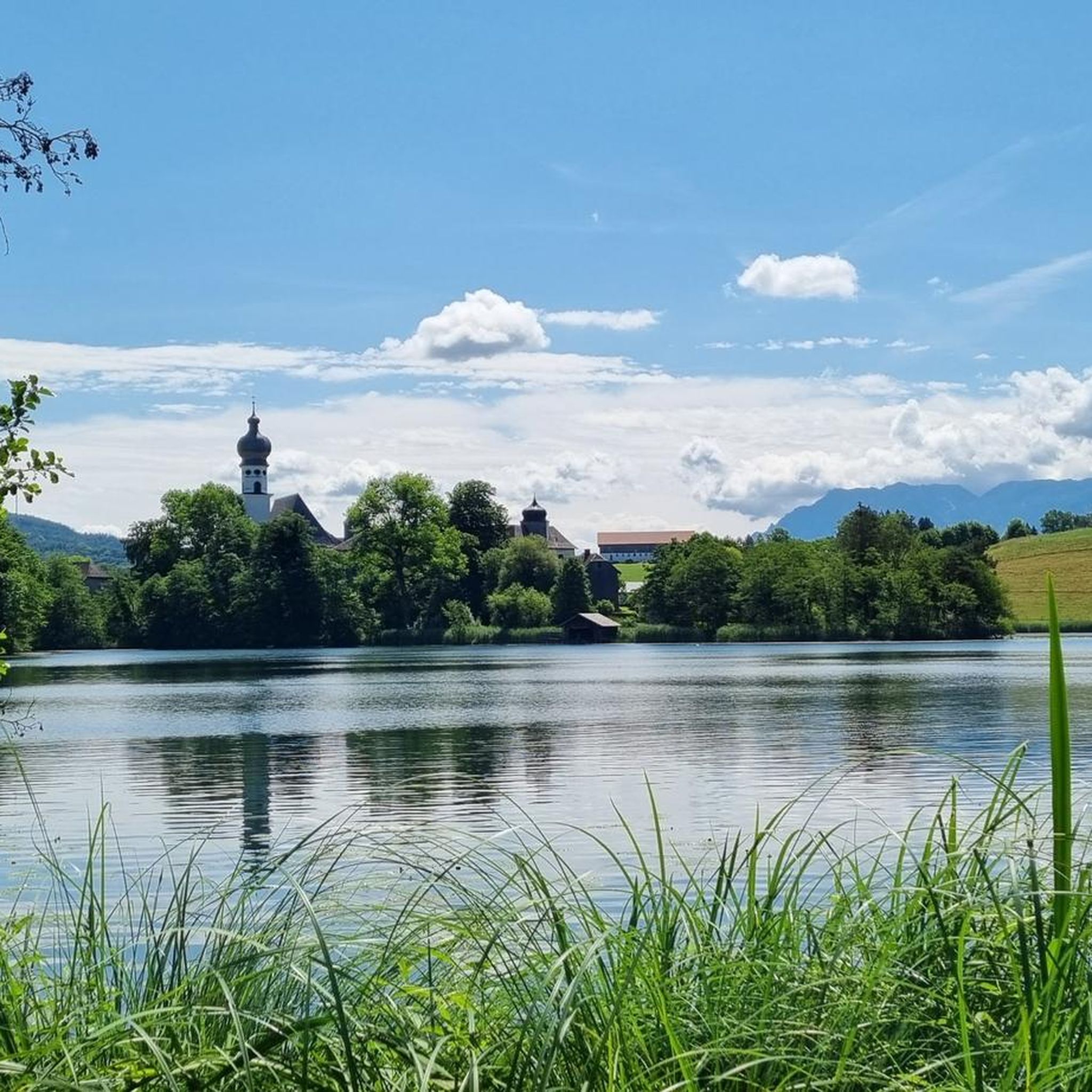
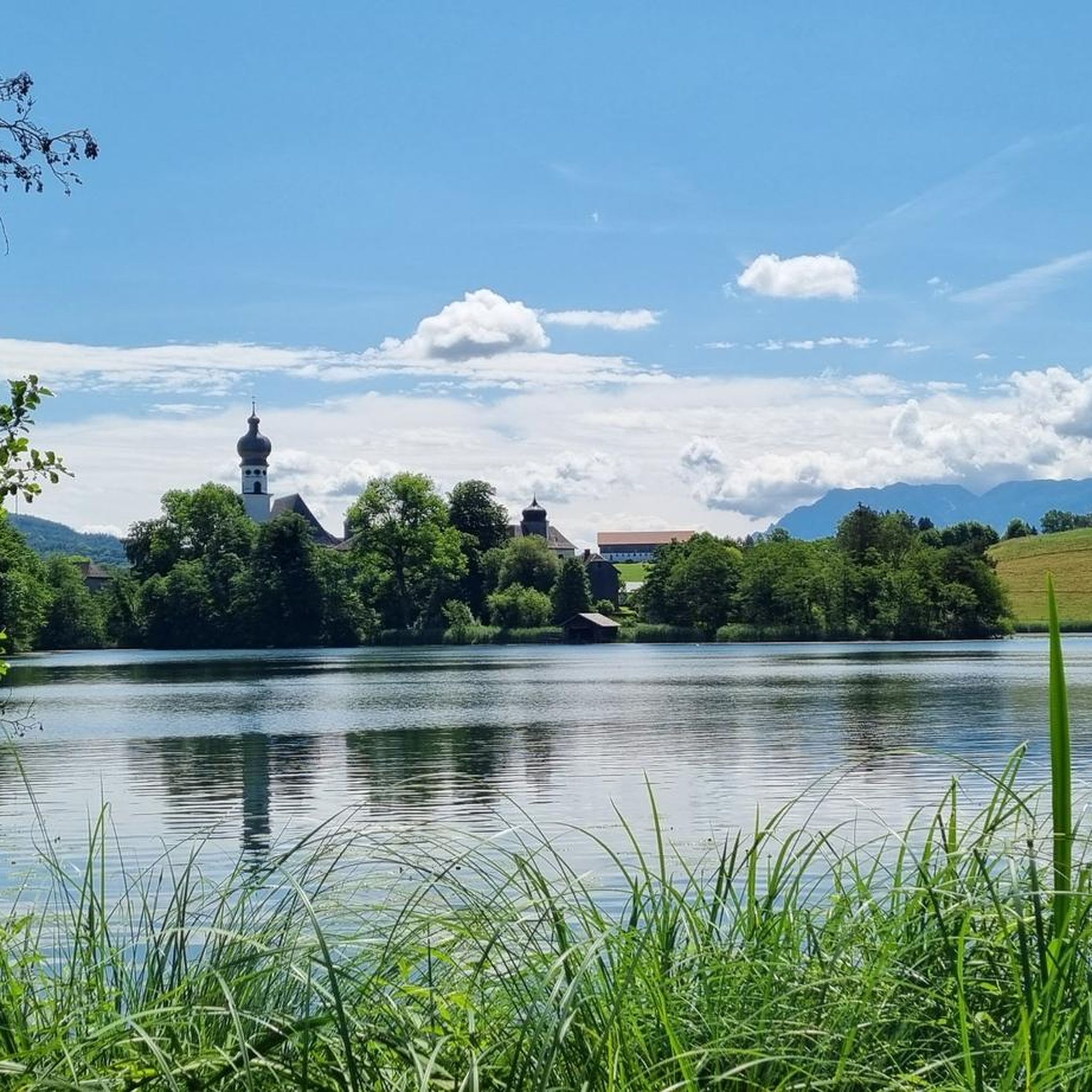
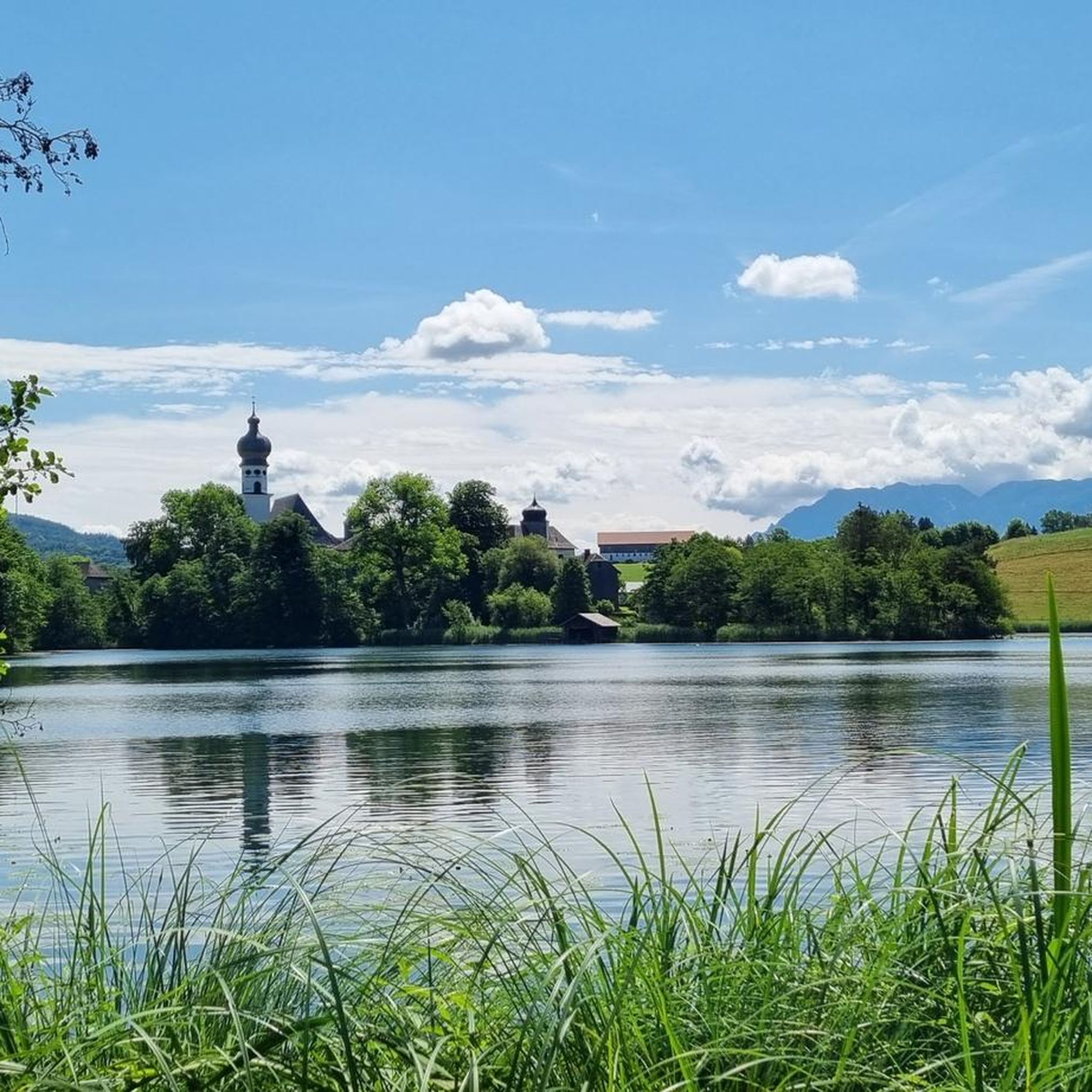
Jogging routes around Höglwörther Lake are set within the Berchtesgadener Land biosphere reserve, offering a blend of natural beauty and historical landmarks. The area features tranquil waters, accessible paths, and a relatively flat, wide circuit around the lake. This landscape is characterized by the serene Höglwörther See, the historic Höglwörth Monastery situated on a peninsula, and a dynamic cascade waterfall.
Best jogging routes around Höglwörther Lake
- The most popular jogging route is Höglwörth Lake loop from Anger, a 5.7…
Last updated: May 20, 2026
12
runners
7.56km
00:49
140m
140m
Moderate run. Good fitness required. Mostly paved surfaces. Suitable for all skill levels.
4.0
(1)
9
runners
20.8km
02:43
850m
850m
Hard run. Very good fitness required. Sure-footedness, sturdy shoes and alpine experience required.

Sign up for free
8
runners
5.48km
00:38
100m
100m
Moderate run. Good fitness required. Mostly paved surfaces. Suitable for all skill levels.
4.9
(31)
52
runners
6.12km
00:40
80m
80m
Moderate run. Good fitness required. Mostly paved surfaces. Suitable for all skill levels.
21
runners
9.36km
00:59
100m
100m
Moderate run. Good fitness required. Mostly paved surfaces. Suitable for all skill levels.
Get access to more routes and recommendations from other explorers.
Sign up for free
Already have an account?
Our route recommendations are based on thousands of hikes, rides, and runs completed by other people on komoot.
Start today with a free account
Your next adventure awaits.
Login or Signup

Tips from the Community

today, after the rain, not nice to ride, but with MTB tires no problem
1
0

While it would have been good if you hadn't been in a cloud
0
0

Great view at the Stoißer Alm
0
0

The Schornbach and Höglwörther Seebach streams, both of which rise in the hills west of the A8 motorway, merge in a pond above Lake Höglwörth. From there, the lake's largest tributary cascades through the forest, plunging more than 30 meters down the slope to the west of the lake, via numerous stone cascades.
14
0
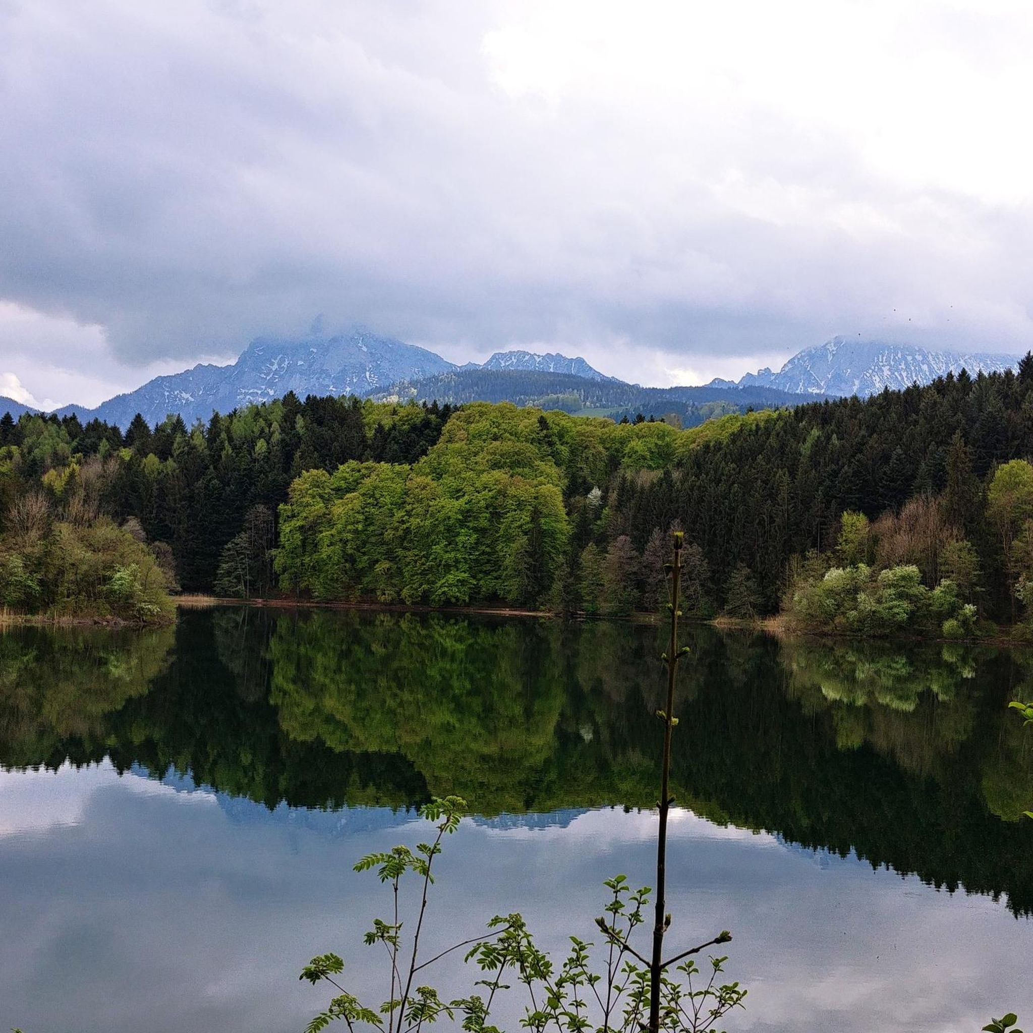
The lake was formed as a terminal moraine lake after the melting of the Salzach Glacier about 10,000 years ago. Today, it is subject to inexorable silting. The lake, which is up to six and a half meters deep, is home to numerous animal species. A hiker can walk around it in just over half an hour. The views of Höglwörth Monastery, located on a peninsula in the lake, are remarkable.
13
0
The former monastery church of St. Peter and Paul is now a branch church of the Anger parish and impresses with its architectural history, which ranges from the Romanesque period to the late Rococo period. The square bell tower with its onion dome, the single-nave nave with a gallery, and the Romanesque choir with its groin vault tell of centuries of architectural history. Particularly noteworthy are the high altarpiece by Francesco Vanni (c. 1600), depicting the Transfiguration of Christ, and the stucco work by Benedikt Zöpf (1765), which lend the church a unique atmosphere.
14
0
Archbishop Konrad I of Salzburg founded this Augustinian monastery in 1125 on an island in Lake Höglwörth. On July 30, 1817, the last provost, Gilbert Grab, voluntarily abolished the monastery and privatized it. It was the last monastery to be secularized in Bavaria. In 1821, the building was purchased by the Wieninger brewery family, who still own it today. In addition to its spiritual significance, beer also played a major role in Höglwörth. Starting in 1730, the monks built a brewery here, which initially made losses but then flourished. By 1804, the monastery was already producing 3,800 hectoliters of beer. The brewery continued to exist, even after the monastery was dissolved.
14
0

Frequently Asked Questions
How many running routes are available around Höglwörther Lake?
There are over 270 jogging routes available around Höglwörther Lake, offering a wide variety of options for different preferences and fitness levels. You'll find everything from easy loops to more challenging trails.
What is the terrain like for jogging around Höglwörther Lake?
The terrain around Höglwörther Lake is generally characterized by relatively flat and wide paths, especially the circuit directly around the lake. This makes it suitable for comfortable runs and leisurely jogs. Some longer routes may include varied terrain, but the immediate lake area is very accessible.
What do other runners enjoy most about the trails near Höglwörther Lake?
The running routes around Höglwörther Lake are highly rated by the komoot community, with an average score of 4.5 stars from over 430 reviews. Runners often praise the blend of tranquil lake waters, historical architecture like the Höglwörth Monastery, and accessible paths that offer continuous scenic views.
Are there any easy or beginner-friendly jogging routes around Höglwörther Lake?
Yes, Höglwörther Lake offers several easy and beginner-friendly jogging routes. The path encircling the lake is particularly flat and wide, making it ideal for a comfortable run. Overall, there are 37 easy routes available in the area, perfect for those new to running or looking for a relaxed pace.
What interesting landmarks or natural features can I see while jogging near Höglwörther Lake?
Jogging around Höglwörther Lake offers a rich experience with several notable landmarks and natural features. You can admire the historic Höglwörth Monastery situated on a peninsula, enjoy the serene beauty of Höglwörth Lake itself, and even discover a dynamic cascade waterfall formed by the Schornbach and Höglwörther Seebach streams.
Are there any circular running routes around Höglwörther Lake?
Yes, the most popular jogging route is the Höglwörth Lake loop from Anger, which is a 9.1 km (5.7 miles) trail offering continuous scenic views of the lake and monastery. The lake circuit itself is relatively flat and can be completed in about 15 minutes for a quick run.
Can I bring my dog on the running trails around Höglwörther Lake?
The trails around Höglwörther Lake are generally dog-friendly, allowing you to enjoy a run with your canine companion. However, as the area is part of the Berchtesgadener Land biosphere reserve and a landscape conservation area, it's always recommended to keep dogs on a leash to protect wildlife and ensure a pleasant experience for all visitors.
Are there any family-friendly jogging options near Höglwörther Lake?
Yes, the relatively flat and wide paths, especially the circuit around Höglwörth Lake, are very suitable for families. The manageable distance and scenic views make it an enjoyable outing for all ages. You can also find designated bathing areas like La Petite Maison du Lac – Höglwörth Lake Bath for relaxation after your run.
Is there parking available for runners at Höglwörther Lake?
While specific parking details for every route are best checked on the individual komoot tour pages, the popularity of Höglwörther Lake for outdoor activities suggests that parking facilities are available in the vicinity, particularly near common starting points like Anger. It's advisable to look for designated parking areas to ensure easy access to the trails.
What is the best time of year to go jogging around Höglwörther Lake?
The jogging paths around Höglwörther Lake are accessible year-round, offering a unique experience in every season. Spring brings awakening nature, summer allows for post-run swims at designated bathing spots, autumn showcases beautiful foliage, and winter transforms the landscape into a snow-covered wonderland. Your 'best time' depends on your preferred scenery and weather conditions.
Are there any cafes or places to get refreshments near the jogging routes?
Yes, after your run, you can find options for refreshments. The bathing area at Höglwörth Lake includes a lakeside cafe, perfect for a post-jog treat. The nearby village of Anger also offers various cafes and restaurants.
Are there any longer, more challenging running routes in the area?
For those seeking a greater challenge, routes like Stoisser Alm – View of Teisenberg loop from Anger offer a more demanding experience. This difficult 20.8 km (12.9 miles) trail includes significant elevation changes, providing a robust workout with rewarding views.
Most popular routes around Höglwörther Lake
Most popular attractions around Höglwörther Lake

Get inspired with the komoot mobile app


Explore more
Browse the best Running Trails & Routes in other regions.
