The best running trails around Wolletzsee
4.6
(59)
641
runners
62
runs
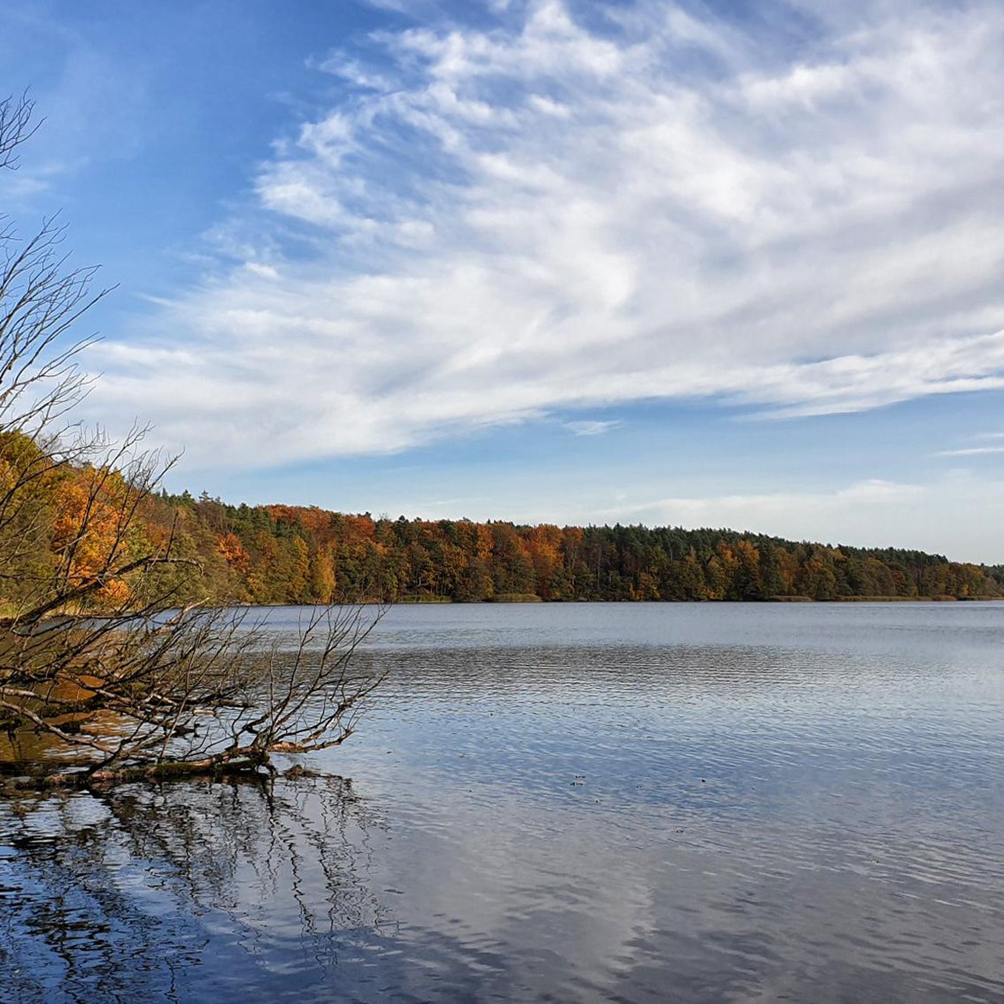
Jogging around Wolletzsee offers diverse landscapes and well-maintained trails within the UNESCO Biosphere Reserve Schorfheide-Chorin. The region is characterized by a hilly, wooded environment, featuring old beech forests and the clear waters of the Welse River. Runners will encounter varied terrain, including steep bank areas, open meadows, and fields, providing a dynamic experience.
Best jogging routes around Wolletzsee
- The most popular jogging route is View of the Wolletzsee – North Shore of Wolletzsee loop from Strandbad Wolletzsee, a 10.6…
Last updated: June 28, 2026
5.0
(5)
69
runners
Hard run. Very good fitness required. Mostly paved surfaces. Suitable for all skill levels.
6
runners
5.07km
00:34
30m
30m
Moderate run. Good fitness required. Mostly paved surfaces. Suitable for all skill levels.

Sign up for free
5
runners
5.89km
00:41
50m
50m
Moderate run. Good fitness required. Mostly accessible paths. Some sure footedness required.
5.0
(5)
66
runners
Hard run. Very good fitness required. Mostly paved surfaces. Suitable for all skill levels.
9
runners
6.00km
00:40
80m
80m
Moderate run. Good fitness required. Mostly paved surfaces. Suitable for all skill levels.
Get access to more routes and recommendations from other explorers.
Sign up for free
Already have an account?
Our route recommendations are based on thousands of hikes, rides, and runs completed by other people on komoot.
Start today with a free account
Your next adventure awaits.
Login or Signup

Other adventures around Wolletzsee

Tips from the Community

That place doesn't exist anymore
1
0

Beautiful and peaceful in winter, picturesque
0
0

It's only open Wednesday to Sunday. But at least there are restrooms nearby, apparently, because they're specifically indicated.
0
0

The detour to the lake is worthwhile; it's simply pure nature. You can even take a break right by the water.
0
0

Sabine's information probably refers to the Great Black Lake to the southwest of here. It is much closer to the terminal moraine and the Althüttendorf gravel pit. (It is a bit confusing when three lakes in Grumsin are called Black Lake.) This particular Black Lake here, at the northern end of the forest, is supposedly the highest lake in Brandenburg.
0
0

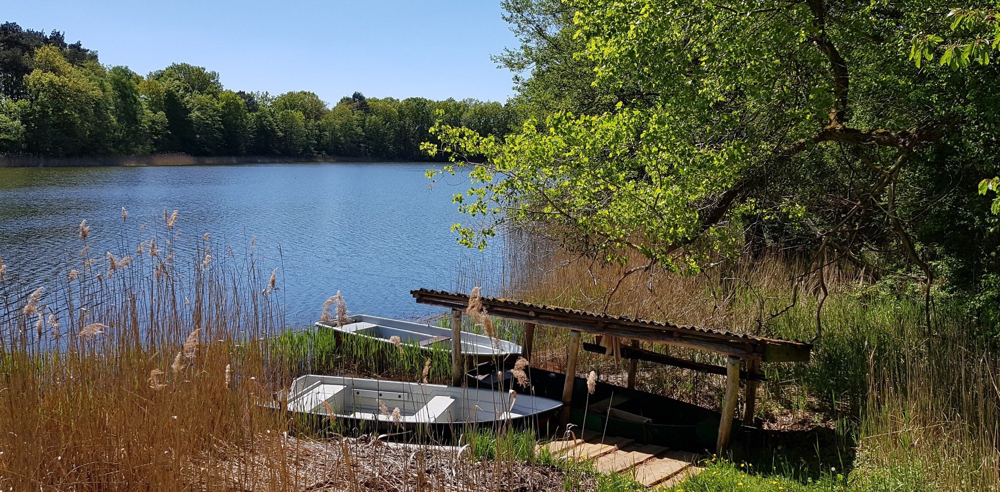
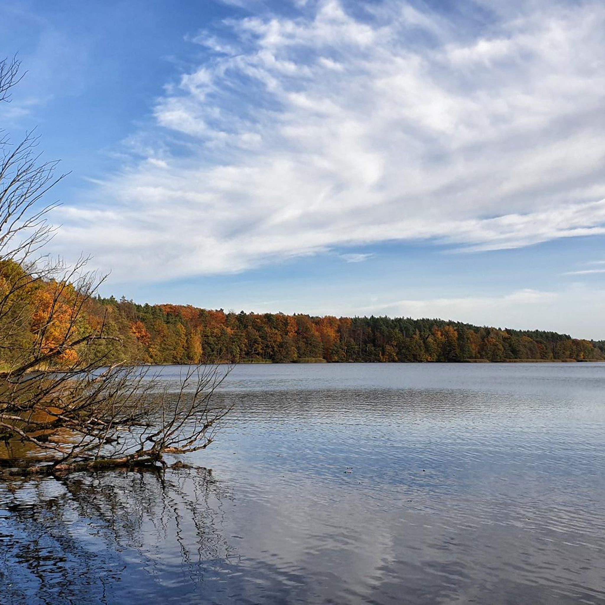
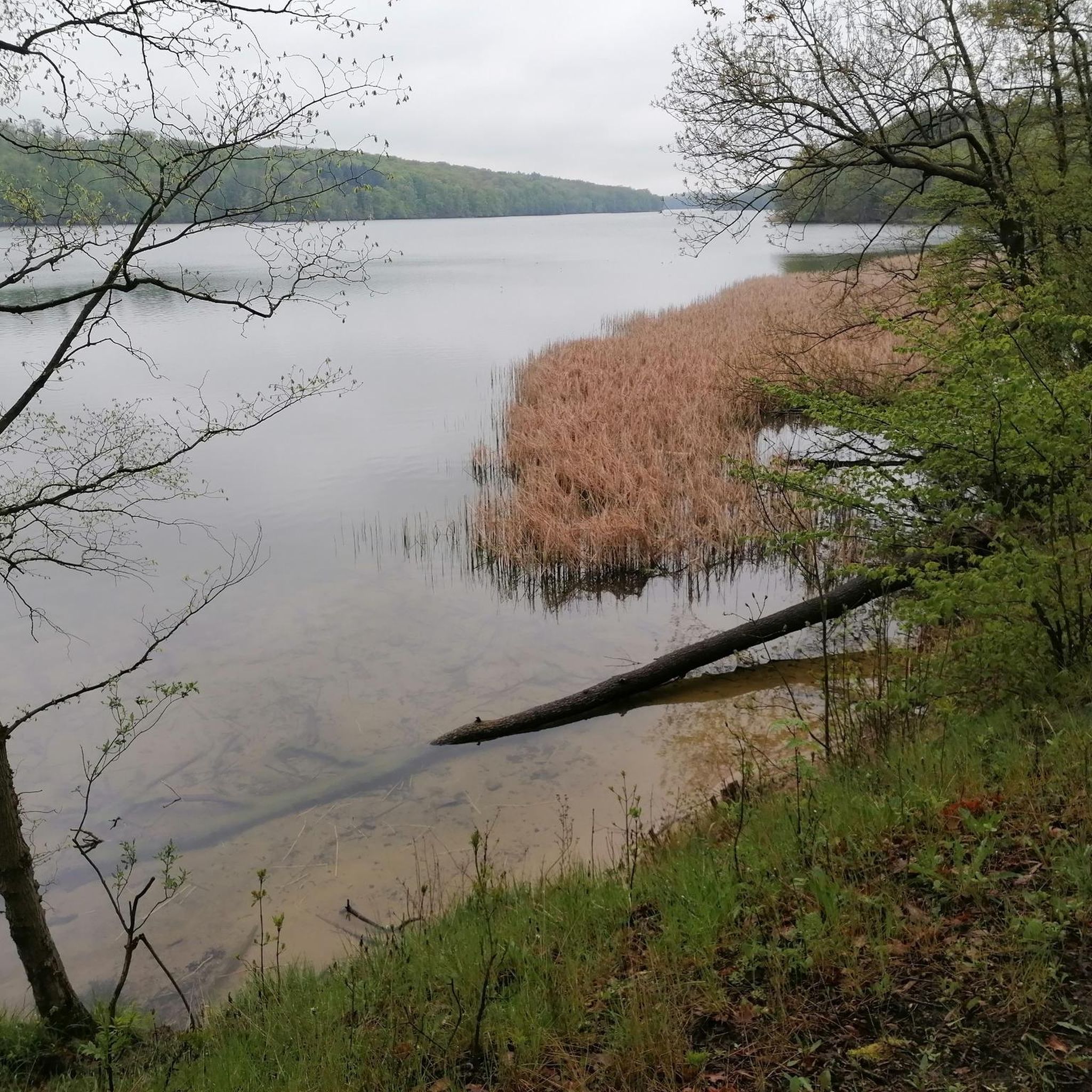
Nestled in the hilly forest landscape on the edge of the UNESCO Schorfheide-Chorin Biosphere Reserve, the seven-kilometer-long Wolletzsee lies just outside Angermünde. The clear lake, up to 18 meters deep, is fed by the Welse and is a popular destination for bathers, divers and anglers. A 16.5-kilometer-long hiking trail leads around the lake and offers a variety of impressions. Steep shores are lined with old beech forests, while meadows and fields stretch out in other places. The stilt houses on the south and east banks are particularly interesting—allotments that are not on the water, but on it. The path on the north bank is pleasant to walk and offers quiet sections for relaxation. A paradise for amateur photographers with picturesque motifs opens up along the Welse. From various points you have beautiful views of the lake and the surrounding area. A detour to the Wolletzsee is worthwhile at any time of year. The combination of water, forest and hilly landscape creates a special atmosphere that invites you to linger. If you want, you can refresh yourself in the clear water and enjoy nature to the fullest.
0
0
The Heilige See is located in front of the much larger Wolletzsee. You can see it quite well, and it is highly recommended that you visit the outstandingly beautiful bathing area (for swimming or just looking or for a relaxing rest). It is only about 100m away from the car park, which offers plenty of space. The lake and its great bathing area (with jetty and covered rest area) are also very easy to reach by bike. If you are on the Berlin-Usedom cycle path, which runs close to the Wolletzsee, you should also plan a short detour to the Heilige See if possible.
1
0

The Grumsiner Forest Information Center is located in the heart of the nature reserve of the same name in Brandenburg. It serves as a central point of contact for visitors who want to learn more about the fascinating natural and cultural landscape of this region. You can find more information about the Grumsiner Forest here: https://www.barnimerland.de/de/das-barnimer-land/naturlandschaften/grumsiner-forst.html
2
0
Frequently Asked Questions
How many running routes are available around Wolletzsee?
There are over 60 dedicated running routes around Wolletzsee, catering to various fitness levels. These include 5 easy routes, 47 moderate paths, and 13 more challenging trails, ensuring a suitable option for every runner.
What kind of terrain can I expect on the running trails near Wolletzsee?
The running trails around Wolletzsee offer a diverse and engaging experience. You'll encounter a hilly, wooded landscape with old beech forests, including parts of the UNESCO World Natural Heritage site Grumsin Beech Forest. The routes feature varied terrain, from steep bank areas to open meadows and fields, often alongside the clear waters of the Welse River.
Are there any easy running routes suitable for beginners or a relaxed jog?
Yes, Wolletzsee offers several easy running routes perfect for beginners or those seeking a relaxed jog. For example, the Running loop from Am Wolletzsee is a moderate 5.2 km path that provides a pleasant experience without significant elevation changes.
Can I find longer, more challenging running routes around Wolletzsee?
Absolutely. For a more challenging run, consider the popular View of the Wolletzsee – North Shore of Wolletzsee loop from Strandbad Wolletzsee. This route spans 17.1 km and offers extensive views of the lake. Another option is the 20.9 km Altkünkendorf – Heiliger See Altkünkendorf loop from Altkünkendorf, which is also rated as difficult.
Are the running routes around Wolletzsee suitable for families?
Many of the routes around Wolletzsee are suitable for families, especially the easier and moderate paths. The diverse landscape and natural attractions make for an enjoyable outing. While specific family-friendly routes are not explicitly listed, the shorter circular routes in the Wolletzwald, varying from 2.5 km, are generally good options for a family jog or walk.
Are dogs allowed on the running trails around Wolletzsee?
Yes, dogs are generally welcome on the running trails around Wolletzsee. It's a popular area for dog owners due to its natural environment. However, always ensure your dog is kept on a leash, especially in nature reserve areas and near wildlife, and remember to clean up after them.
What natural features or landmarks can I see while jogging around Wolletzsee?
While jogging around Wolletzsee, you can experience a wealth of natural beauty and interesting landmarks. Highlights include the Lake Wolletz itself, the Adlerquelle Rest Area, and various Bathing Spots on Lake Wolletzsee. You'll also find scenic View of the Wolletzsee points and run alongside the pristine Welse River. The ancient Grumsin Beech Forest is another significant natural feature.
Where can I find parking for the running routes around Wolletzsee?
Parking is available at several points around Wolletzsee. A convenient starting point with parking is often the Strandbad Wolletzsee, which also offers amenities. The historic town of Angermünde, a short distance away, also provides parking options if you plan to extend your run from there.
Is Wolletzsee accessible by public transport for runners?
Yes, Wolletzsee is accessible by public transport. You can reach the area via Angermünde train station. From Angermünde, you have the option to extend your run to the lake, making it a 23.5 km route if you start directly from the station.
What is the best time of year to go running in Wolletzsee?
Wolletzsee offers excellent running conditions throughout much of the year. Spring and autumn provide pleasant temperatures and beautiful scenery with blooming nature or vibrant fall foliage. Summer is also popular, especially with the option to cool off in the lake's bathing areas. Even in winter, the trails can be enjoyed, though conditions may be more challenging with snow or ice.
Are there places to get refreshments or food near the running trails?
Yes, after your run, you can find refreshments. The Strandbad Wolletzsee often has a snack bar. For a more substantial treat, the "KaffeeKonsum" in Wolletz offers homemade cakes and small dishes, perfect for recharging.
What do other runners say about the trails in Wolletzsee?
The running trails in Wolletzsee are highly rated by the komoot community, with an average score of 4.6 stars from over 50 reviews. Runners often praise the diverse landscapes, the refreshing environment of the beech forests, and the scenic views of the lake and the Welse River. Many appreciate the variety of terrain and the well-maintained paths.
Are there any circular running routes around Wolletzsee?
Yes, circular routes are a prominent feature of running around Wolletzsee. A popular option is the full circular trail around the entire lake, which is approximately 16.5 km or 17 km. Additionally, within the Wolletzwald, there are four circular routes varying in length, including a 2.5 km easy path and a more challenging 12.8 km route.
Most popular routes around Wolletzsee
Most popular attractions around Wolletzsee

Get inspired with the komoot mobile app


Explore more
Browse the best Running Trails & Routes in other regions.
