The best walks and hikes around Ridgefield
4.8
(36)
348
hikers
80
hikes
Hiking around Ridgefield explores a landscape of rolling hills, dense woodlands, and preserved natural spaces. The region is characterized by its numerous parks and sanctuaries, which contain a network of trails passing through forests, meadows, and wetlands. Many routes feature ponds and geological formations like glacial erratics. The area is also known for its proximity to the Columbia River and the Ridgefield National Wildlife Refuge, offering diverse natural habitats.
Best hiking trails in Ridgefield
- The most popular hiking route is Weir Pond Trail, a 2.1 miles (3.4 km) trail that takes about 55 minutes to complete. This easy hike follows a path down to the pond and back through the park's forest.
- Another top favourite among local hikers is Saddleback and Topledge Loop, a moderate 4.6 miles (7.3 km) path. This route circles Pierrepont Pond and includes some ascents through the park's woodlands.
- Local hikers also love the Wilton Town Forest Blue Trail, a 3.4 miles (5.5 km) trail leading through varied forest terrain, often completed in about 1 hour 30 minutes.
- Hiking around Ridgefield is defined by woodland paths, pond-side trails, and rolling hills. The network of Ridgefield hiking trails offers options for different ability levels, from accessible loops to more moderate routes with some elevation.
- The routes in Ridgefield are highly rated by the komoot community with an average score of 4.9 stars from more than 20 reviews. More than 300 hikers have used komoot to explore Ridgefield's varied terrain.
Last updated: September 28, 2026
8
hikers
5.55km
01:32
80m
110m
The Wilton Town Forest Blue Trail offers a dynamic hiking experience through a varied landscape. You'll traverse packed earth, dirt paths, and surprisingly rocky sections, winding through a mix of deciduous hardwood forest and small, serene hemlock groves. Keep an eye out for the picturesque Sheep Falls in the park's northeast corner, a lovely natural feature that adds to the trail's charm. This 3.4-mile (5.5 km) route, despite its easy rating, presents 270 feet (82 metres) of elevation gain and takes about 1 hour and 31 minutes, making it a great option for those who enjoy a bit of ruggedness.
Planning your visit to the Wilton Town Forest Blue Trail is straightforward, as there are no permits or fees required. The trail is part of a larger network, and while this specific loop is considered easy, be prepared for sections with rooty singletrack and rock gardens, particularly on the Blue East portion. Parking is typically available at the trailhead, but arriving earlier in the day can help ensure a spot, especially on busy weekends. This trail is ideal for hikers looking for a diverse and engaging walk without committing to a full-day excursion.
Beyond its natural beauty, the Wilton Town Forest holds historical significance, with features like the
3
hikers
3.44km
00:55
40m
40m
Embark on an easy hike along the Weir Pond Trail, a 2.1-mile (3.4 km) loop that takes you through a diverse landscape of tranquil woodlands, wetlands, and open fields. You will gain 131 feet (40 metres) in elevation, and the route typically takes about 55 minutes to complete. The serene Weir Pond is a central feature, offering panoramic views from the dam on its northern side, making for a truly picturesque experience.
While the initial part of the trail is generally smooth, be prepared for some uneven terrain, especially on the eastern side of the loop around Weir Pond. This section features numerous roots and rocks, and you may encounter stepping stones across muddy areas. Always wear appropriate footwear, as granite steps can become slippery when wet. Dogs are welcome to join you, but they must be kept on a leash, and you should remember to clean up after them.
This trail offers a unique blend of natural beauty and artistic heritage within Weir Farm National Historical Park. As you explore, keep an eye out for historic stone walls that line parts of the path. You might also spot the

2
hikers
7.35km
02:03
150m
120m
Embark on the Saddleback and Topledge Loop, a moderate hiking route that guides you through remote, Maine-like forests. You will experience varied terrain, including single-track sections that offer a true wilderness feel. As you hike, you can look forward to expansive views from Topstone Mountain, where you'll see the park's 25-acre pond to the east and, on clear days, a distant glimpse of Long Island Sound. This loop covers 4.6 miles (7.3 km) with an elevation gain of 508 feet (155 metres), typically taking about 2 hours and 2 minutes to complete.
To plan your visit, head to Topstone Park in Redding, Connecticut, where the Saddleback and Topledge Loop begins. The park is easily accessible, making it a convenient choice for a day out. If you plan to bring your dog, they are welcome on the Saddleback Trail, but please ensure they remain on a leash throughout your hike to maintain a pleasant experience for all park visitors. Check the park's official website for any specific operating hours or seasonal advisories before you go.
This trail stands out for its unique blend of accessible wilderness and scenic overlooks within Topstone Park. The diverse landscape, from dense woodlands to open vistas, provides a refreshing escape. It's a great option if you're seeking a moderate challenge with rewarding views, offering a taste of a more rugged environment without venturing too far from civilization.
1
hikers
2.33km
00:38
50m
10m
The White Trail offers a delightful, easy hike, perfect for a quick nature fix. You'll wander through peaceful wooded sections, eventually reaching the tranquil Trail at Lake Naraneka, providing a lovely backdrop for your outing. The path is generally well-maintained and smooth, making it accessible for nearly everyone looking for a gentle walk.
This 1.4-mile (2.3 km) route has a modest 171 feet (52 metres) of elevation gain, so you can expect to complete it in about 38 minutes. Parking is usually straightforward at the trailhead, but arriving earlier in the day, especially on weekends, is a good strategy. No special permits are needed, making it an easy choice for a spontaneous adventure.
While many trails share the name, this particular White Trail is a gem for those seeking an easy difficulty level and a serene environment. It's an excellent option for families, casual walkers, or anyone wanting to enjoy the natural beauty of Western Connecticut without a strenuous commitment. It's a great way to experience the local flora and fauna in a relaxed setting.
2.23km
00:37
40m
50m
If you're looking for a quick, refreshing nature walk, the Blue/Yellow Trail Loop is a fantastic choice. This easy 1.4-mile (2.2 km) hiking trail, located within the peaceful Leon Levy Preserve, offers a gentle journey through a pleasant forest. With only 116 feet (35 metres) of elevation gain, you can comfortably complete the loop in about 37 minutes, making it perfect for a leisurely outing.
Planning your visit to this family-friendly trail is simple. Parking access is typically available at the preserve, though it's always wise to check local park websites for the most current information. The trail is well-suited for a morning or afternoon hike, and its easy difficulty makes it a great option for beginners or those seeking a relaxed outdoor experience.
The Blue/Yellow Trail Loop provides a wonderful opportunity to connect with nature in Westchester County, New York. The preserve environment offers a tranquil setting, ideal for observing local flora and enjoying the quiet of the woods. It's a great example of how a short, accessible trail can still provide a meaningful escape from the everyday.
Get access to more routes and recommendations from other explorers.
Already have an account?
Our route recommendations are based on thousands of hikes, rides, and runs completed by other people on komoot.
Start today with a free account
Your next adventure awaits.
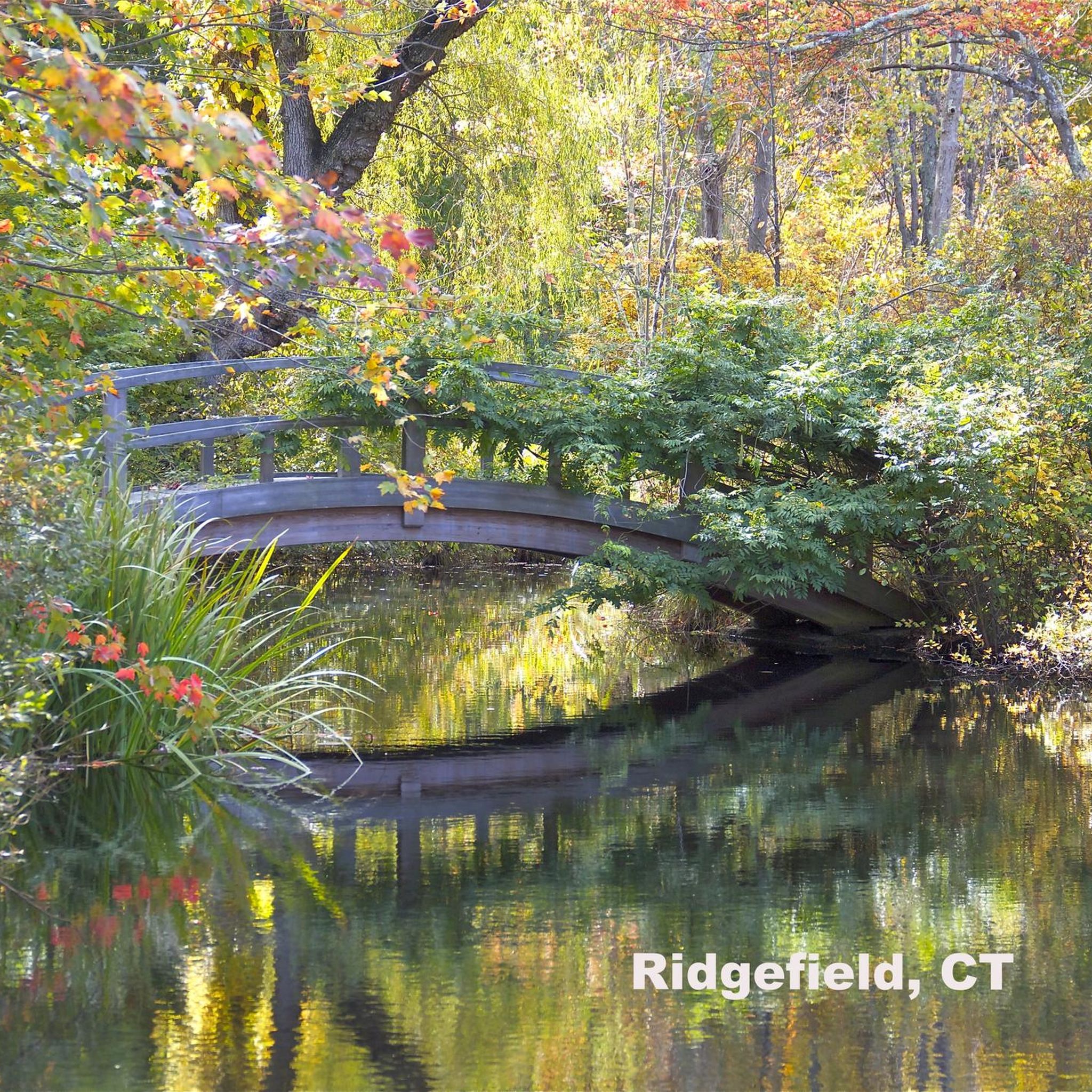

Tips from the Community

Wilton Town Forest is Wilton's largest and best open space park and sits just north of Popes Pond. In its northeast corner is a lovely waterfall known as Sheep Falls. It has numerous walking and biking trails and is quite a rugged but popular recreation area.
0
0

A preserved 370-acre area close to Lewisboro, featuring a wetland, a ravine with 75-foot cliff, and a hardwood forest. Leon Levy Preserve is very diverse and rich in wildlife, with rare plants such as Purple Milkweed and Blue Cohosh Plants. There is an extensive trail system at the Bell property, and some building ruins, such as the Black Mansion (1899-1979). The Preserve was made possible by the donation of $5 million made by the Jerome Levy Foundation, which has Leon Levy as a primary benefactor.
0
0
This is a beautiful National Historic Site that contains the immaculately preserved Weir house, barn and art studios. A stunning setting among more than 60 acres of woods, fields, and waterways. Take some time to visit the home and studio of America's most beloved Impressionist, J. Alden Weir.
0
0

In summer, it is a great place for hiking, and in winter, when the lake is covered with ice, it is great for ice skating.
1
0
Frequently Asked Questions
Are there many hiking trails to choose from in Ridgefield?
Yes, there is a great variety. You can find over 50 hiking routes around Ridgefield, offering a mix of difficulties and lengths to suit most hikers. The area is well-loved by the komoot community, with more than 200 hikers sharing their experiences.
What do other hikers say about the trails in Ridgefield?
The trails around Ridgefield are highly regarded by the komoot community, earning an average rating of 4.9 out of 5 stars. Hikers frequently praise the region's beautiful woodlands, well-preserved natural spaces, and the variety of paths available through its numerous parks and sanctuaries.
Are there any easy, beginner-friendly hikes in the area?
Absolutely. Ridgefield has about 20 easy-rated hikes. For a gentle introduction, consider the Bennett's Pond via Ives Trail Greenway loop. It's a relatively flat and straightforward walk that takes you through the forest and down to the scenic pond.
Can I bring my dog on the trails around Ridgefield?
Many trails in Ridgefield's parks and preserves are dog-friendly, but it's essential to keep your dog on a leash and follow local regulations. State parks like Bennett's Pond and Seth Low Pierrepont generally welcome leashed dogs. Always check the specific rules for the park you plan to visit before you go.
Are there any good circular hikes or loop trails?
Yes, loop trails are very common in the area. A great moderate option is the Park Loop in Seth Low Pierrepont State Park Preserve, which takes you on a scenic circuit around Pierrepont Pond. Many other parks also feature well-marked circular routes.
What are some good options for a family-friendly hike?
For a family outing, look for shorter, flatter trails. The paths at Woodcock Nature Center are a great choice, offering about three miles of easy trails through woods and wetlands. The paved trails at the Ridgefield Recreation Center are also perfect for all ages and fitness levels.
Where can I find hikes with the best views?
For rewarding views, especially in winter when the leaves are down, head to Aldrich Park where trails can offer glimpses of the Redding ridge tops. Another popular spot known for its great views is Hemlock Hills, which features some more challenging trails leading to scenic overlooks.
Are there any trails suitable for trail running?
Many of the hiking trails in Ridgefield are also excellent for trail running. The varied terrain of the Fox Hill & Deer Hollow Trail loop in Ward Pound Ridge Reservation provides a good challenge for runners looking for a mix of forest paths and rolling hills.
What is the best time of year to hike in Ridgefield?
Hiking in Ridgefield is enjoyable year-round, but autumn is particularly spectacular when the dense woodlands are ablaze with fall colors. Spring offers pleasant temperatures and blooming wildflowers, while winter can provide clearer views through the trees and a quieter experience on the trails.
How do I get to the trailheads and is there parking?
Most trailheads in Ridgefield are best accessed by car. State parks and nature preserves like Bennett's Pond and Seth Low Pierrepont have designated parking areas. It's always a good idea to arrive early on weekends, as popular spots can fill up quickly.
What should I pack for a day hike in Ridgefield?
For a day hike, be sure to bring water and snacks, a map or a fully charged phone with the komoot app, and wear sturdy hiking shoes as some trails can be rocky or muddy. It's also wise to pack layers of clothing, sunscreen, and insect repellent, especially during the warmer months.
Are there any longer, more challenging hikes available?
Yes, if you're looking for a longer trek, the Parks Pond via Ives Trail Greenway is a great option. This moderate hike covers over 7.5 miles (12 km) and involves some significant elevation gain, offering a rewarding challenge through Tarrywile State Park.
Most popular attractions around Ridgefield

Get inspired with the komoot mobile app


Explore more
Browse the best Hikes in other regions.
