The best running trails around Maysville
6
runners
4
runs
Jogging around Maysville offers routes through varied mountain terrain, characterized by high-altitude passes, alpine lakes, and extensive trail networks. The region features significant elevation changes, with routes often leading through forested areas and open landscapes. These running trails provide opportunities to explore the natural environment of Maysville, including its mountain passes and lake systems.
Best jogging routes around Maysville
- The most popular jogging route is Boss and Hunt Lakes via The Colorado Trail, a 7.0 miles (11.3 km) trail…
Last updated: June 25, 2026
4
runners
11.3km
02:17
550m
550m
Hard run. Very good fitness required. Sure-footedness, sturdy shoes and alpine experience required.
1
runners
6.56km
01:12
350m
350m
Hard run. Very good fitness required. Sure-footedness, sturdy shoes and alpine experience required.

Sign up for free
1
runners
5.11km
00:40
140m
140m
Hard run. Good fitness required. Sure-footedness, sturdy shoes and alpine experience required.
25.1km
03:34
800m
800m
Hard run. Very good fitness required. Sure-footedness, sturdy shoes and alpine experience required.
Our route recommendations are based on thousands of hikes, rides, and runs completed by other people on komoot.
Start today with a free account
Your next adventure awaits.
Login or Signup
Popular around Maysville
Tips from the Community

Hunt Lake has crystal clear water and is a truly idyllic place to take a break or spend the night. There are some nice campsites close to the shore. Since the lake had some issues with invasive species, don’t expect any fish here.
2
0

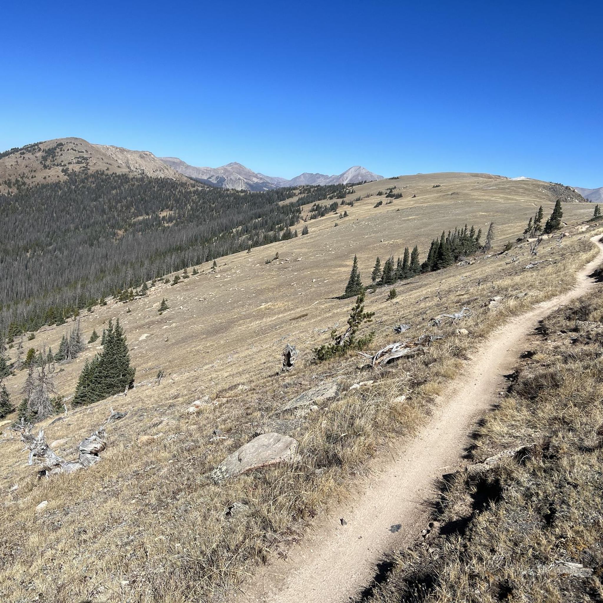
The Monarch Crest Trail shares its path with parts of the Colorado Trail and Continental Divide Trail. This is a super popular trail for mountain biking, but it's a great running and hiking trail, too. The actual "crest" is about 10 miles long and features quite a bit of up and down on its way from Monarch Pass to Marshall Pass. The trail then turns downhill and plummets down to the town of Poncha Springs. Unless you plan on doing a point-to-point run, this trail is mostly utilized in partial segments.
0
0
At an elevation of 11,312 feet, Monarch Pass features a gift shop, parking, restrooms, and acts as a trailhead for a number of trails. Mountain bikes frequent the trails from the pass, but they are also great trails for running and hiking.
0
0

Hiking along the Continental Divide Trail, you can either shop in the small gift shop at Monarch Pass or hitch into the town of Salida that has to offer everything a hiker could ask for.
5
0

Monarch Pass is a high mountain pass with an elevation of 11,312 feet. It is the starting point of the infamous IMBA Epic Mountainbike trail "Monarch Crest". Before you take off to this incredible high alpine mountainbike adventure make sure you have enough snacks and water. In case you are lacking one of these, just hit the store next to the parking lot and buy whatever is missing.
1
1
Frequently Asked Questions
What kind of terrain can I expect on running trails in Maysville?
Running routes around Maysville primarily feature varied mountain terrain. You'll encounter significant elevation changes, high-altitude passes, and trails leading through forested areas and open landscapes. Many routes also offer scenic alpine lake views.
Are there any easy running routes for beginners in Maysville?
The running routes highlighted in Maysville are generally considered difficult due to significant elevation gains and mountainous terrain. For example, routes like Boss and Hunt Lakes via The Colorado Trail and Waterdog Lakes Trail are challenging. Beginners should be prepared for strenuous conditions and consider their fitness level.
What are the typical distances and durations for running trails in Maysville?
Running trails in Maysville vary in length and duration. For instance, the Old Monarch Pass Loop is about 3.2 miles (5.1 km) and takes around 39 minutes, while the Boss and Hunt Lakes via The Colorado Trail covers 7.0 miles (11.3 km) and typically takes 2 hours 17 minutes. The longest route, Monarch Crest and Fooses Creek Trail Loop, is approximately 15.6 miles (25.1 km) and can take over 3 hours.
Are there any dog-friendly running routes in Maysville?
Many trails in the Maysville area, particularly those in national forests and wilderness areas, are generally dog-friendly, provided dogs are kept on a leash. However, always check specific trail regulations before heading out, especially for routes like those leading to alpine lakes or through sensitive wildlife habitats.
What are some scenic viewpoints or attractions I can see while running in Maysville?
Maysville's running routes offer stunning views of mountain passes and alpine lakes. You can experience highlights such as Monarch Pass and the Collegiate Peaks View. Routes like Boss and Hunt Lakes via The Colorado Trail and Waterdog Lakes Trail lead to beautiful alpine lakes.
When is the best time of year to go running in Maysville?
The best time for running in Maysville is typically from late spring through early fall (June to September) when mountain passes are clear of snow and trails are accessible. Summer offers pleasant temperatures at higher elevations, but afternoon thunderstorms can occur. Fall brings cooler weather and vibrant foliage, but be mindful of early snow at higher altitudes.
Are there any circular running paths in Maysville?
Yes, there are circular running paths available. The Old Monarch Pass Loop is a notable example, offering a 3.2-mile (5.1 km) loop through a historic mountain pass. Another option is the extensive Monarch Crest and Fooses Creek Trail Loop.
What should I know about running in Maysville during winter?
Winter running in Maysville can be challenging due to heavy snowfall and icy conditions, especially at higher elevations and mountain passes. Many trails may be impassable or require specialized gear like snowshoes or microspikes. Lower elevation trails might be runnable, but always check local conditions and weather forecasts before heading out.
Are there any running routes in Maysville that are wheelchair accessible?
Given the mountainous terrain and the 'difficult' grading of most routes in Maysville, it is unlikely that many, if any, trails are wheelchair accessible. The routes often feature significant elevation changes and natural, uneven surfaces. It's best to research specific trail conditions if accessibility is a concern.
What do other runners enjoy most about jogging in Maysville?
Runners often praise the challenging nature of the trails and the stunning natural beauty of the Maysville region. The opportunity to explore high-altitude passes, serene alpine lakes, and extensive trail networks through varied mountain terrain is a major draw for those seeking a rewarding outdoor experience.
Are there any hidden running gems or less-known trails in Maysville?
While the guide highlights popular routes, the broader network of trails around Maysville offers many opportunities for exploration. For a longer, more immersive experience, consider the Monarch Crest and Fooses Creek Trail Loop, which provides a challenging run through diverse landscapes away from the most frequented spots.
Most popular routes around Maysville
Most popular attractions around Maysville

Get inspired with the komoot mobile app


Explore more
Browse the best Running Trails & Routes in other regions.
