The best road cycling routes around Eldorado Springs
4.8
(103)
8,978
riders
150
rides
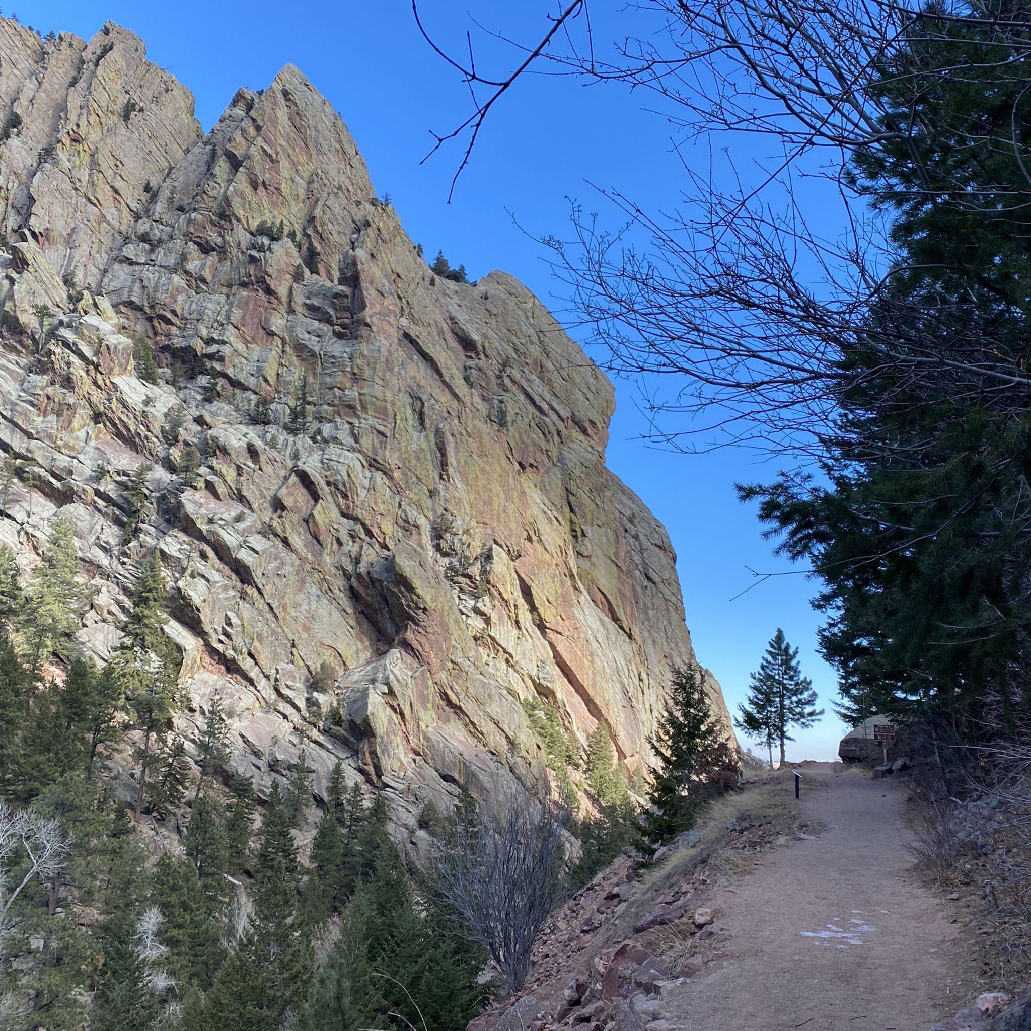
Road cycling around Eldorado Springs features diverse terrain with dramatic canyon walls, lush creek sides, and mountain views. The area offers a mix of paved roads and some sections that may include gravel, catering to various road cycling preferences. Elevation gains are common, providing challenging climbs and scenic descents through natural landscapes. The region is characterized by its significant natural features, including Eldorado Canyon State Park and South Boulder Creek.
Best road cycling routes around Eldorado Springs
- The most popular…
Last updated: September 27, 2026
123
riders
This moderate gravel cycling loop offers a diverse experience across 24.3 miles (39.1 km) with a significant 2420 feet (738 metres) of elevation gain. You can expect to complete it…
30
riders
33.9km
01:47
450m
450m
Cycle the moderate 21.1-mile NCAR and Eldorado Springs loop from Table Mesa, gaining 1465 feet with stunning mountain and canyon views.

5.0
(2)
21
riders
27.6km
01:27
370m
370m
Road cycling the NCAR loop from Table Mesa offers a moderate 17.2-mile climb with great views of the Boulder Flatirons.
5.0
(1)
19
riders
55.1km
03:37
1,260m
1,260m
This difficult 34.2-mile gravel cycling loop near Boulder offers challenging climbs, 4147 feet of elevation gain, and stunning mountain view
137
riders
Moderate road ride. Good fitness required. Some segments of this route may be unpaved and difficult to ride.
Get access to more routes and recommendations from other explorers.
Already have an account?
Our route recommendations are based on thousands of hikes, rides, and runs completed by other people on komoot.
Start today with a free account
Your next adventure awaits.

Tips from the Community

Panorama Point on Flagstaff Mountain in Boulder, CO, offers stunning, panoramic views of the city, whether it's day or night, all year round. You can drive up to the overlook, making it accessible to families and dogs. Parking is limited, however, and the vehicle length limit on Flagstaff Road is 30 feet because it is narrow and twisty. Several trails start and/or pass by here including Flagstaff Trail and the Viewpoint Trail, the latter of which climbs from Boulder Canyon and Eben G. Fine Park near downtown. Panorama Point has three picnic tables, but no restrooms.
0
0

This location has a portable toilet paid for by a member of the cycling community. For more details https://boulderbeat.news/2023/04/19/biking-porta-potties/
0
0
The road up Flagstaff from Chautauqua to Chapman Drive, where you can continue to Artists Point overlooking Boulder, is an iconic Boulder climb. This fun, twisting road (whether you ride up or down) grants you great views over the city as you pass by large sandstone boulders and cliffs, stands of pine trees, and several viewpoints. Watch out for cars on both the ascent and descent, this is a very popular drive for tourists and locals alike and there are several well-trafficked hiking trails off of the road.
1
1
From this overlook, which has a bike repair station if needed, you get fantastic, sweeping views of the Flatirons and the town of Boulder.
2
0
The east end of Pearl Street before you reach the Pedestrian Mall has seen a lot of growth these last few years. There are great restaurants and coffee shops as well as shopping. There are several large outdoors stores from well-known brands, including Patagonia, Arc'Teryx, Backcountry, Stio, and Mont Bell, all within a few blocks of each other. Boxcar Coffee is an excellent place for a post (or mid) ride latte and pastry, and its right next to Rapha, a high-end cycling clothing shop that also serves coffee.
0
0
Gross Dam Road is a mostly-smooth, hard-packed gravel road that connects Flagstaff Road to Coal Creek Canyon Highway. This scenic road sees very little traffic and there are great marked scenic overlooks along the way. Although the road is generally pretty moderate in grade, there are a few moments of 12-15% gradients to get your heart rate up if ascending the road from Coal Creek Highway.
0
0
Super Flagstaff, or more commonly, "Super Flag," is the name of the tough climb from intersection of the road to the Flagstaff amphitheater and Artist's Point, and Chapman Drive to the true summit of Flagstaff Road, marked by a collection of mailboxes. From the bottom of Flagstaff Mountain by, Chautauqua the total ascent is 1,978 feet with the average gradient at 8.2 percent, but there is also a short, 1,000 foot section which goes at 20 percent. This infamous hill is a favorite among locals. From the top you can either turn around and head back toward town, or continue onward toward the remote-feeling Gross Reservoir on the other side of the mountain.
2
0
Gross Reservoir is a large lake on the other side of Flagstaff Mountain. There is a hard-packed gravel road on it's eastern shore which is a great place to snap a few photos after the tough climb up Super Flag and long descent down. If you are unwilling to take you bike on gravel, however, you still get great views of the reservoir and the surrounding area at the junction on the pavement.
0
0
Frequently Asked Questions
How many road cycling routes are available in Eldorado Springs?
Eldorado Springs offers a wide variety of road cycling routes, with over 150 tours available on komoot. These routes cater to different skill levels, including easy, moderate, and difficult options, ensuring there's something for every cyclist.
What kind of terrain can I expect on road cycling routes in Eldorado Springs?
Road cycling in Eldorado Springs features diverse terrain, characterized by dramatic canyon walls, lush creek sides, and impressive mountain views. While many roads are paved, some sections, particularly within Eldorado Springs itself or on trails like Fowler Trail, may turn to gravel. Cyclists should be prepared for mixed surfaces and varying elevation gains.
Are there any challenging road cycling routes for experienced riders?
Yes, Eldorado Springs offers several challenging routes. For instance, the Super Flag, Gross Reservoir, and Coal Creek loop is a difficult 34.2-mile ride with significant elevation gain, providing a demanding experience for advanced cyclists.
Can I find family-friendly road cycling routes in the area?
While many routes in Eldorado Springs feature elevation gains, some sections or nearby trails might be more suitable for families. For example, the Doudy Draw trail, though not exclusively for road bikes, offers a mostly flat creekside path that can be enjoyed by families. When planning, look for routes with lower elevation profiles and consider the surface type.
What are some notable landmarks or attractions I can see while road cycling?
As you cycle, you'll encounter stunning natural beauty and significant landmarks. You might see the dramatic canyon walls of Eldorado Canyon State Park, often with rock climbers scaling the cliffs. Other notable viewpoints include the Davidson Mesa Overlook and the Continental Divide Overlook. The historic Eldorado Springs Swimming Pool, fed by an artesian spring, is also a unique sight.
What is the best time of year to go road cycling in Eldorado Springs?
The area is beautiful year-round, but late spring through early autumn generally offers the most pleasant conditions for road cycling. During autumn, the trees along the routes display vibrant fall colors, adding another layer of beauty to the experience. Always check local weather conditions before heading out, as mountain weather can change rapidly.
Are there options for circular road cycling routes?
Yes, many of the road cycling routes in Eldorado Springs are designed as loops, allowing you to start and end at the same point. Popular examples include the NCAR and Eldorado Springs loop from Table Mesa and the NCAR loop from Table Mesa, both offering scenic circular rides.
Where can I park my car when starting a road cycling tour?
Many road cycling routes in Eldorado Springs start from areas with designated parking. For example, routes originating from Table Mesa often have parking available. When planning your tour on komoot, check the route details for specific trailhead access and parking information.
Are there cafes or places to stop for refreshments along the routes?
While Eldorado Springs itself has limited commercial establishments, you can find cafes and pubs in nearby Boulder, which is easily accessible by bike from many routes. It's always a good idea to carry sufficient water and snacks, especially on longer rides, as stops might be infrequent directly along the more remote sections.
What tire recommendations are there for the mixed surfaces in Eldorado Springs?
Given the mix of paved roads and potential gravel sections, especially within Eldorado Springs and on certain trails, consider using road bike tires that offer a bit more versatility and puncture protection. Tires with a slightly wider profile (e.g., 28-32mm) and a light tread can provide better comfort and grip on varied surfaces without significantly compromising speed on pavement.
What do other cyclists say about road cycling in Eldorado Springs?
The road cycling experience in Eldorado Springs is highly rated by the komoot community, with an average score of 4.7 stars from over 80 reviews. Cyclists frequently praise the stunning mountain and canyon views, the diverse terrain, and the challenging yet rewarding climbs. The area's natural beauty and well-maintained routes are often highlighted as key attractions.
Are there any easy road cycling routes for beginners?
Yes, there are easier options for those new to road cycling or looking for a more relaxed ride. While many routes involve elevation, some are considered moderate with manageable climbs. For example, the Eldorado Springs loop from Culinary School of the Rockies is a moderate 14.3-mile route that can be completed in about an hour, offering a good introduction to the area's cycling.
Most popular attractions around Eldorado Springs

Get inspired with the komoot mobile app


Explore more
Browse the best Road cycling routes in other regions.
