The best walks and hikes around Air Force Academy
4.4
(35)
872
hikers
104
hikes
Hiking around Air Force Academy offers a diverse landscape for outdoor enthusiasts. The trails are situated against the Rampart Range, providing views of Pikes Peak and the Front Range. The area features a variety of ecosystems, including dense pine, oak, spruce, fir, and aspen forests, as well as expansive grassy mountain meadows. Notable natural features include impressive rock formations and the winding Monument Creek.
Best hiking trails around Air Force Academy
- The most popular hiking route is New Santa Fe Regional Trail via Edmundson Trailhead, a 6.8 miles (11.0 km) trail that takes 2 hours 50 minutes to complete. This moderate path follows a historic railroad grade, offering panoramic views of the Rampart Range and Academy grounds.
- Another top favourite among local hikers is Blodgett Peak loop, a moderate 4.0 miles (6.4 km) path. This route features significant elevation gain through varied terrain, including forests and open spaces.
- Local hikers also love the Mary Kyer Park & Water's Edge Park loop, a 1.4 miles (2.2 km) trail leading through parkland, often completed in about 35 minutes.
- Hiking around Air Force Academy is defined by its diverse forests, mountain meadows, and prominent rock formations. The network offers options for various ability levels, from easy strolls to more challenging ascents.
- The routes in Air Force Academy are highly rated by the komoot community with an average score of 4.3 stars from over 28 reviews. More than 700 hikers have used komoot to explore Air Force Academy's varied terrain.
Last updated: September 28, 2026
8
hikers
3.01km
01:42
670m
0m
If you're seeking a rewarding challenge, the Blodgett Peak Trail offers a moderate hike spanning 1.9 miles (3.0 km). You will gain a significant 2210 feet (674 metres) in elevation, typically taking around 1 hour and 42 minutes to complete. The route begins on a wide gravel path before transitioning to a steep dirt singletrack, winding through mixed pine woodlands and sections of Gambel oak. As you ascend, the trail becomes progressively steeper and rockier, featuring talus fields and switchbacks. From the summit of Blodgett Peak, you are treated to spectacular 360-degree panoramic views of Colorado Springs, the eastern plains, Pikes Peak, Rampart Reservoir, and the United States Air Force Academy.
When planning your visit, be aware that beyond the designated Hummingbird Trail, finding your way to Blodgett Peak's summit can be difficult and treacherous. Extreme caution is advised, especially if you are not familiar with the area. In winter, the trail can become icy and muddy, so you might need traction devices like microspikes or snowshoes for a safer passage. Always check weather conditions before heading out, as the trail's character changes significantly with the seasons.
This trail is notable for its direct path to the summit, packing a substantial elevation gain into a relatively short distance. It provides a unique opportunity to experience diverse terrain, from forested slopes to rocky ascents, all within the Blodgett Peak Open Space. The dramatic change in elevation and the expansive views from the top make it a distinctive local adventure, offering a different perspective on the surrounding Colorado landscape compared to other regional trails.
9
hikers
2.65km
00:49
110m
110m
Embark on the Blodgett Peak Open Space Connector Loop for an easy and refreshing hike. This route takes you through mixed pine woodlands, where you'll see Douglas Fir, ponderosa pine, and gamble oak trees. As you hike, you'll gain 352 feet (107 metres) in elevation over 1.6 miles (2.7 km), offering outstanding panoramic views of Colorado Springs and the majestic Blodgett Peak itself. It's a quick way to immerse yourself in the area's natural beauty, taking about 49 minutes to complete.
Before you head out, be aware that the Blodgett Peak Open Space is undergoing improvements, including a new parking lot at the Quarry Trailhead, which is expected to be finished by summer 2026. During winter months, specific sections of the trail, especially those on the Red Squirrel Trail, can become icy and slippery. Always check local weather conditions before you start your adventure to ensure a safe and enjoyable experience.
This loop is a fantastic opportunity to observe local wildlife, such as mule deer, in their natural habitat. Beyond the flora and fauna, you can also appreciate the diverse geological features visible along the way, adding another layer of interest to your hike. It's a perfect choice if you're looking for an accessible outdoor escape with rewarding views and a chance to connect with nature close to the city.

3
hikers
14.4km
04:47
680m
680m
Hike the moderate 8.9-mile West Monument Creek Loop Trail near the Air Force Academy, offering views of the Rampart Range and Pikes Peak.
25.9km
07:50
1,050m
380m
This difficult 16.1-mile hike to Ormes Peak via Blodgett Open Space offers panoramic views and a challenging ascent.
Explore the Cadet Chapel and Falcon Circle on this easy 0.6-mile hike at the U.S. Air Force Academy, offering unique architecture and views.
Get access to more routes and recommendations from other explorers.
Already have an account?
Our route recommendations are based on thousands of hikes, rides, and runs completed by other people on komoot.
Start today with a free account
Your next adventure awaits.

Tips from the Community

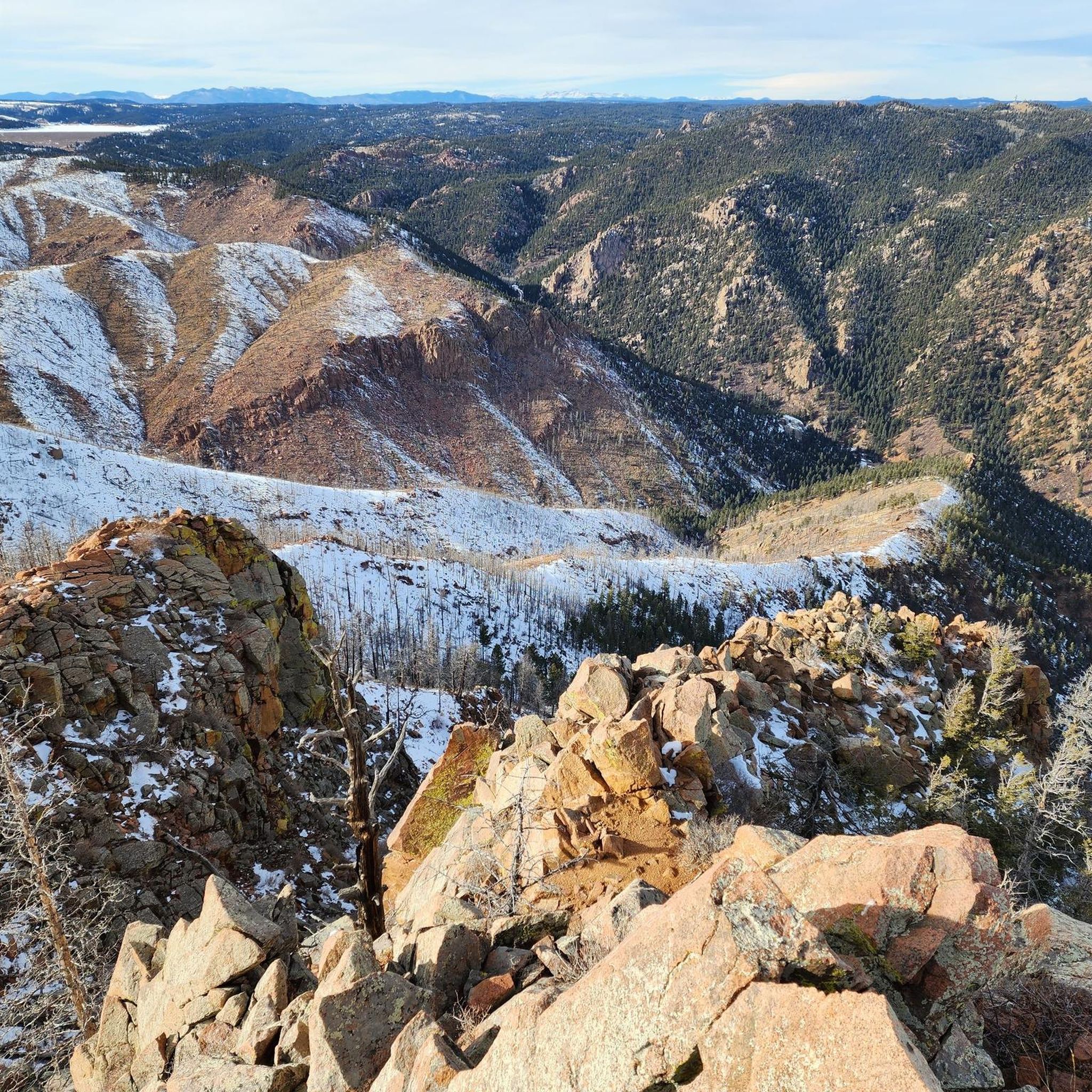
A challenging incline takes you through a rocky canyon to reach this point. Your reward is stunning views of Colorado Springs, Pikes Peak, Rampart Reservoir, and the Air Force Academy.
0
0

There is nice view of Blodgett Open Space, a 384 acre park packed with trails and wildlife. Blodgett Peak towers overhead and is the larger peak on the right.
0
0

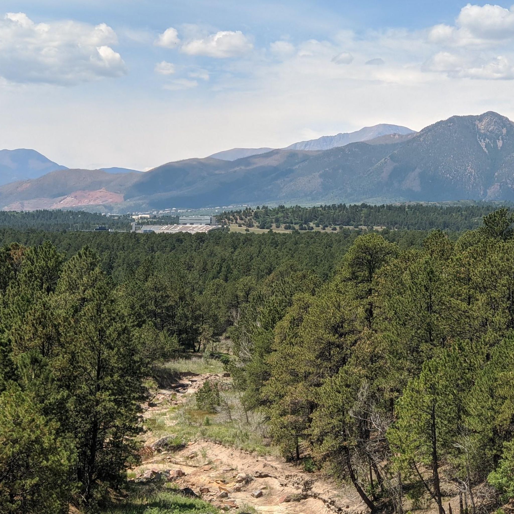
At the halfway point you get both a view of Colorado Springs that you leave behind and the Blodgett Peak in front of you.
0
0
Frequently Asked Questions
How many hiking trails are there around the Air Force Academy?
The Air Force Academy area offers a wide selection of routes, with over 65 hiking trails available. These range from easy strolls to more challenging ascents, catering to various fitness levels.
What kind of terrain can I expect on hikes near the Air Force Academy?
You'll find a diverse landscape, including dense pine, oak, spruce, fir, and aspen forests, as well as expansive grassy mountain meadows. Trails are often set against the stunning Rampart Range, offering views of Pikes Peak and impressive rock formations. Some paths also follow the winding Monument Creek.
Are there any easy, family-friendly hiking options?
Yes, there are many easy trails suitable for families. A great option is the Mary Kyer Park & Water's Edge Park loop, which is a short and pleasant walk through parkland. The New Santa Fe Regional Trail also offers an easy, mostly flat experience, with parts being wheelchair accessible.
Are dogs allowed on the hiking trails?
Many trails in the Air Force Academy area are dog-friendly, but it's always best to check specific trail regulations before you go. Generally, dogs are welcome on leash, especially on trails like the New Santa Fe Trail. Please remember to clean up after your pet.
Are there any trails with significant elevation gain for a more challenging hike?
For those seeking a challenge, the area offers trails with substantial elevation gain. The Blodgett Peak loop is a moderate route with significant climbing through varied terrain. Other challenging options mentioned in the region include Eagles Peak Trail and North Peak, known for their steep ascents and rewarding panoramic views.
What are some notable natural features or landmarks I might see while hiking?
Hikers can enjoy views of the majestic Rampart Range and Pikes Peak. Notable natural features include impressive rock formations, dense forests, and the scenic Monument Creek. You can also explore specific highlights like Pulpit Rock or enjoy the View of Pikes Peak from Austin Bluffs Open Space.
Are there any circular hiking routes available?
Yes, several circular routes are available. Besides the Blodgett Peak loop and the Mary Kyer Park & Water's Edge Park loop, you can also find the Lee Lake loop and the Ute Valley Park Trailhead – View of Ute Valley Park loop, offering diverse experiences.
What do other hikers enjoy the most about hiking in the Air Force Academy area?
The area is highly rated by the komoot community, with an average score of 4.3 stars from over 28 reviews. Hikers frequently praise the diverse terrain, from dense forests to open meadows, and the stunning panoramic views of the Rampart Range and Pikes Peak.
Is there parking available for the hiking trails?
Parking is generally available at various trailheads around the Air Force Academy. Specific parking information can often be found on individual trail pages or local park websites. Visitors to the Academy grounds should be aware of potential access restrictions and may need a valid photo ID.
What is the best time of year to hike around the Air Force Academy?
The Air Force Academy area offers hiking opportunities year-round. Spring and fall provide pleasant temperatures and beautiful foliage, while summer is ideal for higher elevation trails. Winter hiking is also possible, but be prepared for snow and ice, especially on more challenging routes.
Are there any trails that offer great viewpoints?
Absolutely. Many trails provide breathtaking views. Trails like Eagles Peak and North Peak are renowned for their amazing 360-degree vistas of the Academy campus, Colorado Springs, the Rampart Range, and even Pikes Peak. The View of Pikes Peak from Austin Bluffs Open Space is a specific highlight for scenic outlooks.
Can I access the trails using public transport?
While direct public transport to all trailheads might be limited, some areas around Colorado Springs are accessible by public transit. For trails within the Air Force Academy, personal vehicle access is typically the most convenient option, keeping in mind base entry requirements.
Most popular attractions around Air Force Academy

Get inspired with the komoot mobile app


Explore more
Browse the best Hikes in other regions.
