The best road cycling routes around Columbine Valley
4.6
(47)
2,788
riders
96
rides
Road cycling around Columbine Valley, Colorado, is characterized by an extensive network of paved trails and scenic natural features. The area provides diverse cycling experiences, from routes along the South Platte River to paths offering views of the Rocky Mountains. It is well-connected to larger regional trails, including sections of the Mary Carter Greenway Trail and the C-470 Bikeway. This landscape offers varied terrain suitable for different road cycling preferences.
Best road cycling routes around Columbine Valley
- The most popular…
Last updated: July 10, 2026
4.3
(3)
114
riders
Moderate road ride. Good fitness required. Some segments of this route may be unpaved and difficult to ride.
5.0
(1)
90
riders
Easy road ride. Great for any fitness level. Mostly well-paved surfaces and easy to ride.

Sign up for free
3.0
(1)
210
riders
Easy road ride. Great for any fitness level. Mostly well-paved surfaces and easy to ride.
52
riders
86.8km
04:31
670m
670m
The South Platte Reservoir – Bridge into Golden loop offers road cyclists a journey through varied Colorado landscapes. You'll pedal along the South Platte River, enjoying green spaces and direct…
40
riders
97.6km
05:09
1,690m
1,690m
The View from Chatfield Dam – South Platte Reservoir loop from Littleton - Mineral offers a diverse road cycling experience, blending smooth pavement with challenging gravel sections. You'll navigate past…
Get access to more routes and recommendations from other explorers.
Sign up for free
Already have an account?
Our route recommendations are based on thousands of hikes, rides, and runs completed by other people on komoot.
Start today with a free account
Your next adventure awaits.
Login or Signup

Tips from the Community

Grant-Frontier Park sits right on the South Platte River and is the site of the old Montana City, built in the 1850s. Today, visitors can find paved trails, playgrounds, restrooms, and benches.
0
0

Empower Field at Mile High, often called Mile High Stadium, is Denver’s iconic sports venue and home to the NFL’s Denver Broncos. Located near downtown, the stadium sits 5,280 feet above sea level, giving it its name. Opened in 2001, it replaced the original Mile High Stadium and can accommodate over 76,000 fans. The stadium hosts football games, concerts, and other large-scale events and features panoramic views of Denver and the Rocky Mountains. Outside, the "Bucky the Bronco" statue symbolizes the team and its history.
1
0

Great stop on the Platte River Trail, good coffer, place to sit and relx
1
0

The South Platte River is one of the two main tributaries of the Platte River. The river starts in South Park and ends when it joins the North Platte River south of Ogallala, Nebraska.
0
0

Valverde Park is a nice, small park right along the South Platte River. It is a great place for a break if you are walking the Platte River Trail, as there are benches and a picnic area. The park is known for the large statue of a dog that is at the entrance of the park.
1
0

The Platte River Trail is a fine paved multi use trail for walking and cycling, following the Platte River. In this section, starting close to the downtown of Denver it leads all the way south to Vanderbilt Park. Especially in the northern part, the trail passes some industrial sites here and there – but also several parks with picnic sites and cafés close by.
1
0

Tucker Gulch, stretching for about eight miles, plays a significant role as a watershed running from east to west. It cuts through the prairie, situated roughly one mile north of Clear Creek Canyon, and runs parallel to it. The name "Tucker Gulch" is derived from Alfred Tucker, who ran a tollgate within the canyon entrance during the 1860s. Cycling is not allowed here, so you'll have to dismount and walk your bike.
0
0
Tucker Gulch, stretching for about eight miles, plays a significant role as a watershed running from east to west. It cuts through the prairie, situated roughly one mile north of Clear Creek Canyon, and runs parallel to it. The name "Tucker Gulch" is derived from Alfred Tucker, who ran a tollgate within the canyon entrance during the 1860s.
0
0
Frequently Asked Questions
How many road cycling routes are available around Columbine Valley?
There are nearly 100 road cycling routes around Columbine Valley, offering a wide range of experiences. These include 28 easy routes, 48 moderate routes, and 17 more challenging options, catering to various skill levels.
What kind of terrain can I expect on road cycling routes in Columbine Valley?
Columbine Valley's road cycling routes primarily feature an extensive network of paved trails. You'll find flat, accessible paths along the South Platte River, as well as routes with gentle climbs offering picturesque views of the Rocky Mountains and areas like Chatfield State Park. The region provides a mix of urban connectivity and natural open spaces.
Are there any family-friendly road cycling routes in Columbine Valley?
Yes, Columbine Valley offers several family-friendly road cycling options, particularly along its extensive paved trail network. Routes like the Nixon's Coffee House – Confluence Park loop, which connects urban areas with river trails, are generally suitable for families looking for a moderate ride. The flat sections of the Mary Carter Greenway Trail are also excellent for a relaxed family outing.
Where can I find scenic viewpoints or opportunities for wildlife spotting along the routes?
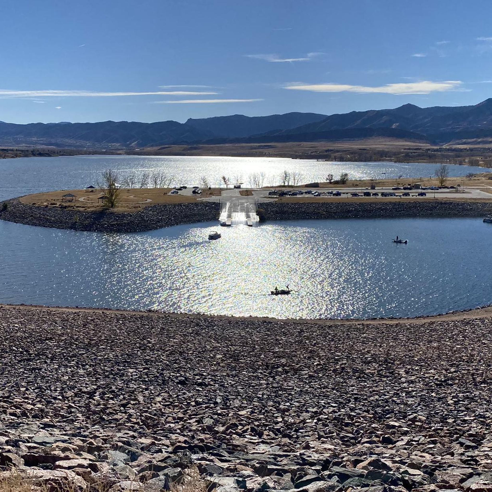
Many routes offer scenic views, especially those near natural features. The View from Chatfield Dam – South Platte Reservoir loop provides stunning vistas of the Chatfield Reservoir and surrounding mountains. For wildlife spotting, trails running alongside the South Platte River and within Chatfield State Park are ideal, where you might see various bird species and other local fauna. The Marjorie Perry Nature Preserve, while primarily soft-surface, offers beautiful surroundings for observing wildlife from designated trails.
Are there any loop road cycling routes available?
Yes, many road cycling routes in Columbine Valley are designed as loops, making for convenient rides. Popular loop options include the Nixon's Coffee House – Confluence Park loop, the View from Chatfield Dam – South Platte Reservoir loop, and the Confluence Park – Cherry Creek Trail loop. These routes allow you to start and finish at the same point, often incorporating diverse scenery.
What attractions or landmarks can I see while road cycling in Columbine Valley?
Road cycling routes in Columbine Valley often pass by notable natural attractions. You can enjoy views of the Chatfield Reservoir, ride along the South Platte Reservoir, and explore areas near the Marjorie Perry Nature Preserve. The Chatfield Dam Trail (Paved Section) offers accessible routes with reservoir and mountain views.
What is the best time of year for road cycling in Columbine Valley?
The spring, summer, and fall months generally offer the best conditions for road cycling in Columbine Valley, with pleasant temperatures and clear paths. While some trails may be accessible in winter, it's advisable to check current road and trail conditions, as well as weather forecasts, due to potential snow or ice.
Are there any cafes or places to stop for refreshments along the routes?
Given the proximity to urban areas and the extensive trail network, many routes in Columbine Valley will have cafes and refreshment stops nearby, especially in Littleton Downtown or areas connected by trails like the Cherry Creek Trail. The Nixon's Coffee House – Confluence Park loop, for example, starts near a coffee house, indicating convenient access to amenities.
What do other road cyclists enjoy most about road cycling in Columbine Valley?
The area is highly rated by the komoot community, with an average score of 4.6 stars from over 30 reviews. Reviewers often praise the extensive paved trail network, the scenic views of the South Platte River and distant Rocky Mountains, and the diverse options available for different skill levels. Over 3000 road cyclists have used komoot to explore the varied terrain here.
Where can I find parking for road cycling trails in Columbine Valley?
Parking is generally available at various access points along the major trail networks. For routes connecting to Chatfield State Park, designated parking lots within the park are available. For urban-connected trails like the Mary Carter Greenway or Cherry Creek Trail, you can often find parking in nearby public lots or neighborhood access points. It's recommended to check specific route details for the most convenient parking locations.
Are there routes suitable for advanced road cyclists looking for a challenge?
Yes, while many routes are moderate, Columbine Valley also offers 17 difficult road cycling routes for advanced riders. These routes may feature longer distances or more significant elevation changes. For example, the South Platte Reservoir – Bridge into Golden loop is a longer, moderate route that could be extended or combined for a more challenging experience, covering nearly 87 km.
Most popular attractions around Columbine Valley

Get inspired with the komoot mobile app


Explore more
Browse the best Road cycling routes in other regions.
