The best running trails around Virginia Lakes
6
runners
3
runs
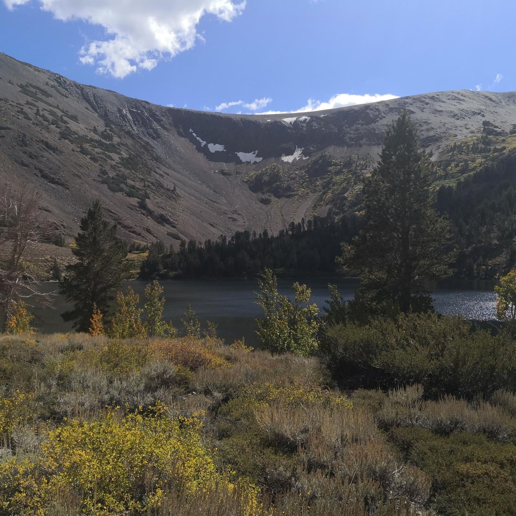
Jogging routes around Virginia Lakes are characterized by their high-altitude mountain setting, featuring numerous alpine lakes, forested areas, and scenic canyons. The region's terrain includes both gentle paths along lake shores and more challenging ascents through rugged landscapes. Elevation changes are common, offering varied running experiences from moderate climbs to significant gains.
Best jogging routes around Virginia Lakes
- The most popular jogging route is Lakes Basin Loop Trail, a 7.2 miles (11.6 km) trail that takes 1 hour 28 minutes to complete, offering views of multiple lakes.
- Another top favourite among local runners is Lundy Canyon Trail, a difficult 6.0 miles (9.6 km) path. This route features significant elevation gain through a scenic canyon.
- Local runners also love the Green Creek Trail, a 3.2 miles (5.1 km) trail leading through a creek valley, often completed in about 42 minutes.
- Jogging around Virginia Lakes is defined by alpine lakes, forested paths, and canyon trails, with options for both moderate and difficult running experiences. The network offers options for different ability levels, from shorter, less strenuous paths to longer, more challenging routes.
- The guide includes highly-rated routes that showcase the best of the region's landscape. More than 10 runners have used komoot to explore Virginia Lakes's varied terrain.
Last updated: August 17, 2026
3
runners
11.6km
01:28
190m
190m
Moderate run. Good fitness required. Mostly paved surfaces. Suitable for all skill levels.
1
runners
9.62km
01:39
630m
630m
Hard run. Very good fitness required. Mostly paved surfaces. Suitable for all skill levels.

Sign up for free
1
runners
5.13km
00:42
170m
170m
Moderate run. Good fitness required. Mostly paved surfaces. Suitable for all skill levels.
1
runners
6.51km
00:49
100m
100m
Moderate run. Good fitness required. Mostly paved surfaces. Suitable for all skill levels.
10.8km
01:38
550m
550m
Hard run. Very good fitness required. Mostly paved surfaces. Suitable for all skill levels.
Our route recommendations are based on thousands of hikes, rides, and runs completed by other people on komoot.
Start today with a free account
Your next adventure awaits.
Login or Signup
Popular around Virginia Lakes
Tips from the Community

Blue Lake is the first lake along the Green Creek Trail. It is set in a beautiful wooded area and gives you a great view of Black Mountain. The banks of the lake are a great spot for a break to soak up the beauty of the area.
0
0

Large blue alpine lake in the 20-Lakes-Basin. The Saddlebag Lake Resort offers regular trips from the General Store with boat taxi to the back of the lake. You can also rent boats for fishing. Saddlebag Lake is one of the few fishing areas where you can catch a High Sierra Fishing Slam: Rainbow, Brown, Brooke and Golden Trout.
0
0
Lightly trafficked out and back trail located near Lee Vining. You pass at least one lake, but you can hike on to several beautiful Sierra Lakes. The trail is difficult and best used between April and October.
0
0

To get to Oneida Lake, take the Lakes Canyon trail. The trail climbs the canyon between two peaks: Gilcrest Peak and Scowden Peak. On the Lakes Canyon Trail it is 3.3 miles to reach Oneida Lake with Blue Lake close by.
0
0
To reach Oneida Lake, take the Lakes Canyon Trail. The trail climbs the canyon between two peaks: Gilcrest Peak and Scowden Peak. On the Lakes Canyon Trail, it is 3.3 miles to reach Oneida Lake with Blue Lake close by.
0
0

Here is the Frog Lake. This high altitude valley has so many lakes that it has been nicknamed "Big Valley Lakes". The valley is part of the Tolyabe National Forest.
0
0
The Blue Lake is the first of a series of three that you will see during this easy hike.
0
0
Cystal clear alpine lake in the 20-Lakes-Basin with some fish and just a quarter mile from the water taxi to Saddlebag Lake Resort.
4
0
Frequently Asked Questions
Are there running routes around Virginia Lakes suitable for beginners?
Yes, while many routes feature elevation changes, there are moderate options. For a good starting point, consider the Green Creek Trail, which is 3.2 miles (5.1 km) long and takes about 42 minutes to complete through a scenic creek valley.
What are some longer running trails in the Virginia Lakes area?
For a more extended run, the Lakes Basin Loop Trail spans 7.2 miles (11.6 km) and typically takes around 1 hour 28 minutes, offering expansive views of multiple alpine lakes.
Are there any challenging trails for experienced runners near Virginia Lakes?
Absolutely. The region is known for its rugged terrain. The Lundy Canyon Trail is a difficult 6.0-mile (9.6 km) path with significant elevation gain, providing a demanding workout through a dramatic canyon landscape.
Can I find loop trails for running around Virginia Lakes?
Yes, loop trails are available. The Saddlebag Lake Loop Trail is a moderate 4.0-mile (6.5 km) option that circles the lake, offering beautiful scenery and a relatively contained running experience.
What kind of scenery can I expect on the running routes in Virginia Lakes?
The routes are characterized by high-altitude mountain settings, featuring numerous alpine lakes, dense forested areas, and scenic canyons. You'll encounter varied landscapes, from tranquil lake shores to more rugged, ascending paths.
Are there any notable landmarks or attractions along the running routes?
Many routes offer views of the region's beautiful lakes. You might pass by areas near Saddlebag Lake Resort, Blue Lake, or Lundy Lake, which are popular points of interest in the area.
What is the best time of year to go running in Virginia Lakes?
The prime season for running around Virginia Lakes is typically from late spring through early fall (June to October), when trails are clear of snow and weather conditions are most favorable. Always check local conditions before heading out, especially in shoulder seasons.
Are the running trails around Virginia Lakes dog-friendly?
Many trails in the Virginia Lakes area, particularly those in the Inyo National Forest, are dog-friendly, but dogs must generally be kept on a leash. Always check specific trail regulations or wilderness area rules before bringing your dog, as some areas may have restrictions.
Where can I find parking for the running trails in Virginia Lakes?
Parking is typically available at trailheads or designated recreation areas around the Virginia Lakes basin. Specific parking details can often be found on individual route pages or local forest service websites. Arriving early, especially on weekends, is advisable during peak season.
Are there any less crowded running options for a more solitary experience?
To find less crowded trails, consider running during weekdays or early mornings. While specific routes vary in popularity, exploring some of the more challenging or longer trails, such as the Lakes Canyon Trail, might offer more solitude due to their difficulty and length.
What should I wear for running in the Virginia Lakes region?
Given the high-altitude mountain environment, layering is key. Be prepared for variable weather, including sudden temperature drops, wind, and sun exposure. Moisture-wicking clothing, a light jacket, sun protection (hat, sunglasses, sunscreen), and sturdy trail running shoes are highly recommended.
How many running routes are available in the Virginia Lakes area?
Komoot features several curated running routes around Virginia Lakes, offering a variety of experiences from moderate to difficult. In total, there are at least 5 routes detailed in this guide, with more options discoverable on komoot.
Most popular routes around Virginia Lakes
Most popular attractions around Virginia Lakes

Get inspired with the komoot mobile app


Explore more
Browse the best Running Trails & Routes in other regions.
