The best road cycling routes around Tara Hills
4.8
(58)
965
riders
32
rides
Road cycling routes around Tara Hills feature a diverse landscape, incorporating established greenways, scenic reservoir paths, and routes along the bay. The region presents varied terrain, from relatively flat sections ideal for casual rides to more undulating paths with moderate elevation gains. Road cyclists can explore areas characterized by open views and developed pathways.
Best road cycling routes around Tara Hills
- The most popular road cycling route is Ohlone Greenway and Bay Trail Loop, a 20.0 miles (32.2 km)…
Last updated: May 21, 2026
5
riders
32.2km
01:22
160m
160m
Easy road ride. Great for any fitness level. Mostly well-paved surfaces and easy to ride.
4.8
(4)
28
riders
39.2km
02:07
710m
710m
Moderate road ride. Good fitness required. Mostly well-paved surfaces and easy to ride.

Sign up for free
5.0
(14)
11
riders
41.0km
02:09
730m
730m
Moderate road ride. Good fitness required. Mostly well-paved surfaces and easy to ride.
11
riders
Easy road ride. Great for any fitness level. Mostly well-paved surfaces and easy to ride.
5.0
(1)
11
riders
Moderate road ride. Good fitness required. Mostly well-paved surfaces and easy to ride.
Get access to more routes and recommendations from other explorers.
Sign up for free
Already have an account?
Our route recommendations are based on thousands of hikes, rides, and runs completed by other people on komoot.
Start today with a free account
Your next adventure awaits.
Login or Signup

Tips from the Community

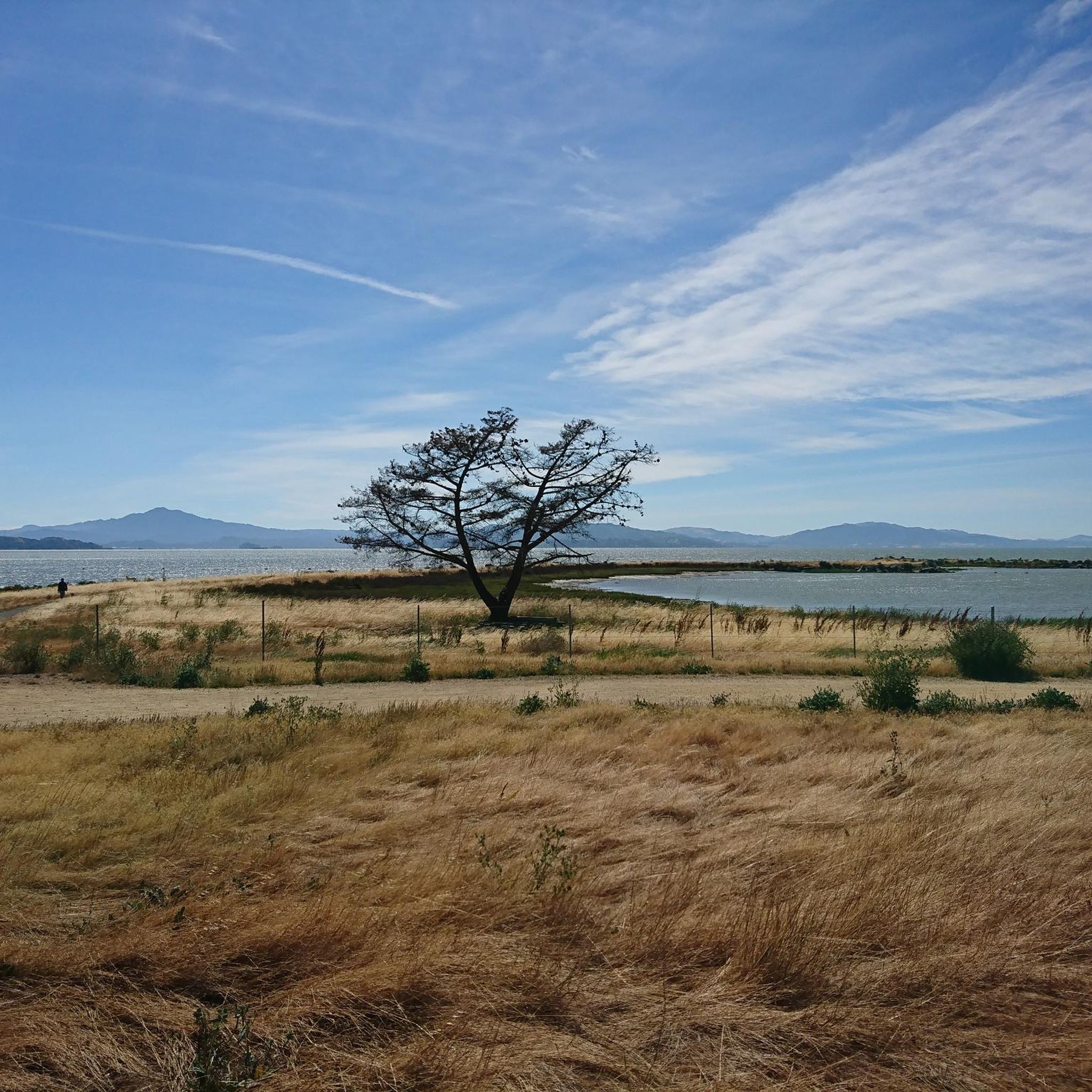
Bayside Views of the San Pablo bay from the paved trails into this waterfront regional park, with old boat docks, some buildings, picnic areas, but only one in-out connection to the bay trail on the other, inland side of the train tracks via a bridge.
0
0
Shoreline park along San Francisco Bay Trail. Unfortunately the trail deadends a mile further west.
0
0

The Crockett World War I Memorial Hall, built in 1925 in Crockett, California, honors local soldiers who served in WWI—many of them workers from the nearby C&H Sugar refinery. Designed in Mission Revival style, the hall features stucco walls and red-tile roofing, typical of early 20th-century California. Today, it stands as a preserved local landmark and is listed on the National Register of Historic Places. A quick stop here offers a glimpse into Crockett’s civic pride and wartime remembrance.
0
0


The reservoir is a definite scenic highlight, and you can expect to see plenty of people kayaking, fishing, and hiking on and off the water. San Pablo Dam Road takes you to a couple different boat launches and picnic areas with views of the water. Old San Pablo Dam Road is more scenic and winds along the shore, but the surface is quite old and, while technically paved, is really better suited for a gravel bike.
0
0

Shoreline Park, nestled along the San Francisco Bay Trail, offers a captivating panorama of the San Pablo Bay. Situated right on the waterfront, this park provides an ideal vantage point to appreciate the stunning views of the bay.
0
0

Point Isabel Regional Shoreline Park is a multi-use park for for joggers, windsurfers, kayakers, photographers, picnickers, and dog walkers. Spanning 50 acres, this park was formerly a landfill but underwent a clay-capping operation in the 1980s, transforming it into a secure and environmentally safe public space.
1
1
Frequently Asked Questions
What are the general characteristics of road cycling routes in Tara Hills?
Road cycling routes in Tara Hills offer a diverse landscape, featuring established greenways, scenic reservoir paths, and routes along the bay. The terrain varies from relatively flat sections, perfect for casual rides, to more undulating paths with moderate elevation gains. You'll find options for different ability levels, from easy paths to more challenging moderate routes.
How many road cycling routes are available in Tara Hills?
There are over 30 road cycling routes available in Tara Hills, catering to various skill levels and preferences. The komoot community has explored these routes over 1000 times.
Are there beginner-friendly road cycling routes in Tara Hills?
Yes, Tara Hills offers several easy road cycling routes. For instance, the Ohlone Greenway and Bay Trail Loop is an easy 20.0-mile (32.2 km) route that follows paved greenways and bay trails, providing consistent surfaces ideal for beginners or casual rides.
Are there challenging road cycling routes for experienced riders in Tara Hills?
For experienced riders seeking a moderate challenge, routes like the San Pablo Reservoir – Inspiration Point Overlook loop from El Sobrante offer a 24.3-mile (39.2 km) path with significant elevation gain, circling the reservoir and including an overlook point. Another moderate option is the Carquinez Scenic Drive – Carquinez Scenic Drive through loop from Rodeo, which spans 33.5 miles (53.9 km) through scenic drive areas.
What is the typical length of road cycling routes in Tara Hills?
The road cycling routes in Tara Hills vary in length. You can find shorter routes around 20 miles (32 km), such as the Ohlone Greenway and Bay Trail Loop, up to longer rides like the San Pablo Reservoir – Orinda BART Station loop from Pinole, which is approximately 42.3 miles (68.1 km).
Can I access road cycling routes in Tara Hills using public transport?
Yes, some routes are accessible via public transport. For example, the San Pablo Reservoir – Orinda BART Station loop from Pinole specifically mentions starting from a BART station, indicating public transport access points are available for certain routes.
Are there scenic viewpoints along the road cycling routes in Tara Hills?
Absolutely. Many routes offer scenic vistas. The San Pablo Reservoir – Inspiration Point Overlook loop from El Sobrante includes a dedicated overlook point. Additionally, you can find a 360-degree viewpoint within the Natural Monuments around Tara Hills, which might be accessible or visible from some routes.
What can I see along the road cycling routes in Tara Hills?
Beyond the cycling itself, you can explore various points of interest. Consider visiting Point Isabel Regional Shoreline Park, or the San Rafael Bridge Bike Path for additional cycling experiences. For historical interest, the Rosie the Riveter Memorial is also nearby.
Are there any circular road cycling routes in Tara Hills?
Yes, many road cycling routes in Tara Hills are designed as loops. Examples include the popular Ohlone Greenway and Bay Trail Loop, the San Pablo Reservoir – Inspiration Point Overlook loop from El Sobrante, and the Alfred Zampa Carquinez Bridge – Alfred Zampa Memorial Bridge loop from Hercules.
What do other road cyclists enjoy the most about road cycling in Tara Hills?
The area is highly rated by the komoot community, with an average score of 4.9 stars from over 30 reviews. Reviewers often praise the diverse terrain, from greenways to reservoir paths, and the well-maintained routes that offer options for various skill levels.
When is the best time of year to go road cycling in Tara Hills?
Given the region's characteristics, road cycling in Tara Hills is generally enjoyable for much of the year. Spring and fall typically offer mild temperatures and pleasant conditions. Summer can be warm, especially inland, while winters are usually mild but may bring occasional rain.
Most popular routes around Tara Hills
Most popular attractions around Tara Hills

Get inspired with the komoot mobile app


Explore more
Browse the best Road cycling routes in other regions.
