The best cycling routes around South Whittier
4.7
(62)
631
riders
60
rides
Touring cycling around South Whittier offers a diverse network of dedicated bike paths, expansive parks, and routes through rolling hills. The region features significant river trails like the San Gabriel River Trail and Rio Hondo River Trail, providing extensive networks for longer rides. Riparian woodlands and lakes are present in areas such as the Whittier Narrows Recreation Area, contributing to varied scenery. The landscape includes both flat, paved sections and more challenging routes with elevation changes.
Best touring cycling routes…
Last updated: June 26, 2026
14
riders
Moderate bike ride. Good fitness required. Mostly paved surfaces. Suitable for all skill levels.
5.0
(2)
14
riders
18.8km
01:08
60m
60m
Easy bike ride. Great for any fitness level. Mostly paved surfaces. Suitable for all skill levels.

Sign up for free
10
riders
27.2km
01:37
100m
100m
Easy bike ride. Great for any fitness level. Mostly paved surfaces. Suitable for all skill levels.
12
riders
Moderate bike ride. Good fitness required. Mostly paved surfaces. Suitable for all skill levels.
8
riders
12.5km
01:13
300m
300m
Moderate bike ride. Good fitness required. Mostly paved surfaces. Suitable for all skill levels.
Get access to more routes and recommendations from other explorers.
Sign up for free
Already have an account?
Our route recommendations are based on thousands of hikes, rides, and runs completed by other people on komoot.
Start today with a free account
Your next adventure awaits.
Login or Signup




Tips from the Community


The San Gabriel Dam is a rock‑fill structure completed in 1939 on the San Gabriel River and is used for flood control.
0
0

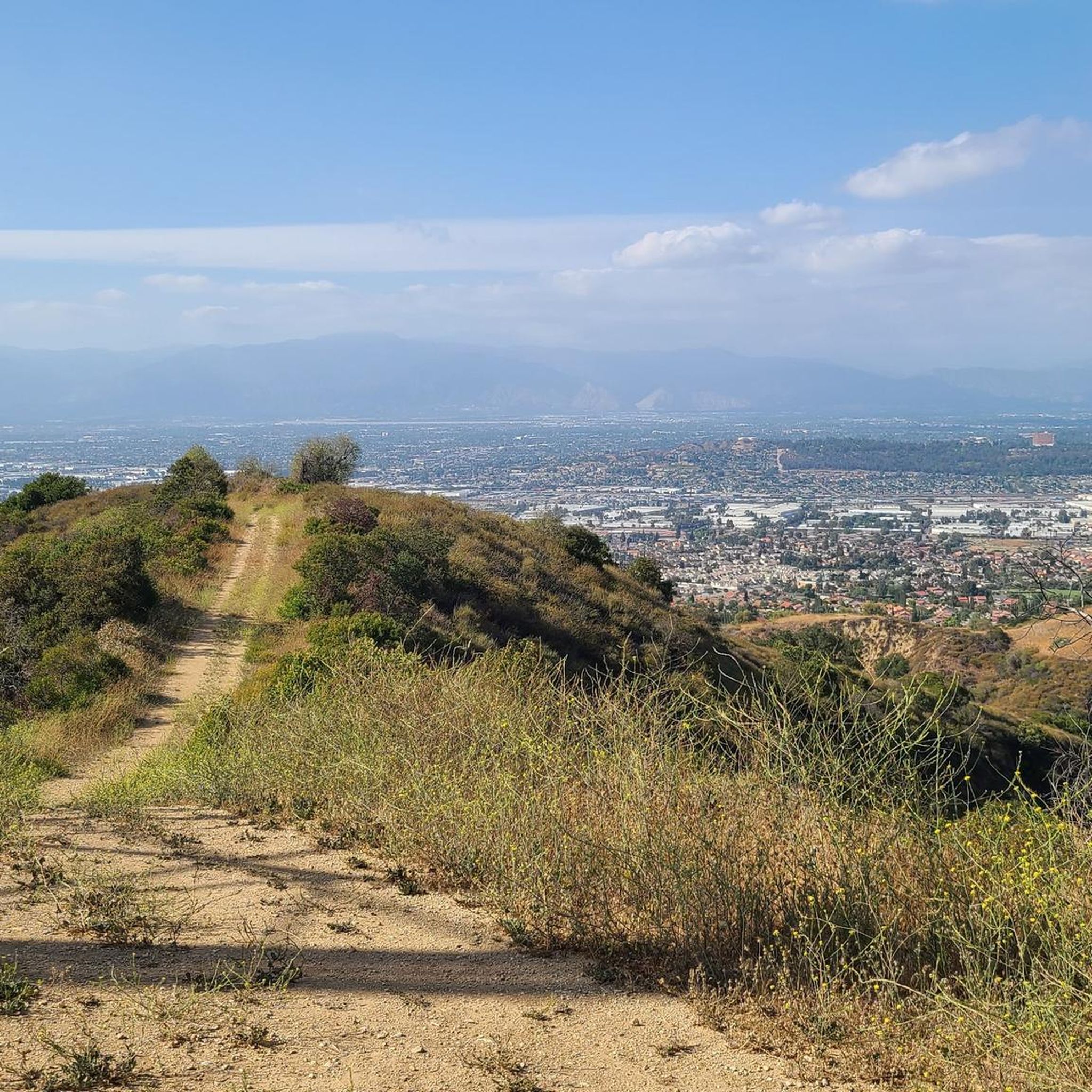
Ride through Turnbull Canyon and be rewarded with stunning views of Los Angeles County and surround yourself with a mix of natural beauty and historical intrigue. The road climbs with an average gradient of 5.2%, gaining 775 feet in elevation and peaking at 1,161 feet. Be cautious of fast-driving vehicles on the winding roads.
1
0

There is a parking lot and restroom here at the trailhead, which provides access to a large network of paved and packed dirt trails along the beautiful Rio Hondo. The trailhead closes at sunset.
0
0

be cautious, lots of young fast and furious wannabe racers out on the canyon at all hours of the day. listen to your surroundings. be safe
0
0

From here you have a wonderful view of the ship Queen Mary I, which has been converted into a hotel
1
0
Wonderfully wide beach, the bike path right in the middle.
0
0

As you bike near Turnbull Debris Basin, observe its crucial function in storing runoff and sediment, acting as a safeguard against downstream flooding and sedimentation, and protecting human life and property. Positioned along the canyon road en route to the Turnbull Canyon Trailhead, it plays a vital role in mitigating flood risks downstream, ensuring community safety.
0
0
Frequently Asked Questions
How many touring cycling routes are available in South Whittier?
South Whittier offers a wide selection of touring cycling routes, with over 60 different tours available on komoot. These routes cater to various skill levels, from easy, flat paths to more challenging rides with significant elevation changes.
What kind of terrain can I expect on touring cycling routes in South Whittier?
You'll find a diverse range of terrain. Many routes feature dedicated bike paths like the Whittier Greenway Trail, offering smooth, car-free experiences. You can also explore expansive parks such as the Whittier Narrows Recreation Area with both paved and dirt options, and routes through rolling hills like those near Turnbull Canyon, which provide scenic vistas.
Are there easy touring cycling routes suitable for beginners or families?
Yes, South Whittier has several easy touring cycling routes perfect for beginners and families. For instance, the Pio Pico State Historic Park loop from South Whittier is an easy 12.2-mile trail with minimal elevation gain, passing by a significant historical site. Another great option is the San Gabriel River Dam – Bosque del Rio Hondo loop from South Whittier, an easy 17.0-mile path following river trails.
Are there more challenging routes for experienced touring cyclists?
Absolutely. For those seeking a challenge, routes like the Schabarum Trail – Workman Ridge Trail loop from Whittier offer a difficult 15.9-mile ride with over 740 meters of elevation gain, providing a rewarding workout and panoramic views.
What are some notable landmarks or attractions I can visit while cycling?
Many routes pass by interesting attractions. You can cycle past the Turnbull Canyon for panoramic views, or visit the Bosque del Rio Hondo. The Pio Pico State Historic Park loop from South Whittier takes you directly to the beautifully restored home of California's last Mexican governor. The Whittier Narrows Recreation Area also hosts the American Military Museum.
Can I connect to longer regional trail networks from South Whittier?
Yes, South Whittier is strategically located to provide access to extensive regional trail networks. Its proximity to the San Gabriel River Trail and the Rio Hondo River Trail allows touring cyclists to embark on longer, uninterrupted rides that connect to other parks and communities throughout Los Angeles County.
Are there any circular touring cycling routes in the area?
Many of the touring cycling routes in South Whittier are designed as loops, offering convenient starting and ending points. Examples include the Schabarum Trail loop from Whittier and the Turnbull Debris Basin – Turnbull Canyon loop from Norwalk/Santa Fe Springs, allowing you to return to your starting point without retracing your path.
What amenities are available at Whittier Narrows Recreation Area for cyclists?
The Whittier Narrows Recreation Area is a significant hub for outdoor activities, including cycling. It features numerous bike trails, lakes, and a nature center. Bike and specialty cycle rentals are available within the park, making it convenient for visitors who don't bring their own equipment. You can also find facilities like the Dragon Playground for families.
What do other touring cyclists enjoy most about cycling in South Whittier?
The touring cycling routes in South Whittier are highly regarded by the komoot community, boasting an average rating of 4.6 stars from over 60 reviews. Cyclists often praise the diverse network of dedicated bike paths, the scenic natural features like riparian woodlands and lakes, and the accessibility to historical sites. The variety of routes, from easy river trails to challenging hill climbs, is also frequently highlighted.
Is public transport available to access cycling trails in South Whittier?
While specific public transport connections to every trailhead can vary, the Whittier Greenway Trail is designed to promote active transportation and is integrated into the local community. For larger parks like Whittier Narrows Recreation Area, it's advisable to check local transit authority websites for the most current bus routes and schedules that serve the park's entrances.
Are there any lakes or natural areas to explore by bike?
Yes, the Whittier Narrows Recreation Area is a prime spot for exploring natural areas by bike. It encompasses 400 acres of riparian woodland with four lakes, including Laguna Lake and Legg Lake. These areas provide picturesque scenery, opportunities for bird-watching, and a habitat for native plants and animals.
What is the best time of year for touring cycling in South Whittier?
South Whittier generally offers pleasant cycling conditions year-round due to its mild Southern California climate. Spring and fall are particularly ideal, with comfortable temperatures and often clear skies. Even winter cycling is enjoyable, though it's always wise to check local weather forecasts for any rain or cooler temperatures.
Most popular attractions around South Whittier

Get inspired with the komoot mobile app


Explore more
Browse the best Cycling routes in other regions.
