The best road cycling routes around San Miguel
4.5
(131)
5,093
riders
107
rides
Road cycling around San Miguel offers a diverse landscape for riders. The region features varied terrain, including rolling hills and more challenging ascents, characteristic of its volcanic origins. Roads often traverse through lush greenery and open areas, providing a mix of gradients. The area's topography allows for both extended endurance rides and shorter, more accessible routes.
Best road cycling routes around San Miguel
- The most popular road cycling route is Sunol Depot loop, a 65.4 miles (105.3 km) trail…
Last updated: May 28, 2026
29
riders
105km
04:25
600m
600m
Moderate road ride. Good fitness required. Mostly well-paved surfaces and easy to ride.
4.8
(4)
575
riders
59.9km
03:22
1,200m
1,200m
Hard road ride. Very good fitness required. Mostly well-paved surfaces and easy to ride.

Sign up for free
5.0
(2)
250
riders
89.5km
04:14
1,050m
1,050m
Hard road ride. Very good fitness required. Mostly well-paved surfaces and easy to ride.
21
riders
93.4km
04:45
1,400m
1,400m
Hard road ride. Very good fitness required. Mostly well-paved surfaces and easy to ride.
5.0
(3)
41
riders
Easy road ride. Great for any fitness level. Mostly well-paved surfaces and easy to ride.
Get access to more routes and recommendations from other explorers.
Sign up for free
Already have an account?
Our route recommendations are based on thousands of hikes, rides, and runs completed by other people on komoot.
Start today with a free account
Your next adventure awaits.
Login or Signup



Tips from the Community

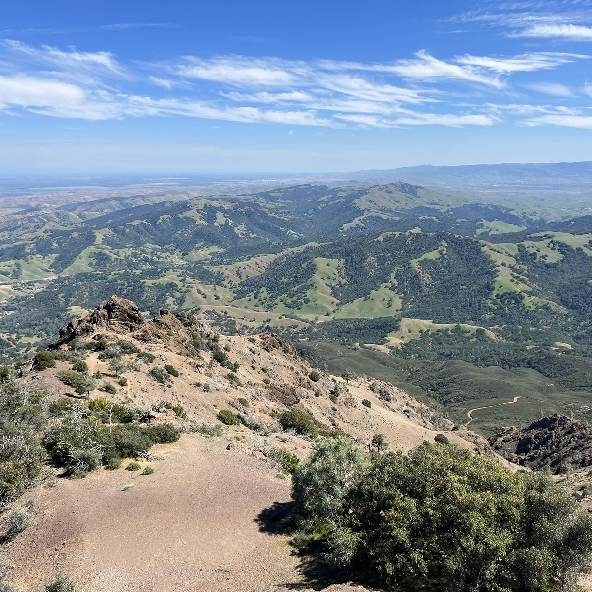
Mount Diablo, is the Bay Area second-highest peak at 1173m (3849ft). The challenging climb features constantly fluctuating gradients averaging 8%, with tough sections up to 18% and a brutal 23% finish in the last 200m. The equally demanding descent requires good bike handling due to tight corners, potholes, and strong winds. The road to the top is open daily from 8 AM till sunset.
0
0

This road parallels the ridgeline above and have great views over the bay and surrounding hills.
0
0

Leigh Creekside Park is a small park that is just over an acre in size. The park is a nice resting spot just off the Lafayette-Moraga Trail and features picnic tables, a drinking fountain, and plenty of shade
0
0
The Iron Horse Trail is a 32-mile multi-path that connects the towns of Concord and Pleasanton. It follows the route of the abandoned Southern Pacific Railroad. With its access to schools, business centers, and parks, the path is popular with commuters and recreationalists.
0
0

The Lamorinda Trail Loop passes through Orinda, Moraga, and Lafayette. The loop spans 17.5 miles in total, mostly flat and paved, with parking available in downtown Orinda or El Nido Ranch Road. The St. Stephen's Trail is 1.2 miles, suitable for pedestrians, bikes, dogs, and wheelchairs.
0
1
This charming lake sits along the Ygnacio Canal Trail at Heather Farm Park. The park features two lakes, open grassy areas, playgrounds, picnic tables, and other facilities. The lake and surrounding areas are a great spot to take a break while cycling the Ygnacio Canal Trail.
0
0
The Lafayette-Moraga Regional Trail is a 7.65-mile paved path for hiking, biking, and horseback riding, open from 5 a.m. to 10 p.m. daily. Paralleling St. Mary's Road, the trail connects Lafayette and Moraga, passing through the scenic Moraga Valley. It is a historical route for mule and steam trains transporting redwood lumber. The trail starts at Olympic Boulevard in Lafayette and ends at the Valle Vista staging area near the San Leandro Reservoir. Along the way, it links to schools, parks, and commercial areas and is maintained by the East Bay Regional Park District.
0
0

Lafayette is a city in Contra Costa County, California, with a population of 25,391 as of 2020. Named after the Marquis de Lafayette, a French officer in the American Revolutionary War, landmarks include the Lafayette Library and Learning Center, Oakmont Memorial Park, and the Cross of Lafayette Memorial, a somewhat controversial tribute to U.S. soldiers who died in Iraq. Lafayette is also home to the historic Park Theater, which closed in 2005 but is currently being considered for reopening. This is a great town to pass through, or start and/or end a ride.
0
0
Frequently Asked Questions
How many road cycling routes are available around San Miguel?
There are nearly 100 road cycling routes around San Miguel, offering a diverse range of experiences. These include 47 easy routes, 37 moderate routes, and 14 challenging routes, catering to various skill levels.
What kind of terrain can I expect on road cycling routes in San Miguel?
Road cycling around San Miguel features varied terrain, including rolling hills and more challenging ascents. Routes often traverse through lush greenery and open areas, providing a mix of gradients suitable for both extended endurance rides and shorter, more accessible options.
Are there any easy road cycling routes suitable for beginners in San Miguel?
Yes, San Miguel offers several easy road cycling routes. A good option for beginners is the Heather Farm Park Lake – Walden Park loop from Walnut Creek, which is 24.8 km long with minimal elevation gain, making it a pleasant ride.
Which routes offer significant elevation gain for a challenging ride?
For a challenging ride with substantial elevation gain, consider the Grizzly Peak Boulevard – Skyline Boulevard loop from Walnut Creek. This 82.5 km route features over 1,380 meters of ascent, leading through elevated areas and providing a demanding experience.
What are some notable landmarks or viewpoints I can see along the road cycling routes?
Many routes offer scenic views and pass by interesting landmarks. You might encounter natural features like Mount Diablo Summit or Eagle Peak. Some routes also pass by cultural sites such as the Museum of the San Ramon Valley.
Are there any long-distance road cycling routes for endurance training?
Absolutely. For a longer endurance ride, the Sunol Depot loop is an excellent choice. This moderate route spans 105.3 km and takes approximately 4 hours and 25 minutes to complete, featuring significant elevation gain over varied terrain.
What do other road cyclists say about the routes in San Miguel?
The road cycling routes in San Miguel are highly rated by the komoot community, with an average score of 4.4 stars from over 100 reviews. Cyclists often praise the varied terrain and the mix of challenging climbs and scenic stretches.
Are there any loop routes available for road cycling in San Miguel?
Yes, many road cycling routes in San Miguel are designed as loops. Examples include the Iron Horse Trail bridge – Iron Horse Trail junction loop from Walnut Creek, a challenging 90.3 km route, and the easier Leigh Creekside Park – Lafayette-Moraga Trail loop from Walnut Creek, which is 29.6 km long.
Can I find dedicated cycle paths or trails for road biking in the area?
While many routes utilize roads, you can also find sections that incorporate dedicated cycle paths. The Lafayette-Moraga Regional Trail and the Lamorinda Trail are examples of cycle-friendly infrastructure that can be integrated into rides.
What is the best time of year for road cycling in San Miguel?
The region's climate generally allows for road cycling throughout much of the year. However, for the most comfortable conditions, spring and fall often offer pleasant temperatures and less extreme weather, making them ideal for exploring the varied terrain.
Are there any facilities or visitor centers along the routes?
Some areas offer facilities that cyclists might find useful. For instance, the Mitchell Canyon Visitor Center could be a point of interest or a place to stop during a ride in that vicinity.
Most popular attractions around San Miguel

Get inspired with the komoot mobile app


Explore more
Browse the best Road cycling routes in other regions.
