The best walks and hikes around Running Springs
29
hikers
14
hikes
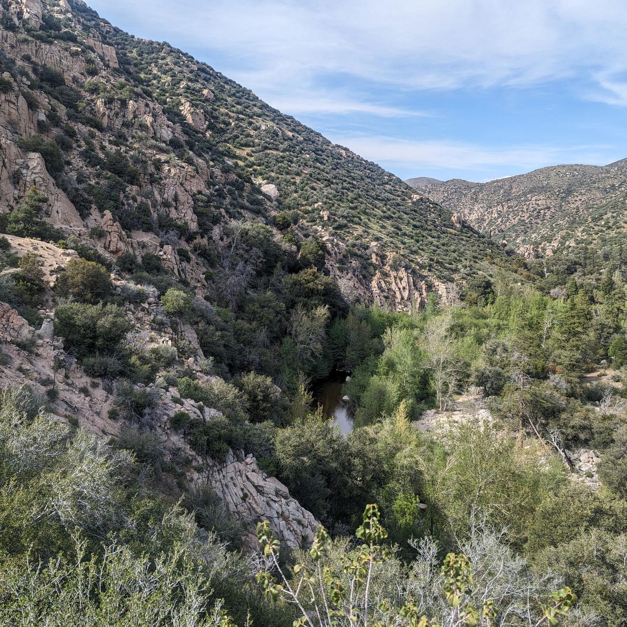
Hikes around Running Springs CA explore the mountainous terrain of the San Bernardino National Forest. The region is characterized by dense pine forests, hidden meadows, and trails that ascend to local peaks and lakes. Routes range from moderate loops to challenging ascents with significant elevation gain, offering a variety of options for hikers.
Best hiking trails around Running Springs
- The most popular hiking route is Keller Peak via Exploration Trail — Lake Arrowhead, a 13.3 mile (21.5 km) trail…
Last updated: May 10, 2026
3
hikers
4.61km
01:21
130m
120m
Easy hike. Great for any fitness level. Easily-accessible paths. Suitable for all skill levels.
34.4km
10:00
1,100m
620m
Hard hike. Very good fitness required. Easily-accessible paths. Suitable for all skill levels.

Sign up for free
2.45km
00:39
20m
20m
Easy hike. Great for any fitness level. Easily-accessible paths. Suitable for all skill levels.
8.59km
02:39
450m
60m
Moderate hike. Good fitness required. Easily-accessible paths. Suitable for all skill levels.
6
hikers
21.5km
06:20
620m
620m
Hard hike. Very good fitness required. Easily-accessible paths. Suitable for all skill levels.
Get access to more routes and recommendations from other explorers.
Sign up for free
Already have an account?
Our route recommendations are based on thousands of hikes, rides, and runs completed by other people on komoot.
Start today with a free account
Your next adventure awaits.
Login or Signup
Popular around Running Springs
Tips from the Community

Green Valley Lake sits at 7,000 feet, higher than both Lake Arrowhead and Big Bear. It's secluded, about four miles from State Highway 18, surrounded by National Forest. This small, scenic lake is uncrowded and ideal for a peaceful retreat.
0
0

Keller Peak sits at an elevation of 7,882 feet. At the top there is the Keller Peak Fire Lookout, which is the oldest fire tower still standing in San Bernardino National Forest.
0
0

At 7,882 feet, Keller Peak takes a sustained effort to get to the top. However, it is worth the effort as the views you get from the top are incredible.
0
0
Keller Peak sits at an elevation of 7,882 feet. At the top there is the Keller Peak Fire Lookout, which is the oldest fire tower still standing in San Bernardino National Forest. There is also a paved road to drive all the way to the top for family members unable to make the hike.
0
0
The Exploration Trail is a non-motorized, family friendly trail. The trail was designed by children along with help from the U.S. Forest Service personnel.
0
0

Holcomb Creek runs along the PCT for quite a while. It is fairly reliable and has cold, clear water. At this location you have to cross the creek.
4
0
Frequently Asked Questions
Are there any dog-friendly hiking trails in Running Springs?
Yes, many trails in the San Bernardino National Forest are dog-friendly, but your dog must be on a leash. A popular choice is the Heaps Peak Arboretum, which features a well-regarded, relatively easy one-mile loop trail that's perfect for a walk with your pup. For a slightly longer outing, the Little Green Valley Trail is another great option where dogs are welcome.
What are some good family-friendly or easy hikes in the area?
The Exploration Trail is a fantastic choice for families. It was designed in part by children and can be hiked in shorter, manageable segments. Another excellent spot is the Heaps Peak Arboretum, which offers a gentle, one-mile educational loop through a grove of sequoias that is accessible for most ages and abilities.
Where can I find a good circular hike near Running Springs?
For a rewarding loop hike, consider the Snow Valley Mountain Ski Resort loop. This moderate 5.7-mile (9.2 km) trail offers a different perspective of the area, taking you around the resort grounds with varied terrain.
What should I know about parking at the trailheads?
Parking can be limited, especially on weekends. Most trailheads, like those for the Exploration Trail and Little Green Valley Trail, have small dirt lots. It's best to arrive early to secure a spot. You may also need to display a National Forest Adventure Pass to park at many trailheads within the San Bernardino National Forest, so be sure to check requirements for your chosen trail.
Do I need a permit to hike in the Running Springs area?
For most day hikes, you do not need a specific hiking permit. However, you will likely need a National Forest Adventure Pass to park your vehicle at many trailheads. If you plan to hike into a designated wilderness area, such as the San Gorgonio Wilderness via the Siberia Creek Trail, a separate, free wilderness permit is required for both day use and overnight trips.
Are there any challenging, long-distance hikes available?
Yes, the region offers several strenuous hikes for experienced adventurers. The Siberia Creek Trail to Bluff Lake is a demanding 19.7-mile (31.7 km) trek with significant elevation gain, taking you deep into the forest. This route requires good fitness and preparation.
Can I go hiking in Running Springs during the winter?
Winter hiking is possible, but it requires special preparation. Trails can be covered in snow and ice, so traction devices like microspikes and trekking poles are highly recommended. Higher elevation routes may be inaccessible. Always check current weather and trail conditions before you go, and stick to lower-elevation or south-facing trails that receive more sun.
What kind of wildlife might I see on the trails?
The San Bernardino National Forest is home to a variety of wildlife. It's common to see squirrels, chipmunks, and various bird species like Steller's jays. Deer are also frequently spotted. While less common, black bears and mountain lions inhabit the area, so it's important to be aware of your surroundings, make noise while you hike, and know what to do in case of an encounter.
Are there any trails that follow a creek or lead to water?
The Camp Creek Trail to Siberia Creek Campground is a great option. This moderate 6.4-mile (10.4 km) hike follows a creek through a forested canyon, offering a pleasant streamside experience. The trail leads to a campground area, making it a nice destination for an out-and-back hike.
How does hiking in Running Springs compare to Big Bear?
Running Springs generally offers a quieter, less crowded hiking experience than the more bustling Big Bear area. The trails here, like the Exploration Trail and those around Green Valley, are often described as more secluded. While Big Bear has a larger concentration of trails centered around a lake, Running Springs serves as a gateway to more dispersed routes within the San Bernardino National Forest, focusing on forests, peaks, and canyons.
What should I pack for a day hike in this area?
Even for short hikes, it's essential to be prepared. Key items include:
- Water: Bring more than you think you'll need, as the altitude and dry air can be dehydrating.
- Layers: Weather can change quickly in the mountains. Pack a jacket, even on a warm day.
- Sun Protection: A hat, sunglasses, and sunscreen are crucial due to the high elevation.
- Navigation: Have a map of the trail, either on your phone with komoot or a physical copy.
- Snacks: High-energy snacks will keep you going.
- Footwear: Sturdy hiking shoes with good grip are recommended for the rocky and sometimes steep terrain.
Are there any loop trails with good views?
The Crafts Peak loop is a moderate 6.6-mile (10.7 km) hike that provides some lovely vistas through the trees. While it doesn't lead to a major summit viewpoint, the trail winds through beautiful forest scenery and offers glimpses of the surrounding mountains along the way.
Most popular routes around Running Springs
Most popular attractions around Running Springs

Get inspired with the komoot mobile app


Explore more
Browse the best Hikes in other regions.
