The best cycling routes around Rio Linda
4.8
(5)
247
riders
17
rides
Touring cycling routes around Rio Linda primarily traverse flat, accessible terrain, characterized by a network of creeks and rivers. The landscape features open spaces and green corridors, often following waterways like the American River and Dry Creek. This area provides a generally low-elevation environment, making it suitable for various cycling abilities. The routes frequently incorporate bridges, offering scenic crossings over the region's aquatic features.
Best touring cycling routes around Rio Linda
- The most popular touring cycling route is Guy West Bridge – Bridge over American River loop from Royal Oaks, a 29.9 miles (48.2 km) trail that takes 2 hours 44 minutes to complete, featuring significant river crossings.
- Another top favourite among local touring cyclists is Pleasant Grove Creek Trail – Pleasant Grove Creek Trail loop from Vintage Square, an easy 17.0 miles (27.3 km) path. This route follows the natural contours of Pleasant Grove Creek, offering a tranquil ride.
- Local touring cyclists also love the Dry Creek Trail – Dry Creek Trail loop from Taco Bell, a 8.9 miles (14.4 km) trail leading through the Dry Creek greenway, often completed in about 50 minutes.
- Touring cycling around Rio Linda is defined by river and creek-side paths, open parklands, and urban greenways. The network offers options for both easy, family-friendly rides and longer, moderate excursions.
- The routes in Rio Linda are highly rated by the komoot community with an average score of 4.9 stars from around 10 reviews. More than 200 touring cyclists have used komoot to explore Rio Linda's varied terrain.
Last updated: June 25, 2026
4.5
(2)
100
riders
46.1km
02:38
100m
100m
Moderate bike ride. Good fitness required. Mostly paved surfaces. Suitable for all skill levels.
18
riders
Easy bike ride. Great for any fitness level. Mostly paved surfaces. Suitable for all skill levels.

Sign up for free
7
riders
77.9km
04:28
190m
190m
Moderate bike ride. Good fitness required. Mostly paved surfaces. Suitable for all skill levels.
9
riders
12.1km
00:42
20m
20m
Easy bike ride. Great for any fitness level. Mostly paved surfaces. Suitable for all skill levels.
13
riders
14.7km
00:50
20m
20m
Easy bike ride. Great for any fitness level. Mostly paved surfaces. Suitable for all skill levels.
Get access to more routes and recommendations from other explorers.
Sign up for free
Already have an account?
Our route recommendations are based on thousands of hikes, rides, and runs completed by other people on komoot.
Start today with a free account
Your next adventure awaits.
Login or Signup
Popular around Rio Linda


Tips from the Community

This trail connects clean, scenic Bannister Park with the American River.
0
0

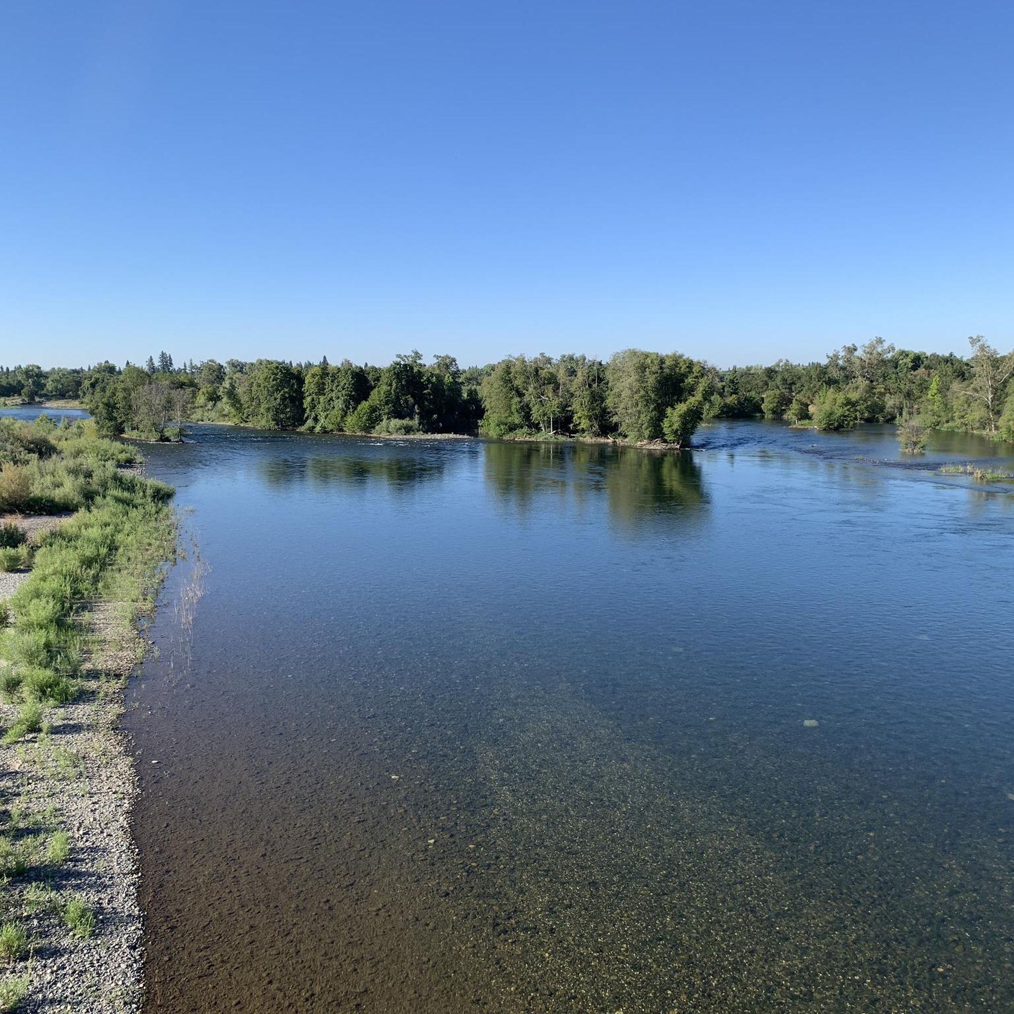
Little tip-outs on both sides to safely pull over & take pics; the north side (upriver) is deep & boaters fish there. the south side faces down river & the myriad of rapids there. This bridge is one of many along the Jedediah Smith Memorial Bike Trail; a 32 mile, 2 lane multi-use paved path (bikes, peds, equestrian) that runs twix Discovery Park & Granite Bay. IT IS IN ESSENCE OUR BIKE SUPERHIGHWAY..... No Vehicles Allowed. the Jededia is patrolled by red-shirted volunteers, Sac Sheriff & Rangers. there's also Emergency Call Boxes all along it & water spigots too (but only a few! 🤣😆)
0
0

The Harold Richey Memorial Bicycle Bridge, named after county commissioner Harold M. Richey and dedicated to him in 1987, is popular with families and cyclists, especially on weekends. The bridge does not allow cars, with rules on the bridge deck that outline right-of-way guidelines for pedestrians, equestrians, and cyclists.
1
0

Amazing huge steel bridge ride over a fork in the Sac River
0
0

At nearly 80 acres, Hagan Community Park is the largest park within Cordova Recreational Park District CRPD. It is also located adjacent to the American River Parkway, providing quick access to natural walking and biking trails and eco-friendly commuter routes to downtown Sacramento. This spectacular park boasts dozens of family-friendly amenities. Hagan Community Park will remain open even while parking security gates and restrooms will be closed on Thanksgiving Day, Christmas Day and New Year’s Day.
3
0

This is a flat, paved trail that connects Bannister Park with the American River. It's hailed as being one of the more clean and scenic parks of Sacramento. It's a great place to spend a sunny afternoon, there are picnic areas, shelters and a plenty of places to sit along the river.
0
0
This is an historic metal truss swing bridge that spans the American River. Cycling over it will provide fantastic views down the waterway.
1
0
If you're up for a day of fun on Lake Natoma, check out this aquatic center. They offer classes and equipment rentals for various watersports like sailing, rowing, paddling, windsurfing, wakeboarding, jet skiing, and boating. It's the perfect spot for a water adventure!
1
0
Frequently Asked Questions
How many touring cycling routes are available in Rio Linda?
There are over 10 touring cycling routes around Rio Linda documented on komoot, offering a variety of experiences. These routes have been explored by more than 200 touring cyclists.
What is the general terrain like for touring cycling in Rio Linda?
Touring cycling routes in Rio Linda primarily traverse flat, accessible terrain. The landscape is characterized by a network of creeks and rivers, open spaces, and green corridors, often following waterways like the American River and Dry Creek. This low-elevation environment is suitable for various cycling abilities.
Are there routes suitable for beginners or families?
Yes, Rio Linda offers several easy touring cycling routes perfect for beginners or families. For example, the Tower Bridge – Tower Bridge loop from Gateway Oaks + Oak Harbour is an easy 12.1 km ride, ideal for a relaxed outing.
What is the best time of year to go touring cycling in Rio Linda?
Given the generally mild climate of the Sacramento Valley, spring and fall are often ideal for touring cycling in Rio Linda, offering comfortable temperatures. Summer can be hot, so early morning or late afternoon rides are recommended. Winter rides are also possible, though cooler and potentially wetter.
Are there any circular touring cycling routes?
Many of the touring cycling routes in Rio Linda are designed as loops, allowing you to start and end at the same point. An example is the Tower Bridge – Jibboom Bridge loop from Royal Oaks, an 18.2 km easy route that provides a scenic circular journey.
Where can I find parking for touring cycling routes in Rio Linda?
Parking availability varies by route starting point. Many routes begin near public parks or commercial areas that may offer parking. For routes like the Dry Creek Trail – Dry Creek Trail loop from Taco Bell, you might find parking near the designated start points or adjacent public spaces.
Is public transport accessible near the touring cycling routes?
Public transport options, such as local bus services, may provide access to areas near some touring cycling routes in Rio Linda. Cyclists should check local transit schedules and bike-on-bus policies for specific routes and stops that align with their chosen cycling path.
What kind of scenery can I expect on touring cycling routes in Rio Linda?
You can expect diverse scenery including river and creek-side paths, open parklands, and urban greenways. Many routes feature scenic crossings over the region's aquatic features via bridges. The landscape offers a mix of natural beauty and accessible, well-maintained paths.
Are there any interesting landmarks or attractions along the routes?
Yes, several routes pass by or near interesting landmarks. For instance, you might encounter the historic Jibboom Bridge or the expansive Discovery Park. Other notable points include Pipe's Bridge and Sutter's Landing Park, offering pleasant stops along your ride.
Can I expect to see wildlife while cycling in Rio Linda?
While specific wildlife sightings are never guaranteed, the routes often follow green corridors and waterways, which are natural habitats. You might spot various bird species, small mammals, and aquatic life, especially along the American River and Dry Creek trails.
What do other touring cyclists enjoy most about cycling in Rio Linda?
The touring cycling routes in Rio Linda are highly rated by the komoot community, with an average score of 4.9 stars. Reviewers often praise the flat, accessible terrain, the scenic river and creek-side paths, and the overall tranquility of the rides, making them enjoyable for all skill levels.
Are there any longer touring cycling routes for more experienced riders?
Yes, for those seeking a longer ride, the Guy West Bridge – Bridge over American River loop from Royal Oaks is a moderate 48.2 km route that takes approximately 2 hours 44 minutes to complete, featuring significant river crossings and offering a more extended touring experience.
What kind of surfaces can I expect on the touring cycling routes?
The touring cycling routes in Rio Linda typically feature well-maintained paths, often paved or with smooth, compacted surfaces suitable for touring bicycles. These paths are designed for accessibility and comfort, making for a pleasant riding experience along the region's greenways and riverbanks.
Most popular routes around Rio Linda
Most popular attractions around Rio Linda

Get inspired with the komoot mobile app


Explore more
Browse the best Cycling routes in other regions.
