The best walks and hikes around Rancho San Diego
4.8
(94)
1,240
hikers
48
hikes
Hiking around Rancho San Diego offers access to diverse natural landscapes, including coastal sage scrub, chaparral, and oak woodlands. The region features significant natural attractions such as the San Diego National Wildlife Refuge and Sweetwater Summit Regional Park. Hikers can explore trails alongside the Sweetwater River and around the Sweetwater Reservoir, with elevations ranging from gentle river paths to the 870-foot peak of Mother Miguel Mountain. These varied environments provide opportunities for wildlife spotting and panoramic views.
Best hiking trails around Rancho San Diego
- The most popular hiking route is McGinty Mountain Trail, a 2.3 miles (3.6 km) trail that takes 1 hour 21 minutes to complete. This route involves significant elevation gain, rewarding hikers with panoramic views from its summit.
- Another top favourite among local hikers is Otay Sweetwater Refuge Trail, a moderate 9.7 miles (15.7 km) path. This trail offers diverse scenery within the refuge, showcasing varied ecosystems.
- Local hikers also love the Damon Lane County Park Trail, a 1.4 miles (2.2 km) trail leading through Damon Lane County Park, often completed in about 35 minutes.
- Hiking around Rancho San Diego is defined by the San Diego National Wildlife Refuge, Sweetwater Summit Regional Park, and the Sweetwater River and Reservoir. The network offers options for different ability levels, from easy walks to more challenging ascents.
- The routes in Rancho San Diego are highly rated by the komoot community with an average score of 4.8 stars from over 120 reviews. More than 1200 hikers have used komoot to explore Rancho San Diego's varied terrain.
Last updated: June 25, 2026
4
hikers
15.7km
04:16
220m
220m
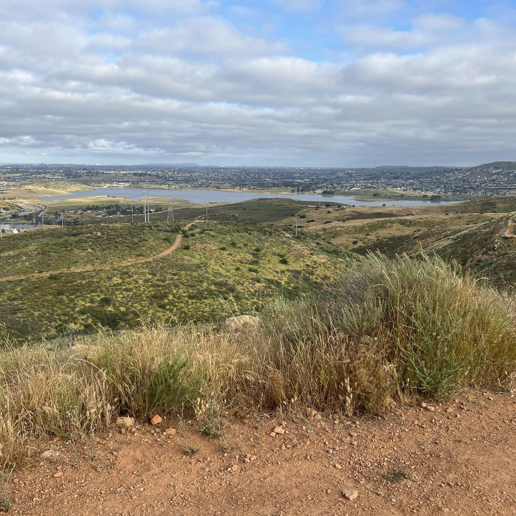
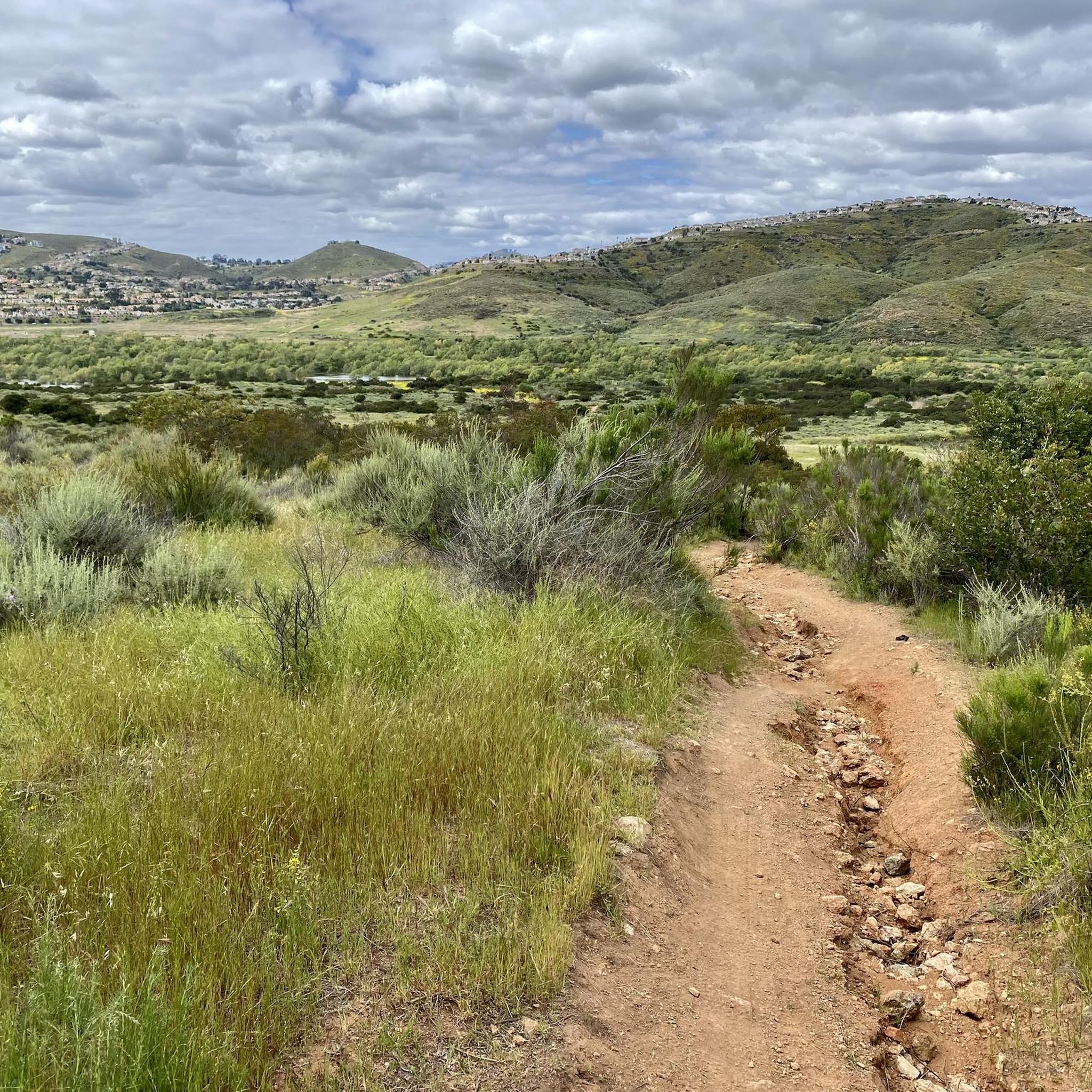
Explore the Otay Sweetwater Refuge Trail, a moderate hiking route spanning 9.8 miles (15.7 km) with an elevation gain of 727 feet (222 metres). You can expect to complete this journey in about 4 hours and 15 minutes. As you hike, you will encounter varied terrain, from wide dirt paths to areas with gentle rises, and even a charming wooden boardwalk that crosses a marsh. Keep an eye out for the Gazebo With View of Sweetwater Reservoir, which offers expansive vistas, and enjoy distant views of San Miguel Mountain.
This multi-use trail is popular with hikers, cyclists, and equestrians, so be ready to share the path. Many sections are open with little shade, making cooler weather more comfortable for longer excursions. Parking is generally available at various access points along the route, allowing you flexibility in where you begin your adventure. Consider starting your hike earlier in the day to avoid peak traffic and enjoy the tranquility.
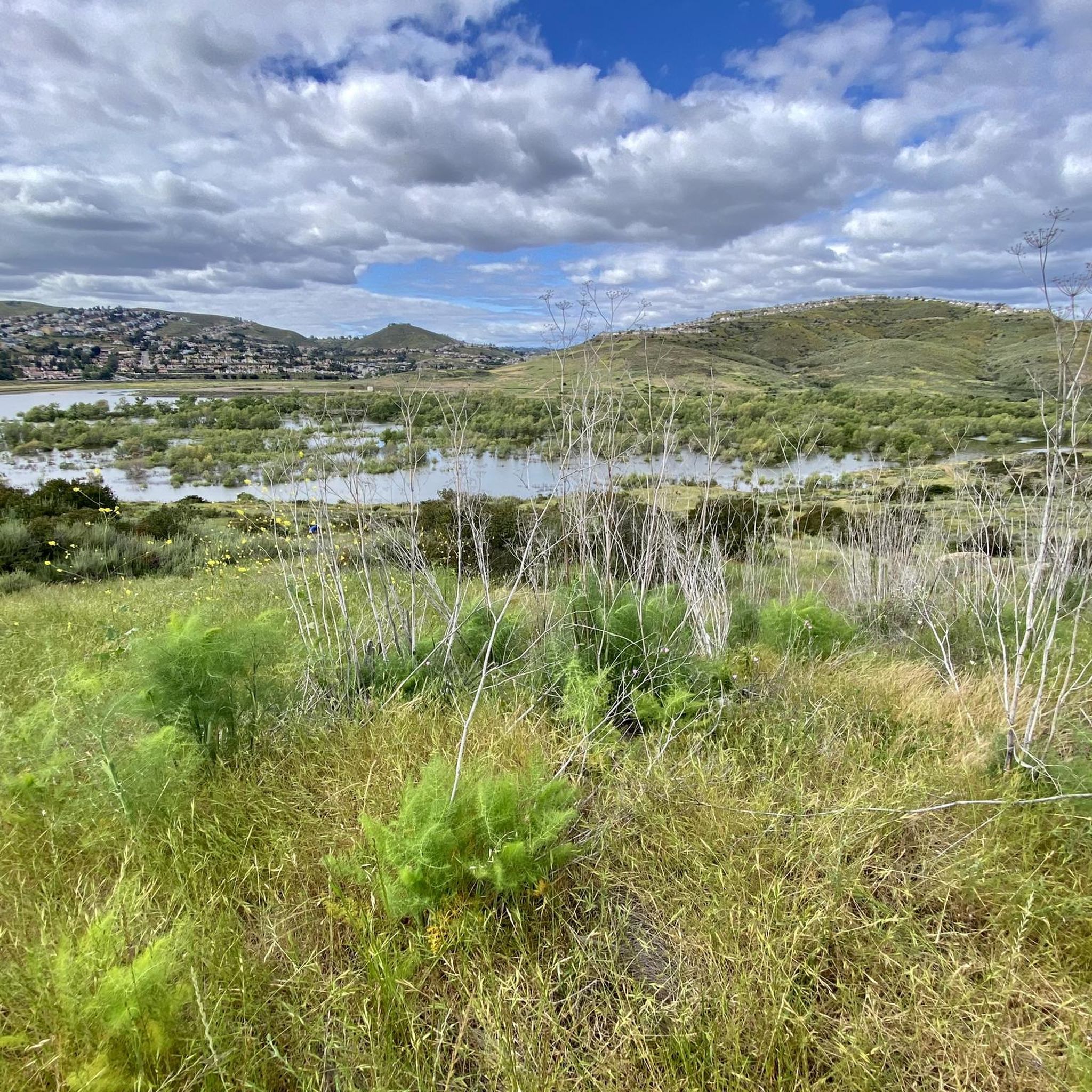
The route takes you through a vibrant riparian ecosystem within the San Diego National Wildlife Refuge. You will discover ponds and groves of towering eucalyptus trees, providing a diverse natural experience. In spring, the valley truly comes alive with beautiful wildflowers, adding a splash of color to the scenic beauty of the refuge.
3
hikers
3.65km
01:21
370m
10m
Embark on the McGinty Mountain Trail for a rewarding hike that climbs 1206 feet (367 metres) over 2.3 miles (3.6 km). This moderate route typically takes around 1 hour and 21 minutes to complete, offering a challenging ascent through diverse landscapes. As you gain elevation, you will encounter unique plant species, including the rare San Diego thornmint, leading to expansive panoramic views from the summit.
When planning your visit, be aware that the trail offers very little shade. You should bring plenty of water, sunscreen, and a hat, especially on warmer days, to stay comfortable. While dogs are welcome on the route, they must be kept on a leash at all times. Navigation can be tricky due to limited signage, so pay close attention to the most traveled path to stay on course.
McGinty Mountain Trail is situated within the San Diego National Wildlife Refuge, providing a serene experience away from more crowded areas. From the top, you can often spot distant landmarks like Downtown San Diego, Tecate Peak, and even the Pacific Ocean on clear days. This trail is particularly notable for its significant elevation gain and the opportunity to connect with nature in a unique ecological setting.

Sign up for free
5.0
(1)
1
hikers
2.18km
00:35
30m
30m
Enjoy an easy 1.4-mile hike on the Damon Lane County Park Trail, featuring eucalyptus groves, a year-round creek, and scenic views.
1.78km
00:35
130m
0m
The Dictionary Hill Loop offers a fantastic, quick escape into nature with surprisingly diverse terrain and expansive views. You'll wind through eucalyptus trees and chaparral, with the highlight being the 360-degree vistas from Dictionary Hill itself, where you can spot the Sweetwater Reservoir, Point Loma, and even the Coronado Islands. It's an easy 1.1-mile (1.8 km) hike with 431 feet (131 metres) of elevation gain, making it a perfect choice for a short, scenic outing.
Planning your visit is straightforward for this popular trail. While Komoot rates it easy, some sections are steep and rocky with loose dirt, so trekking poles can be helpful. The route is dog-friendly, allowing leashed pets to join you. It's a great option for a morning or afternoon hike, taking approximately 34 minutes to complete.
Beyond the stunning views, Dictionary Hill boasts a rich ecosystem, serving as an important habitat for various wildlife, including the threatened California Gnatcatcher. Historically, it was known as "Lookout Mountain" by early settlers and holds geological significance as a remnant of a 125-million-year-old volcanic island. This blend of natural beauty and history makes it a unique spot in Spring Valley.
6.91km
02:29
580m
100m
Embark on a moderate hike up McGinty Mountain North, a challenging route that covers 4.3 miles (6.9 km) and ascends 1914 feet (584 metres). You can expect to complete this journey in about 2 hours and 29 minutes. As you climb, the trail winds through distinctive chaparral and sage scrub, revealing unique plant life adapted to the mountain's red gabbro soils. The path can be steep and rocky in places, especially around switchbacks, so watch your footing. Reaching the summit rewards you with sweeping panoramic views, where you might spot Tecate Peak, Otay Mountain, and even the distant Pacific Ocean on a clear day.
Before you head out, be aware that signage on McGinty Mountain North is limited, making a downloaded trail map essential to stay on course and avoid unintended detours. The route is situated within the San Diego National Wildlife Refuge, so plan your visit according to any specific regulations for the area. Consider starting early to make the most of cooler temperatures and clearer views, especially during warmer months. Always carry enough water and sun protection, as exposed sections are common.
This trail offers a unique opportunity to experience the rare plant communities thriving in the mountain's distinct gabbro soils. Keep an eye out for species like Parry's tetracoccus and Dehesa nolina, which contribute to the area's ecological significance. The challenging ascent provides a great workout, culminating in expansive vistas that showcase the diverse landscape of the region. It is a rewarding experience for hikers seeking both physical exertion and natural beauty.
Get access to more routes and recommendations from other explorers.
Sign up for free
Already have an account?
Our route recommendations are based on thousands of hikes, rides, and runs completed by other people on komoot.
Start today with a free account
Your next adventure awaits.
Login or Signup

Tips from the Community

This is a small wooden bridge that crosses over the Sweetwater River, looping to the other side of the river trail.
0
0
Dictionary Hill is a short summit with an elevation of 565 feet. From the top you can enjoy a panoramic view of Spring Valley and the San Diego area as well as a butterfly ecosystem.
0
0

This "Tiki Hut" is really just an awning with a bench overlooking Sweetwater Reservoir. There are a few other benches dispersed on the singletrack trails through the property.
0
0
This small hut is a great shaded spot to stop and admire a viewpoint of the south end of the Sweetwater Reservoir.
0
0

Frequently Asked Questions
How many hiking trails are available in Rancho San Diego?
Rancho San Diego offers over 25 hiking trails, catering to various skill levels from easy walks to more challenging ascents. The area is rich with diverse landscapes, including coastal sage scrub and oak woodlands.
Are there easy hiking trails suitable for families?
Yes, Rancho San Diego has several easy trails perfect for families. An excellent option is the Sweetwater River Trail loop — San Diego National Wildlife Refuge, which is an easy 2.2-mile path showcasing a green belt of trees and open brush along the river. Another family-friendly choice is the Summit Park Trail and Lake View Trail loop — Sweetwater Summit Regional Park, offering pleasant views.
Can I bring my dog on the hiking trails in Rancho San Diego?
Many trails in the Rancho San Diego area, particularly within the San Diego National Wildlife Refuge and Sweetwater Summit Regional Park, are dog-friendly. However, it's always best to check specific trail regulations before heading out, and dogs should generally be kept on a leash.
What kind of views can I expect on hikes in this area?
Hikers in Rancho San Diego can enjoy a variety of scenic views. Trails like the Rock House Trail to Mother Miguel Mountain offer panoramic vistas of the Sweetwater River Valley and the surrounding city from its 870-foot peak. Other trails provide views of the Sweetwater Reservoir and diverse natural habitats.
Are there any loop trails for a varied hiking experience?
Yes, there are several loop trails available. The Sweetwater Reservoir loop via Sweetwater Summit Regional Park is a popular 5.8-mile moderate loop. For an easier option, consider the Sweetwater River Trail loop.
What are some notable natural attractions or landmarks to see while hiking?
While hiking in Rancho San Diego, you can explore significant natural attractions. The Mother Miguel Mountain Summit Rockhouse offers stunning views. You can also discover the Sweet Water River Trail, which winds through a green belt of trees. The area is also home to the San Diego National Wildlife Refuge, protecting diverse habitats and species.
Is parking available at the trailheads in Rancho San Diego?
Yes, parking is generally available at trailheads for popular areas. For instance, public access to the San Diego National Wildlife Refuge is provided via a new parking lot off State Route 94 at Millar Ranch Road in Rancho San Diego. Parking for Mother Miguel Mountain is often available near Mount San Miguel Park, which also provides restrooms.
What is the best time of year to go hiking in Rancho San Diego?
The Rancho San Diego area offers pleasant hiking conditions for much of the year. Spring and fall generally provide the most comfortable temperatures for hiking. Summers can be hot, so early morning or late afternoon hikes are recommended, while winters are mild and often suitable for outdoor activities.
Are there any permits required for hiking in the Rancho San Diego area?
Generally, permits are not required for day hiking on most public trails within the San Diego National Wildlife Refuge or Sweetwater Summit Regional Park. However, it's always advisable to check the official websites of the specific park or refuge you plan to visit for any updated regulations or special permits for activities like horseback riding or specific events. You can find more information about the San Diego National Wildlife Refuge at fws.gov.
What do other hikers say about the trails in Rancho San Diego?
The trails around Rancho San Diego are highly rated by the komoot community, with an average score of 4.8 stars from over 120 reviews. Hikers often praise the diverse terrain, from gentle river paths to challenging ascents, and the beautiful natural surroundings found within areas like the San Diego National Wildlife Refuge and Sweetwater Summit Regional Park.
Are there any longer, more challenging hikes for experienced hikers?
Yes, for experienced hikers seeking a challenge, the Mother Miguel Mountain via Sweetwater Summit Regional Park offers a longer, moderate route covering over 7.5 miles with significant elevation gain. The Rock House Trail to Mother Miguel Mountain is also a popular moderate option with an 870-foot incline to its peak.
What should I bring for a hike in Rancho San Diego?
For hiking in Rancho San Diego, it's recommended to bring plenty of water, especially during warmer months, as trails can be exposed. Sun protection like hats and sunscreen is essential. Comfortable hiking shoes, snacks, and a map or GPS device are also advisable. Always check weather conditions before you go.
Most popular routes around Rancho San Diego
Most popular attractions around Rancho San Diego

Get inspired with the komoot mobile app


Explore more
Browse the best Hikes in other regions.
