The best road cycling routes around Ramona
4.0
(5)
98
riders
9
rides
Road cycling around Ramona, California, is characterized by its diverse landscapes, including rolling hills and the foothills of the Cuyamaca Mountains. The region features open spaces, scenic canyons, and valleys, providing varied terrain for road cyclists. This area offers a range of cycling experiences, from moderate loops through grasslands to more challenging routes with significant elevation gains.
Best road cycling routes around Ramona
- The most popular road cycling route is Ramona Grasslands loop, a 28.4 miles (45.6 km) trail that takes 2 hours 9 minutes to complete. This moderate route offers scenic views through expansive grassy hills.
- Another top favourite among local road cyclists is Lake Hodges – Highland Valley Road loop from Poway, a moderate 31.6 miles (50.9 km) path. This route features varied terrain with some unpaved segments.
- Local road cyclists also love the View of Sycamore Canyon loop from Poway, a 42.2 miles (67.9 km) trail leading through canyons and hills, often completed in about 3 hours 27 minutes.
- Road cycling around Ramona is defined by rolling hills, expansive grasslands, and scenic canyons. The network offers options for different ability levels, from moderate loops to difficult climbs.
- The routes in Ramona are highly rated by the komoot community with an average score of 4.4 stars from more than 5 reviews. More than 140 road cyclists have used komoot to explore Ramona's varied terrain.
Last updated: July 7, 2026
4.0
(1)
7
riders
45.6km
02:09
560m
560m
Cycle the moderate 28.4-mile Ramona Grasslands loop, gaining 1851 feet in elevation with scenic views and diverse habitats.
5.0
(2)
28
riders
50.9km
02:29
730m
730m
Moderate road ride. Good fitness required. Some segments of this route may be unpaved and difficult to ride.

Sign up for free
2.0
(1)
8
riders
68.6km
03:33
1,130m
1,130m
Hard road ride. Very good fitness required. Some segments of this route may be unpaved and difficult to ride.
6
riders
88.5km
04:06
930m
930m
Hard road ride. Very good fitness required. Mostly well-paved surfaces and easy to ride.
5
riders
67.7km
03:31
1,060m
1,060m
Hard road ride. Very good fitness required. Mostly well-paved surfaces and easy to ride.
Get access to more routes and recommendations from other explorers.
Sign up for free
Already have an account?
Our route recommendations are based on thousands of hikes, rides, and runs completed by other people on komoot.
Start today with a free account
Your next adventure awaits.
Login or Signup
Tips from the Community

This street is often less popular but still cheerful than some of the nearby Christmas neighborhoods. This street seems to get brighter every year. Be sure to swing by during December to see some Christmas cheer
0
0
This neighborhood is one of the most popular in San Diego County. These three streets are some of the most lit up that I've ever seen. There are often street vendors, security guards and many families walking around these streets during the month of December.
0
0

Lake Hodges is a beautiful reservoir, boasting 27 miles of shoreline with incredible views. From this location, you can access the David Kreitzer Lake Hodges Pedestrian Bridge, the longest stress ribbon bridge in the world. It crosses over the San Dieguito River/Lake Hodges and is a perfect detour to take a break during your ride and enjoy some stunning scenery.
0
0
This fun tea café is perfect for taking a break mid-ride. There is a good variety of boba tea (their specialty), smoothies, desserts, and coffee on the menu. While you're here, you can enjoy your drinks and watch Kung Fu movies on their TV screens. There is also an excellent donut shop nearby, a gas station, and a brewery serving pizza, which offers a nice variety of options for taking a break and refueling before you head back on your journey.
0
0
Great spot to stop for a pick-me-up during a long ride. The café boasts arguably one of the best outdoor patios in the area, with an incredible view of Torrey Pines State Reserve. It's an ideal location to enjoy a light breakfast or lunch while you soak in some sunshine.
0
0
This area boasts stunning canyon views, with dots of wildflowers, various sage scrub and chaparral-covered hills. Once home to the Kumeyaay Indians, it is a beautiful stretch of scenery to enjoy as you ride down the highway.
0
0

Extending over 4-1/2 miles, this expansive sandy beach draws crowds for swimming, surfing, and fishing. The scenic bluffs overlooking the beach add to its allure, although occasional collapses or rockslides occur.
0
0

Duck Pond is a charming locale where turtles frequently sunbathe on the trail's concrete edge. Enjoy the sight, but watch your step as you run to avoid any unexpected turtle encounters along the way.
0
0
Frequently Asked Questions
How many road cycling routes are available around Ramona?
Ramona offers a selection of 11 road cycling routes, catering to various skill levels. These routes range from moderate loops through scenic grasslands to more challenging rides with significant elevation gains.
What is the best time of year to go road cycling in Ramona?
Ramona's Mediterranean climate makes it ideal for road cycling year-round, with warm, dry summers and mild winters. The area enjoys an average of 263 sunny days annually. For general outdoor activities, mid-June to late September is excellent, with a peak in early August. However, the mild winters also offer pleasant riding conditions.
Are there road cycling routes suitable for families in Ramona?
While many routes in Ramona feature rolling hills and varied terrain, some are more accessible. For a generally well-paved option, consider The Bernardo Lights – Duck Pond loop from Rancho Bernardo. The nearby Duck Pond is a charming spot where turtles can be observed, adding a family-friendly point of interest.
Where can I find parking for road cycling routes in Ramona?
Specific parking details vary by route. Many routes originate from nearby towns like Poway or Rancho Bernardo, where public parking may be available. For routes like the Ramona Grasslands loop, parking is typically found near the preserve entrances or designated trailheads.
Are there any challenging road cycling routes with significant climbs in Ramona?
Yes, Ramona is situated in the foothills of the Cuyamaca Mountains, offering routes with substantial elevation gains. The View of Sycamore Canyon loop from Poway is a challenging option, covering 42.2 miles with over 1,100 meters of ascent. The region also features climbs like the six-mile ascent up Big Black Mountain, providing panoramic vistas for advanced cyclists.
Can I find loop routes for road cycling in Ramona?
Many of Ramona's road cycling routes are designed as loops, allowing you to start and end at the same point. Popular examples include the Ramona Grasslands loop and the Lake Hodges – Highland Valley Road loop from Poway.
What kind of scenery can I expect while road cycling around Ramona?
Road cycling around Ramona offers diverse and picturesque scenery. You'll encounter rolling hills, expansive grasslands, and scenic canyons. Routes often feature majestic oaks, chaparral-covered hills, and stunning mountain vistas, particularly in areas like the Ramona Grasslands County Preserve and along climbs such as Big Black Mountain.
Are there any natural attractions or landmarks to see near the road cycling routes?
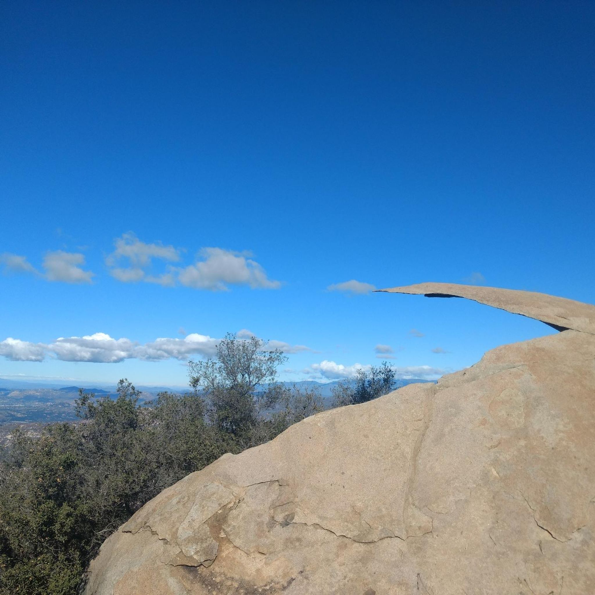
Absolutely! The region boasts several natural attractions. You might consider visiting Potato Chip Rock on Mount Woodson, or the serene Lake Ramona. For a unique sight, Cedar Creek Falls is also a notable natural monument in the area.
What do other cyclists enjoy most about road cycling in Ramona?
The road cycling routes in Ramona are highly rated by the komoot community, with an average score of 4.4 stars from over 5 reviews. Cyclists often praise the varied terrain, from moderate loops through grasslands to challenging climbs, and the scenic beauty of the rolling hills and open spaces.
Are there any easy or beginner-friendly road cycling routes in Ramona?
While many routes involve some elevation, there are options suitable for those seeking a less strenuous ride. The Ramona Grasslands loop is considered moderate and offers scenic views without overly aggressive climbs. For a generally well-paved surface, the Bernardo Lights – Duck Pond loop is also a good choice.
What are the typical weather conditions for road cycling in Ramona?
Ramona experiences a mild, Mediterranean climate. Summers are warm and dry, with average temperatures in the high 70s to low 80s Fahrenheit, making early mornings or late afternoons ideal for riding. Winters are mild, with temperatures typically in the 50s and 60s, and minimal rainfall, allowing for comfortable cycling throughout the cooler months.
Are there places to stop for refreshments or food along the routes?
Yes, the Ramona Valley is a recognized wine region with over 30 wineries, many offering scenic patios for relaxation and refreshments. While specific cafes or pubs directly on every route may vary, the town of Ramona itself and nearby communities like Poway and Rancho Bernardo provide numerous options for food and drinks.
How can I reach the road cycling routes around Ramona using public transport?
Public transport options directly to the trailheads in Ramona can be limited, as many routes are in more rural or suburban areas. It's often more convenient to drive to a starting point in Ramona or a nearby town like Poway or Rancho Bernardo, where you can park and begin your ride. For specific public transport inquiries, it's best to check local transit authority websites for routes serving San Diego County.
Most popular routes around Ramona
Most popular attractions around Ramona

Get inspired with the komoot mobile app


Explore more
Browse the best Road cycling routes in other regions.
