The best running trails around Pine Valley
126
runners
22
runs
Jogging around Pine Valley offers diverse landscapes, from the mountainous terrain of Utah with its ponderosa pine forests and streams to the Cuyamaca Mountains in California. The region features rugged ridges, open meadows, and varied elevations, providing a range of environments for running. Trails often follow natural features like rivers and canyons, with some areas offering cooler temperatures ideal for outdoor activities. The geology includes ancient volcanic formations and granite rock faces, contributing to the scenic backdrop for running routes.
…Last updated: June 29, 2026
14
runners
Hard run. Very good fitness required. Mostly accessible paths. Some sure footedness required.
12
runners
12.7km
01:34
140m
140m
Moderate run. Good fitness required. Mostly paved surfaces. Suitable for all skill levels.

Sign up for free
12
runners
12.6km
01:33
140m
140m
Moderate run. Good fitness required. Mostly paved surfaces. Suitable for all skill levels.
12
runners
6.64km
00:53
190m
190m
Moderate run. Good fitness required. Mostly paved surfaces. Suitable for all skill levels.
12
runners
14.8km
01:53
320m
320m
Hard run. Very good fitness required. Mostly accessible paths. Some sure footedness required.
Get access to more routes and recommendations from other explorers.
Sign up for free
Already have an account?
Our route recommendations are based on thousands of hikes, rides, and runs completed by other people on komoot.
Start today with a free account
Your next adventure awaits.
Login or Signup
Tips from the Community

A quiet pull-off spot just off the highway, surrounded by tall pines and cooler air. The pond itself is small but scenic—a nice excuse to stop, stretch your legs, and enjoy a quick breather before continuing the climb. Not much traffic back here, so it feels like a peaceful break from the road.
0
0

This junction connects Noble Canyon Trail and Indian Creek Trail. It is a good marker for longer hikes moving east to Laguna Meadows or Mount Laguna, or moving north towards Pine Mountain.
0
0
This is a varied and interesting trail that runs through oak and pine forests, and connects to the Laguna Meadow, offering a nice view looking north. It is single track trail and is popular with mountain bikers, so stay aware of bikes on the trail.
0
0
Noble Canyon Trail is a great endurance hike running from Pine Valley through the Cleveland National Forest. It runs through desert landscape, canyon views with a creek and groves, and ends at the Pacific Crest Trail. It is also a popular trail for mountain biking, so keep your ears open for bike bells on the trail.
0
0
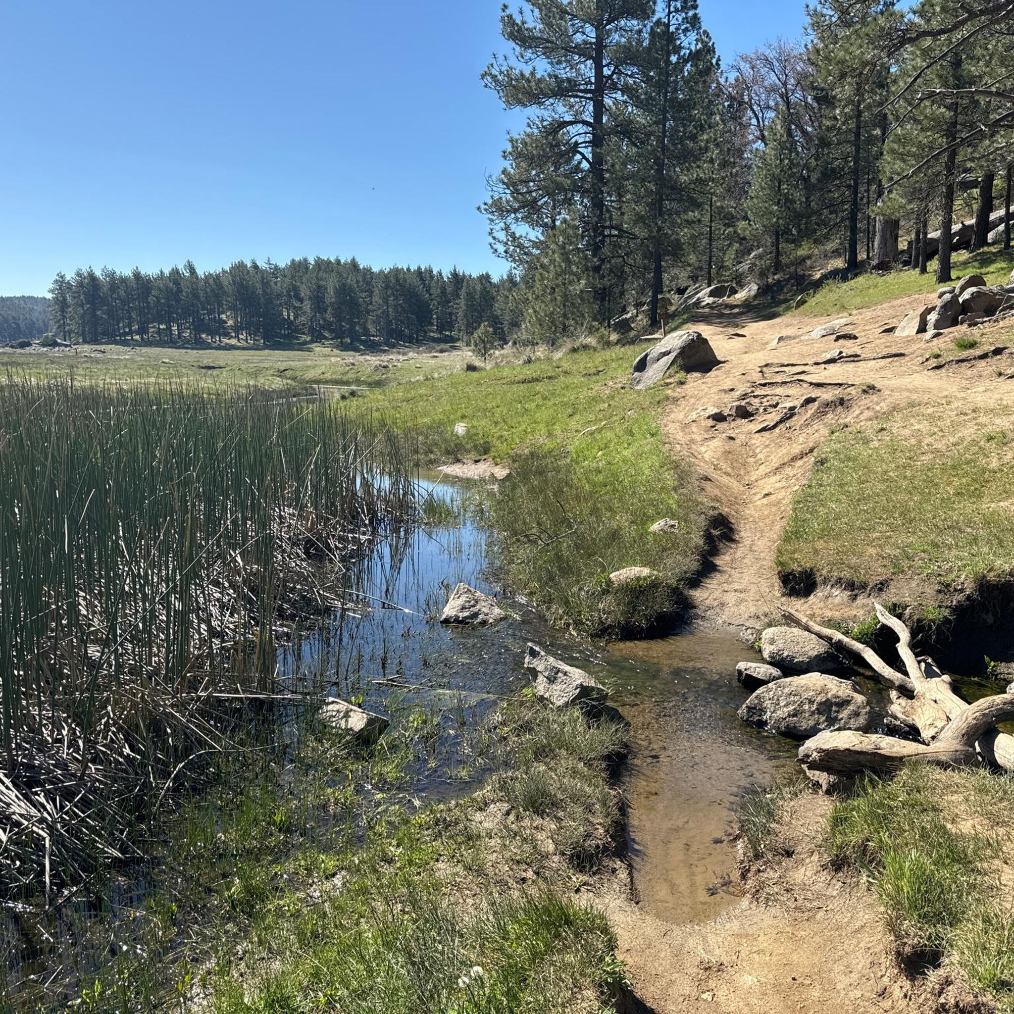
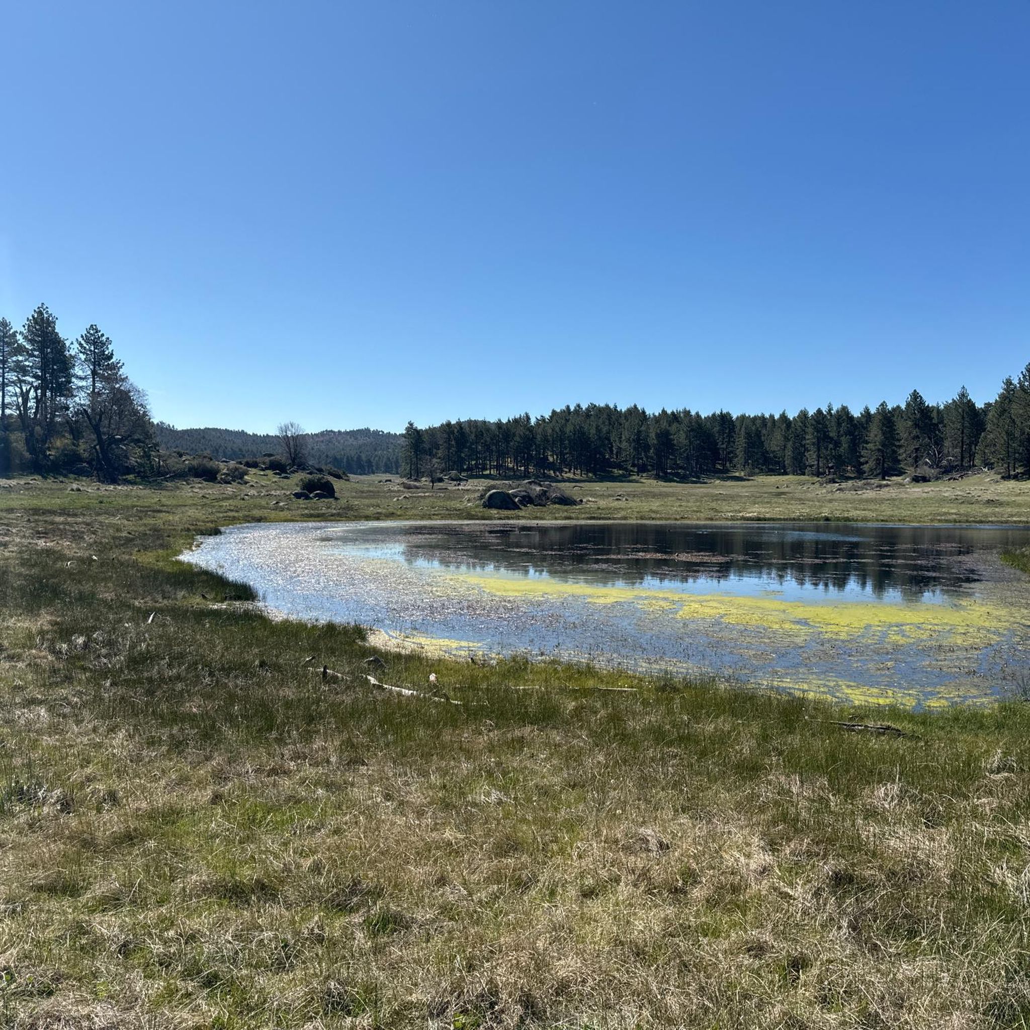
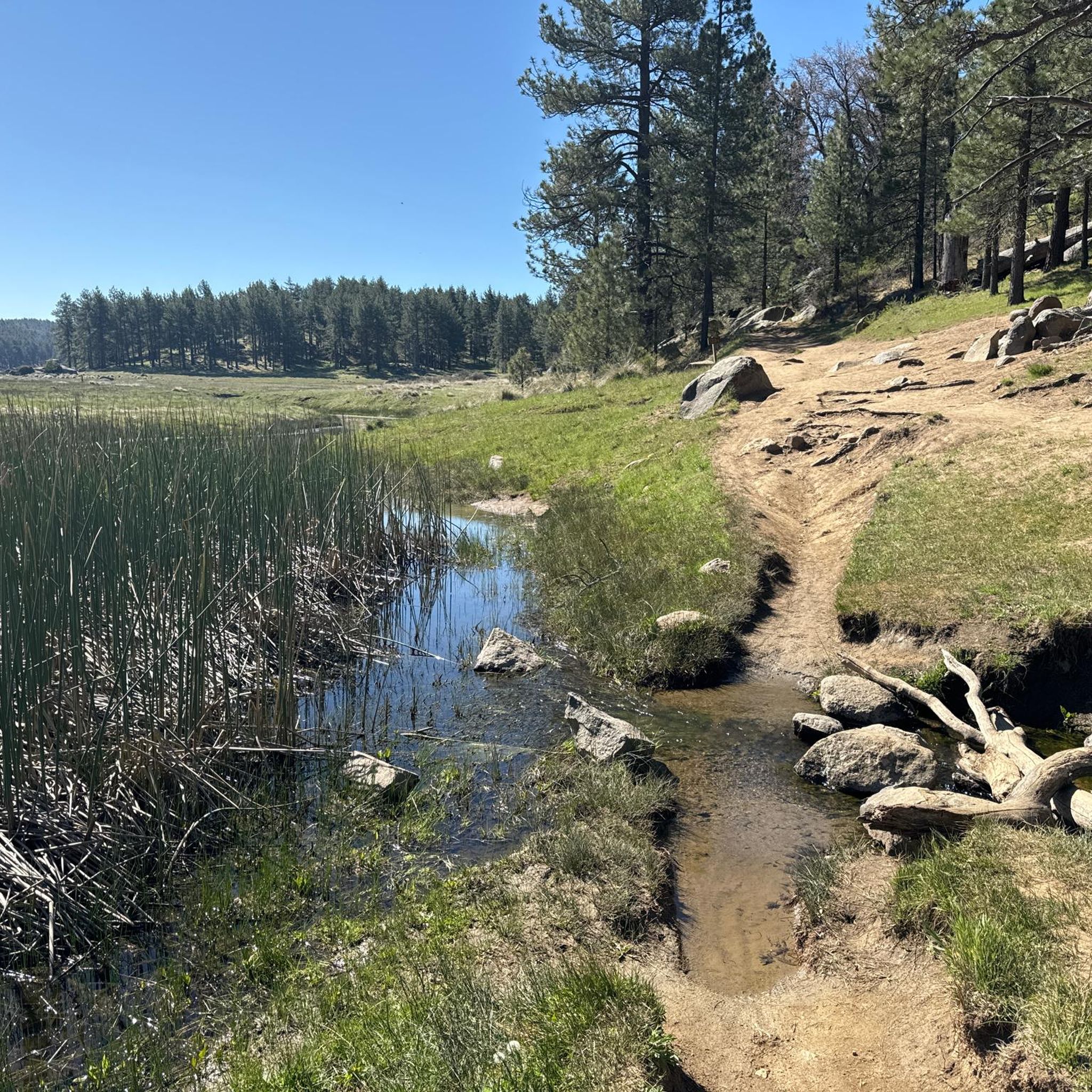
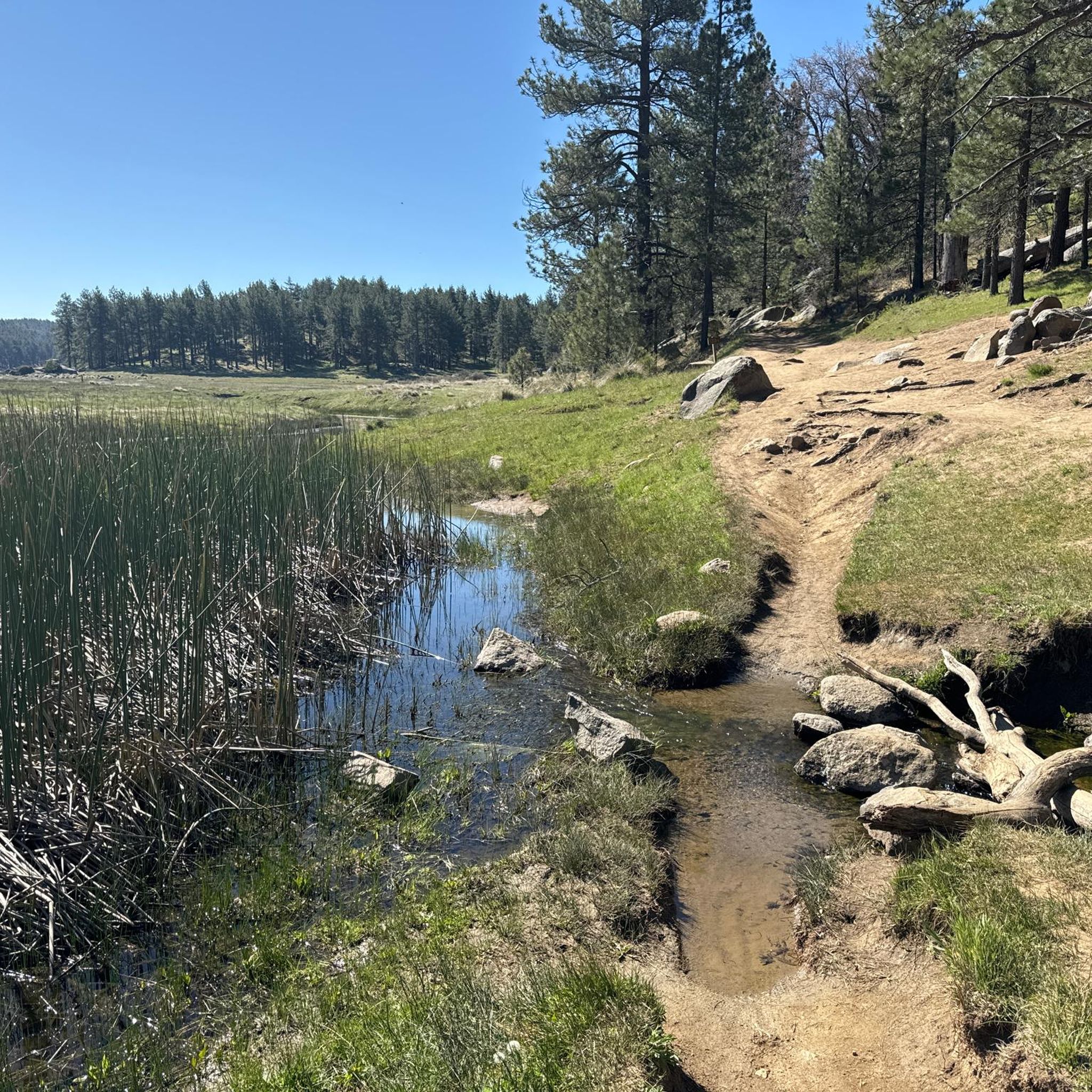
This small seasonal pond in the Laguna Meadows is quite pretty, especially in the spring and early summer. It sits at the junction between Sunset Trail and Kemp Spur Trail, making it a good spot to pause and either continue your hike through the meadows or loop around to another trail.
0
0
Big Laguna Lake sits in the middle of the Laguna Meadows. It is a beautiful sight along the trail, surrounded by pine trees and with a view of the Laguna Mountains in the distance.
0
0
Foster Point offers a great view out over Anza-Borrego and some surrounding peaks. It's a fairly quick summit, compared to some other nearby peaks, so some like to include it in a longer hike. On its own, summiting Forster Point is also a great option to have a kid or dog friendly summit with awesome views.
0
0
This smaller lake in the Laguna Meadows near the campground usually fills after snow melt and heavier rain. Aside from that it is dry for most of the year, though, so don't be surprised if you don't see a lake where you see it on the map! If you catch it full, it is a very pretty sight along the meadows. But even when dry, you can see some cool rock formations here.
0
0
Frequently Asked Questions
How many running routes are available in Pine Valley?
Pine Valley offers a diverse selection of over 20 running routes, catering to various skill levels. You'll find everything from easy paths to challenging long-distance trails.
Are there easy jogging routes suitable for beginners in Pine Valley?
Yes, Pine Valley has options for beginners. For instance, the Water of the Woods – Water of the Woods Trail loop from Little Laguna Lake is a moderate 7.9-mile trail that takes about 1 hour 34 minutes to complete, offering a pleasant experience through forested areas. In Pine Valley, Utah, the Santa Clara River Trail is a 4.2-mile paved path suitable for easy jogs.
What are some longer, more challenging running trails in the Pine Valley area?
For those seeking a challenge, the Desert View Picnic Area – Storm Canyon Overlook loop from Mount Laguna Observatory is a demanding 26.5-mile route that typically takes over 5 hours to complete, offering expansive views. Another difficult option is the Noble Canyon Trail – Noble Canyon Trail loop from Pine Valley, a 9.2-mile path with varied terrain.
Can I find circular running routes in Pine Valley?
Absolutely. Many of the running routes in Pine Valley are designed as loops, allowing you to start and finish at the same point. Examples include the Meadow Spur Trail – Water of the Woods loop from Meadows Trailhead, a 7.8-mile moderate route, and the longer Water of the Woods – Meadow Spur Trail loop from Little Laguna Lake, which spans 12 miles.
What kind of scenery can I expect on the running trails in Pine Valley?
The running trails in Pine Valley offer diverse and stunning scenery. In Utah, you'll find mountainous landscapes with dense ponderosa pine forests, open meadows, and sparkling streams, often with views stretching from the Grand Canyon to Nevada. In California, routes traverse the Cuyamaca Mountains, featuring pine trees and overlooks like the Storm Canyon Overlook.
Are there opportunities for wildlife spotting while jogging in Pine Valley?
Yes, especially in Pine Valley, Utah. The region is home to diverse wildlife, and you might spot mule deer, bald eagles, bluebirds, and occasionally even elk while out on the trails. The dense forests and open meadows provide excellent habitats for these animals.
What are some notable landmarks or points of interest near the running trails?
Near the running trails, you can discover several points of interest. The Storm Canyon Overlook offers expansive views, and Kwaaymii Point is another scenic viewpoint. You might also encounter the Water of the Woods Trail itself, which is a highlight for many runners, or the Beautiful pine forest.
Is Pine Valley suitable for winter running?
Pine Valley, California, experiences occasional snow in winter, particularly between November and March, which could make some trails challenging. Pine Valley, Utah, offers cooler temperatures than the surrounding desert, but higher elevations can also see significant snow. It's advisable to check local weather and trail conditions before planning winter runs.
Are there dog-friendly running routes in Pine Valley?
While specific dog-friendly regulations vary by trail and park, many outdoor areas in Pine Valley are generally welcoming to dogs, often requiring them to be on a leash. For example, Pine Valley County Park in California offers open grassy areas for walks. Always check local signage or park websites for the most current pet policies before heading out with your dog.
What are the parking options for accessing running trails in Pine Valley?
Parking availability varies by trailhead. Many popular trailheads, such as Boulder Oaks Campground & Trailhead and Penny Pines Trailhead, offer dedicated parking facilities. For routes starting from specific locations like Mount Laguna Observatory or Little Laguna Lake, you'll typically find parking nearby.
How long do the running trails in Pine Valley typically take to complete?
The duration of running trails in Pine Valley varies significantly based on distance and difficulty. Easy routes might take less than an hour, while moderate trails like the 7.9-mile Water of the Woods – Water of the Woods Trail loop from Little Laguna Lake can take around 1 hour 34 minutes. More challenging routes, such as the 26.5-mile Desert View Picnic Area – Storm Canyon Overlook loop from Mount Laguna Observatory, can require over 5 hours.
What do other runners say about the trails in Pine Valley?
The trails in Pine Valley are highly regarded by the komoot community, with over 131 runners having explored the varied terrain. Users often praise the diverse landscapes, from mountainous regions with dense pine forests to scenic river paths, and appreciate the range of options available for different ability levels.
Are there any running routes that pass by water features like rivers or lakes?
Yes, Pine Valley offers routes with beautiful water features. In Pine Valley, Utah, the Santa Clara River runs through parts of the wilderness, and the Pine Valley Reservoir is a notable spot. In Colorado, Pine Valley Ranch Park features trails along the North Fork of the South Platte River, such as the Narrow Gauge and North Fork View Loop.
Most popular routes around Pine Valley
Most popular attractions around Pine Valley

Get inspired with the komoot mobile app


Explore more
Browse the best Running Trails & Routes in other regions.
