The best cycling routes around Norris Canyon
4.6
(59)
1,283
riders
82
rides
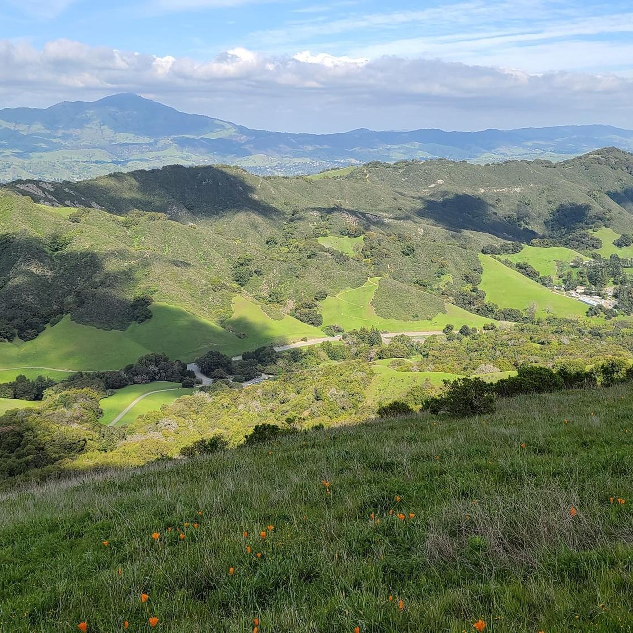
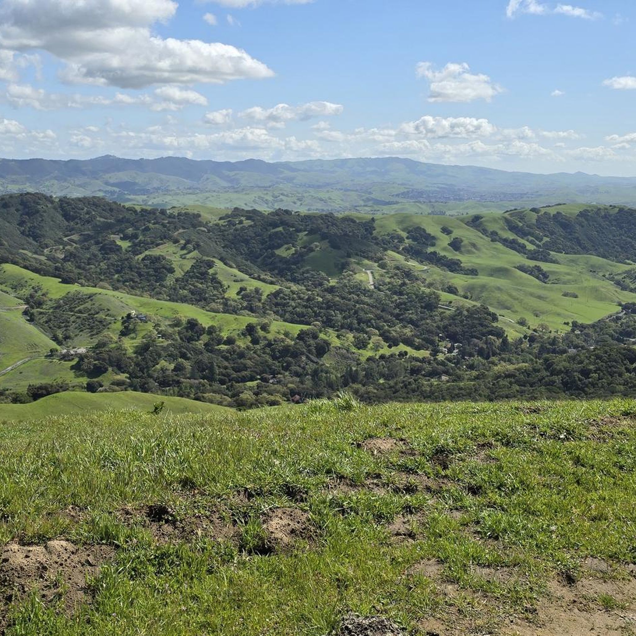
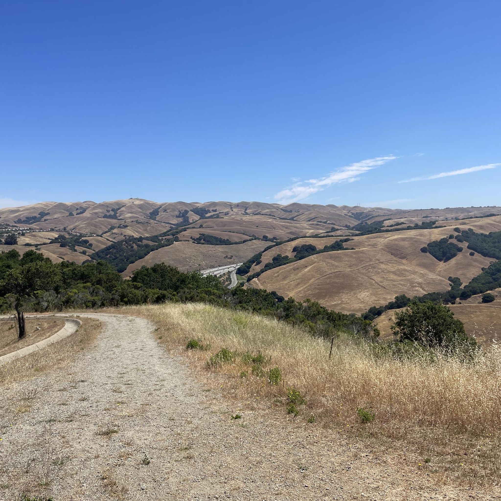
Touring cycling around Norris Canyon, located in Contra Costa County, California, offers a diverse landscape characterized by canyons and rolling hills. The region provides varied terrain, from challenging climbs with sections exceeding a 13% grade to more gentle, flat sections, catering to different fitness levels. It acts as a gateway to extensive trail systems, including the 32-mile Iron Horse Trail, and features scenic, secluded roads that follow waterways like Norris Creek. Several routes also offer views of Mount Diablo.
Best…
Last updated: July 1, 2026
4.0
(1)
15
riders
50.1km
02:54
210m
210m
Embark on the Iron Horse Trail and Pleasanton Ridge Loop, a moderate touring cycling route that spans 31.1 miles (50.1 km) with an elevation gain of 686 feet (209 metres),…
9
riders
47.4km
02:50
320m
320m
Cycle the moderate 29.4-mile Dougherty Hills loop in San Ramon, featuring rolling hills, Mount Diablo views, and mixed terrain.

Sign up for free
5.0
(2)
119
riders
61.2km
04:27
1,300m
1,300m
Hard bike ride. Very good fitness required. Mostly paved surfaces. Suitable for all skill levels.
4.8
(9)
60
riders
Moderate bike ride. Good fitness required. Mostly paved surfaces. Suitable for all skill levels.
19
riders
18.9km
01:05
40m
40m
Easy bike ride. Great for any fitness level. Mostly paved surfaces. Suitable for all skill levels.
Get access to more routes and recommendations from other explorers.
Sign up for free
Already have an account?
Our route recommendations are based on thousands of hikes, rides, and runs completed by other people on komoot.
Start today with a free account
Your next adventure awaits.
Login or Signup

Tips from the Community

Mount Diablo, is the Bay Area second-highest peak at 1173m (3849ft). The challenging climb features constantly fluctuating gradients averaging 8%, with tough sections up to 18% and a brutal 23% finish in the last 200m. The equally demanding descent requires good bike handling due to tight corners, potholes, and strong winds. The road to the top is open daily from 8 AM till sunset.
0
0

The Museum of the San Ramon Valley was established in 1985 and sits in a restored 1891 Southern Pacific Railroad Depot with the Victorian-era “Combination Station No. 22” listed on the National Register of Historic Places. The Official Visitor Information Center offers maps, guides, and knowledgeable staff, along with free parking and restrooms located in the caboose.
1
0

The Pleasant Hill/Contra Costa Center BART Station features the first bike station in Contra Costa County, equipped with 215 bike racks, a retail shop for bicycle accessories, and maintenance services. It is a go-to spot for exploring the area by bike without the hassle of vehicle parking in the city.
0
0

The Iron Horse Trail is a 32-mile multi-path that connects the towns of Concord and Pleasanton. It follows the route of the abandoned Southern Pacific Railroad. With its access to schools, business centers, and parks, the path is popular with commuters and recreationalists.
1
0
This rest area is a popular stop and gathering place, with plenty of benches and a few shaded spots. It features a water fountain, bike racks, and several restaurants within easy walking distance.
1
0

Pleasant ride along the canal. Beautiful white birds are seen occasionally.
0
0
The Iron Horse Trail, open from 5 a.m. to 10 p.m., stretches 32 miles between Concord and Pleasanton, following the former Southern Pacific Railroad. The latest segment, connecting Pleasanton/Dublin BART to Santa Rita Road, opened in 2014 after nearly 30 years of planning. This multi-use trail links residential areas, schools, parks, and public transportation, providing a trail to the local community. This paved trail crosses roads but is a safe way of getting around away from traffic.
0
0

Frequently Asked Questions
How many touring cycling routes are available in Norris Canyon?
Norris Canyon offers a wide selection of touring cycling routes, with over 90 different options recorded on komoot. These routes cater to various skill levels, including 24 easy, 42 moderate, and 25 difficult trails.
What kind of terrain can I expect on touring cycling routes in Norris Canyon?
The region is characterized by diverse terrain, featuring canyons and rolling hills. You'll find everything from challenging climbs, with some sections exceeding a 13% grade, to more gentle, flat stretches. Routes often wind through pretty valleys, follow waterways like Norris Creek, and offer transitions from wooded areas to sunny, grassy landscapes.
Are there any easy touring cycling routes suitable for beginners in Norris Canyon?
Yes, Norris Canyon has several easy touring cycling routes. For instance, the Coyote Creek bridge – Iron Horse Trail loop from San Ramon is an easy option, covering about 14.4 miles (23.1 km) with minimal elevation gain, making it great for a relaxed ride.
Are there any circular touring cycling routes in Norris Canyon?
Many routes in Norris Canyon are designed as loops, offering varied scenery without retracing your steps. An example is the Dougherty Hills loop, which is a moderate 29.4-mile (47.4 km) path featuring rolling hills and picturesque views.
What are some notable landmarks or attractions I can see while cycling in Norris Canyon?
While cycling, you can enjoy views of Mount Diablo from several routes. The area is also close to expansive natural areas like Pleasanton Ridge Regional Park and Anthony Chabot Regional Park. Specific highlights include the Iron Horse Trail itself, Lake Chabot Marina, and the Museum of the San Ramon Valley. You might also spot various peaks such as Las Trampas Ridge.
Is Norris Canyon suitable for family-friendly touring cycling?
Yes, the region offers routes suitable for families. The extensive Iron Horse Trail, a 32-mile paved multi-use trail, is easily accessible and provides a safe, traffic-separated option connecting residential areas, schools, and parks, ideal for family rides. Look for routes categorized as 'easy' for the most family-friendly experiences.
What is the best time of year to go touring cycling in Norris Canyon?
Norris Canyon offers good cycling conditions for much of the year. However, spring and fall generally provide the most pleasant weather with moderate temperatures. Summers can be warm, and it's advisable to check for wildfire season alerts, as this can impact trail access. Winters are typically mild but can bring rain.
Are dogs allowed on touring cycling trails in Norris Canyon?
Dog policies vary across different trails and regional parks in Contra Costa County and the East Bay Regional Park District. While some trails may permit dogs on leash, it's crucial to check specific regulations for each park or trail you plan to visit. For instance, the Iron Horse Trail generally allows dogs on leash.
Where can I find parking for touring cycling routes in Norris Canyon?
Parking is available at various access points for trails and regional parks around Norris Canyon and San Ramon. Specific parking areas are often designated near trailheads or within regional parks like Pleasanton Ridge Regional Park or Anthony Chabot Regional Park. It's recommended to check the starting point of your chosen route for the most convenient parking options.
Are there any cafes or pubs near the touring cycling routes in Norris Canyon?
While Norris Canyon Road itself is known for its secluded nature, you can find cafes, pubs, and other amenities in nearby towns like San Ramon. Many routes connect to or pass through areas where you can easily access refreshments and dining options, especially along the Iron Horse Trail which links residential areas.
How can I reach Norris Canyon touring cycling routes using public transport?
The Iron Horse Trail, a major cycling artery in the region, is well-connected to public transportation. This 32-mile paved trail provides access from various points, making it feasible to reach some touring cycling routes via public transport. Check local bus or BART schedules for connections to towns like San Ramon or Pleasanton, which offer access to the trail network.
What makes touring cycling in Norris Canyon unique?
Norris Canyon stands out for its blend of challenging climbs and serene, secluded roads, offering a sense of escape amidst natural beauty. The area provides access to extensive trail systems like the Iron Horse Trail, connecting diverse landscapes from canyons and rolling hills to picturesque valleys with views of Mount Diablo. The variety caters to all fitness levels, from easy paved paths to demanding routes with significant elevation gain.
Most popular attractions around Norris Canyon

Get inspired with the komoot mobile app


Explore more
Browse the best Cycling routes in other regions.
