The best running trails around Los Olivos
97
runners
6
runs
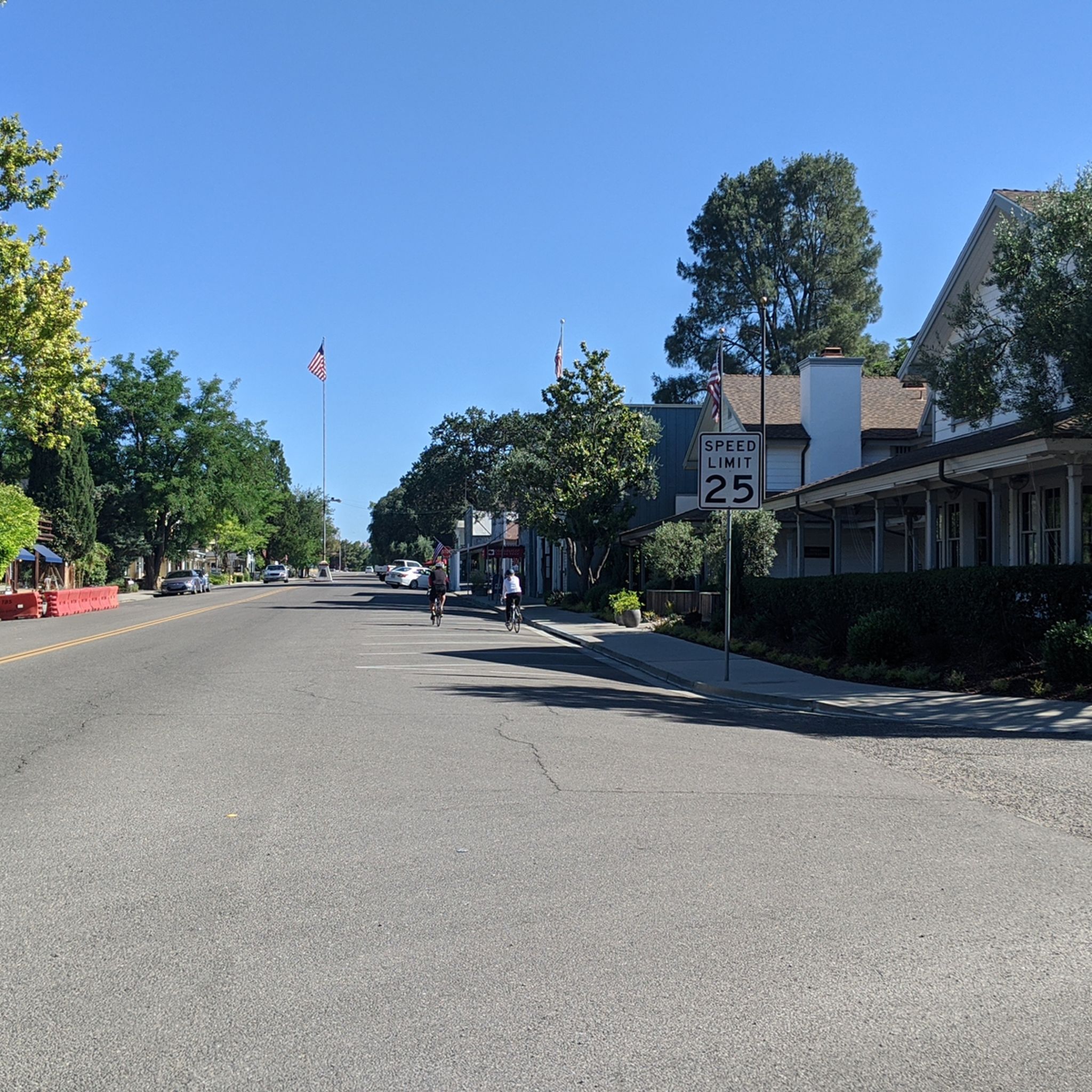
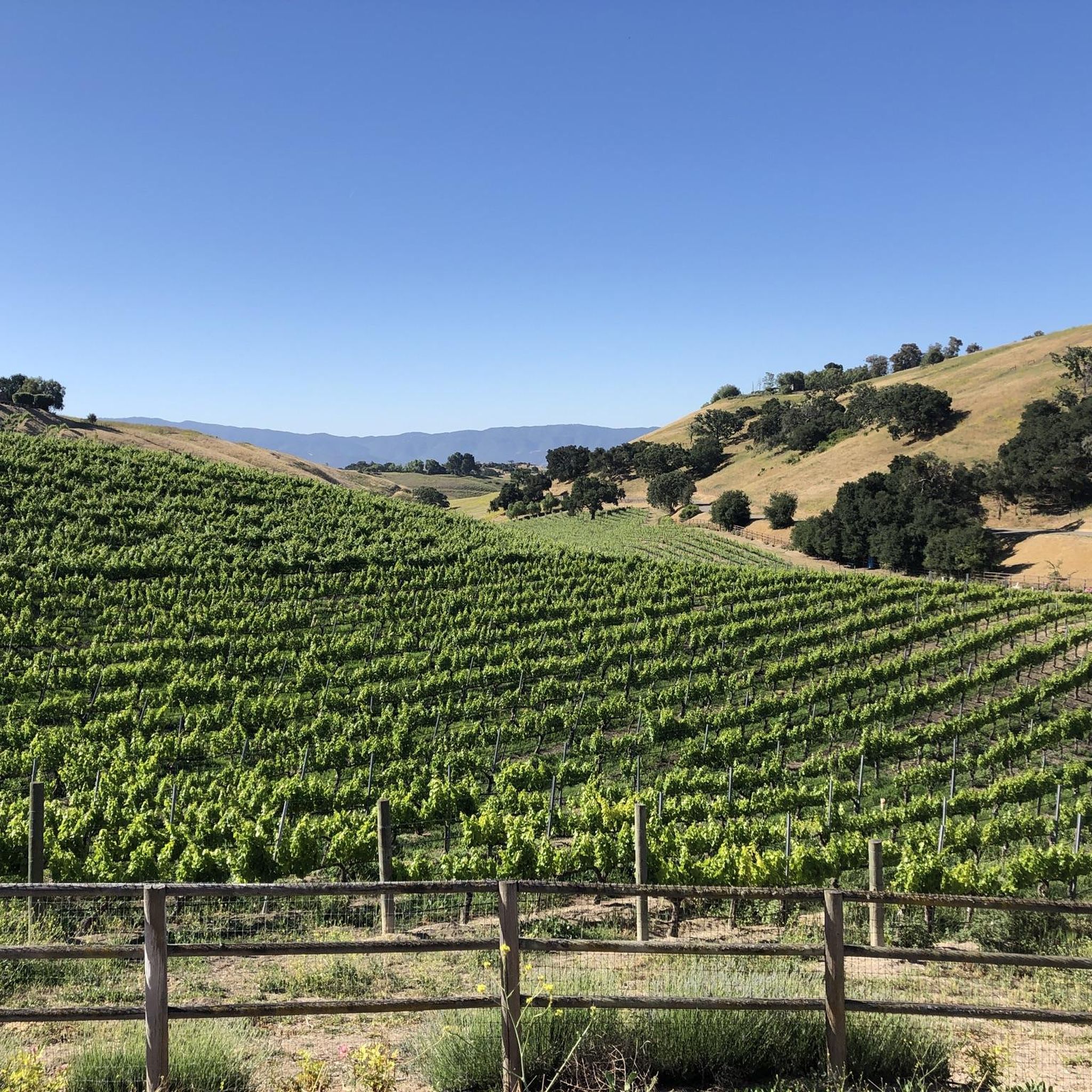
Jogging around Los Olivos offers a diverse range of experiences within the picturesque Santa Ynez Valley. The region is characterized by expansive rolling vineyards and oak-dotted hillsides, providing a scenic backdrop for outdoor activities. Its gently sloping terrain and moderate climate are conducive to year-round running, with options ranging from paved paths to more challenging routes with elevation gains.
Best jogging routes around Los Olivos
- The most popular jogging route is Hans Christian Andersen Park running loop, a 2.2…
Last updated: August 20, 2026
1
runners
3.51km
00:22
30m
30m
Easy run. Great for any fitness level. Mostly paved surfaces. Suitable for all skill levels.
46
runners
20.5km
02:10
230m
230m
Hard run. Very good fitness required. Mostly paved surfaces. Suitable for all skill levels.

Sign up for free
42
runners
21.7km
02:16
200m
200m
Hard run. Very good fitness required. Mostly paved surfaces. Suitable for all skill levels.
4
runners
15.3km
01:37
130m
130m
Hard run. Very good fitness required. Mostly paved surfaces. Suitable for all skill levels.
3
runners
3.36km
00:21
20m
20m
Easy run. Great for any fitness level. Mostly paved surfaces. Suitable for all skill levels.
Our route recommendations are based on thousands of hikes, rides, and runs completed by other people on komoot.
Start today with a free account
Your next adventure awaits.
Login or Signup
Popular around Los Olivos

Tips from the Community

We stop in Solvang and immediately feel like we are in Denmark, as the picturesque town is full of Danish culture, delicious cuisine and scenic scenery. Solvang, California (population 5,286) is nestled in the Santa Ynez Valley wine region on California's central coast. The town's name means "sunny fields" in Danish. Solvang was founded in 1911 when a group of Danish Americans bought 9,000 acres of the former Jonata Ranch. To preserve and promote Danish culture, the founders built Atterdag College in 1914 and Bethania Lutheran Church in 1928.
3
0
We stop in Solvang and immediately feel like we are in Denmark, as the picturesque town is full of Danish culture, delicious cuisine and scenic scenery. Solvang, California (population 5,286) is nestled in the Santa Ynez Valley wine region on California's central coast. The town's name means "sunny fields" in Danish. Solvang was founded in 1911 when a group of Danish Americans bought 9,000 acres of the former Jonata Ranch. To preserve and promote Danish culture, the founders built Atterdag College in 1914 and Bethania Lutheran Church in 1928.
3
0

This lovely park is filled with large oak trees and a network of trails. It's in close reach to the centre of town, so easily accessible. You'll find grassy shaded areas perfect for additional exercise, along with picnic benches providing comfortable resting spots.
1
0

I was born in Solvang and it is a wonderful tourist destination. Make sure to venture outside of town to go wine tasting and climb Figueroa Mountain!
2
0

The Dan Henry Bike Route connects Solvang with Los Olivos. It starts on Alamo Pintado Rd at the Eastern end of the "historic" Solvang downtown. After 2/3 you make a couple of quick turns (just follow the signs for the Dan Henry Bike Route) into Grand Ave which leads you into down town Los Olivos. In case you wondered, Dan Henry is "a bicycling legend and inventor of directional pavement markings commonly used to guide participants along the route of organized bicycling events. The markers themselves are usually called 'Dan Henrys'". The Dan Henry Bike Route is part of the Solvang Century. It connects the Lompoc-to-Solvang leg via Santa Rosa Rd and Hwy 246 on the one side and Foxen Canyon Rd on the other. Alternatively you can take Figueroa Mountain Rd for a nice climb. The road is the continuation of Grand Ave beyond Hwy 154. http://cyclingcalifornia.me.ht/CyclingCalifornia/Solvang/DanHenryBikeRoute/Desc.html
2
0
Wooden sculptures of the founders of the 1911 kitsch Danish tourist town.
2
0
Frequently Asked Questions
What kind of terrain can I expect on running routes around Los Olivos?
Jogging routes in Los Olivos primarily feature picturesque rolling vineyards and oak-dotted hillsides, characteristic of the Santa Ynez Valley. You'll find a mix of surfaces, from mostly paved paths suitable for easier runs to more challenging routes with significant elevation gains through the natural landscape.
Are there any easy running routes suitable for beginners or a relaxed jog?
Yes, Los Olivos offers several easy running options. A popular choice is the Hans Christian Andersen Park running loop, which is about 2.2 miles (3.5 km) and takes around 22 minutes to complete. Another convenient and easy path is the Running loop from Los Olivos, spanning 2.1 miles (3.4 km).
What are some challenging running trails for experienced runners in the area?
For those seeking a more strenuous run, the region provides several difficult routes. The Hans Christian Andersen Park loop from Ballard is a challenging 12.7 miles (20.5 km) trail that takes you through the wider Santa Ynez Valley. Another demanding option is the Hans Christian Andersen Park loop from Solvang, covering 13.3 miles (21.4 km) with notable elevation changes.
Can I find circular running routes around Los Olivos?
Absolutely. Many of the running routes in Los Olivos are designed as loops, offering a convenient way to start and finish in the same location. Examples include the Hans Christian Andersen Park running loop and the Running loop from Los Olivos, both providing excellent circular experiences.
What kind of scenic views can I expect while running in Los Olivos?
Runners in Los Olivos are treated to breathtaking scenery dominated by expansive rolling vineyards and picturesque oak-dotted hillsides. The routes often provide 'open space scenery' and glimpses of the charming 'old west charm' of the town, especially within the beautiful Santa Ynez Valley.
Are there any interesting landmarks or attractions near the running routes?
Yes, the area around Los Olivos offers several points of interest. You might pass through or near the charming town of Solvang, known for its Danish-inspired architecture. Other nearby attractions include Hamlet Square & Copenhagen House, and the scenic Santa Rosa Road, which offers beautiful views of the wine country.
What is the best time of year to go running in Los Olivos?
Los Olivos benefits from a moderate climate with warm days, occasional morning fog, and cool nights, making it conducive to year-round outdoor activities. Spring is particularly beautiful when Figueroa Mountain, a nearby natural feature, is renowned for its blooming wildflowers, adding extra splendor to the scenery.
Are there running routes with significant elevation changes for hill training?
Yes, for runners looking to incorporate hill training, Los Olivos has routes with notable elevation gains. For instance, the Hans Christian Andersen Park – Solvang loop from Buellton, while difficult, includes over 127 meters of ascent, providing a good challenge for elevation training.
Is it possible to find parking near the running trails in Los Olivos?
While specific parking details for every trailhead are not always listed, Los Olivos is a walkable village, and many routes, especially those starting from parks or the town center, typically have accessible parking options nearby. It's advisable to check local signage or park information for specific starting points.
What do other runners think about the jogging routes in Los Olivos?
The running routes around Los Olivos are well-regarded by the komoot community. Over 80 runners have explored the varied terrain, often praising the picturesque vineyards, oak-dotted hillsides, and the overall scenic beauty of the Santa Ynez Valley that defines the jogging experience here.
Are there any family-friendly running routes in Los Olivos?
For families or those looking for a gentler pace, the easier, mostly paved routes are ideal. The Hans Christian Andersen Park running loop is a great option, offering a pleasant and manageable distance through a local park environment.
Can I bring my dog on the running trails in Los Olivos?
While specific dog policies vary by trail and local regulations, many outdoor areas in the Santa Ynez Valley are generally dog-friendly, especially on leash. It's always best to check the specific rules for each park or trail you plan to visit to ensure a pleasant experience for both you and your canine companion.
Most popular routes around Los Olivos
Most popular attractions around Los Olivos

Get inspired with the komoot mobile app


Explore more
Browse the best Running Trails & Routes in other regions.
