Attractions and Places To See around Elizabeth Lake - Top 20
Best attractions and places to see around Elizabeth Lake include natural features, historical sites, and outdoor activities. Situated in the Sierra Pelona Mountains within the Angeles National Forest, Elizabeth Lake is a natural sag pond directly on the San Andreas Fault. The area offers opportunities for hiking, nature trips, and exploring significant historical routes and engineering marvels. Its unique geology and historical context make it a point of interest for visitors.
Best attractions and places to see around Elizabeth Lake
…Last updated: July 6, 2026
Lake Hughes Rd - PCT Trailhead & water cache
Highlight • Trail
Tip by

Pacific Crest Trail Trailhead – San Francisquito Canyon Road
Highlight • Trail
Tip by

Sign up now to discover places like this
Get recommendations on the best single tracks, peaks, & plenty of other exciting outdoor places.
Sign up for free
PCT Trailhead at Bouquet Canyon Rd
Highlight • Trail
Tip by
Top of the switchbacks and canyon down to Lake Hughes Road
Highlight • Canyon
Tip by
San Francisquito Canyon Road
Highlight (Segment) • Trail
Tip by
Sign up for free to discover even more attractions around Elizabeth Lake.
Sign up for free
Already have an account?
Start today with a free account
Your next adventure awaits.
Login or Signup
Popular around Elizabeth Lake
Tips from the Community

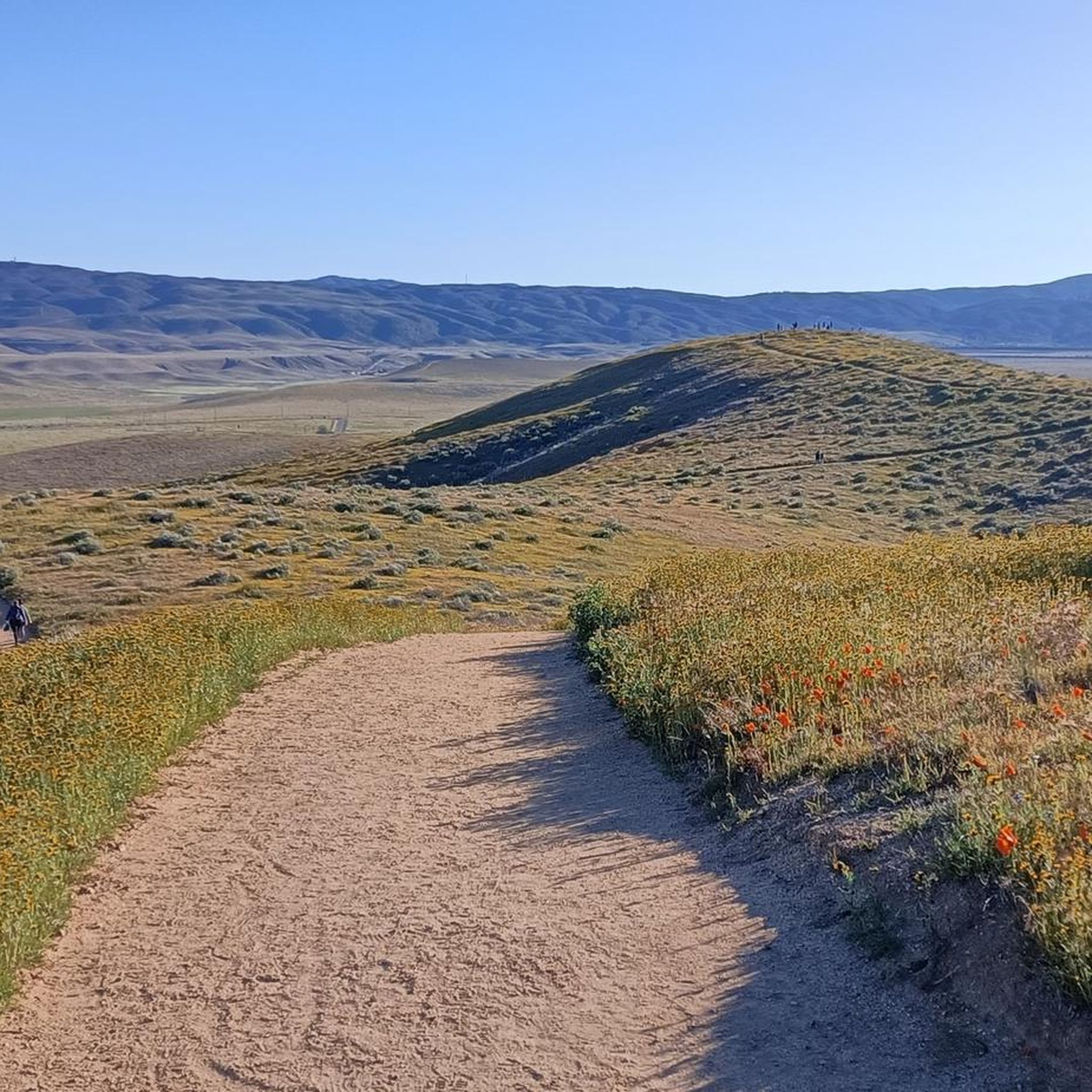
San Francisquito Canyon South via Pacific Crest Trail is a 6.5 mile return trail located near Santa Clarita, California that offers the chance to see wildlife and is rated as moderate. The trail is primarily used for hiking, walking, running, and nature trips.
0
2

As of 2022 there are picnic benches at this trailhead. One is located close to the road, the other one is 0.1 southbound in a shaded spot.
4
0

Perhaps the quickest route across the San Gabriel foothills. Extra careful about a mile west of the town long distance PCT hikers cross the road and often congregate.
1
0
This scenic road runs north-south from Saugus in Santa Clarita to Leona Valley. It is a somewhat faster route than Bouquet Canyon to the Leona Valley area. San Francisquito Canyon has been home to the Harvey Carey Trading Post and numerous horse ranches. The canyon was also a part of the original wagon road between Northern and Southern California. At the time, the summit was known as Turner’s Pass. The St Francis Dam, originally in this canyon, collapsed in 1928. Over 500 people died as a result of the ensuing flood. This stretch between Green Valley and the Pass is perhaps the most scenic section, and it passes by the crossing of the Pacific Crest Trail. Watch out for hikers crossing the road or getting picked up to run in the town for groceries to resupply.
1
0
No paved shoulder but few cars along most of this remote scenic road. Bring plenty of water, given the distances. In emergencies, there is usually water stashed at the crossing with the PCT hiking trailhead.
0
0
After meandering along both sides of a ridgeline here the PCT crosses into the eastern flank of a canyon and begins a long back-and-forth down to the road below. A seasonal stream that has cut this canyon might be parallel but it is mostly dry.
3
0
Bouquet Canyon Rd is a paved east/west connection about 10 miles after leaving Agua Dulce that has no nearby resupply option but can serve as an emergency bailout, either east to Lancaster and Palmdale, or West to Green Valley, where the nearest Post office is and helpful trail angels. From there it is easy to get back on the PCT. Phone signal is decent on the ridge if necessary. The seasonal stream mapped here was not productive even in February.
3
1
Lake Hughes is a possible resupply road, but post office or stores are far and traffic can be spotty for hitchhiking on weekdays. Still, road crossings are crucial for resupply or emergency, and Lake Hughes has some limited services, a church, and locals or campers traveling on this road that connects to the freeway, who can help. Most PCT through hikers are doing the desert southern sections of California very early in the year, when most seasonal springs still have water. In dry years or later in summer some sections can be long without water, so friends or trail angels stock drinking water in such caches. Leave it there untouched unless in an emergency.
1
0
Frequently Asked Questions
What natural features can I explore around Elizabeth Lake?
The Elizabeth Lake area is rich in natural features. You can visit Elizabeth Lake itself, a natural sag pond directly situated on the San Andreas Fault. The surrounding Angeles National Forest offers extensive opportunities for nature trips and scenic views. The San Andreas Fault line is a significant geological point of interest, and the area also features the historic San Francisquito Canyon Road, which provides access to scenic landscapes.
Are there opportunities for hiking near Elizabeth Lake?
Yes, the Elizabeth Lake area is excellent for hiking. The Pacific Crest Trail (PCT) crosses through the region, offering various access points. You can find trailheads like Lake Hughes Rd - PCT Trailhead & water cache and Pacific Crest Trail Trailhead – San Francisquito Canyon Road. For more detailed hiking options, explore the Hiking around Elizabeth Lake guide, which includes routes like Grass Mountain via San Francisquito Canyon Road and San Francisquito Canyon South via Pacific Crest Trail.
What historical sites can I visit near Elizabeth Lake?
The Elizabeth Lake area is steeped in history. You can explore the route of the historic San Francisquito Canyon Road, which was once part of the original wagon road between Northern and Southern California and is notable as the site of the 1928 St. Francis Dam collapse. Another significant historical site is the Elizabeth Lake Tunnel, a five-mile-long engineering marvel completed in 1911 as a crucial part of the Los Angeles Aqueduct project.
What is the best time of year to visit Elizabeth Lake?
The best time to visit Elizabeth Lake largely depends on your preferred activities. The area is surrounded by the Angeles National Forest, making it suitable for outdoor activities during milder weather. It's advisable to check current conditions, especially regarding the lake's water levels, as it can fluctuate and even dry up during drought years. Spring and fall generally offer pleasant temperatures for hiking and exploring.
Are there family-friendly activities available around Elizabeth Lake?
Yes, the Elizabeth Lake area offers family-friendly options. The Elizabeth Lake Day-Use Area provides picnic tables and BBQ pedestal grills, perfect for a family outing. The surrounding Angeles National Forest offers opportunities for easy nature walks and wildlife viewing, which can be enjoyable for all ages. Always check trail difficulty before embarking on a hike with children.
Is the Elizabeth Lake area dog-friendly?
Yes, the Elizabeth Lake Day-Use Area permits dogs, provided they are kept on a leash. Many trails within the Angeles National Forest are also dog-friendly, but it's always best to check specific trail regulations before you go. Remember to bring water for your pet and clean up after them.
What should I know about the water levels of Elizabeth Lake?
Elizabeth Lake is a natural sag pond whose water levels are highly dependent on rainfall. While it is a perennial lake, it can fluctuate significantly and sometimes even dry up entirely during prolonged drought periods. It's advisable to check current conditions before planning a visit if seeing the lake full is a priority for you.
What kind of outdoor activities are available around Elizabeth Lake besides hiking?
Beyond hiking, the Elizabeth Lake area offers opportunities for road cycling. You can find various routes, such as the Lake Elizabeth Loop or the San Francisquito Canyon Road – Spunky Canyon loop from Santa Clarita. For detailed cycling routes, refer to the Road Cycling Routes around Elizabeth Lake guide.
Where can I access the Pacific Crest Trail near Elizabeth Lake?
You can access the Pacific Crest Trail (PCT) from several points in the Elizabeth Lake area. Notable trailheads include Lake Hughes Rd - PCT Trailhead & water cache, which offers picnic benches and serves as a crucial road crossing for hikers. Another access point is the Pacific Crest Trail Trailhead – San Francisquito Canyon Road, which provides access for hiking, walking, running, and nature trips.
Are there any local legends associated with Elizabeth Lake?
Yes, Elizabeth Lake has a fascinating local legend. It was originally named "La Laguna de Diablo" (Devil's Lake) by Spanish explorer-priest Junípero Serra in 1780 due to local tales of a creature residing in its waters. These legends gave rise to stories of the "Elizabeth Lake Monster," though no sightings have been reported since the late 1800s, adding a unique cultural flavor to the area.
What is the significance of the San Andreas Fault in the Elizabeth Lake area?
Elizabeth Lake is directly situated on the San Andreas Fault, making it a significant geological point of interest. The lake itself is a natural sag pond formed by the fault line, alongside nearby Hughes Lake and Munz Lakes. This direct location offers a unique opportunity to observe the geological impact of this famous tectonic plate boundary.
What do visitors particularly enjoy about the Pacific Crest Trail access points near Elizabeth Lake?
Visitors appreciate the accessibility and amenities at the PCT access points. For instance, the Lake Hughes Rd - PCT Trailhead & water cache is valued for its picnic benches and its role as a crucial resupply or emergency point for long-distance hikers. The Pacific Crest Trail Trailhead – San Francisquito Canyon Road is noted for offering a chance to see wildlife and for its connection to Green Valley for potential resupply.
Most popular routes around Elizabeth Lake

Get inspired with the komoot mobile app


Explore more
Still not found the Highlight you’re looking for? See guides of the top attractions in other regions:
