The best cycling routes around Diamond Springs
4.7
(4)
70
riders
9
rides
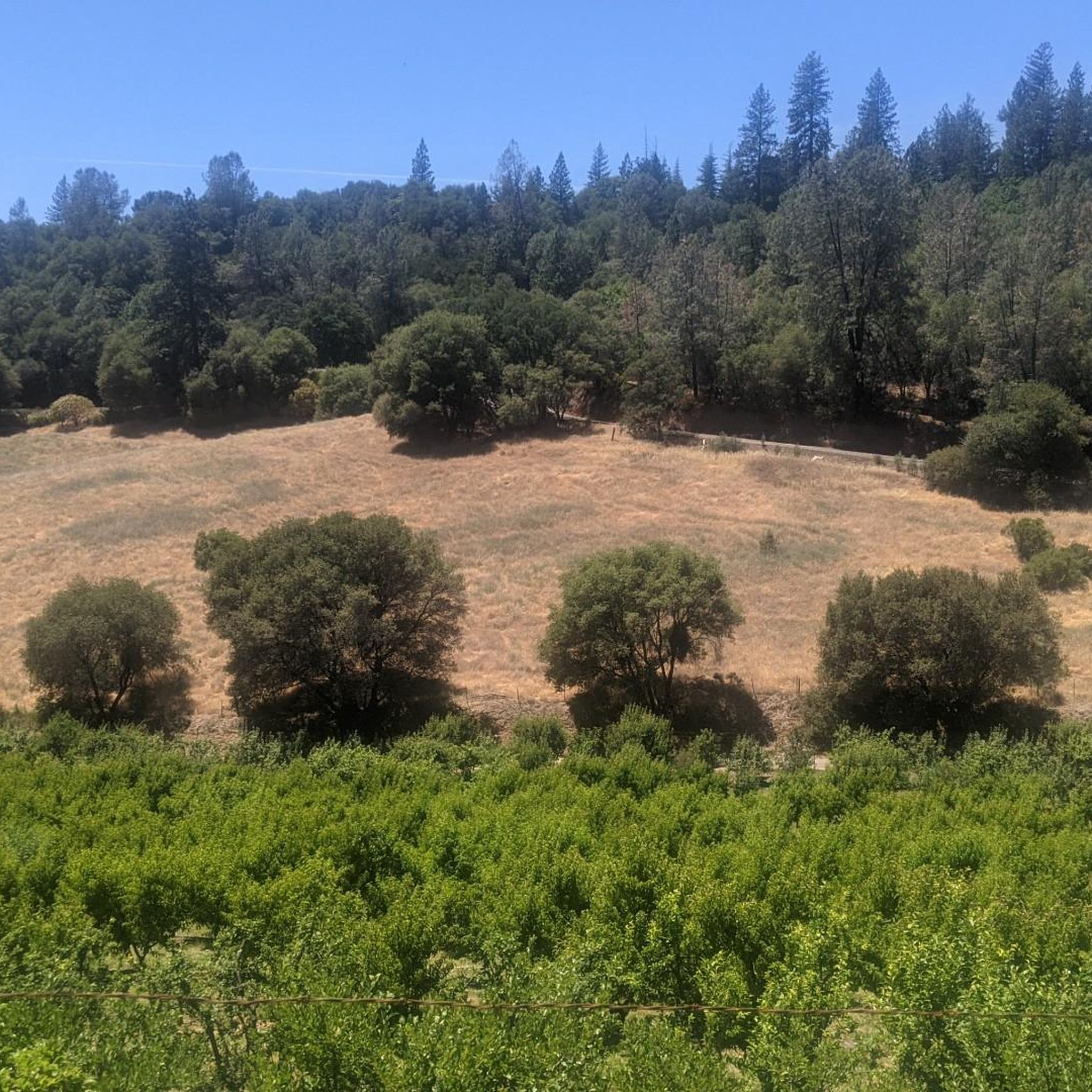
Touring cycling routes around Diamond Springs offer a diverse landscape at the base of the Sierra Nevada mountains. The region features oak-dotted landscapes and rolling hills, providing varied terrain for cyclists. The El Dorado Trail, a key feature, includes both paved and unpaved sections, winding through historic "Gold Rush country." Crystal-clear springs are also characteristic of the area's natural beauty.
Best touring cycling routes around Diamond Springs
- The most popular touring cycling route is El Dorado Trail, a 13.1 miles (21.1 km) trail that takes 1 hour 20 minutes to complete. This route offers a mix of shaded and exposed sections with scenic views.
- Another top favourite among local touring cyclists is French Creek Road via South Shingle Road loop, a moderate 15.2 miles (24.5 km) path. This route provides a peaceful ride through open fields and hills, passing farms and creeks.
- Local touring cyclists also love the El Dorado Trail and Sacramento Hill Loop, a 5.9 miles (9.5 km) trail leading through historic landscapes and rolling hills, often completed in about 40 minutes.
- Touring cycling around Diamond Springs is defined by oak-dotted landscapes, rolling hills, and the multi-use El Dorado Trail. The network offers options for moderate to difficult routes, catering to various ability levels.
- The routes in Diamond Springs are highly rated by the komoot community with an average score of 4.7 stars from a few reviews. More than 60 touring cyclists have used komoot to explore Diamond Springs's varied terrain.
Last updated: July 7, 2026
10
riders
21.1km
01:20
230m
230m
The El Dorado Trail offers a fascinating touring cycling adventure through the Sierra Nevada foothills, blending historical routes with diverse natural beauty. You'll pedal through oak-studded hills, open meadows, and shaded forests, encountering apple orchards and rural scenes with farm animals. This moderate route spans 13.1 miles (21.1 km) with 749 feet (228 metres) of elevation gain, typically taking about 1 hour and 20 minutes to complete, making it a rewarding ride for those who enjoy varied scenery.
Planning your visit requires a bit of foresight regarding your bike choice. The eastern end, particularly from Camino to Placerville, is mostly paved and suitable for road bikes, while west of Placerville, the trail transitions to challenging single-track dirt, ideal for mountain or gravel bikes. The trail provides access to Placerville Historic Downtown, perfect for a post-ride exploration of Gold Rush history. Parking and access points for the El Dorado Trail bike route are available along its length.
This trail follows the historic paths of the Southern Pacific and Michigan-California Railroads, giving it a unique character. A highlight is the impressive Weber Creek trestle, offering expansive views as you cross. The El Dorado Trail is envisioned as a multi-use pathway connecting the entire length of El Dorado County, showcasing California's rich history and natural features along El Dorado Trail.
3
riders
14.4km
01:02
210m
210m
Embark on a moderate touring cycling adventure along the El Dorado Trail, a route that spans 8.9 miles (14.4 km) and includes a manageable 684 feet (209 metres) of elevation gain. You can expect to complete this journey in about 1 hour and 2 minutes, cycling through picturesque oak woodlands and open grassy meadows. Keep an eye out for historic wooden trestle bridges, like the 1903 Weber Creek trestle, which add a unique character to the scenery as you pass through California's Gold Rush country.
When planning your visit, note that while this specific route is ideal for touring bicycles, the broader El Dorado Trail system includes unpaved sections better suited for mountain or gravel bikes. You will find parking readily available at various trailheads along the paved segments, making it easy to begin your ride. Consider starting your tour in the morning to enjoy cooler temperatures and fewer people on the path.
This trail offers a glimpse into the rich history of the region, winding through landscapes that once buzzed with Gold Rush activity. The route's path through diverse terrain, from shaded woodlands to open fields, showcases the natural beauty of the area. It provides a pleasant way to explore the local environment and its historical significance, offering a unique blend of nature and heritage.

Sign up for free
24.5km
01:38
390m
390m
Embark on the French Creek Road via South Shingle Road loop for a moderate touring cycling experience that spans 15.2 miles (24.5 km). This route offers peaceful rides through open fields and rolling hills, where you can enjoy views of local farms and vineyards. You will gain 1293 feet (394 metres) in elevation over an estimated 1 hour and 38 minutes, making it a good workout without being overly strenuous. The trail provides a sense of solitude as you pedal past creeks and away from busier roads, immersing you in the bucolic scenery.
This touring cycling loop is predominantly paved, making it ideal for road and touring bikes. You can expect a peaceful ride with minimal traffic, allowing you to fully appreciate the rural landscape. While some areas around Shingle Springs might feature unpaved sections, this particular route ensures a smooth journey. Consider starting your ride in the morning to enjoy cooler temperatures and the quietest roads.
Beyond the scenic views, this area holds a rich history dating back to the Gold Rush era, which adds a unique character to your ride. The route allows you to escape the main thoroughfares and discover a quieter side of the region. It is a great option if you are looking for a moderate cycling adventure that combines natural beauty with a touch of local heritage.
9.49km
00:40
180m
180m
The El Dorado Trail and Sacramento Hill Loop offers a dynamic touring cycling experience, guiding you through a mix of oak-studded hills, open meadows, and shaded forest stretches. You'll encounter impressive wooden trestle bridges, like the 1903 Weber Creek trestle, providing expansive views over the landscape. The route's varied terrain, from paved sections to unmaintained dirt and gravel, keeps things interesting, making it a good choice for cyclists who enjoy a diverse ride.
This moderate 5.9-mile (9.5 km) route features 584 feet (178 metres) of elevation gain, typically taking around 39 minutes to complete. The El Dorado Trail is a multi-use path, so be ready to share with walkers and equestrians. You can easily access Placerville Historic Downtown directly from the trail, perfect for a post-ride exploration of Gold Rush history.
Following old railroad corridors, the El Dorado Trail is steeped in California's Gold Rush heritage. While the specific "Sacramento Hill Loop" details are less defined, this route combines the trail's historical significance with hilly sections, offering a taste of the challenging cycling opportunities found in the foothills surrounding Sacramento. It's a great way to experience both natural beauty and historical context in one ride.
4.3
(3)
29
riders
Hard bike ride. Very good fitness required. Mostly paved surfaces. Suitable for all skill levels.
Get access to more routes and recommendations from other explorers.
Sign up for free
Already have an account?
Our route recommendations are based on thousands of hikes, rides, and runs completed by other people on komoot.
Start today with a free account
Your next adventure awaits.
Login or Signup
Popular around Diamond Springs

Tips from the Community

French Creek Road is a peaceful, narrow road that rolls through open fields and hills. Along the way, you'll pass farms and cross over creeks. This is a great road to get off the main roads and enjoy a little more solitude.
0
0
El Dorado Trail is a nice, paved trail with a mix of shaded and exposed sections. There are beautiful bridges and viewpoints of the hillside as you progress further. The first half of the trail does have some road noise, but the second half moves away from the road and is more peaceful.
0
0
El Dorado Trail is a family-friendly paved path. Along the trail you can see farm animals from the plots of land bellied up to the trail. For the most part the trail is a gentle grade, but at the very beginning there are a few slightly steeper sections that a kid or mobility equipment may need assistance on.
0
0
Placerville is a nice mid-size town with tons of shopping, restaurants, and historical buildings. There is something for almost everyone in the town, including a winery, the Gold Bug Park & Mine, and an apple orchard.
0
0
Frequently Asked Questions
How many touring cycling routes are available in Diamond Springs?
Diamond Springs offers a selection of touring cycling routes, with nearly 10 distinct paths available for exploration. These routes cater to various preferences, ranging from moderate to more challenging rides.
What kind of terrain can I expect on touring cycling routes in Diamond Springs?
The touring cycling routes in Diamond Springs are characterized by diverse terrain. You'll encounter scenic oak-dotted landscapes and rolling hills, typical of the Sierra Nevada foothills. The prominent El Dorado Trail features a mix of paved and unpaved sections, offering varied surfaces for cyclists.
Are there any challenging touring cycling routes in the area?
Yes, for those seeking a more demanding ride, Diamond Springs offers several difficult touring cycling routes. An example is the Placerville Historic Downtown – El Dorado Trail loop from Camino Heights Park And Ride, which covers over 32 km with significant elevation changes.
What are some scenic highlights or landmarks I can see along the touring cycling routes?
The routes in Diamond Springs pass through rich historical and natural landscapes. You can explore the historic Placerville Historic Downtown, visit Sutter's Mill where gold was first discovered, or enjoy views from the Red Shack Trail Overlook - South Fork American River. The El Dorado Trail itself is a highlight, winding through Gold Rush country.
Are there any loop routes for touring cyclists?
Yes, there are several excellent loop routes for touring cyclists. A popular choice is the French Creek Road via South Shingle Road loop, which offers a peaceful ride through open fields and hills. Another option is the El Dorado Trail and Sacramento Hill Loop, leading through historic landscapes.
What do other cyclists say about the touring routes in Diamond Springs?
The touring cycling routes in Diamond Springs are highly regarded by the komoot community, holding an impressive average rating of 4.7 stars. Cyclists often praise the varied terrain, scenic views, and the journey through historic Gold Rush country.
Is the El Dorado Trail suitable for touring cyclists?
Absolutely. The El Dorado Trail is a primary draw for touring cyclists in Diamond Springs. It offers a mix of shaded and exposed sections, scenic views, and varied terrain suitable for different fitness levels, making it a versatile option for a touring bike.
What is the best time of year to go touring cycling in Diamond Springs?
Diamond Springs, located at the base of the Sierra Nevada, experiences distinct seasons. Spring and fall generally offer the most pleasant cycling conditions with milder temperatures. Summers can be warm, while winters may bring cooler weather, especially at higher elevations. Always check local weather forecasts before heading out.
Are there family-friendly touring cycling options in Diamond Springs?
While specific 'family-friendly' designations aren't always explicit, many of the moderate sections of the El Dorado Trail, particularly those with paved surfaces and gentler grades, can be suitable for families. The El Dorado Trail and Sacramento Hill Loop is a shorter, moderate option that might be a good starting point for families.
Can I bring my dog on the touring cycling routes?
The El Dorado Trail, a central feature for cycling in Diamond Springs, is generally multi-use and often permits dogs. However, it's crucial to check specific regulations for each section or park you plan to visit, as leash laws and access rules can vary. Always ensure your dog is well-behaved and on a leash for the safety and enjoyment of all trail users.
Where can I find parking for touring cycling routes in Diamond Springs?
Parking availability varies depending on the specific trailhead or starting point. For routes that utilize the El Dorado Trail, there are often designated parking areas at various access points along the trail. For routes like the Placerville Historic Downtown – El Dorado Trail loop, you might find parking at locations such as the Camino Heights Park And Ride.
Are there places to eat or stay near the touring cycling routes?
Yes, the Diamond Springs area, including nearby Placerville, offers various amenities. You'll find shops, restaurants, and even a winery in Placerville Historic Downtown. For accommodation, there are local hotels, motels, B&Bs, and vacation rentals available in Diamond Springs and the surrounding communities.
Most popular routes around Diamond Springs
Most popular attractions around Diamond Springs

Get inspired with the komoot mobile app


Explore more
Browse the best Cycling routes in other regions.
