The best walks and hikes around Del Aire
4.6
(21)
1,408
hikers
79
hikes
Hiking trails around Del Aire California are primarily found within its community parks, reflecting its nature as a residential area in Los Angeles County. The landscape is characterized by urban green spaces, offering well-maintained paths suitable for walking and light recreation. While not a destination for extensive rugged trails, these areas provide tranquil settings amidst the urban environment.
Best hiking trails around Del Aire
- The most popular hiking route is Veteran's Parkway, a 4.3 miles (6.9 km) trail that…
Last updated: June 30, 2026
1
hikers
6.93km
01:47
30m
40m
Easy hike. Great for any fitness level. Easily-accessible paths. Suitable for all skill levels.
1
hikers
2.53km
00:38
10m
0m
Easy hike. Great for any fitness level. Easily-accessible paths. Suitable for all skill levels.

Sign up for free
2
hikers
2.90km
00:45
10m
10m
Easy hike. Great for any fitness level. Easily-accessible paths. Suitable for all skill levels.
14
hikers
Easy hike. Great for any fitness level. Easily-accessible paths. Suitable for all skill levels.
5.0
(2)
13
hikers
29.3km
07:33
140m
140m
Hard hike. Very good fitness required. Easily-accessible paths. Suitable for all skill levels.
Get access to more routes and recommendations from other explorers.
Sign up for free
Already have an account?
Our route recommendations are based on thousands of hikes, rides, and runs completed by other people on komoot.
Start today with a free account
Your next adventure awaits.
Login or Signup


Tips from the Community


This statue honors and remembers Tim Kelly, a locally renowned lifeguard, surfer, and youth advocate. It was dedicated in 2000.
0
0

Redondo Beach State Park, located along Pacific Coast Highway 1, offers a vibrant mix of attractions. Once a commercial port, the area now features the Redondo Pier with shops, restaurants, marinas, live music, a skate park, and a sport fishing fleet. The oceanfront esplanade is a walkway known for its stunning sunsets and scenic ocean views. King Harbor has great seafood swimming beaches, surfing, boating, and fishing. More attractions like Veterans Park, Czuleger Park, and the famous “Whaling Wall” by artist Wyland on the old power plant are just as popular as the Redondo beach.
0
0

The West Coast's only heated, sea water swimming lagoon. Open 10:00am - 5:45pm (Friday - Monday) from Memorial Day through Labor Day. The perfect spot to enjoy a day at the beach in salty, calm, shallow water that is always warmer than the ocean.
1
0
Dale Page Park is a small green space operated by the City of Redondo Beach. It is conveniently located next to Beach Cities Cafe and Confections and Panela’s Brazilian Cuisine. The park has basketball courts, children’s play areas, and a senior center, making it a great spot for visitors of all ages.
0
0
The North Redondo Beach Bikeway runs through North Redondo residential areas, under the powerlines, also giving it the nickname "Powerline Trail.". This signed bike route features designated bike lanes, shared low-stress streets, and a segment of separated, wide, lit trail along an overhead electric utility corridor. The trail spans from Rockefeller Ln. and Felton Ln. to Robinson St. and Phelan Ln., with a concrete surface throughout.
0
0

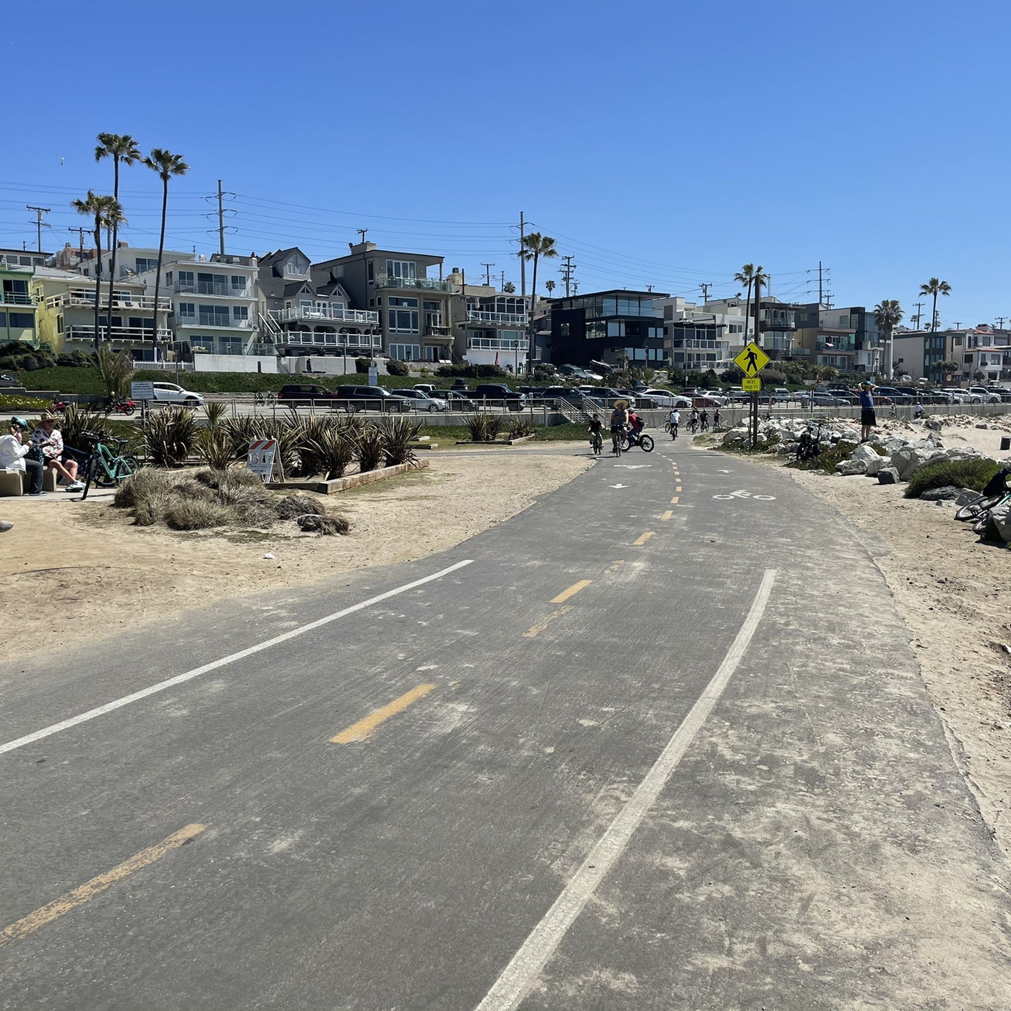
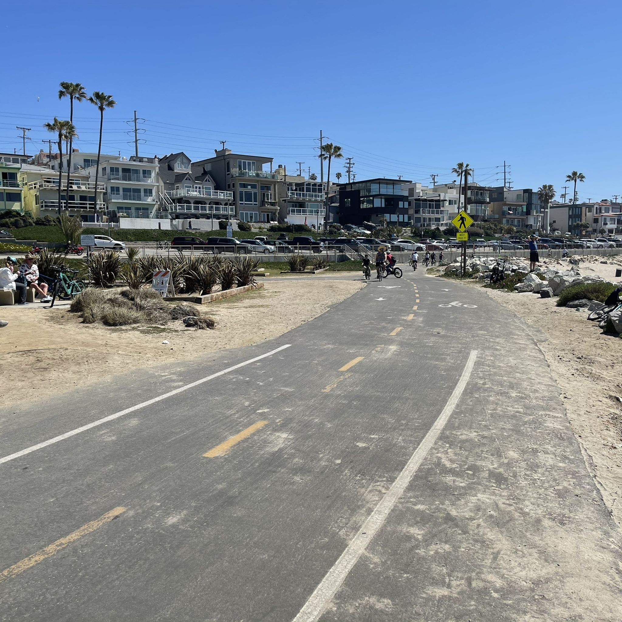
Unexpectedly quiet route in the countryside parallel to the beach. If you are looking for a bit of shade and don't want to see any more bicycles, this is the right path for you!
1
0
Frequently Asked Questions
How many hiking trails are available in Del Aire?
Del Aire offers nearly 80 hiking and walking routes. The majority, about 63, are classified as easy, making them accessible for most visitors. There are also 14 moderate routes and a couple of more challenging options for those seeking a longer excursion.
Are there family-friendly hiking options in Del Aire?
Yes, Del Aire is well-suited for family outings. The trails, primarily within community parks, feature well-maintained paths perfect for leisurely strolls with children. Many routes are classified as easy, such as the North Redondo Bikeway, offering a pleasant experience for all ages.
Can I bring my dog on the trails in Del Aire?
Del Aire Park, the main green space in the area, is generally dog-friendly, allowing leashed dogs on its paths. However, it's always best to check specific park regulations or signage for any restrictions before your visit. For example, the Beachfront Promenade – Manhattan Beach and Pier loop is a popular option where dogs are often seen.
What kind of terrain can I expect on Del Aire's trails?
The terrain in Del Aire is predominantly urban green space with well-maintained, paved or compacted dirt paths. You'll find relatively flat surfaces, ideal for walking and light recreation, rather than rugged, natural landscapes. Elevation changes are minimal, making most routes quite accessible.
Are there any circular or loop hikes available?
Yes, there are several loop options available. For instance, the Beachfront Promenade – Manhattan Beach and Pier loop from Manhattan Beach offers a scenic coastal experience. These loops provide a varied perspective without retracing your steps.
What are some interesting places to see near the trails?
While hiking in Del Aire, you're close to several interesting attractions. You can explore the coastal beauty of El Segundo Beach or visit the vibrant Manhattan Beach and Pier. For nature lovers, the Ballona Wetlands Ecological Reserve offers a chance to observe local wildlife.
Is parking available at Del Aire Park?
Yes, Del Aire Park offers visitor parking facilities. For more detailed information on parking availability and any potential restrictions, you can consult the official Los Angeles County Parks website: Del Aire Park.
How can I get to the hiking areas using public transport?
Del Aire is within Los Angeles County, which has a public transportation network. While specific bus routes directly to trailheads might vary, you can plan your journey to Del Aire Park or other nearby areas using local bus services. We recommend checking the latest schedules and routes with the Los Angeles County Metropolitan Transportation Authority (Metro) for the most up-to-date information.
Do I need any permits to hike in Del Aire?
Generally, permits are not required for casual walking and hiking on the paths within Del Aire's community parks, such as Del Aire Park. These are public recreational spaces. However, for any specific events or larger group activities, it's always advisable to check with the Los Angeles County Department of Parks and Recreation.
What is the best time of year to hike in Del Aire?
Del Aire enjoys a mild Southern California climate, making hiking pleasant year-round. Spring and fall offer particularly comfortable temperatures. Summer can be warm, so early mornings or late afternoons are best. Winters are generally mild, though occasional rain showers can occur. Always check the weather forecast before heading out.
Are there any easy or beginner-friendly routes?
Absolutely. The majority of routes in and around Del Aire are classified as easy, making them perfect for beginners or those looking for a relaxed walk. With 63 easy routes available, you'll find plenty of options, such as the North Redondo Bikeway, which offers a straightforward and enjoyable experience.
What do other hikers say about the trails in Del Aire?
The trails in Del Aire are highly rated by the komoot community, with an average score of 4.7 stars from over 18 reviews. Hikers often praise the well-maintained paths, the tranquil atmosphere of the parks, and the accessibility of the routes for various activity levels.
Are there places to eat or drink near the hiking areas?
As a residential community, Del Aire has local cafes and restaurants within easy reach of its parks. You'll find various dining options in the surrounding areas, particularly in nearby Hawthorne or El Segundo, offering choices for a post-hike meal or a refreshing drink.
Can I spot any wildlife while hiking in Del Aire?
While Del Aire is an urban area, its green spaces and proximity to coastal regions can offer opportunities for wildlife spotting. In Del Aire Park, you might see common urban birds. For more diverse wildlife, consider visiting nearby natural areas like the Ballona Wetlands Ecological Reserve, known for its birdlife.
How long are the typical hiking trails in Del Aire?
The length of trails in Del Aire varies, catering to different preferences. Many routes are shorter, ideal for quick walks, such as the North Redondo Bikeway at about 1.8 miles (2.9 km). However, longer coastal excursions are also available, like the Beachfront Promenade – Manhattan Beach and Pier loop, which is around 2.5 miles (4 km).
Most popular routes around Del Aire
Most popular attractions around Del Aire

Get inspired with the komoot mobile app


Explore more
Browse the best Hikes in other regions.
