The best road cycling routes around Cherryland
4.7
(11)
1,200
riders
54
rides
Road cycling routes around Cherryland offer a diverse landscape for riders. The region features a mix of flat bay trails and rolling hills, with some routes ascending to significant elevations. Terrain varies from paved paths along the shoreline to roads winding through valleys and along skyline drives. This provides options for various skill levels, from leisurely rides to challenging climbs.
Best road cycling routes around Cherryland
- The most popular road cycling route is Tri-Valley loop, a 65.1 miles (104.8…
Last updated: June 26, 2026
21
riders
105km
04:31
860m
860m
If you're looking for a substantial road cycling adventure in California's Alameda County, the Tri-Valley loop delivers a diverse experience. This moderate route covers 65.1 miles (104.8 km) with 2816…
2
riders
44.7km
02:32
50m
50m
Cycle the moderate 27.8-mile San Francisco Bay Trail and Hayward Loop, offering bay views and marshlands in 2 hours and 32 minutes.

Sign up for free
55
riders
74.5km
04:19
1,350m
1,350m
Hard road ride. Very good fitness required. Mostly well-paved surfaces and easy to ride.
5.0
(1)
47
riders
49.4km
02:37
780m
780m
Moderate road ride. Good fitness required. Mostly well-paved surfaces and easy to ride.
83
riders
62.3km
03:17
1,070m
1,070m
Hard road ride. Very good fitness required. Mostly well-paved surfaces and easy to ride.
Get access to more routes and recommendations from other explorers.
Sign up for free
Already have an account?
Our route recommendations are based on thousands of hikes, rides, and runs completed by other people on komoot.
Start today with a free account
Your next adventure awaits.
Login or Signup
Tips from the Community

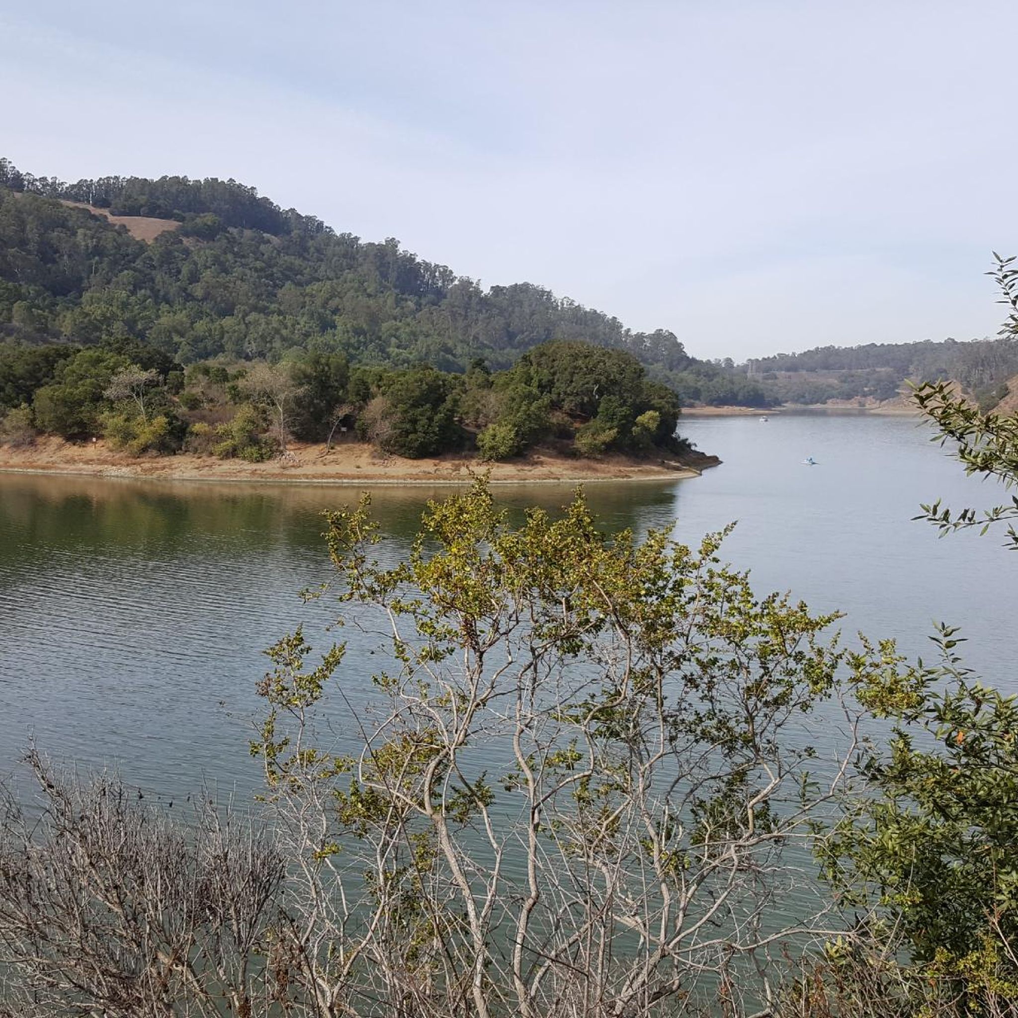
Valle Vista is the trailhead for the paved Lafayette-Moraga Regional Trail, a popular rail-trail for cyclists. There’s a restroom here, but note: the EBMUD dirt trails are hiking-only and require a permit. The bike trail has been officially closed between here and Moraga since a 2019 landslide.
0
0

still closed, for more information and a detour see https://www.reddit.com/r/BAbike/comments/1b0mc5w/redwood_rd_closure_not_recommended_on_a_road_bike/
1
0

There is a paved foot & bike path that runs straight through the park to Arroyo Road, though I am not sure if it actually has an exit onto the road. It continues further into Veterans Park. Of the gravel trails some are closed to bikes for nature preservation reasons. Others allow for a (mostly) easy gravel ride.
0
0


Livermore is California's oldest wine region and lies as the easternmost city in the San Francisco Bay Area. This city boasts a historic downtown with shopping, dining, and entertainment.
0
0
An 847 acre open space park with many native animals that can be spotted from the hiking trails, such as deer, turkey, rabbits, gopher snakes, occasional coyotes, and plenty of bird life. There are many hiking and biking trails in the park, that can be combined to make loops and to access viewpoints. The Sycamore Grove charges a parking fee of $5. For more information, please visit larpd.org/sycamore-grove-park.
0
0

The Olivina Gate is a point of local historical interest and was constructed as a tribute to the late Mr Julius Paul Smith who ran the Olivina winery. The gate marks the entrance to the old winery, and a tree-lined driveway leads to the old ruins. This winery was at one point the region's largest wine producer. As well as grapes, Olivina also grew olives and walnuts.
2
0

Frequently Asked Questions
What kind of terrain can I expect on road cycling routes in Cherryland?
Cherryland's road cycling routes feature a diverse landscape, ranging from flat paved paths along the San Francisco Bay Trail to rolling hills and challenging climbs along skyline drives and through valleys. This variety ensures options for all skill levels.
Are there any easy or beginner-friendly road cycling routes in Cherryland?
Yes, Cherryland offers several easy road cycling routes. For a relatively flat ride, consider the San Francisco Bay Trail and Hayward Loop, which covers 27.8 miles along the bay.
Where can I find challenging road bike climbs in Cherryland?
For a more challenging ride with significant elevation gain, the Lake Chabot Marina – Skyline Blvd loop from Castro Valley is an excellent option. This 46.3-mile route leads through hills and along scenic skyline roads.
What are some scenic viewpoints or attractions along Cherryland's road cycling routes?
Many routes offer scenic views. You can cycle past the Oyster Bay Regional Shoreline or the Lake Chabot Marina. The Hayward Regional Shoreline and Eden Landing Ecological Preserve also offer beautiful natural landscapes to explore.
Are there any road cycling routes around 30 miles in Cherryland?
Yes, the San Francisco Bay Trail and Hayward Loop is a moderate 27.8-mile route, offering a great option for a ride around that distance.
What do other road cyclists say about the routes in Cherryland?
The routes in Cherryland are highly rated by the komoot community, with an average score of 4.4 stars from over 7 reviews. Cyclists often praise the varied terrain, from bay trails to challenging climbs, and the well-maintained paths.
Are there any loop trails for road cycling in Cherryland?
Many routes in Cherryland are designed as loops. For example, the Oyster Bay Regional Shoreline – USS Hornet Museum loop from Bay Fair is a moderate 38.2-mile loop that offers diverse scenery.
What is the best season for road biking in Cherryland?
Cherryland generally offers good road cycling conditions year-round, but spring and fall often provide the most pleasant temperatures and clear skies. Summer can be warm, especially inland, while winter might bring occasional rain.
Are there any routes that pass by lakes or bodies of water?
Absolutely. Routes often feature views of the San Francisco Bay. You can also find routes around Lake Chabot Marina, such as the Lake Chabot Marina – Skyline Blvd loop from Castro Valley.
Are there any family-friendly road cycling routes in Cherryland?
While specific 'family-friendly' routes are not explicitly categorized, the flatter sections of the San Francisco Bay Trail, like those included in the San Francisco Bay Trail and Hayward Loop, are generally suitable for families looking for an easier ride.
What is a popular longer road cycling route in Cherryland?
A popular longer route is the Tri-Valley loop, which spans 65.1 miles and includes significant elevation gain, offering a comprehensive tour of the region's varied landscapes.
Most popular routes around Cherryland
Most popular attractions around Cherryland

Get inspired with the komoot mobile app


Explore more
Browse the best Road cycling routes in other regions.
