The best road cycling routes around Castroville
4.7
(11)
374
riders
7
rides
Road cycling routes around Castroville traverse the scenic landscapes of Medina County, characterized by rolling hills and low-traffic roads. The region is situated within the Texas Hill Country, offering a backdrop of natural beauty with varied gradients. Cyclists can explore routes that follow the Medina River and extend into neighboring areas, providing diverse cycling experiences.
Best road cycling routes in Castroville
- The most popular road cycling route is Medina River Loop, a 25.0 miles (40.2 km) trail that takes 2…
Last updated: May 21, 2026
63
riders
91.2km
04:16
460m
460m
Cycle the moderate 56.7-mile Monterey Bay Coastal Trail and 17-Mile Drive Loop, offering stunning coastal views and wildlife.
7
riders
73.3km
03:30
940m
940m
This difficult 45.5-mile road cycling loop near San Juan Bautista offers challenging climbs and scenic views of Monterey Bay and historic la
37
riders
89.0km
03:53
490m
490m
Moderate road ride. Good fitness required. Mostly well-paved surfaces and easy to ride.
Get access to more routes and recommendations from other explorers.
Sign up for free
Already have an account?
Our route recommendations are based on thousands of hikes, rides, and runs completed by other people on komoot.
Start today with a free account
Your next adventure awaits.
Login or Signup
Popular around Castroville


Tips from the Community


Sand City, California, a small city, is home to the scenic Sand City Beach. Once an industrial area, the dunes west of Highway 1 are now protected as part of the Eolian Dunes Preserve. The Sand City Beach Trail runs through the dunes, offering access to trails for hiking, biking, and leash pets. Sand City Beach is a top spot for beachcombing, especially for finding colorful sea glass, though walking barefoot is risky due to sharp edges.
0
0

The Del Monte Lake Trail is a part of the Monterey Bay Coastal Trail. This wide, paved, multi-use path takes you along the scenic coastline past the famous Monterey beaches. This is a fantastic bit of riding on a traffic-free path.
0
0

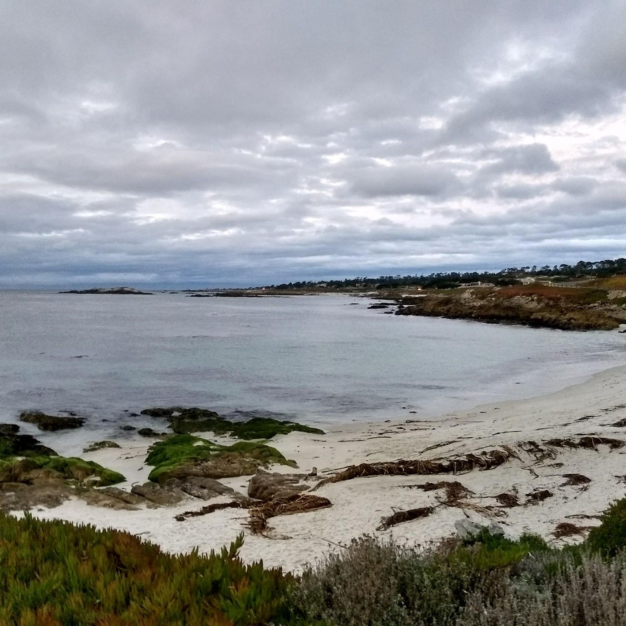
The Monterey Bay Coastal Recreation Trail is a 19-mile-long trail that hugs the coast from Castroville to Monterey Bay. This section is a beautiful stretch near Sand City and gives you wonderful views of the water. The trail is paved and is popular with cyclists and walkers.
1
0

The old, more quiet Del Monte Rd crosses the Salinas river just next to the main Highway 1 bridge, with good views.
0
0

San Juan Bautista is a small town founded in 1797. You'll find plenty of cafés and places to refuel at here.
0
0
Frequently Asked Questions
What kind of terrain can I expect when road cycling around Castroville?
Road cycling routes around Castroville primarily feature rolling hills and low-traffic roads through Medina County. The region is nestled within the scenic Texas Hill Country, offering a mix of gentle stretches and more challenging ascents, often following the Medina River.
Are there road cycling routes suitable for beginners or those looking for an easy ride?
Yes, Castroville offers routes suitable for various skill levels. While the guide highlights a mix of moderate and difficult options, there are easier rides available. The area's low-traffic country roads provide a good environment for less experienced cyclists to enjoy the scenery.
What are some of the more challenging road cycling routes in the Castroville area?
For those seeking a challenge, routes like the "Hill Country Challenge" offer significant elevation changes as they wind through the rolling hills of the Texas Hill Country. This route is a difficult 40.0 miles (64.4 km) path designed to test experienced riders.
Can I find long-distance road cycling routes around Castroville?
Yes, the region caters to long-distance cyclists. Routes like the "Hill Country Challenge" extend for 40.0 miles (64.4 km), and the "Medina River Loop" covers 25.0 miles (40.2 km). The area's network of country roads also allows for combining routes to create longer rides into neighboring towns like LaCoste and Western Bexar County.
Are there any loop road cycling routes in Castroville?
Yes, loop routes are a popular option in Castroville. For instance, the "Medina River Loop" is a 25.0 miles (40.2 km) trail that offers picturesque views along the river and through rural landscapes, bringing you back to your starting point.
What is the best time of year for road biking in Castroville, Texas?
The best seasons for road biking in Castroville are typically spring and fall, when temperatures are milder. Spring brings the possibility of seeing beautiful poppy fields. Summers can be very hot, while winters are generally mild, making year-round cycling possible, though conditions should be checked.
Are there any scenic viewpoints or landmarks along the road cycling routes?
While cycling, you'll encounter the natural beauty of the Medina River and the rolling hills of the Texas Hill Country. For panoramic views, you can visit Cross Hill in Castroville Regional Park, which offers expansive vistas of Castroville and the surrounding landscape. The town's historic Alsatian-style architecture also provides unique visual interest.
Where can I find parking for road cycling in Castroville?
Parking is generally available in and around Castroville, especially near popular starting points for routes. Castroville Regional Park is a central hub for outdoor activities and may offer suitable parking for cyclists looking to access routes along the Medina River.
Are there cafes or places to stop for refreshments along the road cycling routes?
Castroville itself offers various local establishments where cyclists can stop for refreshments. While specific cafes directly on every route may vary, the town's historic district provides options. For example, Pezzini Farms & coffee is a highlight in the broader region that could be a destination or stop.
What do other road cyclists enjoy most about road cycling in Castroville?
Road cyclists frequently praise the low-traffic country roads and the scenic beauty of Medina County and the Texas Hill Country. The variety of routes, from river-side loops to challenging hill climbs, is also highly appreciated, offering diverse experiences for over 100 komoot users who have explored the area.
Are there family-friendly road cycling options in Castroville?
Yes, the presence of low-traffic country roads makes some areas suitable for family cycling. While specific dedicated family routes might require local inquiry, the less challenging sections and the general quietness of the roads outside the main town can be enjoyable for families.
Is public transport available to reach Castroville for cycling?
Castroville is primarily accessed by car. While there isn't extensive public transport directly serving the town for cyclists, its proximity to San Antonio means that private transport or ride-sharing services are the most common ways to reach the area with your bike.
Most popular routes around Castroville
Most popular attractions around Castroville

Get inspired with the komoot mobile app


Explore more
Browse the best Road cycling routes in other regions.
