The best road cycling routes around Agua Dulce
5.0
(15)
449
riders
15
rides
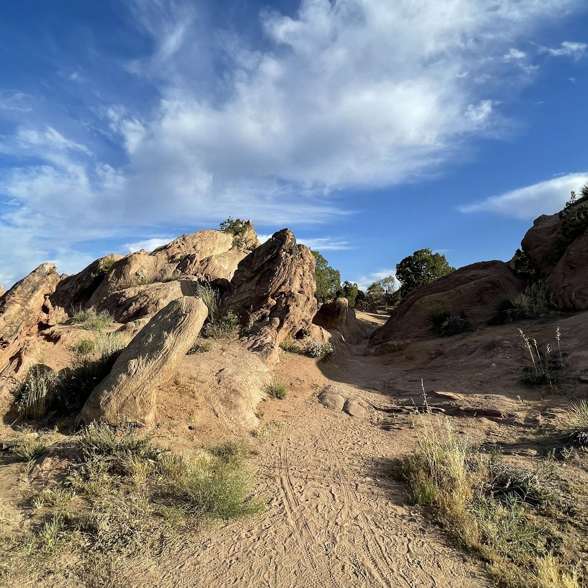
Road cycling routes around Agua Dulce traverse a landscape characterized by the Sierra Pelona Mountains and distinctive geological formations. The area features uplifted sandstone rock formations, notably at Vasquez Rocks Natural Area Park, which provide a unique backdrop for rides. Roads like Agua Dulce Canyon Road and Mint Canyon offer varying elevations and scenic passages through canyons and mountainous terrain. This region provides a diverse environment for road cyclists, from routes with minimal traffic to those with significant climbs.
Best…
Last updated: October 3, 2026
5.0
(14)
198
riders
41.7km
02:06
210m
210m
Moderate road ride. Good fitness required. Mostly well-paved surfaces and easy to ride.
61
riders
49.8km
02:26
600m
600m
Moderate road ride. Good fitness required. Mostly well-paved surfaces and easy to ride.

5.0
(3)
66
riders
34.9km
01:33
170m
170m
Moderate road ride. Great for any fitness level. Some segments of this route may be unpaved and difficult to ride.
18
riders
65.8km
04:06
1,420m
1,420m
Hard road ride. Very good fitness required. Mostly well-paved surfaces and easy to ride.
18
riders
28.9km
01:31
340m
340m
Moderate road ride. Good fitness required. Mostly well-paved surfaces and easy to ride.
Get access to more routes and recommendations from other explorers.
Already have an account?
Our route recommendations are based on thousands of hikes, rides, and runs completed by other people on komoot.
Start today with a free account
Your next adventure awaits.


Other adventures around Agua Dulce

Tips from the Community


At about 84 miles long, the Santa Clara River is the largest natural river system in southern California remaining in a relatively undeveloped state. Along its length there is the 8 mile long Santa Clara River Trail, which is a paved bicycle and walking path in the city of Santa Clarita.
0
0

Here, under the powerlines, South Fork River Trail and an extension of Newhall Avenue cross.
0
0
Placerita Canyon Road is a doubletrack dirt trail accessible for hiking or biking. A gate blocks vehicle access, and the road offers a scenic route trough the Placerita Canyon Natural Area.
1
0

I usually turn around here.
0
0

From this spot just off of the San Francisquito Creek Trail in Santa Clarita, CA, you get fantastic open views down the valley across the grasslands and of the powerlines. This is a nice place to stop and sip some water or snap a photo before continuing on your ride.
0
0

Excellent paved dedicated bike trail along the north bank of the Santa Clara River, It currently stretches from Discovery Park in the west of Santa Clarita to Lost Canyon road a mile east from here, where it connects to rural or residential roads.
0
0
Pleasant long trail along the northern river bank, shared with a parallel paved bike trail.
1
0
Frequently Asked Questions
What kind of terrain can I expect on road cycling routes around Agua Dulce?
Road cycling in Agua Dulce primarily features the rugged terrain of the Sierra Pelona Mountains, offering varying elevations and scenic views. You'll encounter dramatic sandstone formations, especially around Vasquez Rocks Natural Area Park, and scenic canyon roads like Mint Canyon and Agua Dulce Canyon Road. The routes provide a diverse environment, from challenging climbs to more moderate passages.
Are there road cycling routes suitable for beginners in Agua Dulce?
Yes, Agua Dulce offers options for various skill levels. There are 2 easy road cycling routes available, which are great for beginners or those looking for a more relaxed ride. These routes typically feature less elevation gain and more gentle inclines.
What are some of the most scenic landmarks or points of interest I can see while road cycling in Agua Dulce?
Many routes offer stunning views of the unique geological formations at Vasquez Rocks Natural Area Park, known for its uplifted sandstone. You might also pass through scenic areas like Mint Canyon, which provides a peaceful riding experience with minimal traffic and beautiful natural surroundings.
How many road cycling routes are available in the Agua Dulce area?
There are 11 road cycling routes in the Agua Dulce area, catering to various difficulty levels. This includes 2 easy routes, 4 moderate routes, and 5 difficult routes, ensuring there's something for every cyclist.
What do other cyclists say about road cycling in Agua Dulce?
The road cycling routes in Agua Dulce are highly rated by the komoot community, with an average score of 5.0 stars from over 10 reviews. Cyclists often praise the unique landscapes, the challenging climbs, and the quiet, scenic roads that make for a memorable riding experience.
Are there any long-distance road cycling routes in Agua Dulce?
Yes, several routes offer significant distances. For example, the Bear Divide – Dillon Divide loop from Vista Canyon is a challenging route spanning over 36 miles (58 km) with substantial elevation gain, perfect for long-distance enthusiasts.
Can I find challenging road cycling routes with significant elevation gain in Agua Dulce?
Absolutely. The Sierra Pelona Mountains provide ample opportunities for challenging climbs. Routes like the Towers above Camp 9 – Bear Divide loop from Forest Park feature over 3,600 feet (1,100 meters) of elevation gain, making them ideal for experienced cyclists seeking a demanding ride.
Are there any road cycling routes that follow river or creek paths in Agua Dulce?
Yes, you can enjoy scenic rides along waterways. The Santa Clara River and San Francisquito Creek Trail Loop is a popular moderate route that follows river and creek paths, offering a pleasant and picturesque cycling experience.
What kind of roads are typically used for road cycling in Agua Dulce?
Road cycling routes in Agua Dulce utilize a mix of paved roads, including main arteries like Agua Dulce Canyon Road and Sierra Highway, as well as quieter, more remote roads such as Mint Canyon. While some roads may lack paved shoulders, they often offer peaceful riding with minimal car traffic through scenic landscapes.
Are there any loop trails for road cycling in Agua Dulce?
Many of the road cycling routes in Agua Dulce are designed as loops, allowing you to start and end at the same point. Examples include the Placerita Canyon Road – Santa Clara River Trail loop from BLM Open Space and the Bear Divide – Placerita Canyon Road loop from Vista Canyon, providing varied scenery and terrain.
Is there anything else to explore near the road cycling routes in Agua Dulce?
Beyond the cycling, you can visit the Vasquez Rocks Natural Area Park to explore its unique geological formations up close. For a relaxing post-ride experience, the Agua Dulce Winery offers wine tasting and tours amidst the Sierra Pelona Valley's charming landscape.
Most popular routes around Agua Dulce
Most popular attractions around Agua Dulce

Get inspired with the komoot mobile app


Explore more
Browse the best Road cycling routes in other regions.
