The best cycling routes around Covina
4.5
(39)
896
riders
49
rides
Touring cycling routes around Covina are situated within the San Gabriel Valley, offering access to a diverse landscape. The region features a network of interconnected bike paths, including connections to the Pacific Electric Trail, providing continuous routes. Surrounding natural features include the San Gabriel Mountains to the north, offering varied gradients, and expansive regional parks like Frank G. Bonelli Regional Park with its Puddingstone Reservoir. This area provides a mix of urban connectivity and natural settings for cycling.
Best touring cycling routes around Covina
- The most popular touring cycling route is Newman Point Overlook – Little Dalton Debris Basin loop from Glendora, a 19.7 miles (31.7 km) trail that takes 2 hours 24 minutes to complete. This route features significant elevation gain through rolling hills.
- Another top favourite among local touring cyclists is Newman Point Overlook – Glendora Ridge Road loop from Glendora, a difficult 48.3 miles (77.7 km) path. This route offers challenging climbs and expansive views of the surrounding mountain terrain.
- Local touring cyclists also love the Puddingstone Dam loop from Life Pacific University, a 10.2 miles (16.4 km) trail leading through Frank G. Bonelli Regional Park, often completed in about 1 hour 32 minutes.
- Touring cycling around Covina is defined by its access to regional parks, views of the San Gabriel Mountains, and interconnected bike paths. The network offers options for various ability levels, from leisurely rides to more challenging routes with significant elevation.
- The routes in Covina are highly rated by the komoot community with an average score of 4.4 stars from more than 30 reviews. More than 900 touring cyclists have used komoot to explore Covina's varied terrain.
Last updated: June 29, 2026
59
riders
31.7km
02:24
710m
710m
Hard bike ride. Very good fitness required. Mostly paved surfaces. Suitable for all skill levels.
5.0
(1)
17
riders
Easy bike ride. Great for any fitness level. Mostly paved surfaces. Suitable for all skill levels.

Sign up for free
20
riders
64.8km
04:20
940m
940m
Hard bike ride. Very good fitness required. Mostly paved surfaces. Suitable for all skill levels.
26
riders
14.4km
01:23
250m
250m
Moderate bike ride. Good fitness required. Mostly paved surfaces. Suitable for all skill levels.
8
riders
Easy bike ride. Great for any fitness level. Mostly paved surfaces. Suitable for all skill levels.
Get access to more routes and recommendations from other explorers.
Sign up for free
Already have an account?
Our route recommendations are based on thousands of hikes, rides, and runs completed by other people on komoot.
Start today with a free account
Your next adventure awaits.
Login or Signup


Tips from the Community

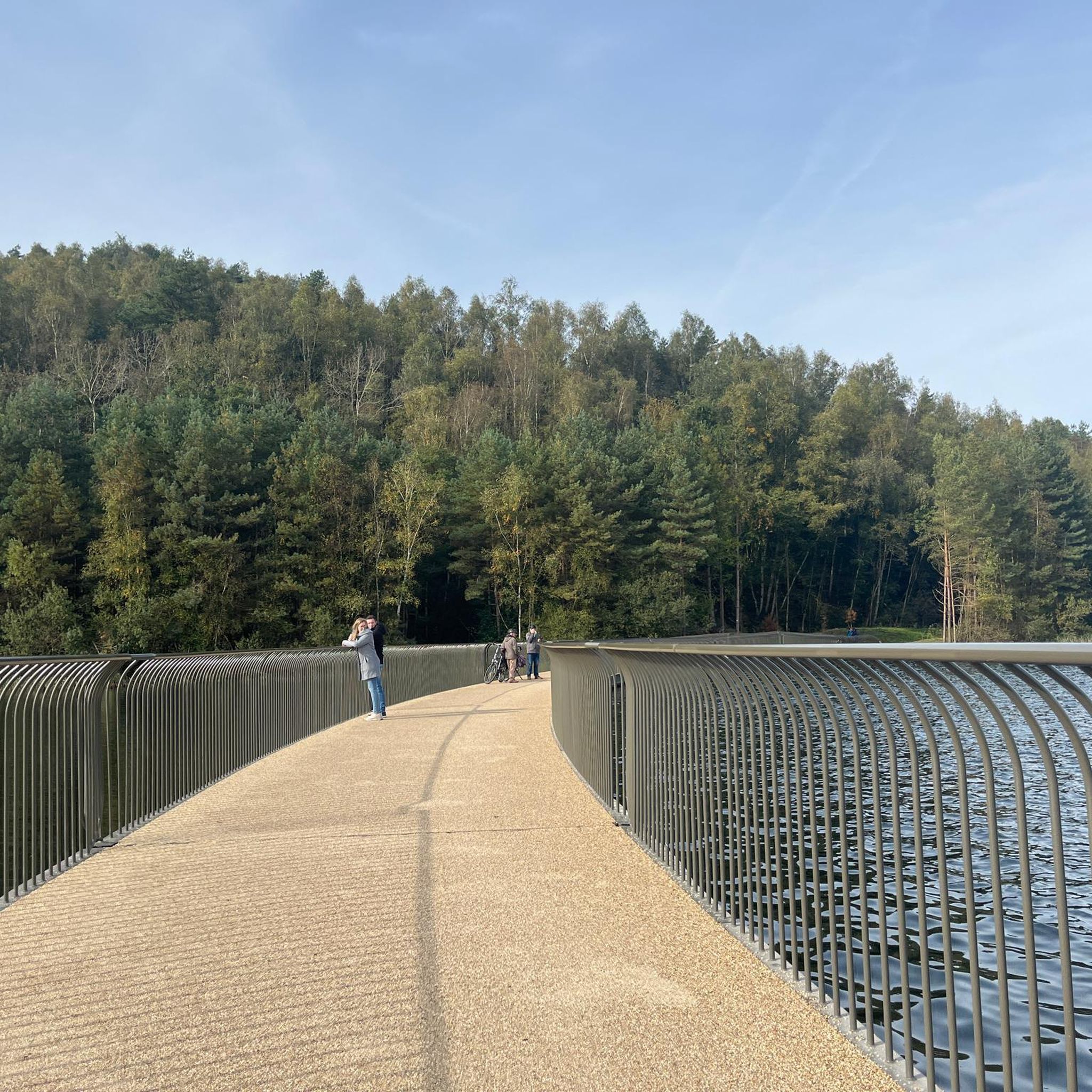
You can cycle across the top of the dam, which was constructed in 1928 to help control flooding in the region. It stands at 147 feet high, and today supports a myriad of outdoor recreation activities on the reservoir.
0
0

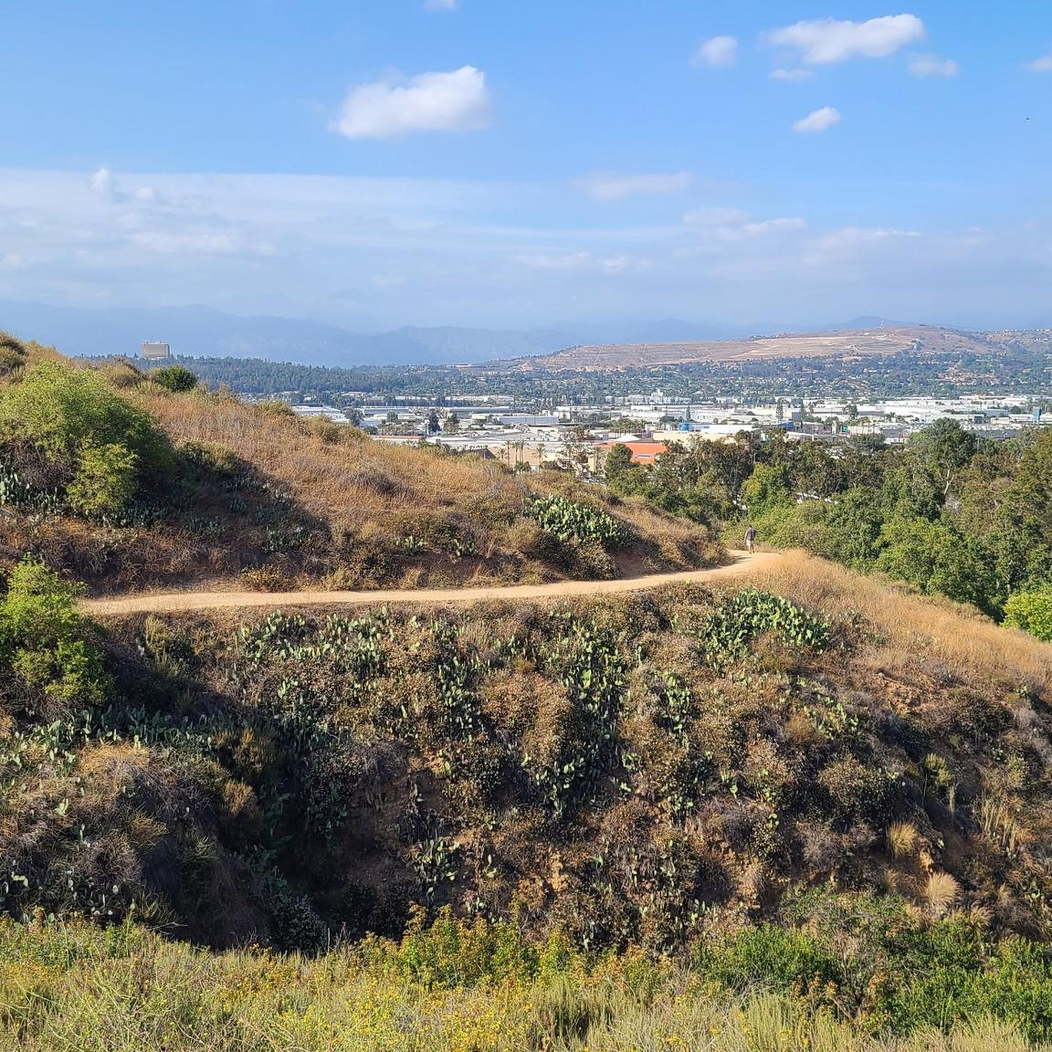
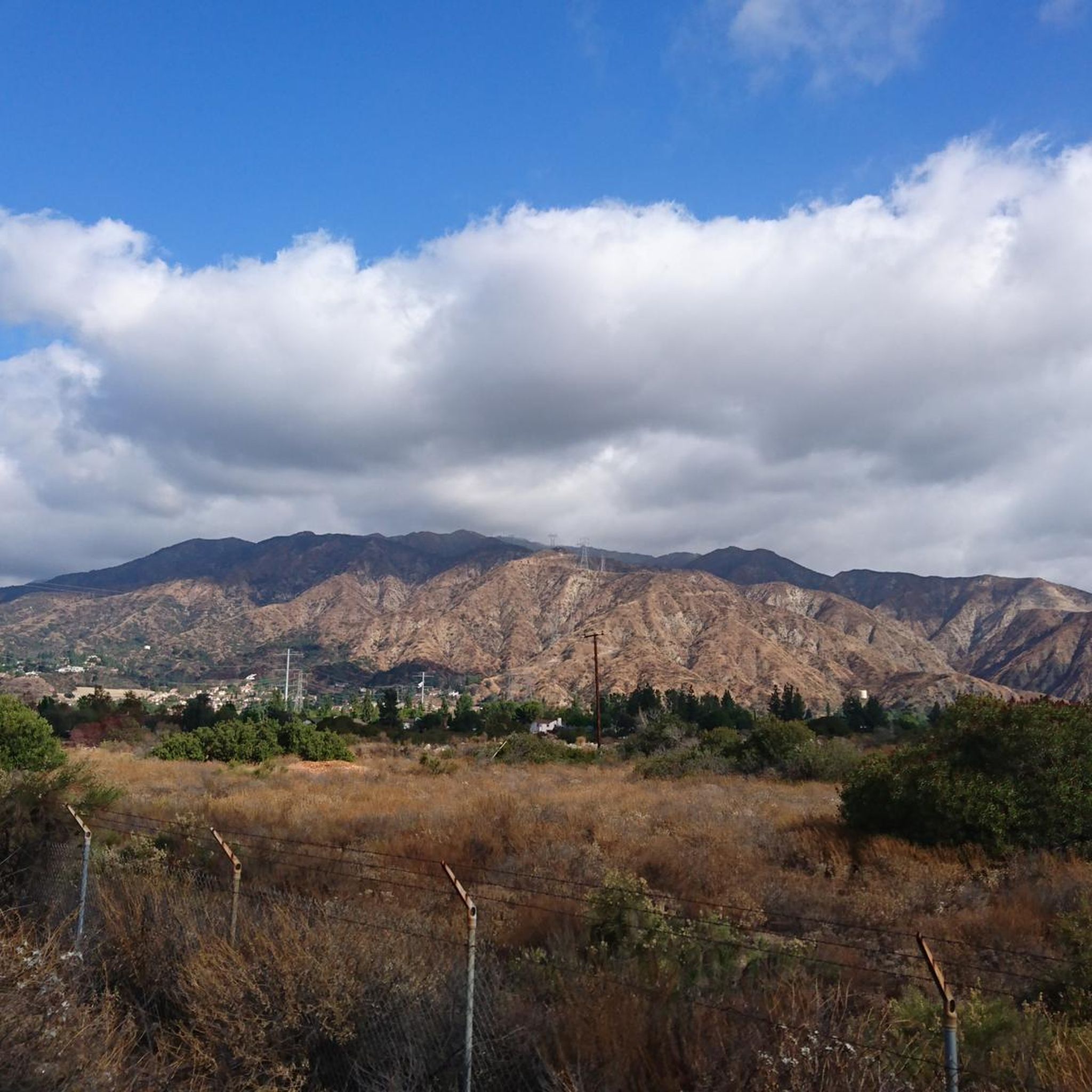
Great view from the cycle path of the San Gabriel Mountains in the distance.
0
0

One of the best dedicated bike trails in the LA area, leading from the San Gabriel mountains north of Azuza along a car free paved river route all the way to Seal beach
1
0
Great view of the Puddingstone Reservoir, a 250-acre man-made body of water. There is a road that runs along the perimeter of the reservoir and there is a spot to pull off the road to get a close up view of the water.
0
0

Hear a plane coming in for a landing? You're experiencing air traffic from Brackett Field Airport. This airport is over 100 years old; it was established in 1911 and is one of the oldest operating airports in the Los Angeles area. There are only two runways here, and this small airport is a hub for flight training schools, charter services, and recreational flying.
0
1

Santa Fe Flood Control Basin is a recreation area in the empty reservoir behind the Santa Fe Dam. You can see and access this area from the San Gabriel River Greenway, a 35.4-mile paved, multi-use path that parallels the San Gabriel River.
1
0

In addition to creating a beautiful natural environment that offers several spots with very good views in its surroundings, such as the Frank G. Bonelli Regional Park, you can cycle around the reservoir on several paved paths. In this reservoir, you can also enjoy many water activities.
1
0

Rubel Castle in Glendora, California, is a unique building that was built by Michael Clarke Rubel. Constructed with recycled materials, including stones from local quarries and discarded items, the castle showcases unique architecture.
0
0
Frequently Asked Questions
What types of terrain can I expect on touring cycling routes around Covina?
Touring cycling around Covina offers a diverse range of terrain. You'll find interconnected bike paths, including connections to the Pacific Electric Trail, providing smoother, continuous routes. The region also features rolling hills, particularly around areas like Frank G. Bonelli Regional Park, and more challenging climbs as you approach the San Gabriel Mountains. Options for road, gravel, and mountain biking are available within the broader Southern California region.
Are there easy touring cycling routes suitable for beginners near Covina?
Yes, Covina offers several easy touring cycling routes. There are 13 routes classified as easy. An example is the View of San Gabriel Mountains loop from Azusa, which is 17.9 km long and offers scenic views with minimal elevation gain.
Are there challenging touring cycling routes for experienced cyclists?
Absolutely. For experienced touring cyclists seeking a challenge, there are 15 difficult routes available. A notable option is the Newman Point Overlook – Glendora Ridge Road loop from Glendora, a demanding 77.7 km path featuring significant climbs and expansive mountain views.
What natural features or landmarks can I see while cycling near Covina?
The region boasts several natural features and landmarks. You can enjoy views of the San Gabriel Mountains, especially on routes originating from Azusa. Frank G. Bonelli Regional Park offers picturesque views of Puddingstone Reservoir. The Santa Fe Dam Recreation Area provides stunning views of the San Gabriel Mountains and is home to abundant wildlife. Additionally, you can explore parts of the Duarte Bike Trail and the San Gabriel River Bike Path.
Are there any circular touring cycling routes around Covina?
Yes, many touring cycling routes in the Covina area are designed as loops. For example, the Newman Point Overlook – Little Dalton Debris Basin loop from Glendora is a popular 31.7 km route. Another option is the Puddingstone Dam loop from Life Pacific University, which takes you through Frank G. Bonelli Regional Park.
What is the best time of year to go touring cycling in Covina?
Covina's climate makes it suitable for touring cycling for much of the year. Spring and fall generally offer the most pleasant weather with mild temperatures. Summers can be hot, especially inland, so early morning rides are recommended. Winters are typically mild, though occasional rain may occur.
Are there family-friendly touring cycling routes in Covina?
Yes, several routes are suitable for families. The interconnected bike paths, such as sections of the Pacific Electric Trail, offer safer and flatter options away from heavy traffic. Local city parks like Charter Oak Park also provide pleasant environments for shorter, leisurely rides. For more information on Charter Oak Park, you can visit lacounty.gov.
Where can I find parking for touring cycling routes near Covina?
Parking is generally available at various access points for bike paths and regional parks. For routes around Frank G. Bonelli Regional Park, there are designated parking areas within the park. For routes connecting to the Pacific Electric Trail or other bike paths, look for parking near trailheads or in adjacent community parks.
What do other touring cyclists enjoy most about cycling in Covina?
The touring cycling routes around Covina are highly rated by the komoot community, with an average score of 4.4 stars from over 30 reviews. Cyclists often praise the region's access to diverse landscapes, from urban connectivity to natural settings, and the variety of routes catering to different ability levels. The views of the San Gabriel Mountains and the scenic paths through regional parks are frequently highlighted.
Are there cafes or places to stop for refreshments along the touring cycling routes?
While specific cafes directly on every trail may vary, many routes pass through or near communities where you can find cafes and refreshment stops. For example, the Duarte Bike Trail – Monrovia Historic Downtown loop from Irwindale will take you close to amenities in Monrovia. It's always a good idea to check the route details on komoot for points of interest and services.
How many touring cycling routes are available around Covina?
There are over 50 touring cycling routes available around Covina, offering a wide range of options for different skill levels and preferences. These routes are well-used, with more than 900 touring cyclists having explored the area using komoot.
Can I access touring cycling routes near Covina using public transport?
Covina is part of the Los Angeles County public transportation network. While direct access to every trailhead via public transport might require some planning, many areas are accessible by bus services. Cyclists can often combine public transport with short rides to reach their desired starting points, especially for routes connecting to major bike paths.
Most popular attractions around Covina

Get inspired with the komoot mobile app


Explore more
Browse the best Cycling routes in other regions.
