The best walks and hikes around Hawaiian Gardens
5.0
(6)
184
hikers
18
hikes
Hiking around Hawaiian Gardens, California, provides access to a network of regional trails and local parks. The area features urban greenways, river levees, and park settings, offering varied landscapes for outdoor activities. While the city itself is relatively small, its proximity to natural spaces allows for exploration of Southern California's diverse terrain.
Best hiking trails around Hawaiian Gardens
- The most popular hiking route is Don Knabe Regional County Park loop — La Palma, a 1.5 miles (2.4 km) trail…
Last updated: October 3, 2026
22
hikers
4.09km
01:02
0m
0m
The El Dorado East Regional Park Perimeter Loop offers a delightful, easy hike through a diverse landscape right in Long Beach. This 2.5-mile (4.1 km) route, with a mere 13…
3
hikers
2.00km
00:30
0m
0m
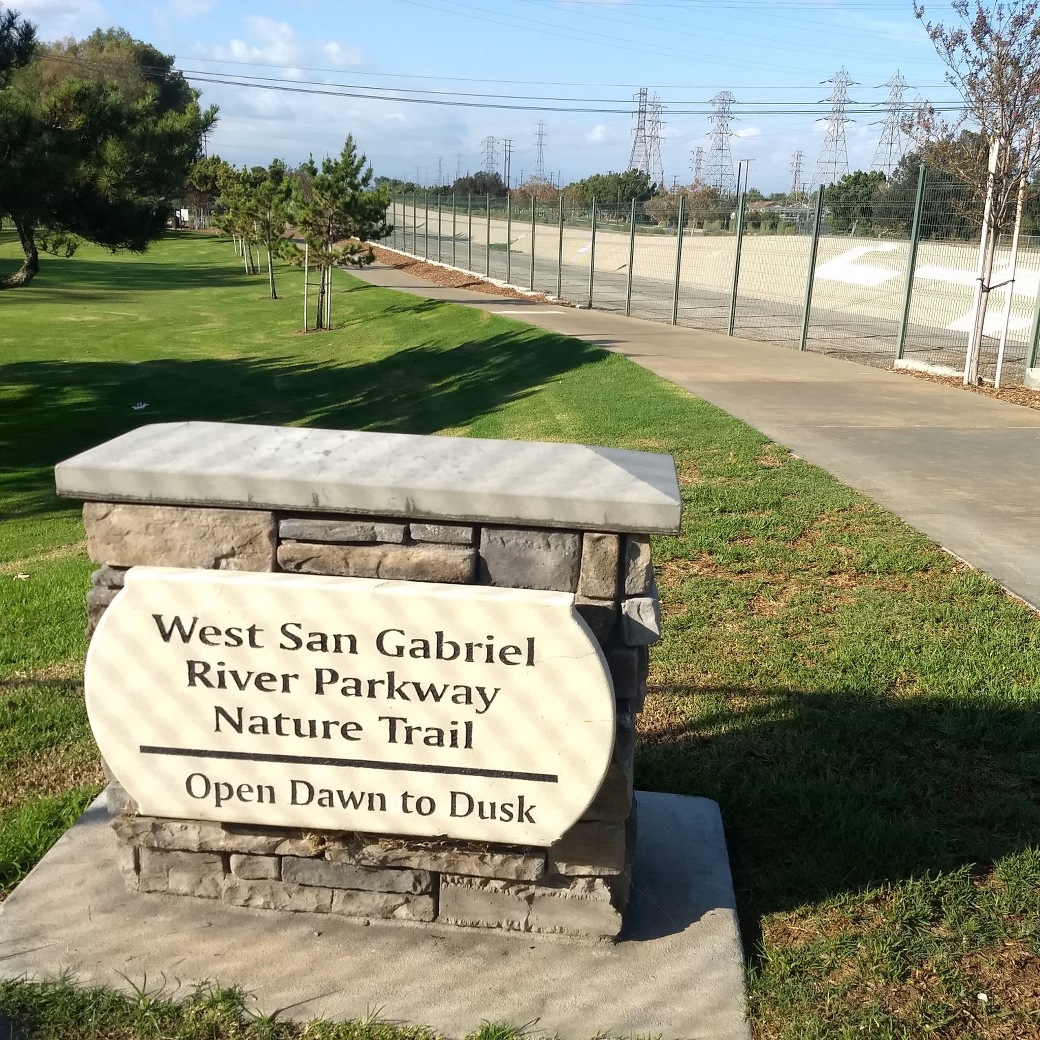
The West San Gabriel River Parkway Nature Trail is a delightful urban escape, often described as a secret garden for its peaceful atmosphere. You'll find a mix of dirt paths…

11.4km
02:52
10m
10m
The San Gabriel River Trail offers a unique blend of urban and natural scenery, following the river through varied terrain. You'll find yourself on largely paved paths, but don't be…
93.7km
23:47
330m
90m
Embark on a difficult hiking adventure along the San Gabriel River Trail, a sprawling 58.2 miles (93.7 km) route that demands approximately 23 hours and 47 minutes to complete. You…
1
hikers
2.37km
00:36
0m
0m
The Don Knabe Regional County Park loop offers a delightful and accessible outdoor experience, winding through an urban oasis. You'll follow paved paths that skirt the park's two expansive fishing…
Get access to more routes and recommendations from other explorers.
Already have an account?
Our route recommendations are based on thousands of hikes, rides, and runs completed by other people on komoot.
Start today with a free account
Your next adventure awaits.
Popular around Hawaiian Gardens

Tips from the Community

An easy, flat loop with lake views—great for a relaxed walk or light jog. The path is paved and shady, and there’s plenty of space to sit, watch ducks, or just take a breather. Good spot if you want something simple and peaceful.
0
0

Limited cars use the roads so it is nice to get away from traffic
0
0

Santa Fe Flood Control Basin is a recreation area in the empty reservoir behind the Santa Fe Dam. You can see and access this area from the San Gabriel River Greenway, a 35.4-mile paved, multi-use path that parallels the San Gabriel River.
1
0

This marks the end of the San Gabriel River Bike Path but you now have the option to extend your ride if you want to. You can either simply head back to town or carry on up the San Gabriel Canyon Road to make this a classic day ride.
0
0
This marks the end of the San Gabriel River Bike Path but you now have the option to extend your ride. If you wish you can head simply head back to town or carry on up the San Gabriel Canyon Road to make this a classic day ride.
0
0

Horseshoe Lake is aptly named and has a restroom next to it. The lake is situated a little ways off the main path, so you can find some secluded spots to sit and enjoy the water around the shoreline.
0
0


One of the largest urban parks in the valley, with lakes, meadows, sports fields, picnic areas, etc.
0
0
Frequently Asked Questions
What types of hiking trails can I find around Hawaiian Gardens?
The area around Hawaiian Gardens offers a diverse network of trails, ranging from urban greenways and river levees to more natural park settings. You'll find paths suitable for various skill levels, from easy strolls to moderate hikes. Many trails explore local parks and connect to regional greenways like the San Gabriel River Trail.
Are there any easy hiking trails suitable for beginners or a relaxed walk?
Yes, Hawaiian Gardens and its vicinity offer several easy trails perfect for beginners or those seeking a relaxed walk. For instance, the Don Knabe Regional County Park loop — La Palma is an easy 1.5-mile path that takes about 36 minutes to complete. Another option is the North Lake – South Lake loop from Los Alamitos, an easy 3.1-mile trail through parkland.
Are there any longer or more challenging hikes near Hawaiian Gardens?
While most trails are easy, there are options for longer excursions. The El Rancho Verde Park — La Palma, California offers a moderate 7.2-mile path that explores park areas, providing a more extended hiking experience.
Can I find circular hiking routes in the Hawaiian Gardens area?
Yes, several trails in the region are circular, allowing you to start and end at the same point. Examples include the easy Don Knabe Regional County Park loop — La Palma, the North Lake – South Lake loop from Los Alamitos, and the Horseshoe Lake loop from Millikan High School.
What are some scenic attractions or points of interest along the trails?
The trails around Hawaiian Gardens offer access to various scenic spots. You can explore areas like El Dorado East Regional Park, enjoy views of North Lake, or walk through the Arbor Day Grove. Some trails also connect to regional greenways like the San Gabriel River Trail and the Coyote Creek Cycleway, which offer glimpses of greenery and waterways.
Are there any trails that offer access to coastal environments?
While Hawaiian Gardens itself is inland, its strategic location provides access to a wider network of trails that can lead to coastal areas. Trails like the Marvin Braude Bike Trail (further afield) offer scenic ocean views. The Seal Beach area is also accessible via connected routes, providing a coastal experience.
What is the best time of year to go hiking in Hawaiian Gardens?
Southern California generally offers pleasant hiking conditions year-round. Spring and fall often provide the most comfortable temperatures for hiking. However, many of the urban greenways and park trails are suitable for enjoyment even during milder winter days or early mornings in summer.
What should I wear for hiking near Hawaiian Gardens?
Given the generally mild climate, comfortable athletic wear is usually sufficient. Layers are always recommended, especially during cooler mornings or evenings. For footwear, comfortable walking shoes or light hiking shoes are appropriate for most of the easy to moderate trails in the area.
Are there any local parks within Hawaiian Gardens for a leisurely stroll?
Yes, within Hawaiian Gardens, Clarkdale Park is known as a 'lush green sanctuary' offering a peaceful setting for strolls and relaxation amidst trees. It provides recreational facilities and accessible paths for a leisurely walk.
How many hiking routes are available in the Hawaiian Gardens area?
There are approximately 10 hiking routes available in the immediate Hawaiian Gardens area and its close vicinity, catering to various preferences and skill levels. These include a mix of easy and moderate trails.
What do other hikers say about the trails around Hawaiian Gardens?
Over 80 hikers have used komoot to explore the varied terrain around Hawaiian Gardens. Users often appreciate the accessibility of the local park trails and the opportunity to explore urban greenways and river-adjacent paths within the metropolitan area.
Most popular routes around Hawaiian Gardens
Most popular attractions around Hawaiian Gardens

Get inspired with the komoot mobile app


Explore more
Browse the best Hikes in other regions.
