The best road cycling routes around Tustin
4.6
(198)
7,203
riders
39
rides
Road cycling around Tustin offers diverse landscapes, from accessible paved paths to challenging routes with significant elevation gains. The region provides excellent access to coastal areas, with routes leading to the Pacific Ocean and scenic wetlands. Inland, cyclists encounter canyons, foothills, and river trails, providing varied terrain for all skill levels. This environment supports a wide range of road cycling experiences.
Best road cycling routes around Tustin
- The most popular road cycling route is Mountains to Sea and Back Bay…
Last updated: August 17, 2026
4.5
(15)
334
riders
40.7km
01:55
220m
220m
Embark on the Mountains to Sea and Back Bay Loop, an easy racebike route that guides you through a diverse landscape in Orange County, California. You will cycle 25.3 miles…
4.6
(5)
239
riders
54.3km
02:27
350m
350m
The Mountains to Sea & Back Bay Loop offers a varied road cycling experience, transitioning from urban edges to serene coastal landscapes. You'll navigate a moderate 33.7-mile (54.3 km) route,…

Sign up for free
4.7
(3)
183
riders
59.2km
02:51
710m
710m
Embark on the Peters Canyon and Walnut Bikeway Loop for a moderate road cycling adventure spanning 36.8 miles (59.2 km). This route offers a diverse experience, blending urban bikeways with…
4.5
(2)
62
riders
93.4km
04:12
830m
830m
Embark on a diverse road cycling journey from Irvine to Newport Bay and Cook's Corner, a moderate 58.1-mile (93.4 km) loop designed for your racebike. You will experience varied scenery,…
4.9
(22)
381
riders
47.7km
02:10
190m
190m
Moderate road ride. Good fitness required. Mostly well-paved surfaces and easy to ride.
Get access to more routes and recommendations from other explorers.
Sign up for free
Already have an account?
Our route recommendations are based on thousands of hikes, rides, and runs completed by other people on komoot.
Start today with a free account
Your next adventure awaits.
Login or Signup

Tips from the Community

Cook’s Corner is a classic stop for cyclists riding through Santiago Canyon and one of the most popular biker hangouts in Southern California. It’s casual and bike-friendly, with shaded picnic tables and plenty of space to park. Grab a burger or a cold drink, rest your legs, and soak in the lively atmosphere—especially on weekends when it’s packed with motorcycles and live music.
0
0

The trail here is paved and designed specifically for foot traffic and bikes with two separate cycling lanes. You get great views across Newport Bay to the ecological reserve as you pass by a couple small parks and vista points.
0
0

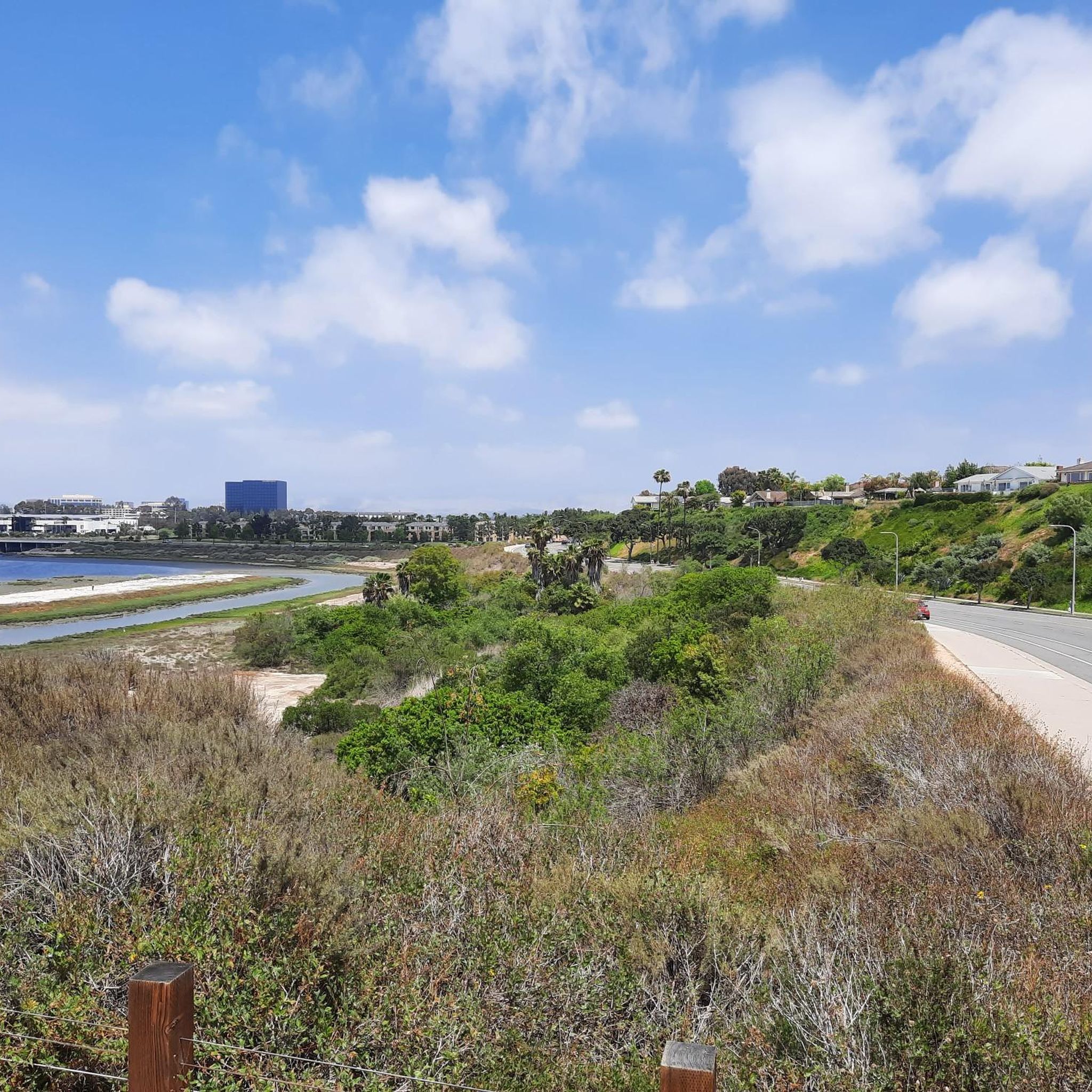
From this spot, you get a nice view over the Upper Newport Bay Ecological Reserve. It is one of Southern California's largest remaining coastal wetlands. This estuary comprises diverse habitats, including salt marshes, mudflats, and riparian zones, providing critical environments for numerous plant and animal species. The reserve is also a vital stopover for migratory birds along the Pacific Flyway, with up to 35,000 birds present during winter migration. It supports nearly 200 bird species, including endangered ones like the Light-footed Clapper Rail and California Least Tern.
0
0

❗The northern segment of the Back Bay Loop Trail, specifically the Bay View Trail including the pedestrian bridge, is closed for repairs from December 9 to December 27, 2024. This closure is in effect daily, including weekends. A detour along Mesa Drive is available for trail users to reconnect with the trail.
0
0


San Diego Creek is a 16-mile urban river that empties into Upper Newport Bay in Orange County. It follows Irvine's extensive system of trails and bike lanes, flowing through industrial areas, residential neighborhoods, and even the borders of the university campus.
1
0

This is a smooth paved section of the Back Bay Loop Trail, approximately 2 miles (3.2k) in length along the north side of the Upper Newport Bay Nature Preserve. Running between Irvine Ave and Jamboree Road, this route takes you away from the busy roads and offers the best views.
0
0

Cycling along Black Bay Drive, overlooking Upper Newport Bay Ecological Reserve, unveils stunning vistas of the estuary. Riders may spot diverse bird species like egrets and herons, while enjoying panoramic views of wetlands and coastal landscapes. The reserve's rich biodiversity enhances the cycling experience with nature's beauty.
0
0
Frequently Asked Questions
How many road cycling routes are available around Tustin?
There are over 45 road cycling routes around Tustin, offering a diverse range of experiences for all skill levels. These routes are highly rated by the komoot community, with an average score of 4.7 stars.
What kind of terrain and elevation can I expect on Tustin's road cycling routes?
Tustin's road cycling routes offer varied terrain, from easy, paved paths with minimal elevation gain to more challenging rides with significant climbs. You'll find routes traversing coastal wetlands, canyons like Peters Canyon, and foothills, providing diverse elevation profiles suitable for different fitness levels.
Are there any family-friendly road cycling routes in Tustin?
Yes, Tustin offers several family-friendly options, particularly on its well-maintained bike paths. Routes that stick to flatter, paved sections, such as parts of the Santa Ana River Trail or the Mountains to Sea trail, are generally suitable for families. Always check the route details for specific difficulty and elevation before heading out.
What natural features and scenic viewpoints can I discover while road cycling in Tustin?
Road cycling in Tustin provides access to diverse natural beauty. You can enjoy spectacular views of the Newport Coast, explore coastal wetlands in areas like the Upper Newport Bay, and ride through scenic canyons such as Peters Canyon. The Back Bay Drive – Upper Newport Bay Ecological Reserve and the San Joaquin Marsh Wildlife Sanctuary are notable highlights along many routes.
Are there any circular road cycling routes around Tustin?
Yes, many of Tustin's road cycling routes are designed as loops, allowing you to start and finish at the same point. Examples include the Mountains to Sea and Back Bay Loop and the Peters Canyon and Walnut Bikeway Loop, which offer convenient circular journeys through varied landscapes.
What are some challenging road cycling routes for experienced riders in Tustin?
For experienced riders seeking a challenge, routes with significant elevation gain and longer distances are available. The Peters Canyon and Walnut Bikeway Loop, for instance, is a moderate 36.8-mile route with substantial elevation. Ascending mountain ranges to the north of Tustin also provide opportunities for more demanding rides.
Where can I find parking for Tustin's road cycling trails?
Many popular trailheads and parks in and around Tustin offer designated parking areas for cyclists. For routes like the Santa Ana River Trail, you can often find parking near access points or at nearby public facilities. It's advisable to check specific route details for recommended parking locations.
Can I access Tustin's cycling routes using public transport?
Yes, some cycling routes in Tustin are accessible via public transport. The Santa Ana River Trail – San Diego Creek Trail loop, for example, can be accessed from the Tustin Metrolink Station, making it convenient for those using public transit.
What is the best time of year to go road biking in Tustin?
Tustin generally offers good road cycling conditions year-round due to its mild Southern California climate. Spring and fall often provide the most pleasant temperatures for longer rides. Winter can also be enjoyable, though it's wise to check weather forecasts for any rain. Summers can be hot, so early morning or late afternoon rides are recommended during peak heat.
What do other road cyclists enjoy the most about road cycling in Tustin?
The road cycling experience in Tustin is highly rated by the komoot community, with an average score of 4.7 stars from over 40 reviews. Cyclists frequently praise the diverse scenery, which transitions from urban settings to coastal wetlands and scenic canyons, as well as the well-maintained bike paths and variety of routes for all skill levels.
Are there any cafes or places to eat near Tustin's road cycling routes?
Yes, many road cycling routes in Tustin pass through or near areas with amenities. Coastal routes leading to destinations like Balboa Island offer various dining options. Additionally, urban areas like The District at Tustin Legacy can be a short side trip from some routes, providing places to refuel and relax.
What landmarks or points of interest can I see along the road cycling routes?
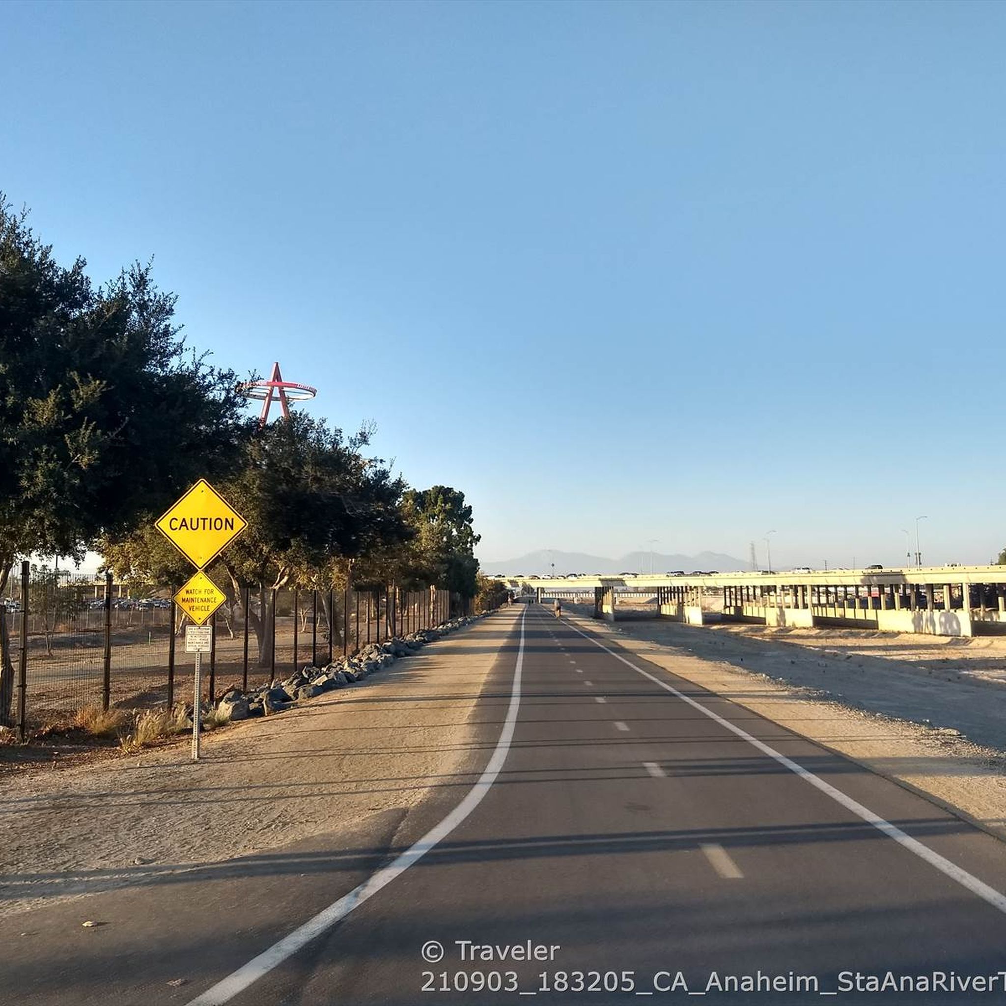
Beyond natural features, you can encounter several points of interest. The Big A Sign at Angel Stadium is a notable landmark visible from some routes. The Back Bay Drive – Upper Newport Bay Ecological Reserve and the San Joaquin Marsh Wildlife Sanctuary offer opportunities to observe wildlife and enjoy the local ecosystem.
Most popular attractions around Tustin

Get inspired with the komoot mobile app


Explore more
Browse the best Road cycling routes in other regions.
