The best cycling routes around La Verne
4.6
(13)
606
riders
38
rides
Touring cycling around La Verne, California, offers diverse landscapes ranging from the foothills of the San Gabriel Mountains to tranquil reservoir loops. The region is characterized by its varied terrain, including rolling hills, valleys, and the dramatic backdrop of the mountains. Cyclists can find routes that traverse urban areas, pass by natural features like Puddingstone Reservoir, and ascend into more challenging mountain environments. This blend of natural beauty and accessible paths makes La Verne a notable destination for touring cyclists.
…Last updated: June 29, 2026
73
riders
84.7km
06:32
2,170m
2,170m
Hard bike ride. Very good fitness required. Mostly paved surfaces. Suitable for all skill levels.
11
riders
35.6km
03:43
1,010m
1,010m
Hard bike ride. Very good fitness required. Mostly paved surfaces. Suitable for all skill levels.

Sign up for free
17
riders
Hard bike ride. Very good fitness required. Mostly paved surfaces. Suitable for all skill levels.
11
riders
30.5km
03:08
780m
780m
Hard bike ride. Very good fitness required. Mostly paved surfaces. Suitable for all skill levels.
7
riders
Hard bike ride. Very good fitness required. Mostly paved surfaces. Suitable for all skill levels.
Get access to more routes and recommendations from other explorers.
Sign up for free
Already have an account?
Our route recommendations are based on thousands of hikes, rides, and runs completed by other people on komoot.
Start today with a free account
Your next adventure awaits.
Login or Signup



Tips from the Community

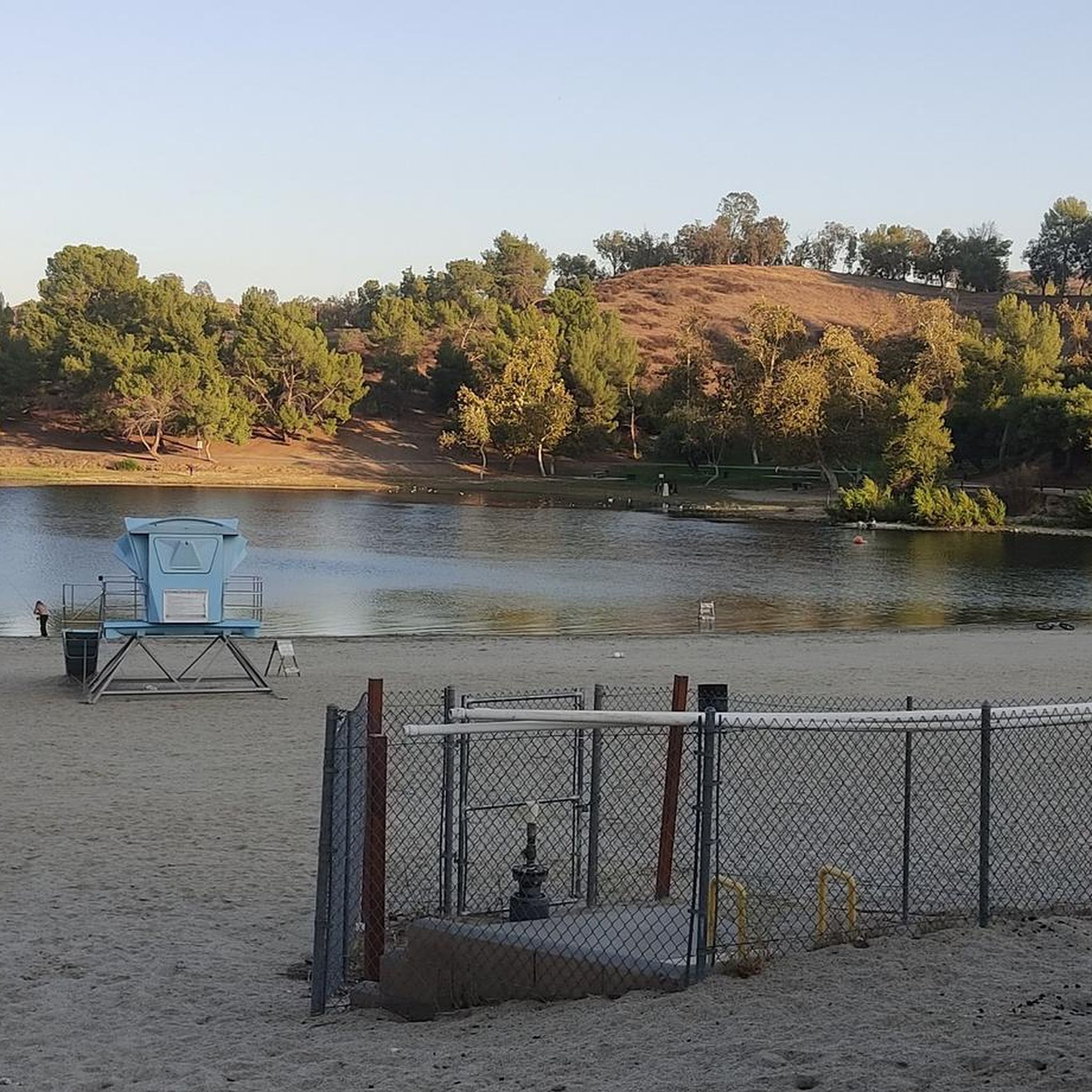
You can cycle across the top of the dam, which was constructed in 1928 to help control flooding in the region. It stands at 147 feet high, and today supports a myriad of outdoor recreation activities on the reservoir.
0
0

The Palmer Evey Trail is a straightforward trail in the San Bernadino Mountains. If you want to get up to Potato Peak, there is a short spur trail to take you to the peak.
0
0

Mount Baldy Village & ski resort towers above the San Gabriel Valley & Los Angeles suburbs and is a lovely alpine community with a wonderful restaurant and a pub. It's a great place to stop, take in the incredible scenery, and refuel during your ride.
0
0
Mount Baldy Village & ski resort towers above the San Gabriel Valley & Los Angeles suburbs and is a lovely alpine community with a wonderful restaurant and a pub. It's a great place to stop, take in the incredible scenery, and refuel during your ride.
0
0

The Marshall Canyon Trail is in La Verne, CA, starts at Oak Mesa Park and features 1,310 feet of climbing, reaching a max elevation of 2,424 feet. Known for its oak tree cover and lush terrain, it’s often referred to as "Sherwood Forest" due to its green, shady environment. The lower section is relatively flat, with more climbing occurring deeper into the canyon. For mountain bikers, there are many variations off the main trail that can add both milage and elevation to your ride. Adding the Claremont Loop, for example, can extend the ride by 4-5 miles and 800 vertical feet. The trail and surrounding area provides a refreshing NorCal feel, with shaded trails and a creek, contrasting with the typically hot and dry surrounding hills.
0
0

Hear a plane coming in for a landing? You're experiencing air traffic from Brackett Field Airport. This airport is over 100 years old; it was established in 1911 and is one of the oldest operating airports in the Los Angeles area. There are only two runways here, and this small airport is a hub for flight training schools, charter services, and recreational flying.
0
1

In addition to creating a beautiful natural environment that offers several spots with very good views in its surroundings, such as the Frank G. Bonelli Regional Park, you can cycle around the reservoir on several paved paths. In this reservoir, you can also enjoy many water activities.
1
0

Dedicated trail-goers will take a potato to the summit to leave as an offering to the potato gods. Check out the summit book, and the echo beneath the metal plate on the top of the tank!
0
0
Frequently Asked Questions
How many touring cycling routes are available around La Verne?
There are over 45 touring cycling routes available around La Verne. These routes offer a variety of experiences, from easy loops to challenging mountain ascents, catering to different skill levels.
What is the overall difficulty level of touring cycling routes in La Verne?
The routes around La Verne offer a good mix of difficulties. There are 5 easy routes, 23 moderate routes, and 21 difficult routes, ensuring options for cyclists of all experience levels.
Are there any easy touring cycling routes suitable for beginners or families in La Verne?
Yes, La Verne offers several easy touring cycling routes. A great option is the Brackett Field Airport – Puddingstone Reservoir loop from Fairplex, which is an 11.1-mile (17.9 km) path offering generally flat, paved sections and views of Puddingstone Reservoir. Routes around Puddingstone Reservoir are generally considered easier and family-friendly.
Where can I find more challenging touring cycling routes in the La Verne area?
For more challenging rides, consider routes that venture into the foothills of the San Gabriel Mountains. The Potato Mountain loop from Damien High School is a difficult 22.2-mile (35.7 km) trail with significant elevation gain, leading through the scenic mountain foothills. Another challenging option is the Newman Point Overlook – Little Dalton Debris Basin loop from La Verne/Fairplex, which covers over 45 km with substantial climbing.
What kind of terrain can I expect on touring cycling routes in La Verne?
La Verne's touring cycling routes feature diverse terrain. You'll find everything from paved paths around Puddingstone Reservoir to rolling hills and more rugged ascents into the San Gabriel Mountains. Some routes traverse urban areas, while others offer a more natural landscape with oak trees and scenic views.
Are there touring cycling routes with scenic views in La Verne?
Absolutely. Many routes offer stunning scenic views, especially those near the San Gabriel Mountains and Puddingstone Reservoir. Glendora Ridge Road is particularly popular for its scenic vistas. You can also enjoy views of the tranquil Puddingstone Reservoir, such as from the View of Puddingstone Reservoir highlight.
What natural attractions or landmarks can I see along the touring cycling routes?
Along the routes, you can explore several natural attractions and landmarks. These include the lush Marshall Canyon Trail, known for its oak-covered terrain, and the scenic San Gabriel River East Fork Trail. The dramatic backdrop of the San Gabriel Mountains is a constant feature, and you can also pass by the Little Dalton Debris Basin.
When is the best time of year to go touring cycling in La Verne?
La Verne's warm climate makes it inviting for cycling throughout much of the year. June and August are particularly popular months for riding. However, the pleasant weather generally allows for enjoyable touring cycling during spring, fall, and even mild winter days.
What do other cyclists say about touring in La Verne?
The touring cycling routes around La Verne are highly rated by the komoot community, with an average score of 4.5 stars from over 12 reviews. Over 650 touring cyclists have explored the area, often praising the diverse terrain and the beautiful mountain backdrop.
Are there any loop trails for touring cyclists in La Verne?
Yes, many touring cycling routes in La Verne are designed as loops, offering a convenient way to explore without retracing your steps. Examples include the Bike loop from Damien High School and the Brackett Field Airport – Puddingstone Dam loop from University of La Verne, both providing circular journeys through varied landscapes.
Where can I find information about Marshall Canyon Regional Park?
Marshall Canyon Regional Park, often called 'Sherwood Forest' for its lush, oak-covered terrain, offers picturesque trails. For more detailed information about the park, including facilities and regulations, you can visit the official Los Angeles County Parks website: lacounty.gov/marshall-canyon-regional-park/.
Most popular attractions around La Verne

Get inspired with the komoot mobile app


Explore more
Browse the best Cycling routes in other regions.
