The best road cycling routes around Paramount
4.7
(54)
1,677
riders
30
rides
Road cycling routes around Paramount, California, benefit from the region's flat to gently rolling terrain and extensive river trail networks. The area is characterized by urban landscapes interspersed with green corridors along the Los Angeles River and San Gabriel River. These paved pathways offer dedicated routes away from vehicular traffic, providing accessible cycling opportunities within Los Angeles County. The central location also allows for connections to broader Southern California cycling infrastructure.
Best road cycling routes around Paramount
- The most popular…
Last updated: May 15, 2026
43
riders
Easy road ride. Great for any fitness level. Mostly well-paved surfaces and easy to ride.
27
riders
50.6km
02:40
70m
70m
Moderate road ride. Good fitness required. Some segments of this route may be unpaved and difficult to ride.

Sign up for free
5.0
(4)
48
riders
Easy road ride. Great for any fitness level. Mostly well-paved surfaces and easy to ride.
58
riders
Easy road ride. Great for any fitness level. Mostly well-paved surfaces and easy to ride.
20
riders
67.1km
03:04
630m
630m
Moderate road ride. Good fitness required. Mostly well-paved surfaces and easy to ride.
Get access to more routes and recommendations from other explorers.
Sign up for free
Already have an account?
Our route recommendations are based on thousands of hikes, rides, and runs completed by other people on komoot.
Start today with a free account
Your next adventure awaits.
Login or Signup
Popular around Paramount


Tips from the Community

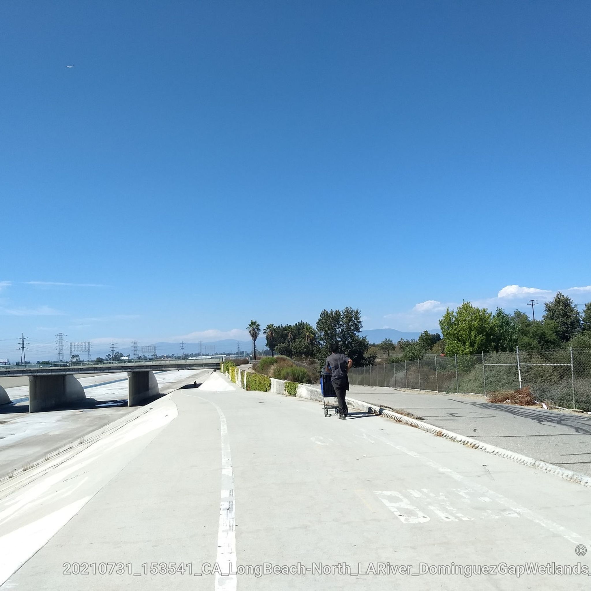
The Greenway is a paved two-lane multi-use path, which stretches for over 50 miles along the LA River.
0
0

The Rio Hondo Bike Bridge is an interesting structure that connects the bike trails that runs on either side of the Rio Hondo.
0
0
The San Gabriel Dam is a rock‑fill structure completed in 1939 on the San Gabriel River and is used for flood control.
0
0

Torrance Beach lies between Redondo Beach and Malaga Cove. The region shared by Torrance and Redondo Beaches is often called “RAT Beach” (short for “Right After Torrance” Beach or “Redondo and Torrance Beach”). This beautiful, soft sand beach has 40 acres of beach and is at the foot of cliffs which extend to the Palos Verdes Peninsula. There restrooms, a concession stand, showers, bike path, beach wheelchairs, and volleyball nets. Torrance Beach is great for swimming, fishing, scuba and skin diving, and surfing.
1
0

On a clear day, you can see Catalina Island in the distance. The island sits 47 miles off the coast.
0
0
Palos Verdes Drive is a scenic ride with climbs, descents, and turns. The South segment near the Portuguese Bend is prone to landslides and is sometimes closed. The best times to ride are in the mornings on weed days, when there is minimal traffic and cooler temperatures. Public restrooms and water are available at the Point Vicente Interpretive Center, Abalone Cove Park, and Malaga Cove School, located in the parking area.
1
0
Palos Verdes Cove begins at Flat Rock Point and rounds into Rancho Palos Verdes. The cove is a protected marine preserve and a well-known surf spot, with both left and right waves. The views from the tops of the cliffs are amazing.
0
0

Limited cars use the roads so it is nice to get away from traffic
0
0
Frequently Asked Questions
What types of road cycling routes can I find around Paramount?
Paramount offers a variety of road cycling routes, primarily featuring extensive river trail networks like the Los Angeles River and San Gabriel River. These routes are mostly paved, providing dedicated paths away from heavy traffic. You'll find options ranging from easy, shorter rides to longer, moderate loops, connecting urban landscapes with green corridors and even coastal areas.
How many road cycling routes are available in the Paramount area?
There are over 35 road cycling routes available around Paramount on komoot. These routes cater to various skill levels, with 17 easy, 17 moderate, and 2 difficult options, ensuring there's a ride for every cyclist.
Are there any easy or beginner-friendly road cycling routes near Paramount?
Yes, Paramount has 17 easy road cycling routes perfect for beginners or those seeking a relaxed ride. An excellent option is the San Gabriel River Trail – El Dorado East Regional Park loop from Bellflower, which is 22.1 km long and features minimal elevation gain, making it very accessible.
What are the typical conditions and terrain like on the river trails?
The river trails, such as the Los Angeles River and San Gabriel River trails, are predominantly paved surfaces. They offer smooth riding conditions suitable for road bikes, often following flat to gently rolling terrain. These dedicated pathways provide a consistent surface, making for a comfortable cycling experience away from vehicular traffic.
What points of interest or landmarks can I see along the road cycling routes?
Many routes follow the San Gabriel River Trail and Los Angeles River Greenway, offering views of these natural corridors. You might cross the Rio Hondo Bike Bridge or the E-Imperial Bridge connecting LA River and Rio Hondo bikeways. Some routes also connect to parks like El Dorado East Regional Park, which features lakes and green spaces.
Are there any family-friendly road cycling routes in Paramount?
Yes, the flat and paved river trail networks are generally suitable for families. Routes like the San Gabriel River Trail – El Dorado East Regional Park loop from Bellflower are easy and offer a safe environment for cyclists of all ages. Local parks within Paramount, such as Ralph C. Dills Park, also provide green spaces and walking paths for general outdoor recreation.
What is the best time of year for road cycling in Paramount?
Paramount benefits from pleasant year-round weather, making it suitable for road cycling throughout most of the year. Southern California's mild climate means you can enjoy the trails even in winter, though checking local weather conditions before heading out is always recommended.
Can I access these road cycling routes using public transport or find parking nearby?
Paramount's central location within Los Angeles County generally allows for various access points to the river trail networks. While specific public transport connections vary, many trailheads and parks along the routes offer parking facilities. It's advisable to check specific starting points for parking availability when planning your ride.
What do other road cyclists enjoy most about cycling in Paramount?
The road cycling routes around Paramount are highly rated by the komoot community, with an average score of 4.8 stars from over 50 reviews. Cyclists frequently praise the continuous paved surfaces of the river trails, the ability to ride away from traffic, and the varied scenery that includes urban green spaces and connections to coastal areas.
Are there any loop routes for road cycling around Paramount?
Yes, many of the popular road cycling routes around Paramount are loops. For example, the Santa Fe Flood Control Basin – San Gabriel River Greenway loop from Norwalk is a moderate 84.9 km loop. Another option is the Los Angeles River Bikeway – Beautiful Beach Bike Path loop from Artesia, which offers varied scenery along the river and towards coastal areas.
Are there any cafes or amenities along the road cycling trails?
While the river trails themselves are primarily recreational pathways, they often pass through or near urban areas where you can find cafes, restaurants, and other amenities. Planning your route in advance and checking for nearby services at your starting or mid-point locations is recommended.
Are dogs allowed on the road cycling trails in Paramount?
Policies regarding dogs on cycling trails can vary by specific park or trail section. Generally, dogs on a leash are permitted in many public parks and on multi-use paths in Los Angeles County. However, it's always best to check the specific regulations for the segment of the trail you plan to ride to ensure compliance.
Most popular routes around Paramount
Most popular attractions around Paramount

Get inspired with the komoot mobile app


Explore more
Browse the best Road cycling routes in other regions.
